
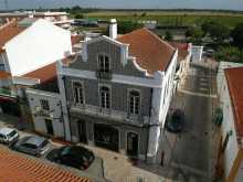
Lisbon is the largest starting point on any Camino, but by European capital standards it's compact and walkable. Give yourself at least a night here before setting off — the city rewards an extra day if you can spare it.
Pick up your credencial at the Se Cathedral in Alfama or the Basilica dos Martires in Bairro Alto. Get two — the Portugues is long and stamps fill up fast. The Se is also the traditional starting point for the Camino; the first yellow arrow is on the lower right of the facade.
The city drapes itself across seven hills above the Rio Tejo. Three neighbourhoods matter most: Alfama to the east, the oldest quarter, climbing steeply beneath the Castelo de Sao Jorge; the Baixa in the centre, rebuilt on a grid after the catastrophic earthquake of 1755; and the Bairro Alto to the west, higher ground with narrow streets and late-night bars.
The Se Cathedral, Romanesque and fortress-like, dates from the 12th century and sits in the heart of Alfama. The Castelo de Sao Jorge above it offers the best panoramic views of the city and the river.
If time allows, take tram 15 to Belem. The Torre de Belem and the Mosteiro dos Jeronimos — both UNESCO World Heritage sites — are worth the trip. The monastery's Manueline stonework is among the finest in Portugal. The nearby Pasteis de Belem has been turning out pasteis de nata since 1837; the queue moves fast.
On your way out of the city toward Parque das Nacoes, you'll pass the Museu Nacional do Azulejo. Housed in the former Convento da Madre de Deus, it traces the history of Portugal's painted tile tradition from its Moorish-Spanish origins to the present. It has a stamp, and the collection is worth at least an hour.
The metro and commuter trains can eliminate the long urban walk. Take the metro to Oriente station (at Parque das Nacoes) to skip the city kilometres, or a commuter train onward to Sacavem, Alverca, or even Azambuja if you'd rather start walking in the countryside.
Before you set off be certain to pick up a pilgrim’s credencial if you have not already done so. It can be found at the Basílica dos Mártires and the Sé Cathedral. This accordion-fold booklet is your passport to the camino and will become your most cherished souvenir of the trip. It is a required document in most pilgrim-specific accommodation, earns you pilgrim prices in many museums, and will serve as proof of your journey when presented to the Pilgrim Office in Santiago if you are planning on getting your Compostela Certificate.
Lisbon has been a harbour settlement since Phoenician times, but the Romans made it a regional capital. They incorporated the area into the province of Lusitania, and the network of roads they built — connecting Olisipo (Lisbon) with Bracara Augusta (Braga), Portus Cale (Porto), and Emerita Augusta (Merida) — survives in fragments all the way to Santiago.
The earthquake of 1 November 1755 destroyed much of the city. The Marques de Pombal oversaw the reconstruction, imposing the rational grid of the Baixa and pioneering some of Europe's first earthquake-resistant building techniques.
The patron saint of Lisbon is Sao Vicente de Saragossa, whose relics are kept in the Se Cathedral. But it's Santo Antonio de Padua — born here in 1195 — who brings Lisboetas into the streets every June 13th for the Festas de Lisboa.
It is Saint Anthony of Padua that brings the Portuguese out to the streets, every June on the 13th.
The way from the Sé Cathedral is straightforward and well-marked, with the first arrow being located on the lower right of the facade. Between here and the Parque you will pass a few notable waymarks, including the Museu Nacional do Azulejo. A large portion of this city walking can be eliminated by taking the metro to the Oriente station located near the Parque; and from there it is also possible to take a commuter train to Sacavém, Santa Iria, Póvoa, Alverca, or Azambuja.
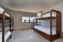
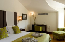
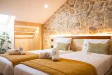
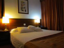
Accommodation in Lisbon.
| Oasis Hostel 15€ 58 Booking.com |

|
| This is Lisbon Hostel 17+€ 34 Booking.com |
|
| Lisbon Lounge Hostel 25€ 32 |
|
| Lisbon Poets Inn 20€ 52 Booking.com |
|
| Living Lounge Hostel 25€ 58 |
|
| Pousada de Juventude Lisboa 15/17€ 100 Booking.com |
|


Also known as Oriente, Parque das Nacoes occupies the site of the 1998 Expo and is now Lisbon's modern quarter — wide promenades, contemporary architecture, and the Oceanario de Lisboa, one of the largest aquariums in Europe. The bus and rail stations are here, and the Metro's Oriente stop is the last one convenient to the camino.
The park along the Rio Tejo provides the first green space since leaving the city centre. Services line the promenade to your left, slightly off the camino. Between here and Azambuja the camino runs largely through industrial areas and along roads — not the most scenic walking.
If you planned on skipping any part, this is the logical place: turn left toward Oriente station and take the commuter train to Azambuja. It costs about 4 euros, runs every 30 minutes, and takes less than an hour.
Well marked but not much to look at, the camino turns inland at Sacavém. The park ends in a parking lot and follows a wide joggers path along the canal.You will follow this canal inland, around a heavily developed hillside along the Rio Trancao, and then back to the Rio Tajo near Póvoa.
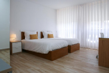
Accommodation in Parque das Nações (Lisboa).


Sacavem is more than a Lisbon suburb — it had its own Roman bridge, which remained in use until the 17th century. The coat of arms still depicts it. A new river walk has opened here along the Tejo, bypassing the old route through Alpriate and providing a much more pleasant path north. Services are available in the town centre, slightly off the camino.
Not to be confused as merely a suburb of Lisbon, the Sacavém coat of arms depicts a Roman bridge for good reason; the one they built here remained in use until the 17th century.
NEW RIVER WALK: Where the camino meets the river in Sacavém a new river walk has opened which bypasses Alpriate altogether. Here is a breakdown of services and landmarks along the way:0-5: Wooden pier5.4: Exit to train station Santa Iria & grocery/restaurants6.1: End wooden pier, start of asphalt path8: Exit to train station Povoa & grocery/restaurants9.6: Praia do Pescadores, "Riverside Lounge Bar"9.7: Start wooden pier10.5: End wooden pier10.6: Camino through reed12.3: Reunification with old camino13.8: Train station Alverca, all services

A large town that the camino tries, with limited success, to avoid. Services are available but stay close to the arrows — they're difficult enough to find without wandering off track. The river walk from Sacavem passes through here.

Alverca was home to Portugal's first international airport until the 1940s, when Lisbon opened its replacement. The Museu do Ar (Air Museum) fills the void — it's one of the better aviation museums in southern Europe, housed in the old airport buildings. It has a pilgrim stamp. The museum is on your right as you approach town; the pedestrian bridge over the railway is opposite it.
The expectation is that you walk on the left side of the road, against oncoming traffic. For this reason, the arrows are more abundant and easier to see from the left side of the road. Keep an eye out for them on traffic and electric posts.
Alverca was the home of Portugal’s first International Airport until the 1940’s when Lisbon opened its replacement. To fill the void left by its departure, they built the Museu do Ar, which as aviation museums go ranks pretty high. It also has a stamp.
When approaching Alverca, keep an eye out for the Air Museum on your right-hand side. Opposite it is the pedestrian bridge over the railway that you will need to cross over into town. Follow the arrows and Fatima signs and to the N10. It is a busy road but with wide berms.

A riverside town where a new pedestrian path has replaced the old camino along the N10. The path follows the water all the way to Vila Franca de Xira and is a significant improvement. Turn right off the N10 and head into town to find it.
A new pedestrian path in Alhandra has replaced the camino proper, but some arrows and signs remain along the N10. These should be ignored in favor of the river path.To get there turn right off the N10 and head into town. The path is easy enough to find at the end of town, and it follows the water to Vila Franca de Xira. Blue and Yellow arrows indicate the way.The pedestrian path keeps along the Rio Tejo into Vila Franca de Xira. The bright yellow bull ring tells you that you have arrived. Unless you need to enter the town, keep along the path. Otherwise, yellow arrows at the bull ring will guide you into and then back out of town to rejoin the path.


Vila Franca is the heart of Ribatejo bullfighting culture. The bright yellow bullring announces your arrival, and the town's campinos — the horsemen who tend the bulls on the surrounding lezírias (floodplains) — are a living tradition. Several bull-running festivals are held in July and October.
The riverside pedestrian path continues through the municipal gardens. Unless you need to enter the town for services, keep on the path — yellow arrows at the bullring will guide you into and out of town if needed.
The town's name suggests it was first settled by French followers of Portugal's first king, Afonso Henriques. The surrounding lezírias — the flat, fertile floodplains of the Tejo — have supported cattle ranching and horse breeding for centuries, giving the Ribatejo its distinctive equestrian culture.
Several bull running/fighting festivals are held in July and October.
The camino goes through the municipal gardens and then under the N10. From this point, the new camino might get confused with the old route. Shortly after the camino passes under the N10, it passes a small factory and then turns right. By turning right the camino continues along a much quieter and safer path to Vala do Carregado.NOTE: The old arrows indicating the way over the busy road may still exist.
Accommodation in Vila Franca de Xira.
| Hospedaria Maioral |
| Suites & Apartments DP VFXira 13€ 16 Booking.com |
|


A small settlement marked by the train station. No services beyond what's at the station.
The arrival to Carregado is marked by the train station. At the far edge of town the camino turns left, where the road meets the river. Follow the river 1km and then cross it via the new bridge.From the bridge, it is 3.5km along a straight road to Vila Nova de Rainha.


No accommodation, but a pair of mini-markets, a bar, a restaurant, and a padaria. The camino through town is brief before returning to the N3.
The camino through town is brief and before long you are back on the N3 national road.It is more road walking all the way to Azambuja. Remember to keep to the left side of the road.

Azambuja is a medium-sized town with all necessary services and is the last place of any size before the long, flat walk across the Ribatejo plain to Santarem. Stock up here.
If you took the train from Lisbon, this is a sensible place to start walking — flat farmland, open skies, and the first stretch of proper countryside after the urban sprawl. The commuter train from Oriente takes under an hour.
Leaving town means another railway crossing. The arrows lead you to the train station, and an elevated pedestrian bridge (painted blue) gets you over the track and onto the first stretch of country walking for some time. You will be in flat farmland nearly the entire way to Santarém. A few villages and countless large Quintas can be found along the way.
Accommodation in Azambuja.
| Casa da Rainha Booking.com |
|
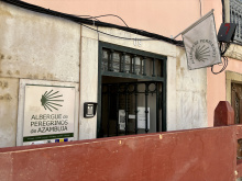
| Albergue de peregrinos de Azambuja 10€ 14 |
|
| Ouro Hotel |


Not to be confused with Ponte do Reguengo. A bar in town — the Cafe Campino. The road follows the top of the embankment separating the lowlands from the river.
At the start of town, the road ascends slightly to the top of the embankment that separates these lowlands from the nearby river. Follow the road.


Several bars and small shops, plus a BP station at the start of town. The walking continues along the embankment toward Porto Muge.
Keep on the same course along the embankment to Porto Muge.
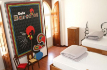
Accommodation in Valada.
| Albergue Dois Caminhos 22*€ 6 |
|
| Casal das Areias |

One bar and some picnic spots. The town is recognisable for the large bridge crossing the river. At the far end, the paved road gives way to a rural farm road — a clear path all the way to Omnias. There are no services for the next 13 km, so fill your water bottles here.
Stock up on water here, 13+ km of nothing ahead!
Accommodation in Porto Muge.
| Quinta da Burra 20*€ |
|
| Quinta da Marchanta Booking.com |
|
| Quinta das Palmeiras |

A hamlet at the base of the hill leading up to Santarem. No services. The climb ahead is a welcome change from so much flatness.
Turn left to cross under the railway. The climb ahead is a welcome change from so much flatness. Santarém is at the top. Turn right when you get to the main road in Santarém and continue straight until arriving at a large roundabout (actually a big oval). There are multiple routes through town.
Santarem sits high above the Tejo on a bluff that has attracted rulers since Julius Caesar set up a military camp here in 61 BC. Despite earthquakes and a Napoleonic invasion, the city retains an extraordinary concentration of Gothic churches — earning it the title Capital do Gotico.
The best of them: the Se Catedral; the Convento de Sao Francisco, whose triple-naved church is the largest Gothic hall in Portugal; the Igreja do Santissimo Milagre, itself a pilgrimage destination housing a eucharistic miracle from the 13th century; and the Igreja de Sao Joao de Alporao, now a museum with an eccentric empty tomb — built for Duarte de Meneses, whose body was never recovered from the battlefield in North Africa, so only a single tooth was placed inside.
The Torre das Cabacas, the old clock tower, houses a small Time Museum and is named for the ceramic vessels (cabacas) once attached to amplify the sound of its bells. The Portas do Sol gardens — built into the old Moorish castle walls — are the highlight: the views over the Tejo valley and the Ribatejo plain are spectacular, and this is where the camino exits the city through the medieval Puerta de Santiago.
Santarem's strategic position on the bluff above the Tejo made it a prize for every power that controlled the peninsula. The Romans built here, the Moors fortified the hilltop, and Afonso Henriques took it from them in 1147 in a daring night assault — scaling the walls while the garrison slept. The city became a favoured royal residence throughout the medieval period, hosting the Portuguese Cortes (parliament) more than any other city.
The Convento de Sao Francisco was built by Franciscan friars in the 13th century and served as a royal pantheon. Several members of the Portuguese royal family are buried here, including Fernando I, the last king of the Burgundian dynasty.
São José is celebrated on the 19th of March.
The exit to town can be difficult to find via arrows and it is best to make your way to the Porta do Sol gardens that are part of the old Moorish castle.As you approach the gardens, there is a small flight of steps on your left-hand side. Turn down those to a small square and the Puerta de Santiago is on your left. Pass through it and pick up a dirt trail that takes you around the old city walls and down to the village of Ribeira de Santarém.
Accommodation in Santarém.
| Pensão Coimbra 15€ 4 |
|
| Tagus Host Booking.com |
|
| N1 Hostel Apartments and Suites 24+€ Booking.com |
|

| Hotel Vitória ★★ Booking.com |
|


A small settlement at the base of the bluff below Santarem, on the bank of the Tejo. The descent from the city is steep and the camino crosses the railway here before continuing through farmland. No services.
After crossing the tracks in Ribeira de Santarém, the camino takes a few turns before arriving at the Ponte do Alcorce.Cross the bridge, and a short distance on keep right to follow the road. Exactly 1km later, turn left off of the road, and then right again 200m later. The camino takes a few turns but is well marked all the way to Vale de Figueira.

A quiet village on the road to Azinhaga. The arrows between here and Golegã have historically been confused — partly because the local councils haven't agreed on the exact route, and partly because frequent flooding in the area makes the original way impassable at times. The arrows will get you to Golegã one way or another.
Keep on the main road until turning right onto Rua do Sobaral (two streets past Church).At the first three-way intersection (Y-shaped), keep left. At the next, keep right (with the forest on your right).The markings from here to Azinhaga are confused and quite possibly misleading; mostly to do with uncertainty at a municipal level as to exactly where the camino should be, and also because frequent flooding in the area make the original way difficult. The arrows will always get you to Golegã, but there is a possibility that they take you through Pombalhino first.


The bronze figure in the square is Jose Saramago, Portugal's only Nobel laureate in literature (1998) and Azinhaga's most famous son. His novel Memorial do Convento is set partly in this Ribatejo landscape. The Casa Memorial Jose Saramago occupies the modest house where his grandparents raised him — worth a visit if it's open.
The camino follows the main road through town to a roundabout with a bullfighter statue. Keep straight, passing through Broa.
Saramago was born here in 1922 to a family of landless peasants. He was largely self-taught, didn't publish his first novel until he was 25, and didn't achieve international recognition until his sixties. His sharp, often subversive prose — Blindness, The Gospel According to Jesus Christ, Baltasar and Blimunda — earned him the Nobel Prize and the lifelong suspicion of the Catholic Church. He's buried in Lisbon, under an olive tree brought from Azinhaga.
The camino follows the main road all the way to the end of town where there is a roundabout with a bullfighter statue in the center. Keep straight here, passing through Broa.Turn right at the next T-intersection and follow the road all the way to Golegã.
Accommodation in Azinhaga.
| Casa de Azzancha 30€ 15 Booking.com |
|
| Casa das Portas Booking.com |
|


Golega is the horse capital of Portugal. The Lusitano breed — one of the oldest saddle horse breeds in the world — has been bred on the surrounding Ribatejo pastures for centuries, and the town celebrates the tradition with the Feira Nacional do Cavalo every November: ten days of equestrian competitions, bull-running, and celebrations that fill every bed within 50 km.
The Igreja Matriz has a spectacular Manueline portal that justifies a stop. In the square opposite, the photography museum and studio of Carlos Relvas occupies one of the most beautiful buildings in town — the entrance is on the street before the main square, not the one the arrows send you down. Relvas was a pioneering 19th-century photographer who built this elaborate glass-and-iron studio to pursue his art.
Services in town. The route out can be confusing — find your way to the front of the church and leave from there.
When entering Golegã, arrows indicate a right turn on the first street. DO NOT take that road. Instead, take the next. You will arrive in the same place (the main square and church), but you will get to see the impossibly beautiful building that is the Cphotography museum and studio of Carlos Revas.
The Ribatejo's horse culture predates the nation of Portugal itself. The Lusitano breed descends from Iberian horses that have roamed this region since antiquity — the Romans called them the fastest horses in the known world. Golega's annual horse fair has been held since the 19th century and is now the most important Lusitano event in the world.
Two horse fairs are held every November.
There are confusing arrows leading you the wrong way out of town by way of Rua Dom João IV. Ignore these and instead find your way to the front of the church. Walk around it via the square with the bullfighter (your left). Turn left on that road, and then right again. Follow the road all the way to, and through, an intersection with the N243.
Accommodation in Golegã.


Not much of a town at all — a small park and an excellent albergue, but little else. The albergue is on the right, opposite the school building. A practical stop if the distances work.
Accommodation in São Caetano.
| Albergue Casa São Caetano 45**€ 7 |
|

The Quinta da Cardiga is a former Templar estate — one of several along this stretch of the Tejo valley where the Order held extensive properties. The palace is abandoned and boarded up, left to slow decay behind its graffiti-covered walls. With no inhabitants, it makes a shady rest stop.
The Templars received these lands from Afonso Henriques in the 12th century as a reward for their help in the Reconquista. When the Order was dissolved in 1312, the Portuguese crown transferred its assets to the newly created Order of Christ, which continued to operate from Tomar.
Leave town by passing over the bridge and turning left. The path with take you all the way to Vila Nova da Barquinha, passing the small hamlet of Pedregoso along the way.


Services are in the town centre, but the camino doesn't enter it — it crosses the main road and the railway before heading out. Turn right at the main road to reach the historic quarter along the river, which has a pleasant park and makes a decent overnight stop.
From the river, the Castelo de Almourol is visible on its island in the middle of the Tejo. The castle was rebuilt by the Knights Templar in 1171 and is one of the most photogenic medieval fortifications in Portugal. Boat trips to the island run from the riverbank in Barquinha.
The Castelo de Almourol sits on a small island in the Tejo and has been a defensive position since Roman times. The Templars rebuilt it as part of their defensive line along the river in the 12th century. Its isolated, fairy-tale setting has inspired legends — most famously the tale of the Moorish princess who haunts the castle at the full moon.
Saint Anthony is celebrated on the 13th of June.
The camino crosses the main road and then crosses the railway before heading out of town. It does NOT enter the town. After the tracks, keep mostly straight at the roundabout. The way is well marked.
Accommodation in Vila Nova da Barquinha.


A bar at the far end of town along the camino. The camino passes straight through and continues along the N110 toward Tomar.
Keep on straight through town, following the road. It will veer to the right and begin a short climb to the church.Keep on straight again beyond the church along the N110 but keep an eye open for where the camino departs from the road along a track through the forests on your right.
Accommodation in Atalaia.
| Casa do Patriarca | 
|


A curious modern church is the only notable building. The camino keeps on the country lane past it, descending into Asseiceira.
Keep on the country lane past the church. You will pass a dirt football pitch that has been re-purposed as an off-road track for dirt bikes, and the road will descend into Asseiceira.

Two bars and a couple of small shops. The last services before Tomar. The route from here into Tomar involves navigating a series of roundabouts near the A13 — follow the arrows carefully, and when in doubt, aim for the town visible ahead.
Keep on the paved road out of town, it will rejoin the N110. From here to Tomar things can get a bit hairy, so be on the lookout for arrows.Stay on the N110 until the first roundabout at a point where it joins the larger A13; at this point you cross under the A13. Once on the other side, at the roundabout, the basic strategy is to keep straight on uphill (towards the "Zona Industrial") rather than turning right to stay on the N110 (though if you did that you would eventually arrive to Tomar, so don't fret). On your way up the road will level out and cross over the railway which parallels the N110 into Tomar. Immediately after crossing the railway, look to your right for a dirt trail and when you spot it, turn right and follow it. At this point the railway is to your right, and beyond it is the N110. You will pass a few small hamlets strung along the road before rejoining the N110 into Tomar.
Accommodation in Asseiceira.
| Albergue D. Dinis 15€ 5 |
|


Tomar deserves at least a half-day. The Convento de Cristo, perched on the hilltop above the town, is one of the great monuments of Portugal — and a UNESCO World Heritage site since 1983. Built as the headquarters of the Knights Templar in the 12th century, it was expanded over four centuries and the result is a layered masterpiece of Romanesque, Gothic, Manueline, and Renaissance architecture.
The star is the Janela do Capitulo — the Chapter Window, a riot of Manueline stonework depicting ropes, coral, seaweed, armillary spheres, and the cross of the Order of Christ. It's the most famous window in Portugal, reproduced on everything from postcards to euro coins.
Inside the complex, the Charola — the original Templar rotunda, modelled on the Church of the Holy Sepulchre in Jerusalem — is the oldest section. The knights attended mass on horseback here, riding their horses into the circular nave.
Across the river, the Igreja de Santa Maria do Olival served as the Templar mother church and pantheon — many Grand Masters are buried here. The Sinagoga de Tomar, on Rua Joaquim Jacinto, dates from the mid-15th century and is one of the few pre-expulsion synagogues surviving in Portugal. It was converted to a prison, then a chapel, then a warehouse before being recognised and restored as a Jewish museum.
The Mata Nacional dos Sete Montes, the woodland park adjacent to the Convento, is a welcome respite on a hot afternoon. Services are plentiful in the town centre.
Tomar's history is inseparable from the Templars. Gualdim Pais, the fourth Grand Master of the Order in Portugal, founded the town and castle in 1160. The Templars defended this stretch of the Tejo against Moorish counter-attacks and were rewarded with vast landholdings across central Portugal.
When Pope Clement V dissolved the Templars in 1312 under pressure from Philip IV of France, the Portuguese king Dinis I simply renamed them. The Order of Christ inherited the Templar properties, personnel, and mission — many of the same knights continued serving under the new name. Prince Henry the Navigator later became the Order's administrator and used its wealth to finance the Age of Discoveries. The cross of the Order of Christ — a red cross with splayed arms — flew on the sails of Portuguese caravels that reached Africa, India, and Brazil.
The Festa dos Tabuleiros, held every four years (next in 2027), fills Tomar's streets with processions of women carrying elaborate towers of bread and flowers on their heads — 30 loaves high, topped with a crown and the cross of Christ or a dove. The tradition may predate Christianity, linked to ancient harvest celebrations.
To leave town cross the river over the Marques do Pombal bridge (it is a single lane bridge with a pedestrian path, and you will be going against the car traffic). Turn left at the start of the Alameda, left again onto Joao dos Santos Simaos, and then right onto Avenida Doutor Egas Moniz.Just past the bullring turn left and then right slightly. Not far ahead you will pass the very prison-like (literally and metaphorically) Infantry Barracks.The road gives way to a country trail and in a short distance arrives at the locally renowned Ponte de Peniche.Keep straight at the junction after the bridge, and continue to cross under the IC9, keeping to your left after doing so. It is pleasant country roads through planted forests.At the first paved intersection (a four-way intersection 3km after passing under the IC9), turn right onto the road. Follow it to the first fork and veer right into Casais.
Accommodation in Tomar.
| Residencial União 30*€ 60 Booking.com |

|
| Hostel 2300 Thomar 25-27*€ 32 Booking.com |
|
| Residencial Luz Booking.com |

|


A hamlet in the hills southeast of Tomar. No services. The camino passes through on its way to Soianda.
Keep on through town, turning left towards the church and curiously large cemetery and back onto the road into Soianda.

A small village on the road between Casais and Calvinos. No services. A steep descent and ascent lie ahead — road signs warn of a 10% grade.
Passing through Soianda is a straight shot, with the only real choice of direction at the far end of town. Turn left when you get there.There is a steep grade ahead, first down and then back up into Calvinos. The road signs indicate a 10% grade, so take your time and if you are out of breath by the end, it is to be expected.


A bar and a mini-market in the village square. The camino passes through on quiet country lanes.
Keep more or less straight into town, through an offset intersection.Turn right at the next intersection to follow the primary road.The next ‘square’ has a bar and a mini-market. Turn left there to leave the main road and head back into the countryside.
Accommodation in Calvinos.
| Albergue de Calvinos 8€ 10 |
|


A tiny settlement with a modern church. The camino passes through in moments — turn right before the church, then left, and you're back in the countryside.
You will emerge into the minuscule Freguesia with its modern church.Turn right before the church, and then left again and just like that you have left Freguesia behind. Quiet lanes will bring you to Ceras where you join the main road.

The camino skirts around Ceras rather than passing through it, staying off the IC3 as much as possible. A confusing section — the arrows will bounce you between road and track for the next few kilometres. This is the easternmost point of the entire Camino Portugues.
The camino takes you mostly around Ceras, and as you approach the town, it will be on your right-hand side.At the first T-intersection turn right (towards the main road) but left again on the first street. The idea here is to keep off the main road as much as possible and in 100m on you will have to turn right towards the road again.Turn left onto the IC3 and follow it for 250m, at which point the camino leaves the road via a path on the right.Once on that path, you will turn left to cross a stream and then turn right again, and at the next intersection turn right again to take you past a ranch; at this point, you will be walking away from the IC3 and back into the forest along a dirt path.NOTE: The next intersection is poorly marked. 1.2km from the ranch the trail you want turns left at a fork and up to the ridge but is poorly indicated. If you get to a 4-way junction, you have gone too far. Fact: this is the eastern most point of the Camino.Turn left up that trail and you will eventually pass through Portela de Vila Verde.


A hamlet between Ceras and Portela de Vila Verde. No services.
Accommodation in Areias.
| Albergue de Areias | 
|

A crossroads hamlet. No services. The camino passes through on its way south toward Daporta.

A small village. No services. The camino passes straight through and climbs into a cork plantation that transitions into eucalyptus forest — pleasant walking for the next 2.5 km.
Pass straight through Daporta and at the first 4-way intersection (after passing through town) turn left onto a dirt road. The junction can be identified by the utility building with a blue door on your left. The path turns back on itself and climbs uphill before entering a cork plantation which transitions into a eucalyptus forest.The forest is well marked and pleasant walking. It is about 2.6km before you arrive at the first large intersection with the main road. At this point, you are technically in Tojal, but there are no houses. Up the road on your right is a gas station.Cross through this intersection and carry on straight in the direction of Alvaiázere (centro). You will be on a paved road all the way to Cortiça (3.2km), passing olive groves along the way.

The bar is in the albergue. The camino turns right at the church — which looks more like a miniature castle than a place of worship — and leaves the main road for a country lane through a string of hamlets before reaching Alvaiazere.
Turn right at the church that looks like more of a mini-castle, leaving the main road for a smaller country lane.You will pass the small hamlet of Oueteiro da Cotovia (it won’t feel like you left Cortiça) and at an intersection marked Outeirinho to the left, turn left.Pass through Outeirinho, turning right then immediately left again once you get there.Then you will pass through Feteiras and Portela da Feteiras, all before arriving in Alvaiazere.
Accommodation in Cortiça.
| Albergaria Quinta da Cortiça – Casa da Torre 27*€ 14 |

|

A small town but the first in a while with anything resembling suburban sprawl — welcome proof that civilisation hasn't abandoned this stretch entirely. Services are plentiful by the standards of the preceding 50 km: bars, shops, a pharmacy, and accommodation.
The albergue is near the church at the upper end of town, with a laundromat beneath it. O'Bras, a reliable restaurant, is along the bike path at the top. The ruins of the Castelo de Alvaiazere are visible on the hillside above but there's not much left to see.
The hills around here are limestone country, covered in olive groves. The name Alvaiazere derives from the Arabic al-bazira — the falconer.
The Arabic origins of the name — and of Alvorge further along the camino — are reminders of the centuries of Moorish presence in central Portugal. The Reconquista pushed through here in the 12th century, but the linguistic traces remain embedded in the landscape.
There are several roads out of town, but the camino is well marked. Still, pay close attention to the arrows and if you are a pre-dawn walker, you are advised to check it out in advance.Leave town by way of the road in front of the church, turning right at a B large palm tree.
Accommodation in Alvaiázere.
| Albergaria Pinheiro's 16€ 20 |
|
| Retiro do Lavrador 22€ Booking.com |
|
| Residencial O Brás Booking.com |
|


A hamlet between Alvaiazere and Vendas. No services.


Several signs lead you into this hamlet, but once you arrive they vanish. Keep straight through, passing houses in various stages of ruin, and the camino picks up again at the top of the hill.
Pass straight through Vendas. There are several signs leading you into it, but once you get there, they vanish or are poorly placed. Keep on straight through the hamlet, passing many houses in ruin. By the time you reach the top of the hill, you are at the end of town. From here the camino keeps to the right and down a path. There are several turns before arriving in Venda do Negro, all well marked.
Accommodation in Vendas.

Another hamlet with missing arrows — a recurring theme on this stretch. The camino leaves via a fork at the far end of town. A dirt track parallels the road and is the preferred option; if you end up on the road instead, follow old arrows to Gramatinha.
Following the road for 100m to the first bend reveals several dirt tracks to the right and a broken camino sign. It is of the post-and-tile kind, and the tile has been removed. The desired track is the rightmost one.You can alternatively take the road, which is marked with the old camino arrows to Gramatinha, and then to Casais Maduros.The dirt track that you turned right on will take you to the road and to Casal do Soeiro. Several more arrows along the way are missing, but the way is clear when you remember that you should NOT walk on the road. Several pleasant tracks bypass the road all the way into town. On particularly wet or rainy days, there is no harm in sticking to the road so long as you mind the minor traffic.
Pass straight through Venda do Negro, turning left at the fork in the road at the far end of town.


A handful of houses. No services. A road sign points toward Casal Maduros and Casal do Soeiro.
In the village, turn right onto the road that shows Casal Maduros and Casal do Soeiro.

A small village where arrows have been removed in places. Turn left after the church and the camino rejoins the trail in 20 metres. Pleasant country walking follows.
Coming into town along the road is OK, but once you get there you will find that the arrows have been removed. Turn left after the church; the camino rejoins the trail in 20m and the country track resumes.
It is pleasant walking along these trails. When you emerge onto the main road, there is a sign on your left indicating Ansião and another on your right indicating Loagoa da Ameixieria. The center of Ansião is still 1.3km away, turn left to get there, but read carefully the notes about what to do next.

A proper town with all services, including the excellent Adega Tipica restaurant and the Solar da Rainha accommodation 600 m beyond the river crossing. The camino arrives at the main road but doesn't follow it — instead it turns left onto a side trail, marked by a small capilla, to bypass the traffic.
The Ponte da Cal crosses the Rio Nabao at the far end of town — the river's volume varies dramatically with the season. From here the camino passes through suburbs and past a football pitch before heading into open country toward Bate Agua.
Where the camino arrives at the main road into Ansião it DOES NOT follow the road. Instead, it turns left onto a side trail and bypasses the road traffic. The turn off is poorly marked but can be identified by the very small capilla that abuts the road.
The Ascension is celebrated on May 25th.
Leave town across the Ponte da Cal, over the Rio Nabão (whose river-like qualities vary with the season). The camino takes you through the outskirts of Ansião; passing some suburbs and a large soccer field. The signs are visible all the way to Bate Agua.
Accommodation in Ansião.
| Alojamento Versão B 32€ Booking.com |
|
| Pensão Adega Tipica 29€ 30 |
|
| Residential Nova Estrela |
| Solar da Rainha 29*€ 30 |
|
| Albergue do Gérard 15€ 6 |
|


The camino splits here into old and new routes — the old way follows the road; the new way takes country paths. In dry conditions, the new way is far preferable. In heavy rain, the road via Netos may be the safer option.
The camino in Bate Agua is marked in two directions: the old way along the road and the new way through country paths, much like the options when leaving Venda do Negro. The preferred path is always the one that takes you away from motorized traffic. In Bate Agua, that means keeping on straight when you get there (the other option being to turn left and follow the old arrows along the road into Netos; a viable option and perhaps the preferred one if there have been heavy rains). Arriving at the first fork, turn left and immediately left again onto a footpath. You will rejoin another small road in a short distance, turn right and follow the curve of the road but you don’t stay on it long so keep an eye open for where the trail diverges again on your left. At the next intersection with a dirt track, turn left and then keep right at a fork a few meters on. This will bring you to a paved road where you turn left and walk into Netos.

A hamlet. No services. Pass straight through, turning left at the last house.
Pass straight through town, turning left at the last house.


A gas station with a cafe — the only services. The camino continues straight past the gas station rather than turning right at the large intersection, despite what older guidebooks may suggest.
Avoid the temptation to follow other pilgrims that might be turning right at the large intersection in Venda do Brasil, faded arrows and older guidebooks describe that as the way. The safer and more pilgrim friendly option is to keep on straight past the gas station on your right-hand side.150m beyond the gas station a gravel road marked Casais Granja takes you up uphill.At the first fork keep right.At the next T-intersection turn right.At the next fork turn right.And then shortly after turn left to go behind a house.The camino rejoins the main road briefly, only to turn left off the road again.This is the new camino, and it avoids both the road and the next town of Junqueira even more than the old camino. Shortly before arriving at Junqueira it turns off to the left once more and back onto a gravel track.

The revised camino bypasses Junqueira entirely, but if you arrive via the road, turn sharply left at the bus stop and right onto the first gravel path.
The new camino does not enter Junqueira, but if you have arrived here via the road, turn sharply left at the start of town, at the small bus stop, and then right onto the first gravel path.

A small village with a new albergue in the basement of the community centre, an ATM, a mini-market, and a friendly bar. The name derives from the Arabic al-burj (the tower), though the tower itself is long gone.
The stretch before Alvorge follows sections of an old Roman road — the arrows have disappeared but the path is clear. Keep straight and you'll arrive.
This gravel path is part of an old Roman road, and the arrows have disappeared. Just keep on straight. When it arrives at a paved road, turn left. But DO NOT stay on this road all the way back to the N347. The arrow is gone, but when you get to a curve in the road, the track to the right is the one you want. That curve in the paved road is 300m from the visible N347, so if you get as far as the main road, you can either retrace your steps or walk the N347 into town.
The tower which gives the town its name (from the Arabic Al Burj) is no more.
Facing the crucifix side of the church, turn right towards the main road (newly cobbled) and turn right onto that road. You should now have a large modern building on your left (the community center and albergue), and you will be going downhill. Continue to the first road and turn left there, downhill.The camino will bring you to the N347, which you follow to the left for a very short distance.It then turns right onto a gravel path.
Accommodation in Alvorge.
| Albergue O Lagareiro 15€ 10 |
|
| Albergue de Peregrinos Alvorge Donativo€ 10 |
|

A stream crossing. No services. More Roman road fragments underfoot — keep straight along the track.
This gravel path is part of an old Roman road, and the arrows have disappeared. Just keep on straight. When it arrives at a paved road, turn left. But DO NOT stay on this road all the way back to the N347. The arrow is gone, but the track to the right is the one you want. That curve in the paved road is 300m from the visible N347, so if you get as far as the main road, you can either retrace your steps or walk the N347 into town.
Keep on the N347 out of town. This road leads directly to Rabaçal, but the camino enjoys a parallel path. Just out of town turn right onto a track that is directly opposite the road towards Vale Florido. Shortly after turn left just before a cluster of buildings, and 150m later turn left once more. You are now paralleling the N347 that you left just a short while ago and the trail will take you to Rabaçal.
Accommodation in Ribeira de Alcalamouque.
| Casinha da Lima 33€ 4 |
|


A quiet village known for two things: Roman ruins and cheese. The Villa Romana do Rabaçal lies about 800 m north of town — a worthwhile afternoon detour if you're staying overnight. The excavated villa preserves excellent mosaic floors and the foundations of a 4th-century country estate.
Queijo Rabaçal, a small, firm cheese made from a blend of sheep's and goat's milk, has a protected designation of origin (DOP). You can find it at local shops and it travels well in a backpack.
There are no services for the next 11 km to Conimbriga — stock up here, even if you have to do it the night before.
There are no services along the next 11km to Conímbriga. Stock up in Rabaçal, the night before if you have to.
Keep on out of town along the road and turn right where indicated in the direction of the Castelo de Germanelo. A turn to the left appears 900m down this road. Turn there and follow a well-marked set of trails all the way to Zambujal.
Accommodation in Rabaçal.
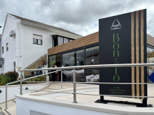
| Albergue O Bonito 20€ 14 |
|

A hamlet between Rabaçal and Conimbriga. No services. The camino passes the church and continues through well-marked trails.
Keep on the camino through Zambujal, with the church on your right. Shortly after at a fork, keep to your left. Keep on this trail, crossing the N347, and into Fonte Coberta.


A handful of houses at the end of a trail from Zambujal. A picnic area has been built but the fountain has not been connected — don't count on water here.
At the end of town the signage has been improved, and a picnic area has been built but the fountain has not been connected. Turn left here and onto a track to Poço.

A hamlet. No services. The camino descends through forested hillside all the way to Conimbriga.
Pass left through Poço and descend through the forested hillside all the way to the museum and ruins of Conímbriga.

Conimbriga is the best-preserved Roman site in Portugal and one of the finest on the Iberian Peninsula. The camino passes directly by the ruins, and you'd be foolish to skip them.
The city was a prosperous Roman settlement from the 1st century BC through the 5th century AD, when Suebi invaders overran its defences. The hasty defensive wall built to repel them — cutting straight through existing houses and streets — is itself a dramatic piece of evidence of the city's final days.
The highlights are the mosaics. The Casa das Fontes (House of the Fountains) preserves elaborate floor mosaics and a sophisticated water garden. The Casa dos Repuxos has hunting scenes in remarkable detail. The museum at the entrance contextualises everything and is included in the ticket.
The only option for food or drink is in the visitor centre. Allow at least an hour, ideally two.
Conimbriga gave its name to Coimbra — when the bishopric relocated to the more defensible hilltop 16 km north in the 6th century, the name travelled with it (Conimbriga became Colimbria, then Coimbra). The site was excavated systematically from the 1930s onward, and only about 10% of the city has been uncovered — the rest lies under farmland to the south.
Leave by way of the road that exits the site. Turn right at the first intersection, heading straight towards and underneath the highway.Once past the highway, you will pass a series of hamlets (Valada, Atadoa, Orelhudo, Ribeira de Casconha, and Casconha) before crossing back over the highway and arriving in Cernache. Along the way, only Casconha has a bar.
Accommodation in Conímbriga.
| Albergue privado de Conímbriga 15€ 10 |
|

Around Orelhudo, a new type of camino marker appears — stone posts with ceramic tiles. They're well designed but not plentiful: one at the entrance to each hamlet, sometimes one at the exit, but rarely in between. Arrows fill the gaps.

A town on the N1 with basic services. The camino passes through and continues toward Coimbra via a series of industrial buildings and residential areas. Not the most scenic stretch.
To leave town, continue along the road you came in on, past the church, to the roundabout with the clinica. Turn right there and pass under the N1 highway. Turn left at the next main road and follow it to the town of Pousada. In Pousada turn right past the church and then left onto the dirt track. The dirt track continues quietly for 2km before arriving at a series of industrial buildings. Turn left at the bus stop, and head into Palheira.
Accommodation in Cernache.
| Albergue Krypteia 14€ 7 |
|

Bigger than the average village but with no pilgrim-oriented services. The camino is well marked through and out of town.
The way through town is well marked, as is the way out.After crossing the N1 turn right, then left both times in the direction that takes you uphill. When you get to a T-intersection, take the steep path straight ahead, up to the Alto de Santa Clara.

The high point on the approach to Coimbra. The camino descends steeply from here, passes under an arch of the Roman aqueduct, and enters the suburb of Santa Clara. Views of the city begin to open up.
Arrows lead you easily out of town, and steeply downhill to an intersection where you turn left to follow a road parallel and immediately adjacent to the highway. The camino crosses over the highway and passes underneath an arch of the Roman aqueduct. You will shortly come to the suburbs of Santa Clara. At the large SANTA CLARA roundabout turn right. Stay on this road until the next roundabout, crossing it to exit the opposite side. Stay on this road; it will curve slightly to the left. At the next intersection, turn left to leave the primary road for a secondary one. It will take you downhill past the church of Nuestra Senhora da Esperança and to the Albergue and Convent of Santa Clara (3.3 from the Alto de Santa Clara).

The Convento de Santa Clara-a-Velha, on the south bank of the Mondego, is the main attraction on this side of the river. Founded in the 14th century by Queen Isabel, it was repeatedly flooded by the rising river and eventually abandoned in the 17th century — the nuns moved uphill to Santa Clara-a-Nova. The old convent has been excavated and restored as a museum, and the Gothic church, half-submerged for centuries, is hauntingly beautiful.
The albergue is near the convent. Follow the winding cobbled lane downhill to reach the bridge into Coimbra.
Follow the winding cobbled lane downhill all the way to the bridge into Coimbra.
Accommodation in Santa Clara.
| Albergue de Peregrinos Rainha Santa Isabel ??€ |
|

Coimbra is the third-largest city on the Camino Portugues and the former capital of Portugal during the 12th and 13th centuries. Even if you're not planning to stay, don't skip the walk through the old town — the concentration of history here justifies every step.
The Universidade de Coimbra, founded in 1290 and a UNESCO World Heritage site, dominates the hilltop. The Biblioteca Joanina is its crown jewel — a Baroque library of staggering excess, with gilded shelves, painted ceilings, and a colony of bats that are released each night to eat the insects that would otherwise devour the books. Visit early; the queues grow quickly and entry is timed.
Afonso Henriques, the first King of Portugal, is buried in the Mosteiro de Santa Cruz in the lower town, as is his son Sancho I. The church facade is Manueline; the interior houses some of the finest azulejo panels in the country.
The Se Velha (Old Cathedral), a compact Romanesque fortress-church from the 12th century, sits on the hillside between the university and the river. It's the credential pickup point in Coimbra. The Se Nova (New Cathedral), former Jesuit church turned cathedral, stands above it — Baroque and Mannerist, with statues of Jesuit saints replaced by Peter and Paul after the Order's expulsion from Portugal.
Coimbra has its own fado tradition, distinct from Lisbon's. Here it's traditionally sung by male university students in black capes, and the songs tend toward melancholy and nostalgia for student days. You're most likely to hear it in the bars around the Se Velha on a weekend evening.
All services available. No pilgrim-specific albergue in the city centre yet — the Convento de Santa Clara on the south bank is the nearest option.
Coimbra served as Portugal's capital from 1131 to 1255, when Afonso III moved the court to Lisbon. The university, founded by King Dinis I in 1290, has been the intellectual heart of the country for seven centuries. It is the oldest university in the Portuguese-speaking world and one of the oldest in continuous operation in Europe.
The city's most famous love story is that of Pedro I and Ines de Castro. Pedro, then crown prince, fell in love with Ines, a Galician noblewoman serving as lady-in-waiting to his wife. When his father, Afonso IV, had Ines murdered in 1355 to prevent Castilian influence at court, Pedro launched a brief civil war. Upon becoming king, he allegedly had Ines's body exhumed and forced the entire court to kiss the hand of his dead queen. Their tombs face each other in the Mosteiro de Alcobaca, 100 km to the south, so that when they rise on Judgment Day, the first thing they'll see is each other.
Fireworks on the 4th of July, in celebration of Queen Elizabeth of Portugal.
If you are keen to pass through Coimbra, turn left after crossing the bridge and begin following the river walk. It will pass underneath the highway and then veer right to parallel a canal (on your left).
Stay on this paved road through a roundabout and soon you will have a different canal on your right. It remains a straight road until just before Adémia da Baixo, where it turns left. Cross the overgrown Rio Velho to the right into Adémia.
Accommodation in Coimbra.


A small settlement on the outskirts of Coimbra where the camino crosses a canal. No services. The walking from Coimbra is flat and follows canals and straight roads through the Mondego floodplain.
Cross the bridge over the canal which you have been walking along and you are in Adémia de Baixo.


A hamlet between Ademia and Trouxemil. No services. Keep left at the first fork and cross the roundabout uphill toward Trouxemil, passing under the A1.
In Fornos, keep to the left at the first fork (a big garage door with blue tiles above). Cross a roundabout and turn uphill all the way to Trouxemil, passing underneath the A1.
A village spread along the road to Sargento Mor. No services of note. Continuous asphalt through both towns.
Pass straight through Trouxemil on the main road. The town is spread out along the road to Sargento Mor which is also spread out along the road. Continuous asphalt the whole way.


A bar and two mini-markets along the main road. The camino leaves the road near the Restaurante Manuel Julio at the start of town.
The camino leaves the road at the start of town near the restaurant Manuel Julio.


Be careful not to follow old arrows along the N1 — the camino has been rerouted. Turn left off the N1 at the start of town and follow the new route through eucalyptus forest to Lendiosa via Mala.
Be careful not to follow the old camino arrows which have you follow the N1.
Turn left off the N1 at the start of town. DO NOT stay on the road to Lendiosa.The camino leaves the N1 and paved roads and into a eucalyptus forest. It will take you to Lendiosa by way of Mala.When the camino emerges onto a paved road, follow the arrows to the right and into Mala.

One cafe-bakery in town. The camino passes through on its way between Santa Luzia and Lendiosa.

A small village. No services. Turn right at the bus stop and follow the arrows — the road gives way to a trail that leads to the outskirts of Mealhada, arriving at a roundabout with a statue of Bacchus seated atop a wine barrel. You've entered the Bairrada.
Turn right at the start of Lendiosa, at the bus stop. The arrows lead you to a road which ends into a trail. This trail will take you to the outskirts of Mealhada, via a roundabout with a statue of Bacchus seated atop a wine barrel.

Vegetarians, avert your eyes. Mealhada is the capital of leitao assado — roast suckling pig. The town's identity revolves around this single dish, and the restaurants lining the main road compete with increasing desperation for your attention. The preparation has been refined here over generations: whole piglets roasted in wood-fired ovens until the skin crackles and the meat falls apart. Even if pork isn't your thing, the spectacle of an entire town built around one recipe is worth absorbing.
Mealhada sits at the heart of the Bairrada wine region, Portugal's other great sparkling wine country. The local espumante pairs naturally with the pig. Basic services in town.
The Bairrada wine region takes its name from barro (clay) — the heavy clay soils that give the local Baga grape its tannic structure. The region has been producing wine since the 10th century but only received its DOC designation in 1979. The Baga grape, difficult to grow and slow to ripen, produces wines of remarkable depth when the vintage cooperates.
The camino leaves town along the highway towards the suburb of Sernadelo where the private albergue is located. The arrow for the turn-off from the main road is not easy to see but can be recognized for the Restaurante Tipico with its massive awning.
Accommodation in Mealhada.

The private albergue known as Hilario is in Sernadelo, just past the turn-off from the main road. The camino leaves Mealhada along the highway and turns right here.
Accommodation in Sernadelo.
| Albergue de Peregrinos Sernadelo - Hilarios 12€ 12 |
|


A hamlet with a church. The camino wraps around it and continues toward Aguim on the road.
A village on the road to Anadia. The arrows near Anadia can be confusing — a set of wiggly arrows on a pole suggests a detour through the woods that was once the route but isn't the current official way. Keep straight on the road.
The way from Aguim to Anadia is well marked and clearly understood, with one exception: when nearing Anadia along the road, an electric pole on your left has some wiggly looking arrows which suggest that you jog left then right to go into the woods. This was once the way and will still get you there, but the official arrows point you straight along the road.In either case, turn left when you get to another road some 400m from this confusing point. This will take you around the newly built sports complex. On the other end keep on the road; turning left at the first roundabout, left at the second roundabout, and right at the third; all are well marked.


The centre of the Bairrada wine region, though the town itself isn't directly on the camino — it's a left turn at the second roundabout near the sports complex. If you need services (shops, ATM, pharmacy), make the detour. Otherwise, follow the arrows through to Arcos.
The Alianca Underground Museum, housed in the cellars of the Alianca winery a few kilometres outside town, has an eclectic collection of archaeology, African art, minerals, and ceramics alongside the wine barrels. Worth a visit if you have time.
Accommodation in Anadia.

A small village with a church. The arrow is at the base of the church — turn right, around a bend, then left toward Alfeolas.
The arrow through Arcos is at the base of the church. Turn right at the church, around a bend, then left. Alfeolas is near.
Accommodation in Arcos.
| Centro Social de São José de Cluny Donativo€ 48 |

A pleasant bar in the old part of town. The village splits into old and new halves, divided by the N235 — cross the busy road and follow arrows through a walled residential area and a small industrial zone. Asphalt all the way to Avelas.
The new half is divided by the busy-ish N235 that you must cross. Once across, turn left and walk through a walled residential area. Following the arrows will then lead you through a small industrial area. The way is asphalt all the way to Avelãs. You will join a busy road for only a small stretch at the start of town.

Most services are along the road at the start of town, opposite the church. The name — Avelas do Caminho — tells you this village has been on the pilgrim road for a long time. A marker near the chapel of Henrique Marques Moura claims 303 km to Santiago; the actual distance is somewhat different.
Leave town on the opposite side of the N1, turning left at the chapel with the bust of Henrique Maroues Moura. A maker here proclaims rather incorrectly that it is 303km to Santiago.Between here and Aguada de Baixo is a string of hamlets (no service) and a chapel in São João da Azenha.
Accommodation in Avelãs do Caminho.

Several bars along the narrow road through town, and a pharmacy near the church at the end. The walking from here to Agueda is along asphalt through a string of hamlets, crossing under the highway and through the Barro Industrial Zone.
Keep on straight through. Along the way, you will cross several surface roads and under the highway. The going is along asphalt the whole way. You will also pass through the Barró Industrial Zone, which is 4.1km from Sardão.


An industrial area between Aguada de Baixo and Sardao. No services. Keep walking.

A short strip of road between the river and the main road — it has seen better days. Cross the road toward a new pedestrian bridge that leads into Agueda.
Sardão is a short strip of road stuck between the river and the road; it has seen better days. Once through cross the road towards a new pedestrian bridge. A second bridge brings you into Águeda.


Agueda is a river town with all basic services, though accommodation options are fewer than you might expect for a town this size. The albergue and Celeste are not centrally located — from the bridge, head straight up the hill, passing the Parque Alta Vila along the way. The park is the best spot in town for a rest.
Every summer, Agueda decorates its streets with hundreds of colourful umbrellas suspended overhead — the AgitAgueda festival. The installation has been photographed millions of times and has put this otherwise unremarkable town on the tourist map. If you're walking in July, you'll see it. The rest of the year, it's a pleasant enough place to stop.
Like Coimbra, you don't need to enter the town centre — turning left at the bridge keeps you on the camino. The next stretch heads uphill through residential areas.
Like Coimbra, you do not need to go into town and can instead turn left at the end of the bridge. The neighboring town is Paredes, which is residential. The going is uphill, and the residential areas continue beyond the railway crossing.
There is a brief industrial stretch before crossing a busy road into Mourisca.
Accommodation in Águeda.

A few bars in town — Pompeia has wifi. The straight road through town passes beautiful homes in various stages of decay, many abandoned. The contrast between past prosperity and present emptiness is a recurring theme through this stretch of central Portugal.
At the far end of town, you will cross the N1 into Pedaçães.
Accommodation in Mourisca.


The town sign appears immediately after crossing the N1, but the town itself is still 1 km ahead through residential areas. Straight walking to the Roman bridge at Marnel.
At the end of town, it is downhill and back across the N1 to the Roman Ponte do Marnel.

The bridge here dates from Roman times and crosses a section of the river that's been turned into a small reservoir by the N1 embankment. In the early morning light, it's a genuinely beautiful sight — two small islands with picnic tables sit in the middle. One of the more photogenic spots between Coimbra and Porto.
After crossing the bridge turn to your left and go back under the N1 into Lamas.

Not much in Lamas itself, but the climb to the church rewards you with a view over the surrounding countryside. The arrows at the end of town are poor, and old arrows can lead you on a needless hike to a washed-out bridge. After descending back to the N1, turn right and cross the Rio Vouga on the road bridge.
The arrows at the end of Lamas are quite poor, and the old arrows can lead you on a needless hike to a washed-out bridge. After descending back to the level of the N1, turn right towards it. You will walk along it, sticking to the left-hand side, across the Rio Vouga. On the far end of the bridge turn left into Lameiro.

A hamlet just off the N1 after crossing the Rio Vouga. No services — just homes. Turn left into it after crossing the river bridge.
Turn left into this hamlet after crossing the river along the N1. No services, just homes.

The bar and mini-market are one and the same — on your right as you pass through. From here the camino enters eucalyptus forest on a wide track. Pleasant walking among the trees for 2.5 km before returning to traffic at Asseilho.
At the end of town you enter the eucalyptus forests again on a wide track. It is a nice walk amongst the trees, and in 2.5km you will return to traffic in Asseilho. Cross over the A3 here and Albergaria-a-Velha is straight ahead but still over 4km away.

The name tells the story: Albergaria means inn or shelter, and this town has been providing hospitality to travellers — pilgrims included — since the medieval period. The a Velha (the Old) distinguishes it from Albergaria a Nova down the road.
Today it's a practical stop with restaurants, shops, accommodation, and a few shaded parks. The camino's route through town doesn't show you the best parts — continuing straight from the roundabout takes you through the centre instead.
The camino through town does not take you along the best path. The recommended route which allows you to see the city center continues straight from the roundabout.
Beyond Albergaria, the camino enters a forest. It emerges to the road a few times and leaves it a few more. The longest stretch of the road is the bit immediately following the Nossa Sra do Socorro (see statue below).The camino crosses railway upon entering Albergaria A Nova.
Accommodation in Albergaria A Velha.
| Albergue de Peregrinos Rainha D. Teresa 8-12€ 31 |
|
| Pensão Restaurante Parentes |

A bar with odd hours and a gas station with a small shop for emergencies. The camino crosses the railway entering town. From here you stay on the east side of the N1 through continuous development — Laginhas, Escusa, and Coche — until reaching Pinheiro da Bemposta.
At the far end of town, just past two bus stops that face each other, leave the N1 to your left. From here you will remain on this side of the N1 until reaching Pinheiro da Bemposta. The way is nearly continuous development but no services. You will pass Laginhas, Escusa, and Coche. At Coche, you begin following along the railway on a small dirt path.
Accommodation in Albergaria A Nova.
| Albergue Albergaria-a-Nova 15€ 12 |
|

An industrial town between Albergaria a Nova and Pinheiro da Bemposta. The camino passes through without ceremony.
Accommodation in Branca.
| Albergue Casa Católico Donativo€ 18 |
|


A bar in the main square, near one of the many covered cruceiros that appear along this stretch. A pharmacy is along the N1 — to reach it, cross the elevated pedestrian walkway and turn south. Otherwise, continue straight off the walkway toward Bemposta.
The camino crosses the N1 by way of an elevated pedestrian walkway and heads straight to Bemposta. There is a pharmacy in Pinheiro, but it is along the N1. To get there cross the walkway and then turn south. Otherwise, continue straight off the walkway.
Accommodation in Pinheiro da Bemposta.
| Watermill Moinho Garcia 16€ 11 Booking.com |
|

Bemposta marks a curious detour in the camino's course. After crossing the N1, the route climbs to the historical centre, passes underneath a house (well marked), descends back to the N1, and crosses over again. The road then turns north through the heavily developed area of Besteiros-Travanca. Traffic here is rarely aware of pilgrim traffic — stay alert.
Bemposta represents a curious turn in the camino from what would be a natural course north. After crossing the N1, you climb to the historical center of town and then back down to the N1 by passing underneath a house (well marked). At the N1, you cross back over. The road turns right (now heading north) and through a mixture of residential and industrial buildings in the area known as Besteiros/Travanca. This area is heavily developed and although traffic is not excessive it is seldom aware of pilgrim traffic. Keep your wits about you.


A developed area along the road with no notable services. The turn-off for the camino is marked with a single arrow and the path seems like a driveway to a house — if you reach the junction with the busy N1, you've gone too far. Retrace your steps. Behind the house, the camino crosses an active railway and continues on a gravel track.
There is nothing particularly tricky about this section, but the turn off only has one arrow and the camino path is an unlikely one. If you miss it and get to the junction with the busy N1, you have gone too far, but there are old arrows there which might convince you otherwise. RETRACE YOUR STEPS, DO NOT FOLLOW THE ROAD. The turn off is on your right, steeply up what might be considered the driveway to a house. Behind the house are the now familiar railway and the camino turns left to pass under the bridge. It follows the railway for a short distance before turning left onto a gravel track. This turn off is evident. NOTE: This is an ACTIVE railway.
After the railway crossing, turn right at the first intersection. This road will take you upwards and over the highway at a large half-cloverleaf intersection. It then descends. At the first intersection turn right.


A crossing point. The road ahead turns left at a railway but the camino crosses the tracks and climbs a cobbled stone path. Turn right at the top — it's straight uphill into Oliveira de Azemeis from here.
Carry on straight from here. The road ahead turns left at a railway, but cross those and continue up a cobbled stone path. Turn right at the top of that path. From here it is straight, and uphill, all the way into Oliveira.
A town on a hilltop with basic services. In the square near the church, one of the original granite camino markers — similar to those common in Galicia — stands with its inlay missing, unable to tell you how far Santiago is.
The Santuario de La Salette, a replica of the French shrine, draws pilgrims in its own right. The Parque da La Salette surrounding it provides welcome greenery. The shrine's feast day on the first Sunday in August can fill every bed in town — book ahead if you're passing through.
Local holiday on the Monday that follows the second Sunday of August.The feast day of La Salette is on the first Sunday in August and there is a celebration at the nearby shrine. As such, beds can be difficult to find.
The road between here and the Roman Ponte do Salgueiro is nothing short of boring. It is continuous development of both industry and housing.
Accommodation in Oliveira de Azeméis.
| AHBV Oliveira de Azeméis Donativo€ 10 |

|
| Pensão Anacleto |


A hamlet on the road between Oliveira de Azemeis and Puente do Salgueiro. No services.

From this point, nearly continuous development stretches all the way to Porto and 20 km beyond. There are exceptions — quiet stretches through forest or farmland — but those are brief. Settle in for urban and suburban walking.
A village between Puente do Salgueiro and Sao Joao da Madeira. The Mosteiro de Cucujaes, a former Benedictine monastery dating to the 10th century, is worth a glance if you pass it.
Accommodation in Vila de Cucujães.
| Albergue de peregrinos do Apeadeiro 10€ 10 |
|
Sao Joao da Madeira built its fortune on hats. The felt and fur hat-making industry that drove the town's growth in the late 19th century is documented in the Museu da Chapelaria — the only hat museum on the Iberian Peninsula. It's on the way out of town, poorly advertised, and looks closed from the outside. It isn't. Don't miss it.
When hats fell out of fashion, the workers shifted to making shoes. The town is now considered Portugal's shoe capital, and the industrial heritage defines the place — the main square (Praca Luis Ribeiro, actually a large roundabout) is dominated by a column celebrating local industry.
All services available. The arrows and shells can get lost among the visual distractions of a working industrial town.
Sao Joao da Madeira's hat-making tradition began in the mid-19th century. By the early 20th century, the town was producing hats for export across Europe and the Americas. The shift to shoe manufacturing in the 1960s and 70s was a practical response to changing fashion — the skills were transferable, the factories were adaptable, and the entrepreneurial spirit remained.
Leave town from the Praça Luís Ribeiro along the Rua Antonio Jose de Oliveira Junior.It is more suburban walking from here to Arrifana.
Accommodation in São João da Madeira.
| Santa Casa da Misericórdia Donativo€ 12 |
|
| AHBV (Zona Industrial) São João da Madeira Donativo€ 70 |
| Solar São João |

A town between Sao Joao da Madeira and Malaposta. The camino climbs the cobbled pedestrian path to the left of the church and winds through residential zones, crossing over the N227 via a road bridge about 2.6 km out. From there, another 3.2 km to Malaposta, mostly along the N1.
From the church, the camino goes up the cobbled pedestrian path to the left. That path gives way to a road which can be followed through residential zones. In winding through these neighborhoods, you will cross over the N227 via a road bridge about 2.6km from Arrifana. From this crossing, there are another 3.2 to Malaposta. Along the way you follow the N1 for most of those kilometers, leaving it to your right at the start of Malaposta.

In Malaposta you walk along the modern Rua Estrada Romana — named because this stretch was indeed a Roman road. Where the pavement ends, a section of the original road still exists. It's beautiful, though the Romans haven't been by to maintain it in some time. Keep straight along the ancient stones.
Accommodation in Malaposta.


One bar along this residential strip. The camino passes straight through and eventually rejoins the N1 in Vergada.


The village proper is off the camino — included here for the accommodation available at the Bombeiros (fire station, which doubles as a lodging option in several Portuguese towns). The Igreja de Lourosa, in the village, is one of the oldest pre-Romanesque churches in Portugal, dating to the 10th century.
Accommodation in Lourosa.
| AHBV Lourosa Donativo€ 100 |

Strung along the N1. The camino crosses the road at a four-way intersection and continues through quieter stretches, passing under the A1 before reaching Grijo.
Vergada is strung along the N1. On its way out of town, the camino crosses the N1 at a 4-way intersection. The stretch ahead has a few more quiet parts and passes underneath the A1 superhighway before arriving in Grijó.

The natural setting around Grijo is the prettiest for a long stretch — high walls, shade, and a welcome sense of enclosure after so much exposed road walking. The Mosteiro de Grijo, a former Augustinian monastery dating to the 10th century, is worth a stop. The church preserves Gothic elements and the monastery grounds provide a peaceful rest before the final push to Porto.
Accommodation in Grijó.
| Albergue São Salvador de Grijó 10€ 24 |
|
| Pensão Sobreiro Grosso |

A hamlet between Grijo and Vila Nova de Gaia. No services.
A small village on the approach to Vila Nova de Gaia. No services.
Porto, across the river, is famous for its Port wine. Vila Nova de Gaia, on the south bank of the Douro, is where it's actually stored and aged. The Port wine lodges — Graham's, Taylor's, Sandeman, Ramos Pinto, and dozens more — line the riverside, most offering tastings and tours. If you have time for only one, Graham's has the best terrace views.
The Jardim do Morro, at the upper level near the Mosteiro da Serra do Pilar, provides excellent views of Porto's Ribeira district across the river — one of the classic panoramas. The monastery itself, with its circular cloister, is a UNESCO World Heritage site.
The Ponte Dom Luis I connects Gaia to Porto at two levels. The upper crossing delivers you to the Se Cathedral; the lower one to the Ribeira waterfront. Check where your accommodation is before choosing — taking the lower route (the marked trail) will require you to make up the elevation difference later.
Upon arriving in Vila Nova de Gaia you are presented with a large roundabout and tram terminal. Continue along the tram line; it is a straight walk all the way to Porto. When you get to the end of town, the bridge over the Rio Douro has two crossings. The upper crossing will take you to the Sé Cathedral in Porto, and the lower one will take you to the riverfront in Porto. It is advisable to check the location of your accommodation before choosing which way to go, as taking the lower route (which is the marked trail) will require you to make up the elevation difference later.


Porto is half the size of Lisbon and twice as rewarding for walking. The city drapes itself across the steep north bank of the Douro, and the historic centre — a UNESCO World Heritage site — earns every bit of its designation. Plan at least one extra day here.
Pick up your credencial at the Se do Porto if you haven't already, or get it stamped if you have. The cathedral, one of the oldest buildings in the city, is Romanesque in origin and fortress-like in character. The cloister's azulejo panels and the terrace views over the rooftops are worth the entrance fee.
The Torre dos Clerigos offers the most commanding 360-degree view of the city — 200 steep steps in a tight spiral. Leave your backpack below. The Igreja do Carmo next to it is unassuming from the outside but spectacular within. Sao Bento railway station, even if you're not catching a train, has an entrance hall covered in 20,000 azulejo tiles depicting Portuguese history — it's one of the most photographed interiors in the country.
The Livraria Lello, often cited as one of the most beautiful bookshops in the world, charges an entrance fee redeemable against a book purchase. The queue can be long. The Cais da Ribeira — the riverside boardwalk — is the social heart of the city, somewhat overpriced but atmospheric.
Three caminos leave Porto: the Central (north through Barcelos and Ponte de Lima to Tui), the Coastal (northwest along the coast through Vigo to Redondela), and the Braga Way (northeast through Braga, rejoining the Central before Santiago). The Central is the most popular and best serviced. The Coastal is growing quickly. The Braga Way has limited infrastructure.
Be aware that arrows in Porto may point to any of these three routes. Follow the Central Way signs heading north from the cathedral.
Before you set off be certain to pick up a pilgrim’s credencial if you have not already done so. It can be found at the Sé Cathedral. This accordion-fold booklet is your passport to the camino and will become your most cherished souvenir of the trip. It is a required document in most pilgrim-specific accommodation, earns you pilgrim prices in many museums, and will serve as proof of your journey when presented to the Pilgrim Office in Santiago if you are planning on getting your Compostela Certificate.As large towns go, Porto is no different when it comes to finding the camino. In fact, it is complicated somewhat by the fact that there are three different caminos between here and Santiago, be aware that you may see signs indicating the ‘Coastal Route’ or the ‘Braga Route,’ or the ‘Central Route’; amongst others.
Porto gave Portugal its name — Portus Cale, the Roman settlement at the mouth of the Douro, evolved into Portucale and eventually Portugal. The city has long valued its independence, earning the nickname Cidade Invicta (The Unvanquished City) after withstanding an 18-month siege by the absolutist King Miguel I in 1832-33. The liberal constitution was preserved, Miguel abdicated, and Porto's resistance became a defining moment of Portuguese political history.
The Port wine trade, controlled by British merchants since the 18th-century Methuen Treaty, shaped the city's economy and architecture. The lodges in Vila Nova de Gaia, the grand houses on the hillside, and the English-style churches all reflect centuries of Anglo-Portuguese commerce.
Between Porto and the border with Spain, the camino splits into three distinct routes. They are known as the Central Way, the Coastal & Litoral Ways, and the Braga Way. Additionally, there are several paths that connect each of these options, creating a network of trails that can sometimes seem confusing. The best plan is to pick one of the options and simply follow it to its natural end.Leaving a large city is often a challenging combination of searching for arrows, heavy traffic, and durable city pavements. As an alternative, it is possible to take the Porto Metro to the city limits or beyond.THE CENTRAL WAYThe Central Way is currently the most popular and well-developed option. As the name implies, the route continues due north from Porto up the center of Portugal. It crosses into Spain at Valença/Tui and continues from there through Redondela to Santiago. THE COASTAL and LITORAL WAYSThe Coastal Way is gaining in popularity as the infrastructure and signage improve. It is sometimes referred to as the Senda Litoral, although this name is technically reserved for the sections of the route that strictly follow the coast. As the primary motivation for choosing the route is the proximity to seaside views, the route set out in this book is a combination of these two routes and the blue line indicated on the map should be interpreted as such. It leaves Porto along the Litoral Route, rather than sharing the first day of walking with the Central Way before turning westward. Where options exist they are indicated on the inset maps. The route passes through Vigo and rejoins the Central Way in Redondela.THE BRAGA WAYSome would consider this the original way, as it passes through the city of Braga where many of the Church's earliest decisions regarding Santiago were made, and where the first Bishop ordained by Santiago (Saint Peter of Braga/Rates) officiated. It was once the capital of Galicia and remains an influential city and massive tourist attraction. These days the infrastructure along the route has not kept pace with the needs of pilgrims and it is seldom traveled. Tours to Braga can be arranged in Barcelos (on the Central Way) if you wish to visit the city. This route is not included in this guide.THE VARIANTE ESPIRITUALThe Variante Espiritual is a popular alternative route north of Pontevedra. It is a two day walk which ends in a 29km boat ride to the town of Pontecesures.
Accommodation in Porto.
| Albergue de peregrinos Porto 20€ 50 |

|
| Spot Hostel 20+€ 42 Booking.com |

|
| The Poets Inn Booking.com |

|
| Gallery Hostel 22*€ 40 Booking.com |

|
| Porto Lounge Hostel 17*€ 26 Booking.com |

|
| Albergue de Peregrinos da Senhora da Hora 13€ 20 |

|
| AHBV Porto Donativo€ 2 |


