
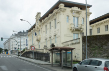
Ferrol is a proper city, not a quaint pilgrim town, and it makes for a fine starting point. The port has served the Spanish Navy since the 16th century, and the grid-pattern streets of the Barrio da Magdalena — laid out by military engineers in the 18th century — give it a surprisingly elegant feel for an industrial shipyard city. Modernist facades line the streets, designed by architect Rodolfo Ucha in the early 1900s.
Pick up your credencial at the Co-Cathedral of San Julián, a neoclassical church built in 1778 with a dome that dominates the skyline. It's open mornings (10:30-13:00) and evenings (17:30-19:00). The Camino starts at the port, next to Sarga restaurant on the waterfront — look for the route marker.
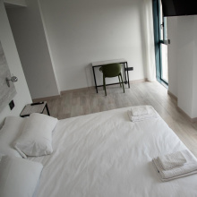
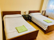
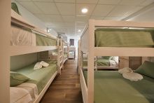
All services here: supermarkets, pharmacies, ATMs, outdoor shops. The public albergue has 60 beds and opened in 2023. Give yourself a night to explore the Magdalena district, the naval arsenal (visible from outside), and the waterfront. The Jofre Theatre and the old fish market are worth a wander if you've got time.
Ferrol's food is Galician through and through. Pulpo, empanada, and fresh seafood from the ría. You won't go hungry.
Ferrol's harbour has been a strategic military asset since the 16th century. Philip V, Ferdinand VI, and Charles III poured resources into building what became the largest naval arsenal in Europe. The city grew around the shipyards, and that industrial heritage still shapes it today. The 18th-century grid of the Magdalena quarter — six parallel streets crossed by nine perpendicular ones — was a military planning exercise that accidentally created one of Galicia's most attractive neighbourhoods.
The Camino leaves Ferrol through the city streets, heading east toward the Ría de Ferrol. The first few kilometres are urban, passing through the Polígono da Gándara industrial area before the landscape opens up along the estuary. The path follows the ría closely, and on a clear day the views across the water are a fine reward for the unremarkable start.


An industrial zone on the outskirts of Ferrol. There's nothing here for pilgrims beyond a few roadside bars, but you pass through it quickly. Press on toward the estuary.
Accommodation in Polígono da Gándara.

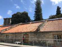
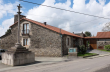
Narón is the municipality next door to Ferrol, and Xubia is where the Camino passes through. The highlight here is the Monasterio de San Martiño de Xubia, a Romanesque monastery complex founded in the 10th century by the Counts of Traba. Documents from 977 already mention it. The monastery church is a fine example of Galician Romanesque — worth a pause.
The path runs along the ría here, past the old tide mill at As Aceas de Lembeie and over the bridge across the Xubia River into Neda. A few cafes along the way. Watch for traffic on some stretches close to the road.
The monastery of San Martiño de Xubia was one of the most important Cluniac houses in Galicia, established by the powerful Counts of Traba in the 10th century. A document from 977 records a noblewoman's donation to the monastery, confirming it was already well established by then.
Accommodation in Xubia - Narón.


A small cluster around the 12th-century Iglesia de Santa María, just before entering Neda proper. The Romanesque church is worth a look if it's open. No services here — Neda is just ahead.
Neda sits at the bottom of the Ría de Ferrol where the river meets the estuary, and it's a natural stopping point about 15 km from Ferrol. The municipal albergue is well-situated in the park along the river, and several bars line the road above and behind it.
The town has Roman-era roots and is known locally for its bread-making tradition — if you arrive during the Festa do Pan, you're in luck. The Puente de Piedra (Roman bridge) and the Cascada de Belelle waterfall are worth a detour if you have the energy. Basic services: bars, small shops. No pharmacy or ATM — sort those out in Ferrol or wait for Pontedeume.
Neda's origins go back to Roman times, and the stone bridge in town is a testament to that. The Iglesia de Santa María dates to the 12th century. For a small town, it punches above its weight in history.
Festa do Pan (Bread Festival) — check locally for dates.
From Neda the path continues along the estuary through Fene and on to Cabanas. The terrain is gentle and mostly flat, following the water. About 14 km to Pontedeume.
Accommodation in Neda.
| Albergue de la Xunta de Neda 10€ 28 |

|
| Casa Rural Pazo da Merced |
| Pensión Maragoto | 
|


A pass-through town between Neda and Cabanas. No significant services for pilgrims, but you may find an open bar. The Camino skirts through without lingering.
Accommodation in Fene.
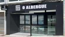
| O Albergue de Fene 18€ 18 Booking.com |
|
| Pensión A Cepa |

More appropriately called Playa Magdalena — it's the beach that defines this spot. There's a bar on the right-hand side just before you arrive at the beach, and several more at the far end. On a hot day, the temptation to stop is real.
The beach faces across the estuary toward Pontedeume, and the views of the medieval bridge and the town beyond are excellent from here.
A short distance on, after leaving the beach behind and passing under the railroad, the Camino crosses the bridge into Pontedeume.
Accommodation in Cabanas.


Pontedeume is the first town on the Camino Inglés that truly feels like a destination. Founded in 1270 by Alfonso X, it sits where the Eume River meets the ría, and the medieval bridge that gives the town its name stretches across it. The old town is compact, cobblestoned, and easy to explore on tired feet.
All services here: bars, restaurants, shops, pharmacy, ATM. The municipal albergue sits down by the harbour — a good spot to rest and watch the water. Pontedeume has genuine character: narrow streets, good food, and a sense of history that isn't put on for tourists.
The Torreón de los Andrade — the last remnant of the once-powerful feudal family that controlled this region — is now an interpretation centre. Climb to the top for views across the estuary to Cabanas, the bridge, and the fish market below. The Iglesia de Santiago and the nearby Fragas do Eume (a pristine Atlantic forest along the river) are worth knowing about, though the forest is a detour off the Camino.
Pontedeume owes its existence to the bridge. Fernán Pérez de Andrade built the original stone bridge in the 14th century — 79 arches stretching some 850 metres across the Eume. The current bridge dates to the 1860s but follows the same crossing. The Andrade family ruled this stretch of coast for centuries, collecting tolls from everyone who crossed. Their tower still stands in town, and Fernán Pérez de Andrade's tomb lies in the Iglesia de San Francisco.
Market day in Pontedeume — check locally for the weekly schedule.
Before arriving in Miño, the Camino makes several twists and turns to navigate around the AP9 highway. The walking is hilly in places and the route can feel a bit industrial near the motorway, but you're rewarded when you reach the coast again. About 12 km to Miño.
Accommodation in Pontedeume.
| Albergue municipal de Pontedeume 10€ 20 |
|
| Albergue Río Eume 15-17€ 20 Booking.com |

|
| Pensión Luis |

| Hotel Eumesa | 
|


All services in Miño, including supermarket, pharmacy, bars, and restaurants. The Albergue de la Xunta has 22 beds. The beach here is one of the better ones on this stretch of coast — if you've been walking since Ferrol, you'll have earned it.
This is your last chance to stock up properly before the long, rural stretch through to Presedo and beyond. There's little in the way of services after Betanzos until Hospital de Bruma.
From Miño the path heads inland toward Betanzos. You'll cross A Ponte do Porco about 1.5 km ahead, then continue through increasingly rural terrain into Betanzos. Around 10 km to Betanzos.
Accommodation in Miño.
| Albergue de la Xunta de Miño 10€ 22 |
|
| Hotel O Cantiño | 
|
| Hostal La Terraza Booking.com |

|


A few bars along the road before crossing the bridge. There's a small beach here too, though less impressive than Miño's. The name translates as 'Pig Bridge' — local legend involves a wild boar and an unhappy love story, though the details vary depending on who's telling it.
Services are minimal. If you need anything, Miño is behind you and Betanzos ahead.

Betanzos is worth your time. This was once the capital of one of the seven provinces of the Kingdom of Galicia, and you can feel it in the medieval walls, the Gothic churches, and the general sense that this town was once far more important than its current size suggests. The locals call it Betanzos dos Cabaleiros — City of Knights — for the noble families that shaped it.
The municipal albergue is housed in a renovated stone building and is reported to be in very good condition. All services here: shops, pharmacy, ATMs, restaurants. Beware, though — in Betanzos, it often feels that every direction is uphill. The old town sits on a hill between two rivers, and the streets wind accordingly.
Three Gothic churches dominate the old town. The Igrexa de San Francisco, built in 1387 by Fernán Pérez de Andrade (the same family from Pontedeume), contains his tomb decorated with hunting scenes. Santa María del Azogue is a 14th-century Gothic church with intricate stonework and a rose window. Both are open to visitors.
You must try the tortilla de Betanzos. It's nothing like the thick, dry tortilla you get in most of Spain — here it's runny in the centre, almost creamy. The bars around the old town all serve their version, and locals have strong opinions about which is best. The Mercado de Abastos is also good for provisions.
Betanzos dates to Roman times but reached its peak in the Middle Ages as a major political and economic centre. The medieval walls were built in the 13th and 14th centuries — fragments survive, along with three original gates including the Porta da Vila. The Andrade family left their mark here too, particularly in the Igrexa de San Francisco. The town's decline from provincial capital to quiet backwater has, ironically, preserved its medieval character better than most places in Galicia.
Festas de San Roque (August) — processions, music, and the spectacular launch of giant handmade paper balloons into the night sky. If your timing coincides, don't miss it.
From Betanzos the Camino heads inland and uphill into increasingly rural and isolated terrain. The next 26 km to Hospital de Bruma are demanding, with significant elevation gain and few services. Presedo, about 12 km ahead, is the only real stopping option with an albergue. Carry food and water from Betanzos — you'll need it.
Accommodation in Betanzos.
| Apartamentos Turísticos Mirador de la Muralla Booking.com |
|
| Apartamentos Turísticos Moreira Booking.com |
| Albergue de la Xunta de Betanzos 10€ 35 |

|
| Albergue Santa María del Azogue 20€ 16 |
| Albergue Hospedería del Convento de las Agustinas Recoletas 15€ 23 |
| Albergue Río Mandeo 18€ 24 |


No services. A tiny hamlet with one small church — the name says it all. You're deep into rural Galicia now, and the villages get smaller from here.

Another tiny hamlet, another small church. No services. The quiet is the point — after Betanzos, this stretch is as rural as the Camino Inglés gets.

There are no services in Presedo beyond the albergue. The albergue itself has 14 beds, doesn't take reservations, and sits slightly off the Camino behind the church on the main road. It's basic but functional.
If you're staying, your dining options are limited but creative. Several restaurants post their menus in the albergue and deliver. The Mesón-Museo Xente no Camião is 500 m down the road — it has WiFi and food if you fancy an evening stroll. Carry provisions from Betanzos if you want to be safe.
This is roughly the midpoint between Betanzos and Hospital de Bruma, and it's the sensible place to split the stretch if 26 km in one go feels like too much.
From Presedo the terrain continues through isolated countryside to Hospital de Bruma, about 14 km ahead. The path is quiet, wooded in places, and the villages between here and Bruma are tiny — don't count on finding a bar. Carry water.
Accommodation in Presedo.
| Albergue de peregrinos de Presedo 10€ 20 |
|

A scattering of houses along the road. No services. Keep walking.
Hospital de Bruma is a tiny hamlet with outsized historical significance — a pilgrim hospital has stood here since 1140, making it one of the oldest documented pilgrim shelters on any Camino route. The original hospital dedicated to San Lorenzo is long gone, but the albergue occupies the same spot. A modest chapel remains.
This is also where the two branches of the Camino Inglés converge — the route from Ferrol and the route from A Coruña meet here. From this point forward, you share the path.
Food is available just down the road at Casa Graña. Services are otherwise minimal — this is a hamlet, not a town.
A pilgrim hospital dedicated to San Lorenzo was established here in 1140 and became part of the Hospital de Santiago. Pilgrims have been stopping at this exact spot for nearly 900 years. The convergence of the Ferrol and A Coruña routes made this a natural waypoint.
The next stretch to Sigüeiro is about 24 km through forest and rural paths. The terrain is predominantly flat with gentle inclines — a welcome change after the hills south of Betanzos. You'll pass through several tiny villages, but services are scarce until Sigüeiro. The walking is pleasant — eucalyptus groves, traditional hórreos, quiet lanes — but carry what you need.
Accommodation in Hospital de Bruma.
| Albergue de la Xunta de Bruma 10€ 22 |

|
| Hostal San Lorenzo de Bruma | 
|
| A Casiña de Bruma |

No bar here, but there's another cluster of buildings a short distance down the road that does have one. Don't count on it being open — check locally or carry your own supplies.


A small village along the road. No notable services for pilgrims. The path continues through quiet countryside.
Accommodation in A Rúa (Inglés).
| Casa Rural DonaMaría Booking.com |
|
A small village near Ordes. No significant services, but Ordes itself — a few kilometres off the Camino — has supermarkets, pharmacy, ATMs, and restaurants if you need to resupply.
Between O Outeiro and Fonta the Camino can become confused. Keep your eyes open for arrows, and remember to distinguish between the purple and yellow variations — they mark different routes. You'll eventually come to a jumble of houses where a road ends, and it's there that the arrows become muddled. Your best option is to stay on the road and watch carefully. From this point, you'll begin a series of steep switchbacks.
Between O Outeiro and Fonta the camino can become confused. Keep your eyes open for arrows, again remembering to distinguish between the purple and yellow variations. You will eventually come to a jumble of houses where a road ends, and it is there that the arrows become confused. Your best option is to keep on the road and watch for arrows. From this point, you will begin a series of steep switchbacks.
Accommodation in O Outeiro (Inglés).
| Albergue de peregrinos Rectoral de Poulo 10€ 42 |
A handful of houses along the road. No services.
Small village. No notable services for pilgrims.
Sigüeiro is the last proper town before Santiago, and it's where you'll want to sort out anything you need before the final stretch. It sits on the Río Tambre, and the bridge across it marks the approach into town.
Basic services: a few bars, restaurants, small shops. The Albergue Camino Real is a large albergue with good facilities including a kitchen. This has been an important stopping point for English Way pilgrims for centuries — close enough to Santiago to allow an early start and arrival for the pilgrim mass.
The town is small and functional, more agricultural than picturesque. But after two days of rural walking with minimal services, a hot meal and a proper bed feel earned.
Sigüeiro has long been the traditional last stop before Santiago on the Camino Inglés. The pilgrim history here is quiet but deep.
Market day — check locally.
Accommodation in Sigüeiro.
| Albergue Ultreia et Suseia 18/20€ 12 Booking.com |

|
| Albergue Camiño Real 15*€ 18 |
|
| Albergue Mirás 18€ 14 Booking.com |
|
| Segue o Camiño 18€ 20 Booking.com |
|
| Sigüeiro Hostel Booking.com |

|

A small village between Sigüeiro and Santiago. No significant services. You're getting close now.
An industrial estate on the outskirts of Santiago. There's a café-bar here (Café Bar Polígono) for breakfast or coffee, but the surroundings offer little visual reward. This is the final sprint — the old town is close now, and you'll be walking through city neighbourhoods from here.
Accommodation in Polígono de Tambre.

Welcome to Santiago. You've walked the English Way, and whatever your reasons for being here, the city has a way of making the arrival feel significant.
Your first pilgrim business is likely in front of the Cathedral, at kilometer zero. A shell and plaque mark the spot in the centre of Plaza Obradoiro. Take a moment — or don't. Some pilgrims are emotional here, others just want a shower. Both are valid.
If you want your Compostela, head to the Pilgrim's Office. It moved in 2016 to a bright new building. From Plaza Obradoiro, face the Parador (the large hotel on your left when facing the Cathedral) and take the road that goes downhill to the left. Halfway down you'll pass the public restrooms, then turn right at the next street. The office is at the end. There are few arrows pointing the way, which feels like one last navigational test.
You're encouraged to stay at least one extra day. Santiago's old town is a web of narrow streets that all seem to bring you back to the Cathedral, and there's more here than you'll see in an afternoon.
The Cathedral — Plaza by Plaza
1. Plaza de Inmaculada (Azabache): The first part of the Cathedral you'll encounter coming into the city. The Puerta de la Azabachería faces the Monastery of San Martín Piñario across the square.
2. Plaza Obradoiro: From Azabache you pass under the Palace of the Bishop — adjoined to the Cathedral and not the sort of palace that affords much peaceful sleeping, given the bagpipes from dawn to dusk. The stairway leads to Plaza Obradoiro and kilometer zero. The scallop shell is embedded in the centre of the plaza. The Obradoiro facade is the most photographed face of the Cathedral — 18th-century baroque, all movement and glass. Behind it lies the Pórtico de la Gloria, the original entrance to the church designed by Maestro Mateo 600 years before the new facade was built.
3. Plaza Platerías: Continue around the Cathedral to the Puerta de las Platerías, named for the silver shops that still trade below it. Some of the stonework is replacement carving — the originals were damaged and moved to the Cathedral Museum, and unfortunately nobody remembered the original composition. The result is a somewhat nonsensical arrangement. The Platerías fountain in front is the usual meeting point for pilgrims — everyone calls it 'the horse fountain'.
4. Plaza de Quintana: The largest of the squares, home to the Puerta de Perdón. The actual Holy Door is behind this facade — which isn't really part of the Cathedral structure, more a highly decorated wall built around the door itself. The 24 saints and prophets carved here are worth studying.
Inside the Cathedral
In medieval times, pilgrims slept on the Cathedral floor and fought — sometimes to the death — for the privilege of sleeping near their preferred chapel. Things have calmed down since.
The best time to visit is early morning, before the crowds. The crypt and the bust of Santiago can be visited quietly then. The botafumeiro — possibly the largest thurible in the Catholic Church — is swung across the transept by a team called the tiraboleiros. It has come loose from the ropes only twice, and never in modern times. The schedule for swinging it changes — ask at the Pilgrim's Office for current information.
San Martín Piñario
The Monastery of San Martín Piñario is enormous — you'll find yourself walking beside it constantly on the north side of the Cathedral. Three cloisters. The church entrance is curious: you descend stairs to reach the doors, rather than climbing them. The reason is a decree by the Archbishop that no building should exceed the Cathedral in height. The architects didn't make San Martín shorter — they dug down and started lower.
San Fiz de Solovio
The oldest building site in Santiago, though you wouldn't guess it from the modest exterior. Find it by heading to the Mercado de Abastos. San Pelayo — the hermit who rediscovered the bones of Santiago — was praying here when the lights called him. Excavations have revealed foundations and a necropolis dating to the 6th century.
The Mercado de Abastos
The produce market is a good place to wander for lunch. Compared to the markets in Madrid or Barcelona, Santiago's is a fairly solemn affair — utilitarian architecture, as Galician as it gets. But the vendors are the experience. Many are second, third, or fifth generation market operators. The current buildings date from the early 1940s but replace structures that stood for 300 years.
Alameda Park
Once a place for Santiago's elite to parade their wealth along class-segregated paths. Now democratic. The park hosts a Ferris wheel and feria in summer, an ice skating rink in winter, and a massive eucalyptus tree with views of the Cathedral year round.
Casa de la Troya
The Troya House inspired one of the most celebrated novels in Spanish literature — a young man from Madrid forced by his father to finish his law studies in Santiago. A tale of misery and eventually love. The museum recreates the boarding house as it would have looked when the novel was written. The Tuna musicians who perform nightly in Plaza Obradoiro would have lived here.
The Hidden Pilgrim
In Plaza Quintana, hiding in the shadows cast by the Cathedral, there's a pilgrim carved into the stone. He's only visible at night. Finding him might take a while.
Santiago has many more monasteries beyond these. Walking between them reveals the bones of how the city was built. Take the time.
Book ahead if you're arriving in high season. The albergue roster has grown in recent years, but pilgrim numbers still exceed capacity in summer. Private accommodation fills up fast around the Feast of Saint James.
The Feast of Saint James (July 25) is the big one — a full week of music and dance, with fireworks in Plaza Obradoiro on the evening of the 24th. Best views from Obradoiro itself or from Alameda Park.
Accommodation in Santiago de Compostela at the end of the Camino Inglés.
| Albergue O Fogar de Teodomiro 19+€ 24 Booking.com |

|
| Albergue SCQ 21+€ 24 Booking.com |

|
| Albergue SIXTOS no Caminho 18-35€ 40 Booking.com |

|
| KM. 0 26+€ 55 Booking.com |

|
| Blanco Albergue 18+€ 20 Booking.com |

|
| Albergue La Credencial 19+€ 36 Booking.com |

|
| Albergue La Estación 20-30€ 30 Booking.com |
|
| Albergue Porta Real 21+€ 20 Booking.com |

|
| Albergue Meiga Backpackers 16+€ 30 Booking.com |

|
| Albergue Seminario Menor en Santiago de Compostela 17€ 199 Booking.com |

|
| Albergue Mundoalbergue 20+€ 34 Booking.com |

|
| Albergue Santo Santiago 14-18€ 40 Booking.com |

|
| Albergue The Last Stamp 19-25€ 62 Booking.com |

|
| Albergue Azabache 20+€ 20 Booking.com |

|
| Albergue La Estrella de Santiago 15+€ 24 |

|
| Albergue Linares 18+€ 14 Booking.com |

|
| Pensión Casa da Balconada Booking.com |
|
| Pensión Pazo de Argra ★ Booking.com |

|
| Hospedería San Martín Pinario ★ Booking.com |

|
| Albergue-Hotel LoopINN 30+€ 48 Booking.com |

|
| Alameda Rooms Booking.com |

|
| Mapoula PR Boutique Booking.com |

|
| Albergue Fin del Camino 15€ 110 |

|

