
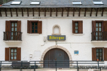
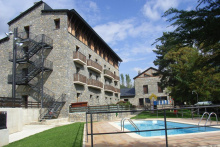
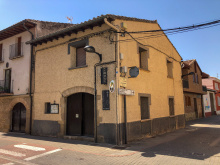
Accommodation in Somport.
| Albergue Aysa 27*€ 40 |

|
| Le Somport 12/15€ 12 |

Accommodation in Candanchú.
| Albergue Pepe Garcés 23*€ 48 |

|

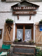
Accommodation in Canfranc Estación.
| Albergue Juvenil de Canfranc Estación 9€ 44 Booking.com |
|
| Albergue Río Aragón 19€ 40 Booking.com |
|
| Casa Rural Marieta Booking.com |
|


Accommodation in Canfranc.
| Refugio de Canfranc Sargantana 11.20€ 74 Booking.com |

|
| Casa Rural La Cabaña Booking.com |

Accommodation in Villanúa.
| Albergue Juvenil Villanua 39*€ 125 |

|


The camino splits shortly after passing through Jaca. The longer of the routes, which visits the monasteries of San Juan de la Peña is the most original of the two. Pilgrims being pilgrims, a shortcut was made which for its shortness has become a well-worn path parallel to the national road. If you can manage an additional 11.5km, you are advised to take the more southern route to the monasteries.
Both paths rejoin in Santa Cilia.
NOTE: The Jaca to Puente la Reina stage splits just before Puente La Reina. Puente is actually on the Northern Route to Sangüesa. Crossing the bridge and entering Puente is not a large detour if you wish to follow the road to Arres (returning over the bridge), and there are services in Puente but no albergue.
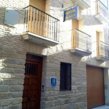
Accommodation in Jaca.
| Albergue de Peregrinos de Jaca 11€ 32 |

|
| Albergue Casa Mamré 25€ 16 |
|
| Hostal París Booking.com |
|


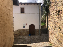
Accommodation in Santa Cilia.
| Albergue de Santa Cilia de Jaca 10€ 18 |

|
The distance to Arres (on the Southern route) is about 4km from the Puente la Reina bridge.
Accommodation in Puente la Reina de Jaca.

Accommodation in Arrés.
| Hospital de Peregrinos de Arrés Donativo€ 16 |

|
| Posada El Granero del Conde |

Accommodation in Artieda.
| Albergue de Artieda 12€ 16 |
|


Accommodation in Ruesta.
| Albergue de Ruesta 12€ 64 |
|

Accommodation in Undués de Lerda.
| Albergue de Undués de Lerda 9€ 24 |

Accommodation in Sangüesa.
| Albergue de peregrinos de Sangüesa 5€ 14 |
|
| Hostal Rural JP 10€ Booking.com |
| Hotel Yamaguchi |


Accommodation in Monreal.
| Albergue de Peregrinos de Monreal 10€ 20 |
|
| Casa Rural Etxartenea 10 |


Accommodation in Tiebas.
| Albergue Concejo de Tiebas 12€ 14 |

|

The Iglesia de Santa Maria de Eunate is one of the most remarkable buildings on the Camino Frances, standing alone in a field about 1.5 km south of Murozabal. It's an octagonal 12th-century Romanesque church surrounded by a freestanding arcade of arches — a design so unusual that scholars have been arguing about its origins for centuries.
The name Eunate likely derives from the Basque for "hundred gates," a reference to the arcade's many openings. That arcade — roughly octagonal itself, with carved capitals and semicircular arches — surrounds the church at a slight distance, creating a covered walkway. It's unlike anything else in Navarra.
The Templar theory is popular but unproven. No documentary evidence links the church to the Knights Templar, though the octagonal form inevitably invites the comparison. The more likely builders were the Hospitallers, whose presence in this area is well documented. The church may have served as a funerary chapel for pilgrims who died on the road — pilgrim burials have been excavated in the surrounding field, and the octagonal plan echoes the Church of the Holy Sepulchre in Jerusalem, a common model for funerary architecture.
Inside, the church is bare and austere. The eight-ribbed vault rises to about 12 meters, with star-shaped openings in the ceiling that admit thin shafts of light. The alabaster windows keep the interior deliberately dark — appropriate for a church whose function may have been the performance of funerary rites. The Cordoban influence in the vault ribbing is unmistakable.
The church operates as a small museum with seasonal hours (generally 10:30-14:00 and 15:00-19:00 from late March through mid-October, with extended afternoon hours in July and August). A path connects Eunate directly to Obanos, so you can visit without backtracking to Murozabal.
The church dates to around 1170. Its octagonal plan and detached cloister arcade are unique in Navarra and rare in all of Europe. The 26 decorated capitals of the interior columns show a mix of geometric, vegetal, and figural motifs. The eight-ribbed vault, with each rib meeting at a different angle because the octagon is slightly irregular, shows sophisticated engineering and a clear debt to Islamic architecture from Cordoba.
The pilgrim burials found around the church support the funerary chapel theory, as does its position near the junction of the Frances and Aragones routes — a natural place for a pilgrim cemetery. The name Eunate is generally understood as Basque for "hundred gates," referring to the arcade's arches. The Hospitallers of St. John are the most likely patrons, though definitive proof remains elusive.

Obanos is the real-life setting of a passion play that takes place here every even-numbered year at the end of July. It is a tragic tale of two saints.
The origins of the play are traced to the 14th century, when Santa Felicia, sister to the Duke of Aquitaine (San Guillén), left her home for a pilgrimage to Santiago.
The life suited her and when she arrived in Obanos she decided to devote herself to aiding pilgrims. Her brother set out on a mission of his own, that of bringing her back home with the lure of the comfortable lifestyle she had left behind. He was unable to do so, and in a fit of rage killed her.
Wracked with remorse, the young Duke decided to complete her pilgrimage in penitence. On his return journey, he holed up in the nearby hermitage of Arnotegui. He built a chapel there and continued the mission that his sister had begun.
The Iglesia de San Juan Bautista preserves the skull of Guillén.
The Mystery of Obanos - end of July on even numbered years, see history below.
Outside of Obanos, on the road to Puente la Reina, the Camino Aragonés joins the Camino Francés.
Accommodation in Obanos From the Aragonés.
| Casa Rural Raichu 9 |
|
| Hostal Rural Mamerto |

Puente la Reina (Gares in Basque) is built along a single main street — the Calle Mayor — that runs from the Iglesia del Crucifijo at the eastern entrance to the famous medieval bridge at the western exit. In between lies a handsome town of stone houses, arcaded streets, and two churches worth seeing. The town's medieval grid of three parallel streets, laid out in the French bastide style, survives largely intact.
The Iglesia del Crucifijo, at the entrance to town, was founded by the Knights Templar in the late 12th century. It houses a striking Y-shaped crucifix — a 14th-century work, likely of German Rhineland origin, that arrived here via pilgrim hands. The unusual shape, with Christ's arms raised above his head on a tree-like cross, makes it unlike any other crucifix on the Camino. The church has two naves: the original Romanesque nave and a Gothic addition from the 14th century.
Further along the Calle Mayor, the Iglesia de Santiago has a Romanesque doorway with a multilobed arch showing Moorish influence — one of the finest carved portals in Navarra. Inside is the Santiago Beltza, a 14th-century Gothic wooden statue of Santiago Peregrino, darkened by age and once coated in soot. The name means "Black Santiago" in Basque.
The bridge itself — the Puente de los Peregrinos — is a six-arched Romanesque span over the Arga, 110 meters long, with smaller vent arches between the main arches to handle flood waters. It originally had three defensive towers, though only fragments of one survive. Cross it at the end of the day when the light hits the stone and you'll understand the fuss.
Several albergues operate in town, along with a handful of hotels and pensiones. Bars and restaurants line the main street, and there's a supermarket for provisions. The town has a pharmacy and an ATM. If you're arriving from the Camino Aragones via Eunate, you'll enter from the south and join the Frances here.
The bridge was built in the 11th century, commissioned — according to tradition — by a queen of Navarra. Historians debate which queen: the leading candidates are Dona Mayor (wife of Sancho III el Mayor) and Dona Estefania (wife of Garcia el de Najera). Whoever ordered it, the bridge was built specifically to serve pilgrims crossing the Arga.
The town received its fuero (charter) in 1122 from Alfonso el Batallador, designed to encourage settlement. The town grew up around the bridge with its French-style bastide layout of parallel streets. It was fortified in the 13th century with a rectilinear wall of 26 towers. Most of the wall has been absorbed into private houses — the Hotel El Cerco incorporates stonework from one of the original towers, and the Calle Cerco ("wall street") traces the old perimeter. Of the four original gates, only the one opening onto the bridge survives.
The Knights Templar maintained a presence here from the mid-12th century, when King Garcia Ramirez IV donated land to the order. They built the Iglesia del Crucifijo and its attached pilgrim hospital. When the order was dissolved in 1312, the facility passed to the Hospitallers (Order of St. John), who added the Gothic nave to the church in the 14th century.
Santiago is the patron saint — fiestas run from July 24 to 30 with music, processions, and bullfights. Harvest festivals in September celebrate the piquillo peppers grown in the surrounding hills between here and Eunate.
The camino crosses the bridge and turns left, crossing the main road and picking up a footpath. Almost immediately it begins a short, steep climb on terrain that gets slippery when wet — a common sight here is cyclists pushing their bikes up. The footing improves quickly and the route continues through pleasant agricultural land toward Maneru, about 5 km ahead.
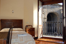
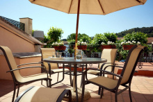
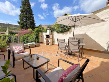
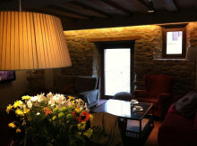
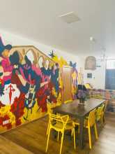
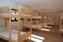
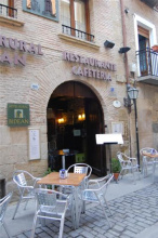
Accommodation in Puente la Reina.
| Casa Maitetxu Booking.com |

|
| Casa Maitetxu 2 Booking.com |
|
| Apartamentos Puente La Reina Booking.com |
|
| Ganbara Booking.com |
|

| Albergue De Peregrinos Santiago Apostol 12-14€ 100 Booking.com |

|
| Albergue Jakue 25€ 16 Booking.com |

|
| Albergue Puente Para Peregrinos 16€ 32 Booking.com |

|
| Albergue Estrella Guia Solo Peregrinos 25€ 6 Booking.com |
|
| Albergue Gares 15€ 40 Booking.com |
|
| Albergue de los Padres Reparadores 9€ 100 |

|
| Hotel Rural Bidean Booking.com |
|

![Photo of Puente la Reina [Gares] on the Camino de Santiago](/sites/default/files/styles/max_650x650/public/newimages/840-200.jpg.webp?itok=sIctMG6K "Photo of Puente la Reina [Gares] on the Camino de Santiago")
![Photo of Puente la Reina [Gares] on the Camino de Santiago](/sites/default/files/styles/max_650x650/public/newimages/840-133359.jpg.webp?itok=7HPS8Shy "Photo of Puente la Reina [Gares] on the Camino de Santiago")