
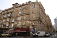
Porto is half the size of Lisbon and twice as rewarding. It sits perched on steep hillsides above the north bank of the Rio Douro, and its historic center could absorb two full days of exploring without repeating a single street. If you've planned a rest day, this is the place for it.
The essential sights are concentrated enough to fill a solid afternoon. The Igreja dos Clerigos and its adjoining tower cost 5 euros, but the 360-degree view from the top justifies every cent and every one of the 200 steps to reach it. Leave your pack behind -- the spiral staircase is a tight squeeze. The Igreja do Carmo is unassuming from the outside but spectacular within, and the 15,000-tile azulejo panel covering its lateral wall is one of the largest in Portugal. The Se do Porto, the city's cathedral, is one of Porto's oldest surviving structures and sits at the highest point of the old town, commanding wide views over the rooftops.
If you entered town along the upper bridge crossing you'll have missed the Cais da Ribeira, the riverside boardwalk that runs below the Se. The restaurants there are overpriced but the atmosphere -- particularly at sunset when the Port wine lodges across the river catch the light -- makes up for it.
The Estacao de Sao Bento, even if you're not catching a train, is worth a detour for its entrance hall. Some 20,000 azulejo tiles painted by Jorge Colaco depict scenes from Portuguese history, from the Battle of Valdevez to the arrival of King Joao I in Porto. The Livraria Lello, a short walk uphill, draws long queues for its neo-Gothic interior and helical staircase, though the entry fee is redeemable against a book purchase.
Porto's food scene deserves attention. A francesinha -- the city's signature sandwich of cured meats, fresh sausage, and melted cheese drenched in a beer-and-tomato sauce -- is a rite of passage. Wash it down with a glass of Port from one of the lodges in Vila Nova de Gaia, directly across the river.
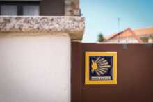
Before you set off be certain to pick up a pilgrim’s credencial if you have not already done so. It can be found at the Sé Cathedral. This accordion-fold booklet is your passport to the camino and will become your most cherished souvenir of the trip. It is a required document in most pilgrim-specific accommodation, earns you pilgrim prices in many museums, and will serve as proof of your journey when presented to the Pilgrim Office in Santiago if you are planning on getting your Compostela Certificate.As large towns go, Porto is no different when it comes to finding the camino. In fact, it is complicated somewhat by the fact that there are three different caminos between here and Santiago, be aware that you may see signs indicating the ‘Coastal Route’ or the ‘Braga Route,’ or the ‘Central Route’; amongst others.
The Portuguese call Porto the Cidade Invicta -- the Unvanquished City. The name stuck after Porto withstood an 18-month siege by King Miguel I in 1832-33. Miguel had little interest in honoring the liberal constitution drafted after a local uprising, but the city held firm. He eventually abdicated, the constitution was restored, and Porto's defiance became a symbol of Portugal's Enlightenment values.
The city's roots go far deeper. A Celtic-Roman settlement called Portus Cale gave its name first to the county and eventually to the entire nation. Porto was already an important trading port by the 14th century, and its shipyards supplied many of the caravels that launched Portugal's Age of Discovery. The story goes that the citizens donated so much of their meat to provision Henry the Navigator's fleet that they were left with nothing but tripe -- earning Porto the nickname Cidade dos Tripeiros, the Tripe City.
The Port wine trade, established by treaty with England in the 17th century, transformed the city. The wine lodges that line the south bank in Vila Nova de Gaia remain the industry's beating heart.
Between Porto and the border with Spain, the camino splits into three distinct routes. They are known as the Central Way, the Coastal & Litoral Ways, and the Braga Way. Additionally, there are several paths that connect each of these options, creating a network of trails that can sometimes seem confusing. The best plan is to pick one of the options and simply follow it to its natural end.Leaving a large city is often a challenging combination of searching for arrows, heavy traffic, and durable city pavements. As an alternative, it is possible to take the Porto Metro to the city limits or beyond.THE CENTRAL WAYThe Central Way is currently the most popular and well-developed option. As the name implies, the route continues due north from Porto up the center of Portugal. It crosses into Spain at Valença/Túi and continues from there through Redondela to Santiago. THE COASTAL and LITORAL WAYSThe Coastal Way is gaining in popularity as the infrastructure and signage improve. It is sometimes referred to as the Senda Litoral, although this name is technically reserved for the sections of the route that strictly follow the coast. As the primary motivation for choosing the route is the proximity to seaside views, the route set out in this book is a combination of these two routes and the blue line indicated on the map should be interpreted as such. It leaves Porto along the Litoral Route, rather than sharing the first day of walking with the Central Way before turning westward. Where options exist they are indicated on the inset maps. The route passes through Vigo and rejoins the Central Way in Redondela.THE BRAGA WAYSome would consider this the original way, as it passes through the city of Braga where many of the Church's earliest decisions regarding Santiago were made, and where the first Bishop ordained by Santiago (Saint Peter of Braga/Rates) officiated. It was once the capital of Galicia and remains an influential city and massive tourist attraction. These days the infrastructure along the route has not kept pace with the needs of pilgrims and it is seldom traveled. Tours to Braga can be arranged in Barcelos (on the Central Way) if you wish to visit the city. This route is not included in this guide.THE VARIANTE ESPIRITUALThe Variante Espiritual is a popular alternative route north of Pontevedra. It is a two day walk which ends in a 29km boat ride to the town of Pontecesures.
Accommodation in PORTO – ALONG THE COASTAL ROUTE.
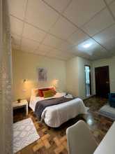
| Albergue de peregrinos Porto 20€ 50 |

|
| Spot Hostel 20+€ 42 Booking.com |

|
| The Poets Inn Booking.com |

|
| Gallery Hostel 22*€ 40 Booking.com |

|
| Porto Lounge Hostel 17*€ 26 Booking.com |

|
| Albergue de Peregrinos da Senhora da Hora 13€ 20 |

|
| AHBV Porto Donativo€ 2 |


Foz do Douro sits where the Rio Douro empties into the Atlantic, and it marks the true beginning of coastal walking. The Jardim do Passeio Alegre, a shaded garden near the river mouth, makes a pleasant first stop. Beyond it, the Farol de Felgueiras lighthouse stands at the end of a long breakwater -- worth the walk out for views back toward the city, though it can be exposed in rough weather.
The Castelo do Queijo, a small 17th-century fort perched on a granite outcrop, guards the transition from river to ocean. The name -- Castle of Cheese -- comes from the rounded shape of the rock it sits on. From here north, the Atlantic is your constant companion.
Accommodation in Foz do Douro.
| Pousada de Juventude Porto 10/12*€ 148 |

The Metro Line A (Linha de Matosinhos) terminates here and offers a convenient way to skip the least scenic stretch when leaving Porto. You can also reach Matosinhos directly from Porto Airport with a single transfer, handy if you're skipping Porto altogether.
Matosinhos is Porto's fishing port, and the streets near the harbor are lined with grilled-fish restaurants where sardines and sea bass cook over charcoal on the pavement. The Senhor de Matosinhos church, designed by the Italian architect Nicolau Nasoni in the 18th century, anchors the town center. If you're passing through in June, the Festa do Senhor de Matosinhos fills the streets with processions and music.
The camino enters town along the beach-front, and turns inland when it reaches the harbor, making a zig zag path to the bridge over the Río Leça. At the end of the bridge you will turn left at the large roundabout, to follow the Rua Hintze Ribeiro back towards the waterfront.
Accommodation in Matosinhos.


There's a bar at the cluster of buildings near the lighthouse, as well as the small Capela de Boa Nova perched on the rocks above the surf. Architecture enthusiasts will recognize the Casa de Cha da Boa Nova, a tea house designed by Alvaro Siza Vieira in the 1960s and now a two-Michelin-star restaurant -- one of his earliest completed works, built into the granite coastline with the Atlantic crashing beneath it.
Passing the lighthouse, keep your gaze to the left, where you can enjoy a sea view far superior to the oil refinery to your right. Between here and the Obelisk you will follow off and on a walkway, passing several food options.

The Obelisk marks the spot where liberal forces under Dom Pedro IV landed in 1832 during the Portuguese Civil War, the same conflict that would earn Porto its nickname as the Unvanquished City. It's a simple stone column, but it marks the beginning of a particularly pleasant stretch of beachfront walking.
From the Obelisk, keep on the beach-side walkways straight ahead. You will pass several bar/restaurants along the way to the Angeiras Sea Houses. The camino follows a pedestrian promenade alongside the sea.

At the start of town you'll find the Angeiras Sea Houses, a row of traditional fisherman's cottages now preserved as a small museum. If niche museums are your thing, they're worth a look -- Angeiras has a long history as a fishing village and the cottages give you a sense of how that life was actually lived. The village itself is quiet, with the sound of the Atlantic doing most of the talking.
At the end of town, leave the road and rejoin the familiar wooden boardwalk, it will soon cross the Río Onda to rejoin the road into Labruge.
Accommodation in Angeiras.
| Clara's Home Booking.com |

|
| Camping Orbitur Angeiras 13-21€ Booking.com |

|
| Angeiras Beach Hostel 32+€ 70 Booking.com |
|


Labruge is a small seaside town. Most services, including the albergue, are located off the camino -- you'll need to turn toward the village center to find them. The beach here is broad and often empty midweek.
At the end of town is the Avenida Da Libertade, turn right here to get to the albergue or continue straight along the beach walk. Arrows are sparse, but a few point the way to the Castro of Sampaio.
Accommodation in Labruge.
| Albergue de S. Tiago 15€ 102 |

|


The Castro de Sampaio (also called Castro de San Paio) is an Iron Age hillfort site above the coast. What remains are mostly foundation walls and earthworks, but the elevated position offers good views over the surrounding dunes and shoreline. A small chapel sits at the hilltop. Castros like this one dot the entire northwestern Iberian coast -- fortified settlements built by Celtic peoples well before the Romans arrived.
The camino leaves the familiar beach setting but follows close to the shore while it climbs to reach the chapel and castro of San Paio. From here follow the walkway along the dunes to reach Facho - Vila Chã.

Vila Cha was traditionally a fishing village, and it's remembered for its sargaceiras -- the women who gathered seaweed from the shore and hauled it inland for use as fertilizer. The work was backbreaking and the pay was poor, but it sustained families for generations. A monument in town honors them. Today the village is quieter, and the camino passes through without touching the waterfront.
At the start of town the camino turns away from the shore and passes through the village, gone is the wooden boardwalk. It will stay some distance from the shore until Povoa de Varzim.
Accommodation in Vila Chã.
| Blue Tex Booking.com |

|
| Prothea Home Booking.com |

|
| Casa Do Facho Booking.com |

|
| Casa Do Mar Booking.com |

|
| Casa Da Fátima Booking.com |

|
| Albergue Trendy Villas 25-35*€ 8 Booking.com |
|
| Albergue de S. Mamede 10€ 20 |

|
| Pensão Café Sandra |

Mindelo is a small coastal village. A new boardwalk has been completed, which means you no longer need to take the red alternate route that older guides may reference. The boardwalk makes for pleasant walking along the shore.
The new boardwalk out of Mindelo has been completed and you no longer need to take the red alternate route.
There are two ways from Mindelo to Ávore, one along the waterfront and one inland. In recent years the waterfront option has become sand-swept, making it difficult for cyclists.

From Ávore the walking is entirely along paved roads.
Azurara sits on the south bank of the Rio Ave, just one Metro stop before Vila do Conde. The Metro Line B (Linha da Povoa) passes through, with a station here if you need to cut the day short. The bridge crossing into Vila do Conde offers your first view of the town's aqueduct and the Convento de Santa Clara high on the hillside.
The Metro of Porto Line B (Linha da Póvoa) passes through Azurara. To stop here, disembark at the Azurara station, but note that one more stop takes you to Vila do Conde’s Santa Clara station.
Between Azurara and Vila do Conde flows the Rio Ave. Once over the bridge, turn left and walk along the park and Plaza de la Republica. At the end of the park follow straight (along the waterfront) until the next side street (the Rua do Lidador) where you turn right and uphill. At the top of hill there is an intersection of the old-town style, which is to say many directions all difficult to describe. Keep straight here, if somewhat to the right, and head towards the Igreja Matriz.
Accommodation in Azurara.


Vila do Conde is the first town along the Coastal route that genuinely merits an extended visit. It's a popular destination among the Portuguese, though it's somewhat overshadowed by the larger Povoa de Varzim to the north.
The town's most striking feature is visible from a distance: the Aqueduct of Santa Clara, a 17th-century engineering marvel whose 999 arches carry water some 4 kilometers from a spring to the Convento de Santa Clara. The convent itself dates to the 14th century and sits high above the Rio Ave. Both the aqueduct and the convent are to your right after crossing the bridge into town.
In the town center, the Igreja Matriz is a handsome Manueline church built at the order of King Manuel I, who passed through Vila do Conde in 1502 on his own pilgrimage to Santiago. His visit left a lasting mark on the town's architecture. Down by the waterfront, the Forte de Sao Joao Baptista (also known as the Forte de Nossa Senhora da Assuncao) guards the river mouth -- it's a bit off the camino but falls along one of the waterfront alternatives.
Vila do Conde has a centuries-old tradition of bobbin lace, known as rendas de bilros. The craft still survives, and you can see lace-makers at work at the Museu das Rendas de Bilros near the center. The town also played a significant role in Portugal's Age of Discovery as a shipbuilding center -- a full-scale replica of a 16th-century nau is on display at the waterfront.
The Metro of Porto Line B (Linha da Póvoa) passes through Vila do Conde. To stop here, disembark at the Santa Clara station.
Vila do Conde is among the oldest known settlements in Portugal, with archaeological discoveries dating back more than 100,000 years. More recently it was a seaport that played a critical role in Portugal's 16th-century Age of Discovery. King Manuel I passed through on his pilgrimage to Santiago in 1502, a visit that led to the construction of the Igreja Matriz and several other notable buildings. The town's shipyards built many of the vessels that carried Portuguese explorers to Africa, India, and Brazil.
The Feira de Gastronomia runs during the third week of August -- plan on being hungry for nine days. The Feira Nacional de Artesanato, a well-known crafts fair, runs from the last week of July through the first week of August. Friday is market day, held next to the church.
From the Igreja Matriz you have two options, the one indicated by the signs takes you through the center of this large town and carries on straight past the church. It is well marked.
The other option is to follow along the Litoral route which is unmarked but easy enough to get to. Opposite the church (on your left as you approach the church) is a small plaza, cross it and follow to the right. Turn left on the second street, the Largo de Doutor Antonío José Almeida. This will take you down to the waterfront, where you turn right and follow the walk all the way to Povoa de Varzim. Just past the harbor the beach-front picks up, and it is here where the main route rejoins.
Accommodation in Vila do Conde.


An unofficial route connects the Coastal route in Vila do Conde with the Central route in Sao Pedro de Rates. It's marked with two sets of arrows -- one newer and brighter, the other faded and sometimes hard to spot. They don't always agree, but both will get you where you're going. The route is predominantly road walking with less than 1 kilometer on woodland trails.
No arrows in Vila do Conde itself will point you toward this route. This is deliberate -- it prevents anyone from accidentally following arrows in the wrong direction.
The key to finding the way is the aqueduct. From the bridge over the Rio Ave you can see the Convento de Santa Clara and its aqueduct up on the hillside. Follow the aqueduct -- it will be your guide out of Vila do Conde. There are no arrows at this point, but they emerge gradually as you go.
Follow the aqueduct to the first barrier -- a fenced-in pasture. Turn left, then right at the first opportunity to get back alongside the arches. The official arrows keep you adjacent to the aqueduct all the way to a point where you must cross a road with no crossing. A safer alternative (marked in red on the map) takes you left at the first roundabout, across the main road near a Renault dealership, then loops back to rejoin the aqueduct.
Continue alongside the aqueduct until you reach a wall with a historical plaque. Turn left and follow the arrows carefully to the main road, where you turn right. The road brings you back to the aqueduct once more. You may notice the arches getting progressively lower -- you're climbing, and the water source is underground. The camino abandons the aqueduct before you get the satisfaction of being taller than it.
Past the highway underpass, the official arrows turn left along a straight, slightly industrial road. An alternative (mapped in red) follows a winding path through small villages -- impossible to describe turn by turn, but manageable with the map. The two rejoin about a third of the way to Rates.
From here the arrows improve markedly. Follow them all the way to the entrance of Rates, but take care not to accidentally loop back to the Coastal route. Aim for the church and avoid any arrows near the bike path -- that way leads to Esposende. From the church, arrows guide you uphill to the albergue and the Central route.

Povoa de Varzim is one of Portugal's most popular seaside resorts, backed by nearly 12 kilometers of sandy beaches and fronted by hotels, shops, and a casino. All of this was built to serve the summer crowds, but outside peak season the town has a quieter, more local character.
Beneath the resort veneer, Povoa has a deep fishing heritage. The Ethnography and History Museum documents centuries of maritime life, including the Siglas Poveiras -- a system of geometric symbols unique to Povoa's fishing families, used for generations to mark property and identify boats. Some of these symbols bear a striking resemblance to ancient runes, though scholars debate whether there's any actual connection.
If you have time for a detour, the Cividade de Terroso lies about 5 kilometers inland. It's an Iron Age hillfort, one of the best preserved in the region, with ring walls and circular house foundations spread across a hilltop. It's not on the camino, but it gives context to the castros you'll pass along the coast.
The Metro of Porto Line B (Linha da Póvoa) terminates here.
The entirety of the walk between Póvoa and A Ver-o-Mar can be done along the coast, following the shoreline. Shortly before arriving in A Ver-o-Mar the signs are unclear. If you get to a large soccer field (no grass) you want it to be on your right, but it will likely be on your left. If it is on your right, the way is across a small bridge. If it is on your left, simply turn left at the end of the field and keep on straight, across a different bridge but one which will likewise take you across a small sandy stretch into A Ver-o-Mar.
Accommodation in Povoa de Varzim.
| Varzinn Hotel ★★★ Booking.com |

|
| Hotel Costa Verde ★★ Booking.com |

|
| Hotel Avenida ★★ Booking.com |

|
| Luso Brasileiro ★★ Booking.com |

|
| The One Grand Hotel Da Póvoa ★★★★ Booking.com |

|
| We Are Hostel 2 Booking.com |

|
| We Are Hostel Booking.com |

|
| Sardines And Friends Hostel 04 18-20€ 12 Booking.com |

|
| Albergue São José de Ribamar 10€ 36 |

|

The name translates as something close to "to see the sea," which is exactly what you do from this small village. There's little in the way of services, but the beachfront walking between here and Santo Andre is some of the most pleasant on the Coastal route.

The chapel of Santo Andre sits up the first street on your right. There's a bar at the hotel and another on the way to the chapel. The village is small but marks a decision point -- you can follow the coast or turn inland through quiet residential streets interspersed with vegetable gardens.
The camino splits once more at the start of Santo André. You can either follow the coast or turn right towards the chapel, and then left at the first roundabout onto the Rua Santo Andre de Cima. The latter course will take you through quiet residential areas interspersed with vegetable patches and a few services.
Accommodation in Santo André.


Aguçadoura is a small coastal farming village where the sandy soil supports intensive agriculture right up to the edge of the dunes. The fields here produce vegetables year-round, and you'll see plastic-covered greenhouses alongside traditional open plots. The beach is broad and often empty.
Follow the camino along the coast. Shortly before arriving to Apúlia the camino splits, and this time the preferred route (for being more direct) takes you away from the beach.
Accommodation in Aguçádoura.


| Casinhadapraia Booking.com |

|
| Mar Rosa Booking.com |

|
| Albergue de Aguçadoura 15€ 24 |

|
Apulia has a long tradition of harvesting seaweed from the shore, a practice called apanha do sargaco that sustained coastal communities for centuries. The seaweed was dried and used as fertilizer on inland farms. The tradition has mostly died out, but you can still see espigueiros -- the narrow, elevated stone granaries -- standing near the beach, a reminder of the agricultural economy that depended on these coastal resources.
An alternate route follows the coast from Apulia, and the seaside bars along that stretch are a welcome temptation.
The most direct route from Apúlia to Fão is away from the beach and through a brief stretch of heavy woodlands.
Accommodation in Apúlia.


Fao sits on the south bank of the Rio Cavado, just before the bridge crossing into Esposende. It's a quiet village with limited services. The bridge itself deserves a word of caution -- the pedestrian section is quite narrow, so take your time and stay aware of traffic.
Crossing the Rio Cávado from Fão to Esposende is done via bridge, take your time as the pedestrian section of the bridge is quite narrow. At the end of the bridge turn left, and at the next roundabout keep to your left into Esposende.
Accommodation in Fão.
| Cantinho Do Cávado Booking.com |

|
| Casa Praia Ofir Booking.com |

|
| Ofir Nature Booking.com |

|
| Apartamento Ofir Booking.com |

|
| Villa Dos Corcéis Booking.com |

|
| The Spot Hostel Ofir 18-25€ 17 Booking.com |

|
| Hostel Do Alto - Fão 21-27€ 16 Booking.com |

|


Esposende is a popular summer resort town, though one that feels considerably more subdued than the cities to the south. It has a relaxed, small-town character and a broad seaside boardwalk that fills with locals in the evening. The town sits at the edge of the Parque Natural do Litoral Norte, a protected coastal zone that extends northward and ensures the landscape ahead stays relatively unspoiled.
If you're interested in pre-Roman history, the Castro de Sao Lourenco lies just north of town -- a hillfort with excavated foundations and interpretive panels.
There are multiple ways through town but the easiest is along the pedestrian path near the sea. When it comes to an end follow the natural bend in the road to the right. From there the camino turns inland towards Marinhas.
Accommodation in Esposende.


Marinhas has several bars suitable for a morning coffee, as well as a shop before the main road crossing. Near the church are a few more bars and the municipal albergue. It's a low-key place to stop if Esposende felt too far the day before or too close for today.
The camino from Marinhas keeps away from the sea, and climbs gradually to offer an elevated view. The path is along paved back roads with little traffic. Eventually, beyond Belinho, the camino crosses descends to cross over the main road and joins a narrow forest path down to the Ponte do Sebastião.
Accommodation in Marinhas.
| Albergue São Miguel 14€ 34 |

|
| Albergue Costa Selvagem 18€ 16 |
Most services in Belinho are along the main road, the N13, but there's a small supermarket along the camino itself. The village sits on slightly elevated ground, and the walking ahead descends through forest to the Ponte do Sebastiao.
Accommodation in Belinho.

A small hamlet between Belinho and the Ponte do Sebastiao, with no services to speak of. Keep moving.
Accommodation in Antas.
| Antas Guest House Booking.com |

|
| Albergue Ultreya 20€ Booking.com |
|

After crossing the bridge the official camino turns right and uphill. However it is possible to turn left and take the old (unmarked) road which follows the coastline. Note that while this route is very doable it is best undertaken with a sense of adventure. There are several bars along the way, and at least a bit of beach walking.

Castelo do Neiva takes its name from a medieval fortress that once guarded the mouth of the Rio Neiva. Almost nothing remains of the castle itself -- the stones were repurposed centuries ago -- but the elevated terrain it occupied is still evident. The village is small and services are limited.
Accommodation in Castelo do Neiva.
| Albergue de peregrinos Don Nausti 15€ 20 |

|
| AL Santiago T2 Booking.com |

|

The Mosteiro de Sao Romao de Neiva is a Romanesque church that survives from what was once a larger monastic complex. The monastery itself is long gone, but the church retains its original portal and some carved stone details typical of 12th-century Portuguese Romanesque. It's a brief stop, but if you've been paying attention to the Romanesque churches along the northern Portuguese coast, this one fits the pattern.

A small village between the Neiva river and the approach to Viana do Castelo. No significant services, but the walking through here is quiet and rural.
Accommodation in Chafé.


Anha is the last village before the long bridge crossing into Viana do Castelo. It's a residential area with a few cafes along the main road. From here the camino makes its way to the dual-carriageway bridge over the Rio Lima -- the approach to Viana.
From Anha the camino makes its way to the very long dual carriage bridge that crosses the Río Limia.
Accommodation in Anha.
| Albergue Casa da Carolina 20*€ 16 |

|
| Quinta do Paço d'Anha Booking.com |

|

The iron bridge that carries the railway across the Rio Lima is commonly attributed to Gustave Eiffel's engineering firm, and its industrial elegance certainly fits his style. The bridge dates to 1878 and served as a critical link in the railway network connecting Porto to Viana do Castelo. You'll cross the river on the road bridge alongside it, with the iron structure in full view to your left.
Viana do Castelo's trading wealth has left the town with a collection of notable buildings that punches well above its weight. The Se Cathedral, built in the 15th century, has a fortified facade that makes it look more like a defensive tower than a church. The Castelo de Santiago da Barra, near the river mouth, is a proper star-shaped fortress that saw action against pirates and rival navies for centuries.
The church you shouldn't miss is the Misericordia of Viana do Castelo. From the outside it's easy to walk past, but inside the combination of gilded woodwork and azulejo tiles covering every surface is extraordinary. The contrast between the modest exterior and the explosive interior makes it one of the best surprises on the Coastal route.
For the best view of the town and the entire Lima estuary, take the funicular up to the Santuario de Santa Luzia. It costs 3 euros round trip and deposits you at the foot of a massive neo-Byzantine basilica crowned by a Sacred Heart statue. The panorama from the terrace -- river, ocean, rooftops, mountains -- is worth considerably more than the fare. You can climb to the dome for an even higher viewpoint.
Back in the center, the Praca da Republica forms the social heart of town, anchored by the 16th-century Misericordia fountain and surrounded by cafes. The Gil Eannes, a former hospital ship that served Portugal's cod fishing fleet in the North Atlantic for decades, is permanently moored in the harbor and now serves as a museum and hostel. It gives you a visceral sense of just how hard the cod fishing life was.
Viana is also known for its traditional gold filigree jewelry, a craft that dates back centuries and remains very much alive in the workshops around town. You'll see the distinctive heart-shaped Coracao de Viana pendants in every jeweler's window.
Until 1848, the town was known as Viana da Foz do Lima, reflecting its position at the mouth of the Rio Lima. It was an important shipping center and critical port of entry during Portugal's Age of Discovery, and later became the country's second-largest center for the cod trade. The bacalhau fleet operated from here for generations, and the Gil Eannes hospital ship -- now a museum in the harbor -- is a tangible remnant of that era.
The town's strategic position at the river mouth attracted its share of conflict. The Castelo de Santiago da Barra was built and repeatedly expanded to defend against pirate raids and naval incursions, and the Se Cathedral's fortified appearance reflects the same defensive anxiety.
In late August the Festas de Nossa Senhora da Agonia take over the town for three days. It's a romeria in honor of the Virgin of Agony, the patron saint of fishermen heading out to sea, and it combines religious processions with folk dancing, fireworks, and a general enthusiasm that draws visitors from across the region. It's one of the largest and most colorful festivals in northern Portugal.
Leave the centro historico of Viana do Castelo from the main square. Head north from the fountain (keep the length of the square to your left) and follow the pedestrianized and tree lined street (the Passeio das Mordomas da Romaria) to the first intersection. Turn left there to follow in the same direction as traffic along the Rua Candido Dos Reis/Luis do Rego. The road ends at the Park and Garden of Dom Fernando, turn right and at the next intersection keep as straight as possible to what looks like a dead end road. Arrows here will direct you down steps and underneath a busy avenida.At the top of the stairs on the other end keep going straight (you will have turned right just before climbing the stairs). DO NOT follow this road all the way to the busy avenida. Instead, turn left uphill and against traffic along the first street. It is signed as a dead end road. Follow it to the underpass.As you exit the underpass you will be in a more residential neighborhood. Turn left at the first street which is directly in front of you, the Rua Dom Moisés Alves de Pinho. From here you continue straight for several kilometers to leave town.The way passes through several narrow streets and cobbled lanes but is well marked. The Quinta da Boa Viagem is the next obvious landmark in Areosa.
Accommodation in Viana do Castelo.
| Pousada de Juventude - Viana do Castelo 23+*€ 40 Booking.com |

|
| Alex Point - Guest House 25-29*€ 6 Booking.com |
|
| Hotel Fábrica do Chocolate ★★★★ Booking.com |
|
| Hotel Calatrava ★★ Booking.com |

|
| Hotel Do Parque ★★★ Booking.com |

|
| Albergue de Peregrinos São João dos Caminhos 12€ 26 |
| Albergue de Santa Luzia 20-40€ 38 Booking.com |

|

Areosa is a residential parish on the outskirts of Viana do Castelo. There are no major sights, but the Quinta da Boa Viagem serves as a useful landmark for navigation. The walking from here through to Carreco involves a series of narrow lanes, stone-walled paths, and forest tracks that make for pleasant if occasionally confusing route-finding.
After passing the Quinta da Boa Viagem, take the first road on your right. The next arrow is low on the curb and has you turn left and you will soon find yourself on a country road flanked by forests on both sides. Were the forest ends the road you have been following takes a sharp bend to the left, but the camino turns to the right to follow a narrow track. When the track emerges it will turn right along the Rua do Louvado and then keep to your left to walk along the cobbled path with stone walls on either side. When the road opens up again there are several roads to choose from, and the one you want is the second from the right. It will take you uphill slowly but steadily until it reaches a fork in the road, at which point the camino takes a turn to the left and downhill, again between two walls. A short distance on it take the first road on the right. The arrows in these parts are well defined and the camino will eventually emerge in Carreço. A bridge over the railway will appear on your left and it marks your arrival.
Accommodation in Areosa.

Carreco is a small coastal village where all services are located along the main road -- you'll need to turn left and cross the railway to reach them. The village has a long beach popular with surfers, and a handful of restaurants that fill up on summer weekends. The camino itself skirts the eastern edge of town, passing behind the church before threading through a series of narrow paths to Afife and beyond.
All services in Carreço are located along the main road. To get there you will need to turn left to cross the railway, and follow the road downhill to the roundabout. Turn left at the roundabout, heading south (with the water on your right).
If you choose to keep on the camino through Carreço, turn away from the bridge and keep to the east of the tracks. It won't be long before the camino turns back to the tracks and crosses at a level crossing. It will arrive at the church and pass behind it. Arrows are scarce to non-existent here, just keep to this same road a short distance until it merges with a larger road and turn right towards the train station. Where this road ends turn right and back over the railway in the direction of "Paço - Carreço". A short distance on the camino turns left at the second street, there is an arrow and a marker for the PR8 hiking trail. Arrows will guide you through town, past the albergue, and at the last junction at the last house in town, keep left and into the forest. The way is anything but straight but is well indicated. You will emerge from the forest at the edge of the town of Afife, and subsequently skirts around the town thereby avoiding all of the services available there. The way is marked and winding along cobbled roads. It will make its way over a small river and continue to climb up through the forest to a road and the stone cross cruzeiro.
Accommodation in Carreço.
| Albergue Casa do Sardão 21.50€ 26 |

|
| Albergue Casa do Adro 20-25€ 28 Booking.com |

|


The stone cross at the cruzeiro marks a high point along this stretch. From here it's downhill all the way to Vila Praia de Ancora, and on a clear day the views over the Atlantic are expansive. Cruzeiros like this one served as waymarkers for centuries, placed at crossroads, hilltops, and parish boundaries throughout Galicia and northern Portugal.
The Cruzeiro marks a high point, and it is downhill from here to Vila Praia de Âncora.

Ancora is a medium-sized beach town with all services except a pilgrim albergue. It has a long sandy beach, a working fishing harbor, and a waterfront promenade that fills with families in the summer months. The Forte da Lagarteira, a small 17th-century fort at the south end of the beach, is an easy detour. The Dolmen of Barrosa, a Neolithic burial chamber on the beach itself, is one of the more unexpected archaeological finds along the Coastal route.
To find your way from Âncora, make your way to the waterfront. The camino follows the road adjacent to it, and where the yellow bike lanes begin you have the option of crossing to the right-hand side of the road, but keep an eye open for where the bike path turns left as you want to follow it to where it ends. From there continue along the dirt track, with the railway to your right for a short distance.
You will pass the Capela de Santa Isodoro on your left. The path will turn to a road as it enters the first suburbs of Caminha, and where the road ends at another turn right. You are at the beach now and a short distance later turn right and pass under the railway. Once back to the main road turn left and continue towards Caminha.
Where the camino arrives at a large roundabout with the N13, take the third exit along the Rua de Pombal (NOT over the railway). The road will eventually twist to pass over the tracks and from there it proceeds directly to Caminha, arriving at the main square, the Praça Conselheiro Silva Torres.
Accommodation in Vila Praia de Âncora.
| Camping Sereia da Gelfa |
| Guest House Pereira 15+€ Booking.com |
|
| Guest House Pereira 15+€ 5 Booking.com |

|
| Hostel D'Avenida 20+€ 20 Booking.com |
|
| Bombarda 51 Hostel 25-30€ 30 Booking.com |
|
| Bombarda 51 Hostel 25-30€ 30 Booking.com |
|


Moledo is a small beach village with views across the Rio Minho estuary to Spain. On clear days you can see Monte de Santa Trega -- the peak you'll be walking near after crossing into Galicia. The beach here is exposed and popular with windsurfers.
Accommodation in Moledo.
| Alojamento Xicotina 2 |
Caminha is the last town in Portugal. From here it's a short water taxi ride across the estuary to Spain -- or more precisely, to the point where the Atlantic meets the Rio Minho, a natural boundary that has separated the two countries for centuries.
The main square, Praca Conselheiro Silva Torres, is one of the finest on the Coastal route and makes for a perfect place to spend an afternoon or linger over an evening meal. At its northern edge stands the Torre do Relogio, a medieval clock tower where a single euro buys you access to the best view in town. Further north, adjacent to the old defensive walls, the Igreja Matriz de Caminha is a late Gothic church with an impressive Plateresque portal and a coffered ceiling of carved wood.
The town's position at the river mouth made it strategically valuable for centuries. The defensive walls you see are remnants of the fortifications that once protected it from both Spanish incursions and the occasional pirate raid.
The ferry schedule to A Guarda varies with the tide, so check locally or at your accommodation. Most places in Caminha will have the timetable posted.
At the far end of town the road meets a roundabout and crosses a smaller river by way of a bridge. DO NOT CROSS THE BRIDGE unless Valença or Tui is your destination. Arrows here still exist, and if they do they are pointing the way to Tui along the Central Way. Instead, turn back towards the harbor; signed "Ferry Boat".
Accommodation in Caminha.
| Albergue de Peregrinos Caminha 10€ 27 |

|
| Albergue Bom Caminha 16-17€ 8 Booking.com |
|
| Olá Vida 23-25€ 14 Booking.com |

|
| Albergue Santiago de Caminha 21€ 16 Booking.com |
|
| Camping Orbitur - Caminha 8+€ Booking.com |

|


Several companies now offer the crossing from Caminha to A Guarda, and the ride takes around 20 minutes. The schedule varies with the tide, so you'll need to check locally or call ahead -- your accommodation in Caminha will almost certainly have the timetable posted, along with a link to make a reservation. Bikes are accepted.
The crossing itself is pleasant, especially in the morning when the estuary is calm. You're moving from Portugal to Spain, so adjust your watch forward one hour when you land. If you're waking at the same time as the day before, expect it to be darker than usual.
Camposancos is the first Spanish village after the ferry landing. From the terminal you have a choice: the main route turns left along the waterfront before heading uphill into A Guarda, or you can take an alternative route that circumnavigates the peninsula to the south. The longer option adds about 4 kilometers but rewards you with panoramic views of the estuary and the Monte de Santa Trega looming above. On a clear morning, it's worth the extra distance.
Change the time on your watch/phone/sundial/wind-up alarm clock. Spain is one hour ahead, so assuming you wake up at the same hour as the day before you will find things to be darker than usual.
From the ferry terminal in Camposancos you can choose to take an alternative route that circumnavigates the peninsula to the south, adding about 4km to the journey but adding some great views. Otherwise turn left from the ferry terminal to follow the water a short distance to the first road, turning right and uphill on the Camino del Palomar. Note that this is not the road that is marked A Guarda 2km. That road, marked red on the map, is a possibility though not the camino. The Camino del Palomar continues more or less straight uphill, turning only to pass around a large apartment block. At the top, it first crosses the road before turning left. A dozen meters on keep to the right along a smaller road, at which point you are heading south rather unnaturally. The camino turns itself around by turning right and then right again to follow a series of roads and trails around the Monte de Santa Trega. It eventually returns to the Paseo de Portugal road mentioned above and turns left into town. Entering this way means that you will stay at the upper half of the town, and a few variations exist which allow you to descend and then ascend.

A Guarda is a working fishing port that takes justified pride in serving the freshest catch-of-the-day seafood in Galicia. The waterfront restaurants specialize in whatever the boats brought in that morning, and a meal here is one of the culinary highlights of the Coastal route.
The harbor itself is compact and busy, with fishermen mending nets and offloading their catch in the early hours. The town climbs steeply from the waterfront, and the streets have a no-nonsense character that reflects a place still genuinely tied to the sea rather than tourism.
A Guarda's most important landmark is the mountain peak to the south, the Monte de Santa Trega. The hike to the summit takes about an hour and the reward is twofold: panoramic views over the Minho estuary and the Atlantic, and one of the best-preserved Iron Age Celtic hillforts (castros) in Galicia. The circular stone foundations of some 40 reconstructed dwellings spread across the hillside, and a small museum on site provides context. The settlement dates to at least the 1st century BC, though some evidence suggests earlier habitation. At the top sits a small chapel, and on clear days you can see north along the entire stretch of coast you're about to walk.
Leave A Guarda along the Rúa Puerto Rico, passing the municipal albergue. The arrows are poor here and the best way is to keep an eye out for a sign indicating the way to Playa Area Granda, a left turn off the Rúa Puerto Rico. Follow this road all the way to the sea and turn right. Ahead is a small beach, followed by a curve in the road, and then a slightly larger beach. This is the Area Grande.
Accommodation in A Guarda.
| Albergue de peregrinos de A Guarda 10€ 36 |

|
| Albergue O Peirao 16-18€ 16 Booking.com |

|


From the Area Grande beach keep to your left and through the car park. Where the car park ends the path narrows, and a smaller trail to your left presents itself. Follow it along the coast. About 1.2km later the camino turns right at a large house, rising uphill to the main road but turning left just before reaching it. The idea here is to again keep off the busy road by means of a few side roads, twisting and turning a bit but eventually returning to the main road once more. When it does so you can follow along a dedicated bike/hike path. It will pass a car park/lookout point before turning left off the road and then right again to parallel the road all the way into Portocelos.
Accommodation in Area Grande.
| Hostal del Mar ★★ Booking.com |

|

From Portocelos, continue along the same secondary road parallel to the main road. It will invariably return to the main road, once again following the dedicated bike/hike path adjacent to the road. Where the curb barrier ends the camino veers left away from the road and into Oia.
The Monasterio de Santa Maria de Oia dominates this small coastal village. It's a Cistercian foundation dating to the 12th century, and its fortified appearance isn't merely decorative -- the monks here were responsible for defending this stretch of coastline against pirate raids and Viking incursions. The monastery's position, right at the water's edge, gave the monks a direct role in both fishing and coastal defense, an unusual combination for a contemplative order.
The building has been privately owned for years and access to the interior is limited, but the exterior -- massive stone walls rising directly from the shore -- is impressive from the camino path that passes right by it. A restaurant sits just before the monastery, well positioned for a meal with a view.
The path through Oia takes you past all of the important stuff; first the Casa Puerta, then the restaurant, and then the Monastery of Oia.
300m beyond the Monastery the camino turns left to follow a coastal footpath and always keeping to the shoreline. You will eventually return to the road, and when you do the familiar bicycle path is there once more, follow it to the left and into Viladesuso.
Accommodation in Oia.
| Casa Puertas Booking.com |

|


Villadesuso is a small village marked by the Hotel Glasgow at its entrance and a Repsol gas station just beyond. Services are limited to these, but the walking between here and Mougas follows the now-familiar pattern of bike/hike paths paralleling the main road, with occasional detours onto coastal trails.
The Hotel Glasgow is the first building in town, and just beyond it is a Repsol station. Just beyond that the camino crosses the main road and turns right uphill. At then end of this short road it jogs right then left again to keep on the path that is marked for bicycles. Follow this path across a river, and then take the first right uphill and away from the main road. Where this uphill climb ends, turn left. Follow this road, eyes to your left to enjoy the view and so that you can spot the turn off to the left, marked only by a yellow and a red arrow on the road itself. It merges with another path and then reaches an intersection, where a left turn takes you back down in the direction of the main road. Just a few meters short of the main road turn right on a narrow lane parallel to it, saving you a few meters of the road and keeping you on the marked bike path which eventually returns to the road, crosses the road, and continues along it. Cross the bridge into Mougas and turn left towards the sea on the first road.
Accommodation in Villadesuso.
| Alojamiento Camino Portugues Oia 15-16€ 20 Booking.com |

|
| Albergue da Estrela 18-20€ 15 |


Mougas is a small coastal village strung along the main road. The camino passes through following the bike path, and there are a couple of campsites along this stretch -- the O Muino campsite and the Mougas Campsite, the latter of which also operates an albergue solidario. The Galician coast between here and Baiona is consistently beautiful, with the Atlantic always in view.
The camino from Mougas to As Mariñas follows the now familiar pattern of following the bike/hike path as it parallels the road, occasionally departing from it.
Along the way you will pass the O Muino campsite on your left, the defunct OMAR3 restaurant, and the Mougas Campsite (and Albergue Solidario) on your left.
Accommodation in Mougás.
| Albergue Turístico Aguncheiro 22€ 18 |

|
| Camping Mougas 23+€ |

|
As Marinas marks a decision point. A short distance before arriving, the camino splits: you can follow the main road along the coast all the way to Baiona, or take a hiking trail that climbs steeply away from the shore and over the hillside to Baredo. The trail is more demanding -- steep in parts, rocky, and occasionally muddy from mountain streams -- but it's considerably more scenic than the road. The Hotel Talaso Atlantic marks the split; if you've reached it, you've gone too far for the trail option.
A short distance before arriving to As Mariñas the camino splits into two routes. The trail turns off the main road in favor of a hiking trail that bypasses the winding shoreline road. Directions for the trail are given below, and following the road along the coast is as easy as that, all the way to Baiona.
The camino takes a right turn off of the main road before arriving to As Mariñas and the Hotel Talaso. The arrows are not very generous here so keep an eye open for the turnoff; if you get to the hotel you've gone too far. The climb ahead is both steep and beautiful but not terribly high in altitude. It is at times a bit of a scramble in parts, in part because of the rocky terrain as well as mucky from mountain streams. It will take you to the small village of Baredo.
Accommodation in As Mariñas.

Arrows will lead you through and out of Baredo, across a small river (the low point) and then back uphill for a short distance to the asphalt road and turn left, passing the Os da Ponte restaurant. Follow it to the first road on your right and veer uphill, you'll be sharing the camino with another hiking trail indicated by red and white bars. This road will come to a small intersection, and here the camino turns sharply right and uphill. Where it meets the road again, turn left sharply back in the direction of Baiona. The next big junction is with a larger road, and the camino turns left to cross a tall bridge over the AG57 highway. Once on the other side it leaves the larger road to the right (near a play park and picnic area and cruceiro), turn there and keep to the right. Here the arrows improve and you wind your way, always downhill, to the first major roundabout in many kilometers. Turn right at the roundabout and then take the next left, passing counterclockwise around the football field which is on your left. At the far corner of the field, turn right and into the pedestrian zone. Ahead is the Plaza Santa Liberata, and two beautiful churches. At the end of the second church, Santa Maria de Baiona (sello available), turn left down the steps and at the bottom turn right, and then immediately left again. You are in the Old Town, and are making your towards the waterfront but not quite to it, the camino proper keeps to the pedestrian area.
Baiona has a well-preserved old town, a waterfront with several sheltered beaches, and a peninsular fortress that rewards an extra 2 kilometers of walking with some of the best views on the Coastal route. Although there's no pilgrim albergue, it remains a favorite overnight stop.
The camino delivers you first to the Ex-colegiata de Santa Maria, a 13th-century collegiate church that mixes Romanesque and Gothic elements. Next door is the Capela de Santa Liberata, consecrated in honor of a local martyr said to have been the first woman crucified -- an unusual distinction. Both churches stand at the edge of the old town.
The Fortaleza de Monterreal occupies the entire peninsula south of town and is now a Parador hotel, though the walls and grounds are open to walkers. The 2-kilometer circuit around the ramparts puts the full sweep of the Atlantic on display. The Museo de la Carabela Pinta is located nearby and offers a sobering look at what oceanic exploration actually entailed in a ship the size of a large living room.
On the 1st of March, 1493, Baiona became the first place in the Old World to learn of Christopher Columbus's successful voyage to the Americas. It was La Pinta that arrived here, captained by Martin Alonso Pinzon -- the experienced navigator whom many historians credit as the practical brain behind the expedition. The news reached Spain three days before Columbus himself would arrive, storm-tossed, at the port of Lisbon. The town celebrated; the King and Queen remained unaware of either arrival.
Pinzon was gravely ill when he landed and died within weeks, never receiving the recognition his role deserved. The replica of La Pinta in the harbor is a reminder of just how small these vessels were for crossing an unknown ocean.
During the first week of March, Baiona celebrates the Fiesta de la Arribada, a festival marking the return of La Pinta with news of the New World. The town recreates a 15th-century market, and the harbor fills with period vessels.
The camino leaves Baiona along the Rúa Ventura Misa, the old town road that is set inland from the main road which follows the coast. It is possible to follow the main road out of town and all the way to Ramallosa.
The arrows are abundant and will take you past and over a pair of small rivers, first the Río da Baíña and then the Río da Groba. It makes the crossing to Ramallosa along an ancient stone now-pedestrian bridge adjacent to the main road. Once over it turns right then left again.
Accommodation in Baiona.
| Hostel BaionaMar 18-20€ 18 Booking.com |

|
| Estela do Mar 19€ 20 Booking.com |

|


Sabaris is a small parish between Baiona and Ramallosa with limited services. The camino passes through on its way to the Ponte Romana that crosses into Ramallosa.
Accommodation in Sabarís.
| Albergue Playa de Sabarís 19€ 32 Booking.com |

|
Ramallosa sits at the foot of the climb toward Nigran, connected to Baiona by an ancient stone bridge (Ponte Romanica de Ramallosa) that spans the Rio Minor. The bridge is medieval despite the name, and it's a pleasant crossing. The Albergue Pazo de Pias is at the top of a short hill at the start of town.
The arrow through Ramallosa take you uphill in the direction of Nigrán, and at the top of the short hill is the Albergue Pazo de Pias. Turn right at the albergue.
The camino here is well indicated by arrows, and follows along a bramble of winding side streets as it makes its way uphill. At the end of a paved holloway it emerges to a small roundabout and turns left along a sidewalk and towards an elevated crossing of the highway. Avoid the urge to make a surface crossing, to your right is a highway tollbooth and drivers in the area are frequently distracted in their search for spare coins.
Turn left after crossing (effectively you have done nothing more than cross straight over the intersection) and when you get to the second roundabout the camino continues straight; the road narrows here and the town of Nigrán (set off from the camino) is to your left.
Accommodation in Ramallosa.
| Albergue Pazo de Pias 18€ 30 Booking.com |

|
Nigran is a residential municipality west of the camino. The town center sits off-route, but it's easily reached by turning left at the roundabout after the camino narrows. The beaches -- Praia America and Praia de Patos among them -- are some of the best in the Ria de Vigo, and the surfing is good when the Atlantic cooperates.
Note: the entry into Vigo from here is complicated. Read the route descriptions carefully before setting off, and familiarize yourself with the map. The camino into and through Vigo has been marked, erased, and re-marked multiple times due to politics and urban sprawl. Yellow arrows, green arrows, stone markers, and blue-and-yellow stickers placed by shopkeepers all coexist, and they don't always agree. They mostly point north, which is something.
Nigrán sits due west of the camino, to get there turn left on the first road after the camino path narrows near the roundabout mentioned above.Entering Vigo: Please read carefully to understand the many options, pitfalls, tips, and why it is the way that it is.The official camino into, through, and out of Vigo does not really exist. Due in part to party politics, and in part to uninhibited urban sprawl, the way has been erased and rewritten on many occasions. Marking the way are yellow arrows, green arrows (if you find your way to the O Freixo albergue), stone markers, and most recently several hundred blue and yellow stickers put in place by well-intentioned shop owners. With regard to these stickers, be aware that they don't really follow any path; they are all over town and their only helpful characteristic is that they mostly point North. And with regard to the stone and arrows, they are on occasion in disagreement and the path you follow might come down to what side of the road you were walking into town on… and therefore which of the two caught your eye first.Before you go any further, do yourself a favor and open the map to familiarize yourself with the solid line that goes through Vigo, and the two alternate lines (in Red) which go around it. One of those paths goes around town to the west and the waterfront. The other goes to the east and although it does enter Vigo it avoids all of the nicer parts. Take a note of where they split.SPLIT 1: You will have been walking along the road for some distance when you get to a roundabout. Here is where you have to choose. To your left, in front of a small home, is the stone indicating the way through/around Vigo along the coast. Fifty meters beyond the roundabout are arrows pointing to the right, that is the way around Vigo to the east as well as the way to the O Freixo albergue.The best advice I can give is to turn left as the two options from here are the only ones which take you through the heart of Vigo. Then pay close attention to where the path splits again.SPLIT 2: The camino splits a second time when it gets to the Rio Lagares: to your right, the arrows take you through Vigo. To the left, there are no arrows but it is a short walk to the sea and from there you simply turn right and keep the water to your left. Both of these routes rejoin at the start of a new pedestrian path that has opened in the old port, and not far beyond that is the new Xunta albergue (completely unmarked, you'll need to refer to the map again). The path through Vigo is not the official path (remember that no such thing really exists) but rather follows the easiest route down to the port where the albergue is, as well as the Basílica de Santa María de Vigo and some of its more charming barrios. Vigo is full of these barrios, they are an anomaly in a city that is the poster child for unplanned expansion. They are like small villages shoehorned into the cityscape.From the river split, the route along the coast is the most scenic of the three options and will only cost you 1 additional kilometer of walking for the benefit of fresh are and much quieter walking. This option also passes through Bouzas (restaurants), one of the oldest and largest of the villages that make up modern Vigo.
The Iglesia de San Salvador de Corujo is a Romanesque parish church set slightly off the camino. It dates to the 12th century and retains its original apse and portal carvings, though the rest has been modified over the centuries. If you've developed an eye for Romanesque doorways along this route, it's worth the brief detour.
The Parque de Castrelos is Vigo's largest green space and home to the Museo Quinones de Leon, housed in a 17th-century manor. The park itself, with its old-growth trees and manicured gardens, offers a welcome respite before entering the urban heart of Vigo. If you're approaching from the east bypass route, you'll pass through or near it.
Vigo -- from the Roman diminutive vicus, meaning small village -- has long since outgrown the name. It's now the largest city in Galicia, a remarkable rise for a place that saw little real growth until the late 19th century. When it did expand, it did so with minimal planning, and the result is a sprawling, sometimes chaotic city that nonetheless has pockets of genuine character.
The Casco Vello, the old town, is one of those pockets. Its narrow streets climb steeply from the port and are dotted with bars, restaurants, and small plazas that feel more like village squares than city spaces. These barrios are an anomaly -- small communities shoehorned into the cityscape -- and they're the best reason to walk through Vigo rather than around it.
Down at the port, the Mercado da Pedra is famous for its ostreiras -- women who sell fresh oysters from stone stalls outside the market. A plate of Galician oysters with a squeeze of lemon and a glass of albarino is one of the great simple pleasures of the Coastal route. Inside the market you'll find everything else the sea provides.
The Basilica de Santa Maria sits above the old town and is worth the climb for its baroque facade. The Castelo do Castro, a hilltop fortress turned public park, offers panoramic views over the city, the ria, and on clear days the Islas Cies -- a national park archipelago accessible by ferry in summer.
The Xunta albergue is located near the old port area but is completely unmarked. Refer to your map or app to find it.
Unlike many of the port cities to the south, Vigo didn't garner much attention during the Age of Discovery. The Vikings found it appealing, though, raiding the settlement multiple times. Francis Drake attacked in 1585, the French occupied it during the Napoleonic Wars, and the British managed to hold it for a week during one of their periodic interventions.
The most dramatic episode was the Battle of Rande in 1702, when an Anglo-Dutch fleet attacked a combined Franco-Spanish treasure fleet in the Ria de Vigo. The Spanish scuttled their own ships rather than let the gold fall into enemy hands, and treasure hunters have been searching the muddy bottom ever since. Philip IV finally built defensive walls in the mid-17th century, but peace came slowly.
The city's modern growth was driven by the cod fishing industry, followed by heavy industry -- most notably the Citroen factory that still operates on the city's outskirts. Today Vigo's port is the largest fishing port in Europe by landing weight.
Departing Vigo is a simple affair. From the Xunta albergue (or the port) follow the Ruá Areal to just beyond the train station. The camino follows the road uphill to the right, but only for a short distance as it turns left almost immediately onto Rúa Garcia Barbón. 2.5km later the camino turns right and crosses the large autopista. A short distance later it turns left and follows along the highway which is high up on the hill on your right-hand side; to your left is the estuary and you are high enough up now to have a wide view of it. When you eventually turn away from the water, you pass over the highway which tunnels beneath you. From here the camino stays inland, winding its way through the suburban hillside until it joins with the Central Way just before entering Redondela.
Accommodation in Vigo.
| Albergue de peregrinos de Vigo 10€ 90 |

|
| Albergue de Peregrinos O Freixo | |
| R4Hostel 17+€ Booking.com |

|


Getting into Redondela from Vigo and out again is straightforward. The town sits at the head of the Vigo estuary, well inland from the coast, and is bisected by two massive railway viaducts -- iron structures that stride across the valley on stone piers. They're the town's most recognizable feature and are visible from a distance as you approach.
Redondela marks the point where the Coastal route rejoins the Central route, and from here the two share the same path all the way to Santiago. You may notice a sudden increase in pilgrim traffic.
The old town has a pleasant character, with a compact center and several small plazas worth exploring if you're stopping for the night. An alternative route signed through town takes you closer to the river.
When leaving town, the camino crosses the N550 at a bottleneck on the north side of town that is heavy with traffic at all hours. Cross the N550 as soon as you get to it, and almost immediately veer left gently onto a side road.
The arrows from here leave a bit to be desired. They are present, but have been spray painted with a not quite right yellow and at times, they don’t feel legit. Follow them all the same, and as you near Cesantes the stone markers return.
Accommodation in Redondela (from Vigo).
| Albergue de Peregrinos (Casa da Torre) 10€ 42 |

|
| A Casa da Herba de Redondela 18-21€ 24 Booking.com |

|
| Albergue Alfonso XII 17€ 12 Booking.com |

|
| Albergue A Conserveira 16-17€ 40 Booking.com |

|
| Albergue Santiago de Vilavella 17€ 46 Booking.com |

|
| Albergue A Rotonda 20€ 9 Booking.com |

|
| Albergue Avoa Regina 15€ 32 Booking.com |

|
| Albergue A Dársena do Francés 20*€ 29 Booking.com |

|
| Albergue Santiago Apóstol 12€ 30 Booking.com |

|
| Pilgrim Rooms |
| A Marisma Hostal 14€ 38 Booking.com |

|
| Apartamentos O Descansiño |

Getting past Cesantes means crossing the N550 at probably the most dangerous point — a blind curve. Head straight across and keep right. The climb around O Viso peak follows, passing an installation of pilgrim shells where you can leave a message on a sun-bleached shell if you have a marker. Downhill again to the N550 and Arcade.
Getting past Cesantes means crossing the N550 once more, at probably the most dangerous point in a curve in the road. Head straight across and keep to your right.You are climbing uphill now and will traverse around the O Viso peak. Along the way you pass an installation of pilgrim shells and if you have a marker on hand you can leave a message on a sun-bleached shell. From here it is downhill again to the N550.At the entrance to Arcade, the camino turns left rather unnecessarily. It will cross back over the N550 in a few hundred meters, taking you past the albergues and shops of Arcade.
Accommodation in Cesantes.
| O Refuxio De la Jerezana 18€ 34 Booking.com |

|
| Albergue A Dársena do Francés 20*€ 29 Booking.com |
|
| Pensión Jumboli Booking.com |

|

If you fancy oysters — and you should — Arcade is the place. The Ostras de Arcade have a protected designation and are harvested from the ria just below town. Several bars along the waterfront serve them fresh. The bridge to Pontesampaio crosses the estuary with a strip of sand on both sides — suitable for a dip.
Accommodation in Arcade.
| O lar de Pepa 10€ 10 |

|
| Albergue Lameiriñas 13€ 26 |

|
| Albergue Casa Calvar 18€ 26 |

|
| Albergue A Filla do Mar 35**€ 26 Booking.com |

|


The hotels are along the main road, which is noisy and dangerous — suitable as a last resort but best avoided. After crossing the bridge, take a left on the first street and follow the zigs and zags uphill. The camino provides a welcome break from road traffic between here and O Pobo.
The Battle of Pontesampaio in 1809 was a key engagement of the Peninsular War. Local Galician militia, aided by a force under Pablo Morillo, destroyed the bridge to prevent the French retreat, trapping and defeating a significant portion of Marshal Ney's forces. The bridge has been rebuilt but the battle is commemorated in the town.
After crossing the bridge, take a left turn on the first street. This turn is followed by a series of zigs and zags that take you up and through town at the highest point. The camino takes a welcome break from the road traffic between here and O Pobo.
Accommodation in Pontesampaio.
| Hostel-Albergue O Mesón 13.50€ 26 Booking.com |

|


A hamlet between Pontesampaio and O Pobo. No services.

In O Pobo an alternative route into Pontevedra presents itself on the left side of the road — turn left to follow signs toward the Rio Tomeza. This riverside path is 3.6 km to the Pontevedra albergue (near the bus and train stations), while the original road route to the same point is 2.8 km. The riverside path is longer but infinitely more pleasant.

A hamlet on the road between O Pobo and Pontevedra. No services.
A hamlet on the outskirts of Pontevedra. No services.
A hamlet at the edge of Pontevedra. No services. The city begins to make itself felt.
Pontevedra has one of the most walkable old towns in Galicia — the entire historic centre is pedestrianised, and you could spend a happy afternoon wandering its granite squares without a map.
Your entrance is punctuated by the Iglesia de la Virgen Peregrina, a scallop-shell-shaped shrine to the Pilgrim Virgin who, according to legend, guided pilgrims here from Baiona. Inside, the polychrome retablo and the unusual round floor plan are worth a look.
The Basilica de Santa Maria la Mayor, often called the cathedral (Pontevedra lost its bishop to Vigo in 1959), has a spectacular Plateresque facade. The Convento de San Francisco preserves Gothic arches and a fine stone cross. The Plaza de la Lena, the smallest and most atmospheric of the old town plazas, is the one to aim for if you only have time for one coffee.
The Museo de Pontevedra is spread across several buildings and is one of the best provincial museums in Galicia — the collection includes Celtic gold torques, Sargadelos ceramics, and a significant holding of Spanish paintings.
Two routes leave Pontevedra for Santiago: the original camino inland via Caldas de Reis (36 km, the shortest and most popular), and the Variante Espiritual via Combarro and Armenteira (44 km on foot plus 28 km by boat or on foot). The split is about 3 km after the bridge, well signposted. All services available.
Local legend claims Pontevedra was founded by Teucro, a hero of the Trojan War who couldn't return home to Salamis after the fall of Troy (his father Ajax blamed him for his brother's death). Teucro wandered the Mediterranean founding cities — Pontevedra was allegedly one of them. The historical truth is less dramatic: the Romans called it Ad Duos Pontes (at the two bridges), and the town grew at the crossing of the Lerez river. The Plaza de Teucro in the old town keeps the legend alive.
Leave by crossing the Ponte do Burgo and heading straight-ish through the next roundabout, turning left immediately after. Before long you will be alongside the railway, which you will cross just before the church of Alba.TWO WAYS TO PONTECESURES / PADRÓNThere are two routes to Pontecesures/Padrón from Pontevedra, and the split occurs about 3km after crossing the bridge in Pontevedra. The original camino keeps on its inland trajectory and is currently the most popular choice among pilgrims. It is also the shortest.The second option is known as the Variante Espiritual and it turns westward to cross over the Monte Redondo as it heads towards the sea at Vilanova de Arousa. From here you have the option of a 3rd day of walking to Pontecesures or a trip by boat up the Ría to the same place. This variant was created and named by the local tourism sector and although the stories told about its origins are fantastic, they are also just that... stories. Don’t let this clever bit of marketing discourage you though, the route is recognized by the Pilgrim Office as an official variant and you will not have any difficulty obtaining your Compostela regardless of whether you take the boat or not.This recognition, and lots of praise from pilgrims, means that this route is growing in popularity. VIA THE VARIANTE ESPIRITUAL - 44. km on foot + 28 km on foot or ferryThe Variante Espiritual is an alternative route which connects Pontevedra with Pontecesures. It adds 8.2km of walking (and a significant climb to the top of the Monte Redondo) and another 28km by boat (from Vilanova de Arousa to Pontecesures).Getting started is as simple as turning left at the well signposted fork in the road. The way almost immediately begins climbing upwards, though gently at first. It is making its way back to the Ría de Pontevedra, going up and around a small monte before arriving in the waterfront town of Combarro. There is one small hamlet before arriving at Cabaleiro, and it has a bar/shop with a very limited selection, but as it has odd hours it is not included here as being reliable.THE ORIGINAL CAMINO, INLAND VIA CALDAS DE REIS - 36.3 kmThis is the easiest to navigate and shortest of the options. From the split simply carry on straight.
Accommodation in Pontevedra.
| Albergue de Peregrinos (Virgen Peregrina) 10€ 56 |
| Aloxa Hostel 19+€ 60 Booking.com |

|
| Slow City Hostel 20-23€ 6 Booking.com |

|
| Albergue Acolá 21*€ 16 Booking.com |

|
| Hostel Nacama 18-20€ 42 |

|
| dpaso Urban Hostel 20+€ 20 Booking.com |

|
| Turoqua Hostel 18-24€ 20 Booking.com |

|
| GBC Hostel Pontevedra 19+€ 40 Booking.com |

|


A hamlet just past the railway crossing beyond Pontevedra. The camino crosses the Ponte do Burgo and passes straight through. No services.

A narrow road with fierce traffic — exercise caution passing through. At the end of town, turn right off the road. Soon you'll be alongside the railway again, following it for several kilometres.
Exercise caution passing through San Caetano as the road is quite narrow and the traffic is quite fierce. At the end of town turn right off the road. Soon you will be along the railway once more which you will follow along for several kilometers.

A hamlet. No services. The camino continues along the railway.
San Amaro sits above the railway tunnel through the hillside. Two bars in town — the first has more character and better service. Turn left at the fork past the park onto a country lane. The turn-off for the A Portela-Barro albergue is along this stretch, uphill to the right.
Turn left at the fork in the road, past the park, and onto a country lane. The turn off for the Portela/Barro albergue is along this stretch, and it takes you uphill to the right.


A deviation from the camino, well signed. The municipal albergue is in a quiet setting that adds a few metres to the journey but provides a welcome change from the road.
Before reaching Briallos, the camino approaches the N550 — signs for the Parque Natural do Rio Barosa and its waterfalls appear here. The waterfalls are 500 m down the opposite road, with picnic areas, a bar, and bathrooms at the base. Worth the detour.
Before arriving at Briallos, the camino approaches the N550 once more. At this point, there are signs for the Natural Park of the Rio Barosa, and the waterfalls. The waterfalls are 500m down the road directly opposite this point and are a worthwhile detour. Picnic areas and a bar and bathroom are at the base of the falls.
Accommodation in A Portela - Barro.
| Albergue de Peregrinos de Barro - A Portela Donativo€ 16 |

|
The albergue and bar are a few hundred metres from the centre — turn left when you reach town, following the signs. Otherwise, keep straight to continue through.
Accommodation in Briallos.
| Albergue de Peregrinos Briallos 10€ 27 |

|

A hamlet between Briallos and Caldas de Reis. No services.
Accommodation in Tivó.
| Albergue Vintecatro 16-19€ 19 Booking.com |

|

Caldas de Reis takes its name from the thermal springs — caldas — that drew the Romans here. The springs still flow, though putting your feet in the public fountains is officially discouraged for hygiene reasons. After a long hot day of walking, you'll understand the temptation and why they had to post signs.
To see the springs and follow the camino, turn left after crossing the first bridge. The route passes through the old quarter before reaching another bridge, with the municipal albergue and the way out of town on the far side.
The Iglesia de Santo Tomas Becket is one of very few churches in Spain dedicated to the murdered Archbishop of Canterbury — and possibly the only one in Galicia. The palm trees surrounding it make a cooling rest spot in the afternoon.
All basic services available.
On the way out of town, it is once more along the N550 (which frankly will be the case frequently between here and Santiago). Leave it to your right at the first bend in the road.
Accommodation in Caldas de Reis.
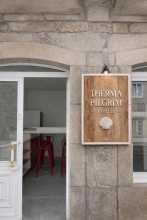
| Therma Pilgrim Hostel 20-25€ 16 Booking.com |
|
| Therma Pilgrim Hostel 20-25€ 16 Booking.com |
|
| Albergue Argemira 19-20€ 28 Booking.com |
|
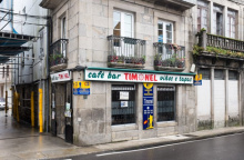
| Albergue Timonel 14€ 20 |
|
| Albergue Albor 22€ 35 Booking.com |

|
| Albergue A Queimada 14€ 74 Booking.com |

|
| GBC Hostel Caldas 25-28€ 100 Booking.com |

|
| Albergue As Pozas Termais 25€ 26 Booking.com |

|
| Albergue de Caldas de Reis Urraca 17-20€ 31 Booking.com |

|


The walk to Santa Marina is through a quiet forest, away from the busy road. The bar is friendly and makes a welcome morning stop if you've left from Caldas. The camino crosses the N550 to visit the church in the upper part of town, then crosses back before Casalderrique.

A hamlet between Santa Marina and O Pino. No services.

The camino only touches the back side of O Pino. A bar and a large albergue are about 200 m off the track — the albergue is clean, friendly, and has a shaded park in front.
Accommodation in O Pino (Valga).
| Albergue de Peregrinos Valga 10€ 78 |

|

A modest church and a bar-grocery-everything store. The quaint countryside walking gives way to the sprawl of Pontecesures from here.

A small church on your right, a playground and recreation area on your left. Hidden in the park is an ancient petroglyph — these Galician rock carvings are common throughout the region and new ones are still being discovered. A bar at the far end of town.
This is the first notable stop on the Variante Espiritual after the fork from the main camino. The route descends through the hamlet of Fragmoreira and emerges at a roundabout on the divided highway.
The camino leaves town along the road but quickly picks up a track as it descends through the hamlet of Fragmoreira. It emerges on a roundabout at the divided highway you have crossed over a few times. Keep to the left as you approach Poio.
Accommodation in Cabaleiro.


A hamlet on the descent from Cabaleiro to Poio. No services.
The Mosteiro de San Xoan de Poio, a massive Benedictine monastery, is the first building in town and impossible to miss. The monastery has been a centre of learning since the 7th century, though the current buildings are mostly 17th and 18th century. Several bars along the descent from the monastery.
The route through town requires care — watch for a narrow path turning upward on your left, just before a small B&B called A Marchanta. From the monastery, the camino descends to the waterfront and a large park before climbing to the main road toward Combarro.
The camino descends from the Monastery and turns right at the bottom of the hill. Mind the traffic here, there are no barriers and not too many arrows. Follow the road to the first crosswalk and turn left to pick up a smaller country road. Here there is one tricky turn. Shortly after crossing the road keep an eye open for a narrow path that turns upward on your left-hand side, it is right before a small B&B called A Marchanta. Follow it upward, then turn right, and then left at the fork onto a small dirt track. This track leads you to the waterfront and a large park which plays host to all manner of celebrations, do not be surprised to find it full of teenagers hungover from a late night of partying or packed full with caravans. The arrows are not bountiful here but keep the water to your left and cross to the far end of the park where a paved road takes you uphill to join the main road. This road is very busy and parked cars make for plenty of blind spots. Keep to the left as best you can and soon you will arrive at Combarro.
Accommodation in Poio.


Combarro is one of the most photographed villages in Galicia, and for good reason. The horreos — the granite granaries that are a defining feature of Galician rural architecture — line the waterfront here, some of them practically hovering above the sea at high tide. They were used to dry fish as well as grain, and the visual effect of a row of them standing on their stilts against the ria is unique.
The town is small, compact, and genuinely beautiful in the way that only a working fishing village can be. The camino doesn't actually pass through the best parts — it turns uphill to join the road before you reach the waterfront. Keep going straight instead to see the horreos and the cruceiros that dot the lanes. Getting lost in Combarro would be an achievement, but be aware that other arrow variations exist and could lead you astray.
A few bars and restaurants. The Variante Espiritual crosses the road from here and immediately begins ascending the Monte Redondo.
The Variante Espiritual crosses the road and immediately begins its ascent of the Monte Redondo. The climb varies in intensity from extremely steep to gently rolling and back again. Go gently.
Accommodation in Combarro.


Not well signposted but identifiable by the large dirt parking lot adjacent to it. The mirador platform doesn't inspire much confidence structurally but offers excellent views east over the Ria de Pontevedra. From here the camino levels out and follows a mountain track before joining a paved road briefly and descending toward Armenteira.
From the mirador the camino levels out a bit and follows along a mountain track. It eventually joins a paved road but only for 250m when it crosses the road and begins the descent into Armenteira.

The camino delivers you directly to the front door of the Monasterio de Santa Maria de Armenteira, a 12th-century Cistercian foundation set in a quiet valley. The church's Romanesque portal and the cloister are the highlights. Two bars in town — the one directly in front is the more popular. The albergue is a few hundred metres further along, following the arrows.
From Armenteira, the camino joins the Ruta da Pedra e da Auga — a popular local trail following a creek downhill to sea level, passing dozens of abandoned water mills. The right-hand side of the creek keeps you closer to the mills and the water. The walking is beautiful and the descent is gradual.
According to legend, a monk named Ero founded the monastery and one day walked into the nearby woods, where he sat listening to a bird sing. When he returned, 300 years had passed. The story of San Ero is one of Galicia's most enduring legends and is similar to the tale of Rip Van Winkle — though it predates it by several centuries.
From Armenteira the camino joins a popular (among locals) trail known as the Ruta de la Piedra y del Agua. It follows along a creek, with trails on both sides, as it descends to sea level. Along the way, it passes several dozen abandoned water mills. Note that although you can safely and easily follow both sides of the river, it is the right-hand side that keeps you closer to the mills and the water.
Accommodation in Armenteira.
| Albergue San Ero Armenteira Meis 10€ 17 |

|
| Albergue Armenteira 25€ 22 Booking.com |
|
| Caroi Hostel & Rooms 30€ 20 Booking.com |
|
| Casa Adriana | 
|
| Monasterio Cisterciense de Armentaira 25 |


A large picnic area and recreation space with public bathrooms. A small bar-kiosko operates during the summer months. The riverside walk is interrupted by a highway and roundabouts, but the trail resumes quickly on the far side.
The riverside walk is interrupted by a large highway and associated roundabouts, but no sooner than you pass them do you return to the trail.
A small seasonal bar on your left at this junction. A larger bar-restaurant is over the river. The camino approaches Puente Arnelas via a steel-and-wood walkway under the bridge — follow the arrows up to road level.
As you approach Puente Arnelas you need to follow the arrows that lead you up a steel and wood walkway under the belly of the bridge. At the top, turn right to get up to the road level and follow it into the small village. A short ways on the camino joins the broad Río Umia.
Accommodation in Os Castaños.
| Albergue Camino Espiritual 20€ Booking.com |
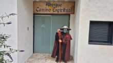
|
| Hospedaje Os Castaños |
A small village with a chapel, a large pharmacy, and bars at both ends. If both bars are closed, a gas station provides backup. The camino continues along the Rio Umia from here.
The camino ahead includes a small climb up through the town of Gombra. It also follows the road for a short stretch before turning left into the small village of Mouzas. There are a few more hamlets along this stretch before the camino arrives at a large crossing of the PO-549. Here there is a pair of bars, including the happy for hamburgers Mississippi Bar. Cross the road towards Cores.
A small village on a brief climb. No services. The camino passes through and returns to the road before turning left into Mouzas.
A hamlet. No services. The camino passes through to a crossing of the PO-549, where a pair of bars await — including the eccentrically named Mississippi Bar.
Just beyond Cores, the camino reaches the sea for the final stretch of the Variante Espiritual. The last 3 km follow sandy paths with beaches on your left and beach bars on your right, arriving at Vilanova de Arousa via a large bridge.
Just beyond Cores the camino arrives at last to the sea, and the last 3km are along sandy paths with beaches on your left and beach bars on your right. The camino keeps close to the water and arrives at Vilanova by way of a large bridge.
A seaside harbour town with bars and restaurants but not much else besides the pleasure of gazing out to sea after days of walking inland. The albergue is the operational hub for arranging the boat to Pontecesures.
The boat recreates the Translatio — the legendary voyage that brought Santiago's body from Palestine to Galicia. Schedule varies with the tide, the number of passengers, and the captain's calculations. You can't reliably plan it days in advance — show up at the albergue and arrange things with the hospitalero.
The alternative to the boat is a roadside walk roughly mirroring the coastline but providing little contact with it. Arrows are lacking in places, and accommodation along this stretch is unreliable outside peak summer months.
THE BOAT. Everything you need to know about the boat to Pontecesures is impossible to print here. The schedule varies with the tide, the number of passengers, and the whims of the captain and the hospitalero at the albergue (he who makes the arrangements). The matter is complicated by the fact that the same captain helms two boats of different sizes and capabilities and there is a daily calculation to maximize profit. Unfortunately, this means that there is little that you can do to plan it days in advance, and more or less need to turn up at the albergue and arrange things with the hospitalero.THE ROAD. The alternative to the boat is a predominantly roadside walk along a path that roughly mirrors the coastline but doesn’t provide for much contact with it. The arrows are lacking in certain areas and the accommodation along this stretch should only be relied upon during peak Summer months and with a reservation.
Accommodation in Vilanova de Arousa.
| Albergue de Peregrinos Vilanova de Arousa 10€ 28 |
| A Salazón 20€ 10 Booking.com |

|
| Albergue A Corticela 20€ 10 Booking.com |

|


Pontecesures occupies a pleasant riverside location that is somewhat spoiled by the factory across the Rio Ulla. The town is where the Variante Espiritual (by boat or by road from Vilanova de Arousa) rejoins the main camino.
The bridge here is where, according to the Translatio legend, the stone boat carrying Santiago's body arrived. The Roman bridge foundations survive beneath the current structure. The camino crosses the river into the approach to Padron.
The name Pontecesures derives from Pons Caesaris — Caesar's Bridge. The Roman crossing here connected the Ria de Arousa with the interior, and the site has been a point of arrival since antiquity. The Translatio tradition — the story that Santiago's body was brought by boat from Jaffa to this exact point — made Pontecesures one of the most symbolically important places on any Camino.
The arrows go under the road and over the bridge and across the Río Sar to Aduana. Here it runs all the way into Padrón.
Accommodation in Pontecesures.
| Albergue de Peregrinos Pontecesures 10€ 54 |

|


The Monasterio de San Antonio de Herbon and its albergue could not be better placed for a peaceful penultimate night before Santiago. The albergue is run by the Galician Amigos del Camino and is one of the few places on the route where you can count on eating dinner with everyone staying there.
The monastery's kitchen gardens are where the famous Pimientos de Padron originate — Franciscan monks brought pepper seeds from the Americas in the 16th century and planted them here. The peppers are at their best between May and September.
Follow the red arrows marked Herbon — this is a deviation from the main camino, adding 3 km total (2.7 km from Pontecesures, plus 3 km the next morning to reach Padron). The detour is worth it for the hospitality alone.
To get there simply follow the red arrows marked Herbón. This detour if for anyone wishing to spend the night in the Albergue at the Monastery of Herbón (recommended). From Pontecesures it is 2.7km, with an additional 3km the following morning to bring you to Padrón. In all this detour adds 3.1km to the official route.
Accommodation in Herbón.
| Albergue de Herbón Donativo€ 20 |

|

A hamlet between Pontecesures and Padron on the main camino. No services.

Padron may be the most important small town on any Camino. This is where, according to the Translatio legend, the stone boat carrying Santiago's body came to rest — the pedron (mooring stone) from which the town takes its name sits beneath the altar of the Iglesia de Santiago on the riverfront. Ask the sacristan to show you; it's in the crypt.
Santiago is said to have preached here during his lifetime, making his posthumous return a homecoming of sorts. The Convento del Carmen, on the hill above town, offers views over the valley.
Padron is also the birthplace of Rosalia de Castro, the 19th-century poet who is to Galicia what Pessoa is to Portugal — the voice of a people and a language. Her house on the edge of town is now a museum. Camilo Jose Cela, the 1989 Nobel laureate, was also born here.
And then there are the peppers. The Pimientos de Padron — small green peppers fried in olive oil and sprinkled with coarse salt — originate from the monastery gardens at nearby Herbon. The famous saying holds: uns pican e outros non (some are hot and some are not). Between May and September they're at their peak. Out of season, you'll still find them, but the Russian roulette is less thrilling.
All services available.
The pedron — the stone beneath the altar of the Iglesia de Santiago — is traditionally identified as the mooring post to which the stone boat carrying Santiago's body was tied when it arrived from Palestine. Archaeological evidence suggests it may be a Roman altar or milestone, repurposed by Christian tradition. Regardless of its origin, the stone has been venerated for over a thousand years and connects Padron to the foundational myth of the entire Camino.
Take a look at the elevation profile for an idea of what these last 24km will be like, many pilgrims underestimate the elevation changes which increase as you near Santiago.
Accommodation in Padrón.
| Albergue de peregrinos de Padrón 10€ 46 |

|
| Albergue Flavia 20€ 22 Booking.com |

|
| Albergue Corredoiras 15-19€ 17 Booking.com |

|
| Albergue Camiño Do Sar 20-22€ 20 Booking.com |

|
| Albergue A Barca de Pedra 18-25€ 22 Booking.com |

|
| Albergue O Pedrón 14-17€ 44 Booking.com |

|
| Albergue & Rooms Murgadán 16-20€ 32 Booking.com |

|
| Albergue d'Camiño 19-27€ 15 Booking.com |

|
| O Albergue da Meiga 15-20€ 50 Booking.com |

|
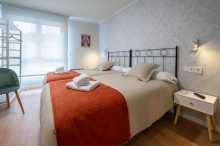


Iria Flavia is one of the most historically important sites on any Camino, though you wouldn't know it from the modern settlement. This was the original bishopric — the episcopal seat before it was transferred to Santiago de Compostela after the discovery of the Apostle's tomb in the 9th century.
The Colegiata de Santa Maria de Iria Flavia is the site of the original cathedral. The Adro (the cemetery and churchyard) is worth visiting — Rosalia de Castro was originally buried here before her remains were moved to the Panteon de Galegos Ilustres in Santiago.
Pass through Pazos, Rueiro, Tarrio and Vilar (albergue); none with services.
Accommodation in Iria Flavia.
| Albergue Cruces de Iria 22-24€ 20 Booking.com |
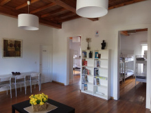
|
| Albergue O Sabor do Camiño 18+€ 14 Booking.com |
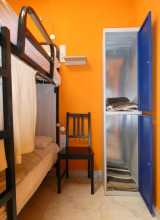
|


A hamlet between Iria Flavia and the approach to Santiago. No services.
A hamlet with an albergue but no other services.
Accommodation in Vilar.
| Albergue O Lagar de Jesús 25€ 18 |

|
| A Casa da Meixida Booking.com |

|
Although more than 17 km still separate you from the Cathedral, from here onward you're essentially walking through an expanding string of Santiago suburbs. Most remain small, but the sprawl is building.
In town, turn right off the N550 at the church, passing around its park. A country road takes you steeply uphill. You will pass through the hamlet of Cruces, Angueira de Suso, and into Areal before returning to the main road at Picaraña.
Accommodation in A Escravitude.
| Albergue Villa Vieira 29*€ 30 Booking.com |
|
| Albergue de Capellania 12€ 18 |

|
| Albergue Crucesinn 17€ 50 Booking.com |

|
| Casa Grande da Capellania Booking.com |

|

A hamlet on the approach to Santiago. No services.
Accommodation in Angueira de Suso.
| Albergue Camiño da Vieira 27*€ 13 Booking.com |

|
Watch for faded arrows before the gas station directing you left and off the road — this newer route through countryside is much better than the road. The trail can have tall grass in places but is obvious and well-marked. It brings you to the road at the entrance to O Faramello.
NOTE: BEFORE the gas station a set of faded arrows directs you left and away from the road. Going that way takes you through a new route marked out by the local friends of the camino and is a much-preferred option to the road. After turning left keep an eye open for arrows which will turn right onto a grass (sometimes tall) path. This arrow might be a bit faded but the way is obvious, and it turns into a well-worn trail with plenty of arrows. It will bring you right up to the road at the entrance to Faramello.
Accommodation in Picaraña.


Two bars — one at the entrance just after leaving the N550, another at the private albergue.
Accommodation in O Faramello.
| Albergue de peregrinos de Teo 10€ 20 |

|
| Albergue La Calabaza del Peregrino 18-22€ 36 Booking.com |

|
From Rua de Francos, the camino passes through the hamlets of Osebe and A Grela on its way into the Santiago suburb of O Milladoiro.
From Rúa, the camino passes through several small hamlets (Osebe and A Grela) as it makes its way into the large Santiago suburb of Milladoiro.
Accommodation in Rúa de Francos.
| Casa Rural Parada de Francos Booking.com |

|
The camino passes between Osebe (to your left, train station) and Casalonga (to your right, on the main road, with shops and an ATM). Pedreira, not far ahead, has an albergue and food truck. The three settlements blend together — it's not clear when you're passing from one to the next.
Accommodation in Osebe - Casalonga - Pedreira.
| Albergue Casa Aldea da Pedreira 22-24€ 20 Booking.com |

|
A hamlet on the edge of Santiago's suburban sprawl. No services on the camino.
Santiago's largest suburb, and soon you'll have your first glimpse of the Cathedral. The camino passes through the back side of town, avoiding the busy main road with its apartment blocks. The growing network of highways around Santiago creates a series of crossings and zigzags — occasionally new and old camino stones point in different directions. At the choice between 'Santa Marta' and 'Conxo', take Santa Marta (left) for the most direct route.
The growing network of highways around Santiago mean that you will make a few crossings and zig zags before you get to the city limits. There are even a few occasions where new camino stones stand adjacent to old camino stones, each pointing in their own direction. One offers a choice between ‘Santa Marta’ and ‘Conxo’ and here the best and most direct choice is ‘Santa Marta’, or left.
Accommodation in O Milladoiro.
| Albergue Milladoiro 17€ 62 Booking.com |

|
| Hotel Payro Booking.com |

|
Santiago. You made it.
Start in the Plaza del Obradoiro — kilometre zero, marked by a scallop shell and plaque in the centre of the square. The Obradoiro facade of the Cathedral, completed in the 18th century, is the Baroque frame for Maestro Mateo's 12th-century Portico de la Gloria behind it.
If you want your Compostela — the certificate of completion — visit the Pilgrim's Office. From the Plaza, face the Parador (the grand building on your left if you're facing the Cathedral), look for the road going downhill to the left, pass the public restrooms, turn right at the next street, and follow it to the end.
The Cathedral demands at least two visits. Walk it plaza by plaza: the Puerta de la Azabacheria faces the Monasterio de San Martin Pinario to the north; the Obradoiro opens west; the Puerta de las Platerias faces south, named for the silver workshops still operating below; the Plaza de Quintana and the Puerta del Perdon (the Holy Door, opened only in Holy Years) face east. Go early, before the crowds.
The crypt and the embrace of Santiago's bust are best experienced in the morning quiet. The botafumeiro — arguably the world's largest thurible — swings across the transept on ropes pulled by eight tiraboleiros.
The Monasterio de San Martin Pinario is so large you'll find yourself next to it from almost every direction north of the Cathedral. Its facade descends rather than ascends to its doors — the architects dug downward rather than compromise on height after the Archbishop decreed that no building should exceed the Cathedral in elevation.
San Fiz de Solovio, near the Mercado de Abastos, is the oldest building site in Santiago. The hermit San Pelayo was praying here when the lights in the sky called him to the field where Santiago's tomb was found. Excavations have revealed foundations and a necropolis dating to the 6th century.
The Mercado de Abastos is Galicia at its most practical — utilitarian architecture, no-nonsense vendors, many of them second, third, or fifth-generation operators. The produce is excellent and the atmosphere is unadorned. The buildings date from the 1940s but replace ones that stood for 300 years.
Alameda Park, south of the old town, overlooks the Cathedral. In the Plaza de Quintana, after dark, look for the hidden pilgrim — a shadow cast by the Cathedral stonework, visible only at night.
Stay at least one extra day. The web of stone streets will bring you back to the Cathedral every time you think you've escaped it.
One word of caution regarding accommodation is in order. If you are arriving in the high season, you are advised to make a reservation in advance. There have been several additions to the albergue roster in recent year but the numbers of pilgrims still exceed capacity in the high season.
The Feast day of Saint James is celebrated with a full week of music and dance, with a fireworks display in the Plaza Obradoiro on the evening of the 24th of July. The best views can be had from Obradoiro, or from Alameda park.
Accommodation in Santiago de Compostela at the end of the Camino Portugues.
| Albergue O Fogar de Teodomiro 19+€ 24 Booking.com |

|
| Albergue SCQ 21+€ 24 Booking.com |

|
| Albergue SIXTOS no Caminho 18-35€ 40 Booking.com |

|
| KM. 0 26+€ 55 Booking.com |

|
| Blanco Albergue 18+€ 20 Booking.com |

|
| Albergue La Credencial 19+€ 36 Booking.com |

|
| Albergue La Estación 20-30€ 30 Booking.com |
|
| Albergue Porta Real 21+€ 20 Booking.com |

|
| Albergue Meiga Backpackers 16+€ 30 Booking.com |

|
| Albergue Seminario Menor en Santiago de Compostela 17€ 199 Booking.com |

|
| Albergue Mundoalbergue 20+€ 34 Booking.com |

|
| Albergue Santo Santiago 14-18€ 40 Booking.com |

|
| Albergue The Last Stamp 19-25€ 62 Booking.com |

|
| Albergue Azabache 20+€ 20 Booking.com |

|
| Albergue La Estrella de Santiago 15+€ 24 |

|
| Albergue Linares 18+€ 14 Booking.com |

|
| Pensión Casa da Balconada Booking.com |
|
| Pensión Pazo de Argra ★ Booking.com |

|
| Hospedería San Martín Pinario ★ Booking.com |

|
| Albergue-Hotel LoopINN 30+€ 48 Booking.com |

|
| Alameda Rooms Booking.com |

|
| Mapoula PR Boutique Booking.com |

|
| Albergue Fin del Camino 15€ 110 |

|


