Aire-sur-l'Adour is a proper town with roughly 6,000 inhabitants and full services: hotels, gites, restaurants, supermarket, pharmacy, ATM, hospital. It's also where you cross from the Gers into the Landes department. The Adour River divides the town, with the center on the left bank clustered around the Cathedrale Saint-Jean-Baptiste.
The real draw is up on the Mas hill: the Eglise Sainte-Quitterie, a UNESCO World Heritage site since 1998. Built in the late 11th century on the remains of a Roman temple dedicated to Mars, this church was transformed into Gothic style in the 14th century. The Romanesque choir retains eight decorated capitals with biblical scenes and fantastical creatures. But the treasure is in the crypt, restored between 2016 and 2018: a 4th-century white marble sarcophagus from Saint-Beat in the Haute-Garonne, 2.12 meters long, carved with scenes from the Old and New Testaments -- the dream of Jonas, the sacrifice of Abraham, Daniel in the lion's den. The crypt also contains 14th-century wall paintings and reliquaries.
The town's markets (Tuesday and Saturday mornings) are excellent, and Aire is famous for its foie gras trade -- a vast octagonal grain hall from 1855 and a covered foie gras market from 1911 speak to that tradition.
Aire-sur-l'Adour has deep roots. Probably founded as a Celtic settlement called Atura, it fell to Crassus's troops in 56 BC. The Romans renamed it Vicus Julii. In the 5th century it became a Visigothic royal residence, and in 506 King Alaric II promulgated the Breviarium Alaricianum here -- a legal code governing relations between Visigoths and Gallo-Romans that remained in force until the 11th century. It's one of the most important legal documents of the early medieval period.
The legend of Sainte-Quitterie says she was a Catholic princess fleeing a forced marriage who was beheaded here by Arian Visigoths in 476. Where her head fell, a miraculous spring gushed forth. No historical sources confirm the story, but her veneration spread across southwestern France and northern Iberia, making her one of the most important regional saints for Camino pilgrims. A bishopric was maintained here for fifteen centuries, with the first bishop attested at the Council of Agde in 507.
Leaving Lectoure the GR65 enters the heart of Gascony, crossing the rolling hills of the Gers department through Armagnac country. The terrain is gentle but constant -- an endless sequence of small ascents and descents through vineyards, sunflower fields, and cereal crops. This section is rich in heritage: the UNESCO collegiate church at La Romieu, the walled village of Larressingle, the Gallo-Roman mosaics at Seviac, the treasure museum at Eauze, and Sainte-Quitterie's UNESCO-listed church at Aire-sur-l'Adour.
Services cluster in the larger towns -- Condom, Eauze, Nogaro, and Aire-sur-l'Adour -- with very little available in the hamlets between. Water can be scarce in the smaller villages during summer, so plan accordingly. The major resupply points are Condom and Eauze.
The landscape here is distinctly Gascon: think Armagnac vineyards (France's oldest brandy region, predating Cognac by 200 years), half-timbered colombage houses, bastide market squares, and course landaise arenas. You're in d'Artagnan country now.
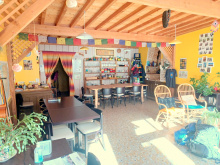
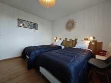
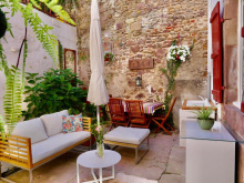
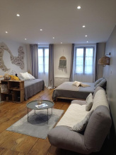
Accommodation in Aire-sur-l'Adour.
| Accueil Communauté du Chemin Neuf 17€ 4 |
|
| Gîte La Chapelle des Ursulines 15€ 12 |
|
| Gîte d´étape La Maison des Pèlerins 18€ 15 |
|
| Gîte d´étape Au Passage de l'Adour 25*€ 4 |
|
| Gîte Au Gré de l'Adour 23*€ 5 Booking.com |

|
| Gîte-Hôtel de la Paix 15-18*€ 9 |
Miramont-Sensacq is the second-highest point in the Landes department at 221 m, and on clear days you can see the Pyrenees from Bigorre to the Basque Country. The commune was formed in 1845 when the old bastide of Miramont (established by Edward I of England in 1274) merged with the hamlet of Sensacq. About 374 inhabitants now -- less than half the 1881 population.
The main heritage site is down in Sensacq: the Eglise Saint-Jacques, a 12th-century Romanesque church classified as a Historic Monument. It's built on the foundations of a 4th-century Gallo-Roman villa, with Roman stones reused in the north wall. Inside you'll find stonemason marks, medieval graffiti depicting a horse and knight, traces of frescoes of Christ in the transept, and an 11th-century baptismal font. The dedication to Saint James confirms this has been pilgrim territory since the beginning.
Accommodation in Miramont-Sensacq.
| Gîte communal du pèlerin de Miramont-Sensacq 13€ 20 |
Sensacq is the hamlet south of Miramont proper, now part of the same commune. The church here -- the Eglise Saint-Jacques de Sensacq -- is the reason pilgrims know this spot. It's a Romanesque church from the 11th-12th centuries with three stepped apses, a transept with stonemason marks, and medieval graffiti that includes depictions of a hall, horse, and knight. The church sits on 4th-century Gallo-Roman villa foundations, and tumuli from the end of prehistoric times have been found nearby. The building caught fire in 1373 but retains its essential Romanesque character.
Bestit is a very small hamlet between Sensacq and Pimbo. There's nothing here beyond open farmland in the rolling Tursan hills. It's a trail waypoint rather than a destination.
Accommodation in Bestit.
| Gîte d´étape La Ferme de Marsan 14€ 10 |
Pimbo is a one-street village perched on a ridge in the Tursan region, and despite its tiny size it holds the oldest bastide in the Landes (founded in 1268) and a collegiate church that dominates the landscape for miles around.
The Collegiale Saint-Barthelemy started as a Benedictine monastery attributed to Charlemagne in 778 -- the Sainte-Marie-de-Pendulo, mentioned in 11th-century records. The current church dates from the 12th century and has a wide bell tower-porch with a massive military silhouette, a carved portal with Celtic-style discs and pine cone motifs, and a fortified 14th-century appearance that speaks to the violent centuries it survived. Huguenot forces ransacked it in 1569 and it took further damage during the Revolution.
About 13,000 pilgrims pass through annually. From the parish priest's garden you get panoramic views over the Gabas valley and, in clear weather, the Pyrenees.
The bastide was formally founded in 1268 through a pareage contract between the Abbot of Pimbo and the seneschal of Gascony, acting for Henry III of England. But the site's history goes much deeper -- the monastery is attributed to Charlemagne's 778 campaign returning from Spain, the same expedition that ended in the disaster at Roncesvalles. A fortified castle (Chateau de Barene) was built alongside the monastery to protect it.
Accommodation in Pimbo.
| Gîte communal de Pimbo 17*€ 21 |
| Gîte Ferme de Nordland 22€ 8 |
Boucoue is now part of the commune of Poursiugues-Boucoue, merged in 1841. Before the Revolution, both villages belonged to the Tursan terroir in the neighboring Landes. The commune has a 15th-16th century Chapelle Saint-Laurent and a 19th-century parish church. The GR65 passes through between Pimbo and Arzacq-Arraziguet.
Arzacq-Arraziguet is the largest settlement between Aire-sur-l'Adour and Arthez-de-Bearn, and it's a genuine bastide with character. The Place du Marcadieu retains its covered galleries with pillars and arcades -- the marketplace that once made Arzacq one of the most important markets in all of English Guyenne. The bastide grew as an extension of an 11th-century castle on a mound, which explains its atypical shape.
Look for the Tour de Peich with its distinctive humped roof, two horseshoe-shaped lavoirs, and the covered arenas where local festivals are held. The town sits within the IGP Bayonne Ham production zone, and the Maison du Jambon de Bayonne celebrates the connection.
Saturday morning brings the local producers' market. All basic services are available: shops, restaurants, accommodation. A solid stage town.
Accommodation in Arzacq-Arraziguet.
| Centre d'accueil communal d'Arzacq 12€ 90 |
Labalette is a tiny hamlet on the GR65 leaving Arzacq heading south. No services or notable landmarks -- just open countryside between the bastide and Louvigny.
Accommodation in Labalette.
| Gîte d´étape A Labalette 36**€ 10 |
Louvigny was probably the feudal seat of the Viscounty of Louvigny, which persisted until the end of the Ancien Regime. The GR65 descends through fields and woods, crosses a bridge to reach the Moulin de Louvigny (an 18th-19th century mill), then passes the Chapelle Saint-Martin. Farms from the 18th and 19th centuries dot the area.
At the location called Lou Castet you'll find remains of a 12th-13th century feudal motte -- a moat and defensive wall marking what was probably the feudal seat of the Viscounty of Louvigny. The hamlet sits at a higher elevation between Louvigny and Fichous-Riumayou, offering panoramic views before the trail descends to the Moundy crossroads.
Fichous-Riumayou is a commune formed when two villages merged by royal decree in 1842. The name Fichous appears in records as early as the 12th century (as "Fixoos"). The draw here is the Eglise Saint-Girons, a 12th-century church remodeled in the 15th century and restored in the 19th. The choir contains a Romanesque mosaic worth a look. The church has an elongated single-nave plan typical of the region.
Larreule was once home to one of the three most important abbeys in Bearn, founded at the end of the 10th century by Guillaume Sanche, Duke of Gascony, and Centule III, Viscount of Bearn. The name derives from "Regula" (the rule) -- the Benedictine rule the monks followed. The bastide grew at the foot of the abbey in the late 13th century.
Montgomery's Protestant forces devastated the abbey in 1569 -- part of the same August sweep that destroyed nearly every major religious building on this stretch. By the 18th century only two monks remained, and the Revolution finished the job. What survives is the Eglise Saint-Pierre, the abbey's 12th-century church, now the only vestige of what was once a major monastic center.
Accommodation in Larreule.
| Gîte et chambre d'hôtes L'Escale 15€ 12 |
Uzan's parish church is dedicated to Saint Quiteria, a virgin martyr venerated across southwestern France and northern Spain. The church sits below the village center near the source of Saint Quiteria, first mentioned in 1487 records though the pilgrimage site likely dates from the 12th century.
Accommodation in Uzan.
| Gîte Chez Darribère 35**€ 4 |
Geus-d'Arzacq is a small agricultural commune of about 205 inhabitants between Pomps and Uzan. No notable heritage features. Average altitude 130 m.
Accommodation in Géus-d'Arzacq.
| Gîte Ayguelongue 35**€ 4 |
Pomps is a Bearnais village whose name probably derives from a former orchard or apple grove ("Poms" in 14th-century records). The Eglise Saint-Jacques-le-Majeur -- dedicated to Saint James the Greater, patron of pilgrims -- confirms the village's ancient Camino connection, though the current building dates from the early 19th century with a side aisle added in 1871.
A notable historical detail: the Chateau de Pomps was built in 1547 by a cagot from Morlanne. The cagots were a marginalized social group in the western Pyrenees and Gascony, restricted to certain trades including carpentry and construction -- one of the most unusual social phenomena of medieval and early modern France.
Accommodation in Pomps.
| Gîte d´étape communal de Pomps 13€ 18 |
Castillon (officially Castillon-d'Arthez) sits about 3 km from Arthez-de-Bearn. The name derives from castellum (small fortification), suggesting a medieval defensive origin. The commune and its church are on the GR65. About 297 inhabitants.
The Chapelle de Caubin is a 12th-century Romanesque chapel on the outskirts of Arthez-de-Bearn, and it's one of the more evocative stops on this stretch. Built by order of Gaston IV le Croise, Viscount of Bearn, the chapel was part of a commanderie of the Hospitallers of Saint-Jean de Jerusalem -- the most important commanderie of the Order in all of Bearn.
The architecture is distinctive: an almost flat roof (rare in Bearn), a simple single-nave plan, a sculpted portal, and a bell-tower wall. Inside, a Gothic enfeu (funerary niche) in Flamboyant Gothic style contains the effigy of a 14th-century knight, finely sculpted in chainmail with a sword at his side.
Montgomery's Protestant forces destroyed the hospital on August 15, 1569. An association was created in 1966 to save what remained, and restoration was completed in 1974. Classified as a Historic Monument. Guided tours available seasonally.
Since its foundation around 1154, the hospital of Caubin was the most important commanderie of the Order of Malta in Bearn, welcoming pilgrims traveling to Santiago de Compostela. By the mid-16th century it was the sole official stronghold of the Order in the region. The destruction in 1569 was part of Montgomery's systematic sweep through Bearn on orders from Jeanne d'Albret -- the same campaign that devastated Pimbo, Larreule, and Sauvelade.
Arthez-de-Bearn is an ancient fortified village perched above the plain of the Gave de Pau, and it marks the traditional entry into the historic region of Bearn for pilgrims coming from the north. Gaston Febus -- the legendary 14th-century Count of Foix-Bearn -- transformed it from a simple hamlet into a medieval fortress charged with defending Bearn's northern frontier. In 1385 it had 255 hearths, making it the 5th city of Bearn.
The Wars of Religion hit hard. Jeanne d'Albret, Queen of Navarre, embraced Protestantism in 1560 and made it the official religion of Bearn. The churches of Notre-Dame and the Trinity were destroyed. The Eglise Saint-Etienne you see today was built in 1887, though it incorporates a 12th-century bell tower from the vanished castle.
This is a good stage town with services. The Commanderie of Caubin (just outside town) is the major historical site. From here the terrain shifts noticeably -- you're leaving the rolling agricultural hills and entering Bearn proper.
Arthez-de-Bearn's history is inseparable from the religious wars that tore through the region. Jeanne d'Albret (1528-1572), Queen of Navarre, converted to Protestantism and in 1571 banned Catholic worship throughout Bearn. Her forces under Montgomery burned Catholic abbeys and churches across the region in the devastating 1569 campaign. After the 1620 reattachment to France and reinstatement of Catholicism, the pendulum swung back. A Protestant temple was eventually built in Arthez but its vestiges were damaged beyond repair in 1998.
Accommodation in Arthez-de-Béarn.
| Gîte d´étape communal La Maison des Pèlerins 13€ 15 |
| Gîte d´étape Domi 16€ 7 |
|
| Gîte d´étape Pingouin Alternatif 15€ 5 |
|
| Gîte de la boulangerie Broussé 13€ 18 |
Argagnon, known as Arganion in 977, takes its name from "Domain of Arcanius" -- its first owner. The commune holds prehistoric camps, the most important being the Turou de Dous Garos at 90 m altitude with Iron Age remains. The 11th-century Eglise Saint-Pierre is registered as a Historic Monument. In 1385, Argagnon had just 9 hearths. The commune merged with Marcerin in 1851.
Accommodation in Argagnon.
| Gîte d´étape du Cambarrat 15€ 8 |
Maslacq's main landmark is the Chateau de Maslacq, originally an abbey mentioned in the 16th century and reconstructed in classical form in 1774 -- a main building over two stories flanked by two wings. The d'Abbadie d'Arboucave family occupied it for three centuries. During WWII it served as a fallback facility for the Ecole des Roches in the free zone. Across the road stands an important circular dovecote topped with a dome. The chateau is private and not open to visits, but visible from the road.
Accommodation in Maslacq.
| Gîte L'Estanquet 25*€ 7 |
Sauvelade is home to a former abbey with a complicated history. In 1127, Gaston IV le Croise, Viscount of Bearn, returning from the capture of Zaragoza, gave a Benedictine monk named Dom Helie the forest of Faget to build a monastery dedicated to the Virgin Mary. For 160 years it was Benedictine -- the Cistercian affiliation only came in 1286/1287, despite most sources shortening the story to "Cistercian abbey."
Montgomery burned the abbey on August 10, 1569 -- part of the same campaign that destroyed Caubin, Larreule, and Pimbo. By the 18th century only two monks remained. The Revolution confiscated what was left.
What survives is the church: a single nave with a dome surmounting the crossing, resting on arches supported by pilasters -- a rarity in the region. It's the only major surviving testimony of the abbey and worth stepping inside.
Accommodation in Sauvelade.
| Gîte d'étape Le P'tit Laa 14€ 15 |
Le Grand Saule ("the great willow") is a tiny hamlet on the GR65 between Sauvelade and Meritein. Pastoral countryside in the rolling hills. No services.
Accommodation in Le Grand Saule.
| Gîte Le Grand Saule 16€ 3 |
Meritein is a small commune with medieval roots in Bearn. In the medieval period it was governed by the Abbey of Saint-Vincent de Lucq. The GR65 passes through between Sauvelade and Navarrenx.
Accommodation in Méritein.
| Accueil Chez Marinoë Donativo€ |
Navarrenx sits on the Gave d'Oloron and holds a remarkable distinction: it's the first bastioned city in France, predating Vauban's fortified towns by about 100 years. After Castilians seized and destroyed the earlier settlement in 1523, Henri II d'Albret commissioned new fortifications designed by Italian engineer Fabricio Siciliano, based on the citadel of Lucca in Tuscany. Built between 1538 and 1549, the ramparts run 1.7 km, stand 10 meters high, and feature two orillon bastions, two demi-bastions, a ravelin, dry moats, and the Bastion des Contremines -- a 140-meter underground passageway built to detect enemy mining operations. In 1685, Vauban himself inspected the walls and found them excellent.
The town has been a member of Les Plus Beaux Villages de France since 2014. The original bastide grid layout is preserved, along with the Wednesday market (running since the 1500s), a 16th-century poudriere (powder magazine), and the Military Fountain producing about 1,700 liters per hour from an unknown source.
Navarrenx is also the capital of salmon fishing. The Gave d'Oloron is the longest salmon river in France, and the town has hosted the World Salmon Fishing Championships for over 40 years. The championship runs in two rounds, May and July, with fish weighing up to 10 kg.
Full services: shops, restaurants, accommodation, market. A proper stage town.
The name means "the edge of Navarre" in Latin (Sponda-Navarrensis in the 11th-century cartulary). A bridge charter from 1188 under Gaston VI established the crossing point, and the town became a bastide in 1316.
The 1569 siege is Navarrenx's proudest moment. The Protestant garrison under the Baron of Arros successfully resisted a three-month Catholic siege -- the only siege in the city's history. Jeanne d'Albret had converted the Saint-Germain church into a Protestant temple in 1555. The connection to the Musketeers runs deep: Aramis and Athos grew up within 50 km, and Porthos (Isaac de Portau) came from nearby Audaux and trained with the city guards at Navarrenx. Paul de Batz, elder brother of the historical d'Artagnan, served as citadel governor.
From Aire-sur-l'Adour the GR65 crosses the rolling Tursan and Chalosse hills of the southern Landes, then enters the Pyrenees-Atlantiques as it approaches Bearn. The terrain is a steady sequence of green hills with cornfields giving way to mixed farming and the first intimations of the Pyrenean foothills.
This stretch carries a recurring theme: nearly every significant religious building -- Pimbo, Caubin, Larreule, Sauvelade -- was damaged or destroyed in August 1569 when Montgomery's Protestant forces swept through on Jeanne d'Albret's orders. The rebuilt and surviving fragments tell the story of a region torn apart by religious war.
Key stops are Arzacq-Arraziguet (bastide with all services, Saturday market), Arthez-de-Bearn (traditional entry to historic Bearn, Caubin chapel nearby), and Navarrenx (France's first bastioned city, Plus Beaux Villages). Services thin out considerably between the larger towns.
Accommodation in Navarrenx.
| Gîte d´étape communal de Navarrenx 13€ 54 |
| Gîte et chambre d'hôtes Le Cri de la Girafe 25*€ 8 |
|
| Gîte d´étape L'Alchimiste 20*€ 12 |
Castetnau-Camblong sits about 2 km from Navarrenx on the road south. It's a small commune of maybe 500 people formed from the merger of Castetnau and Camblong in 1842. The Eglise Saint-Pierre dates from the 12th century with later modifications, and there's a 15th-century Chateau de Camblong nearby. The castle is private property. Pleasant rolling countryside between Navarrenx and the hills ahead.
Accommodation in Castetnau-Camblong.
| Gîte Chez Bouju 20€ 14 Booking.com |

|
Lacorne is a hamlet on the GR65 between Castetnau-Camblong and Lichos. There's a 16th-century chapel and scattered Bearnais farmhouses, but no services. The walking here is through gently rolling pastoral landscape.
Accommodation in Lacorne.
| Eco-Accueil Le Jardin des Rêves Donativo€ 18 |
Lichos is a commune straddling the historical boundary between the ancient provinces of Bearn and Soule. The Eglise Saint-Grat is dedicated to a 5th-century Bishop of Oloron who became the patron saint of crops and wine harvests. You'll see his name on churches throughout the Pyrenees-Atlantiques.
Lichos also marks a cultural transition point. As you walk south from here, the architecture begins shifting from Bearnais stone farmhouses to the white-and-red half-timbered etxeak (Basque houses) that define the landscape ahead. The change is gradual but unmistakable by the time you reach Larribar-Sorhapuru.
Aroue (officially Aroue-Ithorots-Olhaiby, formed from the merger of three villages in 1842) sits at the transition from Bearnais to Basque territory. The Eglise Saint-Etienne is of Romanesque origin with a circular apse and preserves 12th-century bas-reliefs from the old porch. It's the first hint of the Basque architectural style you'll see more of heading south.
The village has basic amenities for pilgrims. The walk from Navarrenx to Aroue covers about 19 km with 470 m of elevation gain -- the hills here are surprisingly steep and strenuous for what looks like gentle green countryside on the map.
Accommodation in Aroue.
| Gîte d´étape communal d'Aroue 15€ 14 |
| Gîte d´étape Bellevue 12-13€ 14 |
|
| Gîte Amaren Bidea chez Simone et Manu 37**€ 15 |
|
Landaco is a tiny hamlet between Aroue and Jaureguiberry on the GR65. No services. The landscape is transitioning from Bearn to Basque Country -- green hills, bracken, and the first white-and-red farmhouses appearing along the trail.
Accommodation in Landaco.
| Accueil Landaco Permaculture Donativo€ 9 |
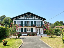
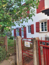
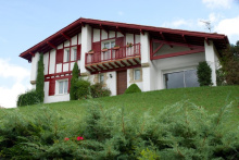
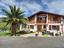
Jaureguiberry is a hamlet whose name is unmistakably Basque -- jauregia means "palace" or "noble house" in Euskara. You're crossing into Basque Country now, culturally if not yet administratively. The traditional Basque etxe (house) with its whitewashed walls and red-painted timber becomes the dominant architectural style from here onward. No services in the hamlet itself.
Belanchuche is a small hamlet on the GR65 between Jaureguiberry and Larribar-Sorhapuru. The Basque place name confirms you're now in the heart of the cultural transition zone. Rural farmland and scattered etxeak along the trail. No services.
Larribar-Sorhapuru is a Basque commune in the Bidouze valley, formed from the merger of two villages in 1841. The population hovers around 250. The architectural transition is now complete -- you're walking through a landscape of white-and-red Basque farmhouses with their characteristic half-timbered facades, red shutters, and asymmetrical rooflines.
The name Larribar may derive from larre (heath/pasture) plus ibar (valley). The commune sits at the boundary between the Bearnais and Basque worlds, with Basque becoming the dominant cultural expression from here to Saint-Jean-Pied-de-Port.
The Chapelle d'Harambeltz is one of the most historically significant pilgrim sites on the entire French Camino, even though it's easy to walk right past. Founded in 1059 by Benedictine monks from the Abbey of Sauvelade, the chapel was part of a hospitale (pilgrim hospital) that served walkers converging on the three French routes near Ostabat.
What makes Harambeltz special is the community of donats who ran it -- lay people who took religious vows specifically to care for pilgrims. They farmed the surrounding land to fund the hospital's operations. The Latin name Hospitale Sancti Nicolai de Arambels appears in medieval documents. This is one of the oldest documented pilgrim care sites in France, and the donat model -- farmers who were also healthcare workers and spiritual caregivers -- represents a unique medieval institution.
The chapel is classified as a Historic Monument. It's small and austere, fitting for a place that was about practical charity rather than display.
Accommodation in Harambeltz.
| Gîte d´étape Etchetoa 15€ 12 |
Ostabat-Asme is where three of the four great French pilgrimage routes converge before the final push to Saint-Jean-Pied-de-Port and the Pyrenees. The Via Podiensis (your route from Le Puy), the Via Turonensis (from Paris), and the Via Lemovicensis (from Vezelay) all funnel together near here before merging into the Chemin de la Navarre.
The actual convergence point is at a crossroads called Gibraltar, about 7 km upstream in the commune of Uhart-Mixe. The name has nothing to do with the famous Rock -- it derives from the Basque Xibaltarre, meaning "Saviour," referring to the nearby sanctuary of Saint-Sauveur. A directional stele topped with a discoid stele (the circular funeral monument traditional in Basque cemeteries) was erected there on August 2, 1964.
In the Middle Ages, Ostabat was enormous by local standards. The 1350 fiscal census recorded 68 dwellings including about 20 inns, 2 hospitals, 3 churches, and 2 priory-hospitals -- all financed by tolls on the passing pilgrim traffic. At its height the town could reportedly house 5,000 pilgrims. The lower part of the village still preserves houses that were once medieval hostels. Today it's a quiet hamlet, but the infrastructure of those pilgrim centuries is still legible in the streetscape.
Ostabat was likely created in the 11th century under Arnaud I Garcia, lord of Mixe and Ostabarret. His possessions transferred to the Kingdom of Navarre in 1196. In 1515, Ostabat obtained the title of "town," granting legal capacities and representation to the States of Navarre.
Medieval pilgrim accounts mention the wicked toll-collectors of Ostabat -- a reminder that the Camino was always as much commercial enterprise as spiritual journey. The convergence of three routes made this one of medieval Europe's great pilgrim crossroads.
Accommodation in Ostabat.
| Gîte Aire-Ona 20€ 12 |
|
| Gîte d´étape Ospitalia 14€ 12 |
|
| Gîte d’étape Izarrak 42**€ 26 |
|
Larceveau (part of Larceveau-Arros-Cibits since 1842) sits in the Bidouze valley in the Ostabarret region of Lower Navarre. The old town center had a bastide plan that appears to have been destroyed during the 16th-century Wars of Religion.
The reason to stop here is the Harriak Iguzkitan centre ("stones in the sun" in Basque), established in 2007 by the Lauburu association. It displays some of the oldest and most beautiful traditional Basque discoidal steles -- funeral monuments with a trapezium-shaped base representing the earth and a circular top representing the sun. The complete structure symbolizes the soul's passage from earthly life to the afterlife. Some specimens date from the 16th and 17th centuries. The centre also explains the ezkoa candle, crafted from beeswax, which represents eternal life in Basque mourning practices.
The Col d'Osquich is accessible from here if you're a cyclist -- 8% gradient.
Utxiat was a former commune that merged with Cibits and eventually became part of Larceveau-Arros-Cibits. The hamlet had its own donat community connected to the pilgrim hospital system, which disappeared in 1757. The Moulin de l'ancien prieure d'Utziate (mill of the former priory) sits on the GR65 about 4 km after Ostabat and serves as a rustic, unstaffed pilgrim shelter -- 4 places, always open, reserved for pilgrims on foot.
Accommodation in Utxiat.
| Ospital de Utxiat Donativo€ 4 |
Gamarthe sits at the northern boundary of the Pays de Cize in Lower Navarre, about 8 km from Saint-Jean-Pied-de-Port. The village is dominated by Gaztelharri ("stone of the castle" in Basque), a limestone pinnacle with the remains of a medieval fortress at its summit. Excavations in 1995 identified this as the probable site of Rocabrun, a Navarrese royal castle documented from 1191 to the end of the 15th century.
On the GR65 you'll pass the Croix de Galzetaburu, a Navarrese cross classified as a Historic Monument since 1972. The 19th-century church contains a retable and wooden galleries from the 17th and 18th centuries -- the interior galleries are a characteristic feature of Basque churches that you'll see increasingly as you approach SJPP.
Mongelos (Basque: Monjolose) is a former commune now part of Ainhice-Mongelos, created in 1240 and historically subject to the King of Navarre. It's about 8 km from Saint-Jean-Pied-de-Port on the GR65. The 1240 founding date suggests this was a planned settlement, possibly established to serve increasing pilgrim traffic in the 13th century.
Domaine Larralde-Borda is a traditional Basque farm in the commune of Gamarthe, about 10 km from Saint-Jean-Pied-de-Port. The name tells the story: larralde means "beside the pasture" and borda means "farm building" in Basque. The old stone farm has been converted into gite accommodation, with the Maison d'hotes Iturria offering beds and group housing for up to 40 people. A practical pilgrim stop in the Basque countryside.
Lacarre is a commune in the Cize valley of Lower Navarre, about 6 km from Saint-Jean-Pied-de-Port. The Cize was one of the valleys (along with Baigorri, Osses, and Arberoa) that formed the first nucleus of the Navarrese grip on lands north of the Pyrenees. Pilgrims have traveled across Cize on their way to the mountain passes into Spain for a thousand years. The commune has monuments associated with the French pilgrim routes.
Bussunarits (Basque: Duzunaritze) is part of the commune of Bussunarits-Sarrasquette in the Cize region of Lower Navarre, with about 206 inhabitants. The Basque name means "oak grove of aspens" -- a beautiful etymology for a place set in the green foothills approaching SJPP.
The Eglise Saint-Jean-Porte-Latine dates from the 15th century and contains a 17th-century statue of the Virgin and Child. The unusual dedication -- to Saint John before the Latin Gate, referring to the tradition of John the Evangelist's attempted martyrdom in Rome -- is worth noting. The Col de Gamia nearby has a restaurant serving pilgrims and hikers.
Saint-Jean-le-Vieux (Basque: Donazaharre, contraction of Donibane Zaharra, meaning "the old Saint John") is the penultimate stop before SJPP on the GR65, lying just 3.6 km from the famous gateway to the Pyrenees. But this quiet village has a story that runs deeper than its more famous neighbor.
The Romans established a garrison here from 15 BC, calling it Imus Pyrenaeus ("foot of the Pyrenees") -- a waystation on the road from Bordeaux to Astorga listed in the Antonine Itinerary. The rectangular castrum measured 200 by 115 meters with a strong rampart, a regular city plan, and a small forum with a temple. Archaeological excavations since 1965 have revealed thermal baths, amphorae, ceramics, coins, and glassware. The site is a classified Historic Monument, and the GAPO archaeological centre offers visits (Mon-Fri 9-12/2-4, Sat 9-12, 3 EUR).
Saint-Jean-le-Vieux was the capital of the Pays de Cize from the 11th to the 13th century -- until Richard the Lionheart razed it to the ground in 1177. The Kings of Navarre then refounded the regional capital a few kilometers south as what we now know as Saint-Jean-Pied-de-Port. Hence "le Vieux" -- the old one.
The Eglise Saint-Pierre d'Usakoa (13th century) has a Romanesque portal with three archivolts, a chrismon, and 17th-century wooden galleries typical of Basque churches. The Chapelle Saint-Blaise d'Aphat-Ospitalia was the seat of a commandery of the Hospitallers, documented as early as 1186.
Two thousand years of the same road converge here. The Bordeaux-Astorga Roman road that passed through Imus Pyrenaeus is essentially the same route the GR65 follows today. Pilgrims walk where legionnaires marched.
The Roman garrison saw real prosperity in the late 2nd century with an influx of goods from Spain, but evidence of massive destruction in the mid-3rd century -- likely from early Germanic invasions -- marks the beginning of the end. Final abandonment came before the 5th century.
Richard the Lionheart's 1177 campaign destroyed the medieval town, and the Basque name Donazaharre ("Old Saint John") preserves the memory. The refounding at Saint-Jean-Pied-de-Port created the town that pilgrims now know, but the deeper history lives here.
From Navarrenx the GR65 crosses into the Basque Country -- first gradually through the transitional villages of Lichos and Aroue, then unmistakably as the white-and-red half-timbered etxeak replace Bearnais stone farmhouses and Basque place names become the norm.
The big landmark on this stretch is Ostabat, where three of the four great French pilgrimage routes converge. From there the trail enters Lower Navarre, the Basque province that was part of the Kingdom of Navarre for centuries. The Cize valley carries you through Gamarthe, Mongelos, and Bussunarits to Saint-Jean-le-Vieux -- the Roman Imus Pyrenaeus, destroyed by Richard the Lionheart in 1177 and replaced by its more famous neighbor.
The terrain is green, hilly, and increasingly dramatic as the Pyrenees loom ahead. The landscape shifts from rolling pastoral hills to wilder, windswept terrain with streams and drystone walls. Services are scarce between towns -- plan your water and food. Harambeltz chapel (1059) and Ostabat's medieval pilgrim infrastructure are the cultural highlights. You'll see discoidal steles in the cemeteries and hear Basque spoken in the villages. You're almost at the mountains.
Saint Jean Pied de Port is the nexus of several routes that spread out across mainland Europe, and it was from here (primarily but not exclusively) that pilgrims most frequently made the crossing into the Iberian peninsula.
The tradition remains and the small town is often saturated with pilgrims, and pilgrim related tourism, during most of the year. With so many newly minted pilgrims roaming the streets, it has an air of excitement mixed with apprehension and a touch of dread.
You are advised to have a reservation before arriving, and the same holds true for the very few accommodation options that exist between here and Roncesvalles. If reservations are not part of your plans, march on with the philosophy that the camino provides, as it so often does in the most unexpected of ways.
Landmarks to explore include the Citadelle at the top of town, the Porte de San Jacques, and the Notre Dame du Bout du Pont. Look to the cobbled streets for the well-trodden plaques that point the way to Santiago de Compostela.
Before you set off for the Pyrenees and the border crossing into Spain be certain to pick up a pilgrim’s credencial at the pilgrims office (Rue de la Citadelle). This accordion-fold booklet is your passport to the camino and will become your most cherished souvenir of the trip. It is a required document in most pilgrim-specific accommodation, earns you pilgrim prices in many museums, and will serve as proof of your journey when presented to the Pilgrims Office in Santiago if you are planning on getting your Compostela Certificate.
It is important to be aware of the dangers of weather between here and Roncesvalles. These mountains have claimed more than a few lives, including several in recent history. If you have any questions regarding the journey ahead, the volunteers at the pilgrim office are there to help and advise.
Saint Jean Pied de Port, or Donibane Garazi as it is known in Basque (remember that the French border aside, this town was once a part of Lower Navarre and the Basque language is as common here as it is over the pass), was founded in the late 12th century by the Kings of Navarre and served as the capital.
Market day in Saint Jean Pied de Port is Monday, which is also one of its least busy days for pilgrims.
The distance between here and Roncesvalles is the most physically difficult stretch of road you are likely to encounter on the whole of your camino. From the “Foot of the Pass,” it is a steady climb for the majority of the day, with a rather steep descent into Roncesvalles for the last hours. This steep descent can be made easier, though longer, via a path which joins the two options at the Puerta de Ibañeta.The Valcarlos Route - 23.5 kmThe Valcarlos Route follows close to the road and is the advised route during poor weather. It passes through two towns (with services) located directly on the road between here and Roncesvalles, and two villages that are not on the road and which have no services.The Napoleon Route - 24.3 kmThe Napoleon Route is the longer of the two and covers small mountain roads and trails. It was popularized as a way to bypass the banditry that was all too common in the valley below. You will soon see that up in the mountains, there are few places to hide.During times of poor weather, this route will be closed. When the skies are clear you can see for miles, otherwise you are not likely to see past the horses and sheep that pasture here.
Accommodation in Saint Jean Pied de Port at the end of the Vía Podiensis.


| Gite Compostella Booking.com |
|
| Albergue Beilari 47**€ 14 |
|
| Gîte Le Chemin Vers L'Etoile 23-26€ 46 Booking.com |
|
| Gîte Le Lièvre et La Tortue 24€ 14 |

|
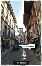
| Gîte Bidean 18€ 12 Booking.com |
|
| La Vita E Bella 20€ 12 Booking.com |
|
| L'Auberge du Pèlerin 24*€ 24 Booking.com |
|
| Maison Laurentzenia Booking.com |
|
| Hôtel Des Pyrénées ★★★★ Booking.com |
|
| Hotel Des Remparts ★★ Booking.com |
|
| Parc Arradoy Booking.com |
|
| Gite De La Porte Saint Jacques: A Hostel For Pilgrims 49**€ 6 Booking.com |
|
| Albergue de peregrinos de Saint Jean Pied de Port 15*€ 32 |
|
| Refuge Accueil Paroissial Kaserna 20*€ 14 |
| Camping Municipal Plaza Berri 10 / tent€ 50 |