
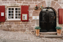
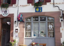
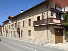
Saint Jean Pied de Port — Donibane Garazi in Basque — is where the majority of Camino Francés pilgrims begin. Several European routes converge here, funneling walkers from Paris, Vézelay, Le Puy, and beyond into a single starting point at the foot of the Pyrenees.
The town runs along the Nive river, its cobbled Rue de la Citadelle descending from the old fortress to the Porte d'Espagne, the medieval gate through which pilgrims have passed for centuries. It's a beautiful small town, made even more so by the anxious energy of all those about to set off.
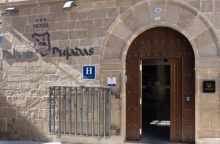
The Pilgrim Office (39 Rue de la Citadelle) issues credenciales, stamps, and weather reports for the mountain crossing. It gets busy — arrive early or expect a queue. They'll also give you the latest on route conditions over the pass, which you should take seriously.
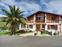
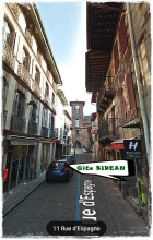
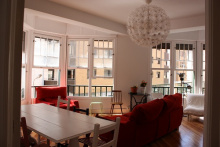
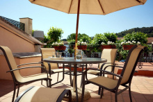
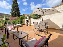
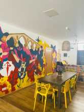
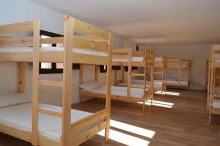
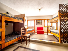
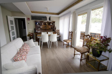
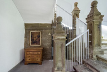
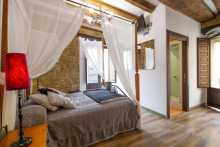
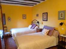
Accommodation fills up fast in summer. There are several albergues including the municipal Accueil des Pèlerins and the private Gîte de l'Esprit du Chemin, plus a range of hotels and gîtes d'étape along the Rue de la Citadelle and Rue d'Espagne. Book ahead if arriving on a weekend.
The town has everything you need: supermarkets, pharmacies, outdoor gear shops, ATMs, and plenty of restaurants. For your last French meal, the restaurants along the main street do hearty Basque fare — try the trout or the gâteau basque. Monday is market day, and coincidentally one of the quieter pilgrim days.
The mountain crossing to Roncesvalles is dangerous in bad weather. Snow, ice, fog, and high winds can all occur, even outside winter. Check the weather forecast at the Pilgrim Office before departing. These mountains have claimed lives — take the warnings seriously. If conditions are poor, take the Valcarlos route or wait a day.
Saint Jean Pied de Port — literally "Saint John at the Foot of the Pass" — has been a gathering point for pilgrims since the medieval period. It sits in Lower Navarre, historically part of the Kingdom of Navarre rather than France, and the Basque identity runs deep.
The Citadel above town was rebuilt by Vauban in the 17th century on older fortifications. The town's defensive walls, the Porte d'Espagne, and the Porte Saint-Jacques (a UNESCO World Heritage site since 1998) survive largely intact. For centuries this was the last provisioning stop before the dangerous mountain crossing into Spain, and the concentration of pilgrim infrastructure — hospitals, churches, hostels — reflects that critical function.
Market day is Monday, which is also one of the quieter days for pilgrims. The town celebrates the Fête de la Saint-Jean around June 24 with Basque music, dancing, and pelota matches.
Two routes cross the Pyrenees to Roncesvalles: the Napoleon Route over the high pass (the traditional and more popular option), and the Valcarlos Route through the valley (lower, longer, and the bad-weather alternative). Both are approximately 25-27 km to Roncesvalles.
From the Porte d'Espagne, the Napoleon Route climbs steeply on road through Honto and past Orisson before gaining the ridgeline. The Valcarlos Route drops to Arnéguy and follows the valley road through Valcarlos before climbing steeply from Gañecoleta to the Puerto de Ibañeta.
The Napoleon Route is closed to walkers from November 1 to March 31 (and sometimes longer depending on conditions). During this period you must take the Valcarlos Route. Even outside the closure period, the Napoleon Route should only be attempted in clear weather.
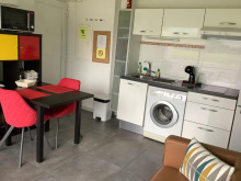
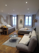
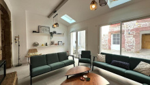
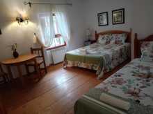
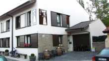
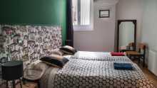
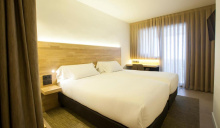
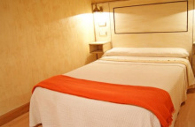
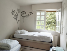
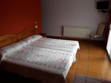
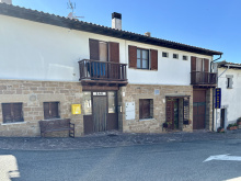
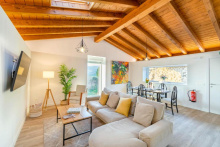
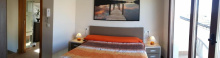
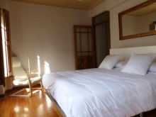
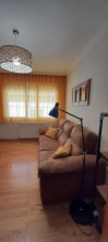
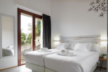
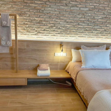
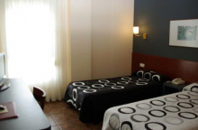
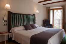
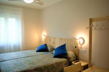
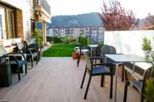
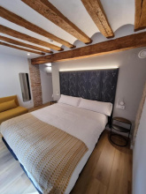
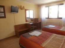
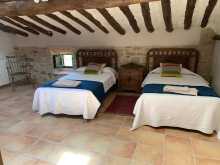
Accommodation in Saint Jean Pied de Port.

| Gite Compostella Booking.com |
|
| Albergue Beilari 47**€ 14 |
|
| Gîte Le Chemin Vers L'Etoile 23-26€ 46 Booking.com |
|
| Gîte D'Étape Zuharpeta Randonneur Pèlerin 18€ 22 Booking.com |
|
| Gîte Le Lièvre et La Tortue 24€ 14 |

|
| Gîte Bidean 18€ 12 Booking.com |
|
| La Vita E Bella 20€ 12 Booking.com |
|
| L'Auberge du Pèlerin 24*€ 24 Booking.com |
|
| Maison Laurentzenia Booking.com |
|
| Hôtel Des Pyrénées ★★★★ Booking.com |
|
| Hotel Des Remparts ★★ Booking.com |
|
| Parc Arradoy Booking.com |
|
| Gite De La Porte Saint Jacques: A Hostel For Pilgrims 49**€ 6 Booking.com |
|
| La Villa Esponda Booking.com |
|
| Albergue de peregrinos de Saint Jean Pied de Port 15*€ 32 |
|
| Refuge Accueil Paroissial Kaserna 20*€ 14 |
| Camping Municipal Plaza Berri 10 / tent€ 50 |


Two routes cross the Pyrenees from Saint Jean Pied de Port to Roncesvalles. Your choice depends on the weather, the season, and your own fitness.
The Napoleon Route is the high road. It climbs steeply from town on asphalt through Honto and past Orisson, then follows the open ridgeline over the Collado de Bentartea and the Collado de Lepoeder before descending through beech forest to Roncesvalles. The views are extraordinary — on a clear day you can see deep into both France and Spain — but the exposure is total. There's no shelter above Orisson, and weather can change in minutes. This route is closed from November 1 to March 31.
The Valcarlos Route is the valley road. It drops to Arnéguy at the border, follows the N-135 through Valcarlos, then climbs steeply from Gañecoleta to the Puerto de Ibañeta before descending to Roncesvalles. It's longer, less scenic, and the road walking through the valley isn't the most inspiring, but it's the safe option in bad weather and the only option in winter.
Most pilgrims walk the Napoleon Route in good weather. It's the more dramatic and more historic crossing. But don't let pride push you up the mountain in dangerous conditions — the Valcarlos Route gets you to Roncesvalles just the same.
Honto is the first hamlet on the Napoleon Route, about 5 km from Saint Jean Pied de Port and 400 m higher. A small cluster of farmhouses with a bar and the Ferme Ithurburia gîte d'étape, which also serves meals. This is the last chance to eat or drink before Orisson (another 3 km up the road).
If you're feeling the climb already, this is a good reality check — you're less than a quarter of the way to Roncesvalles and the steepest sections are still ahead.
Beyond Honto the road continues to climb steadily on asphalt. After about 1 km the camino leaves the road for the first time, winding uphill through a series of switchbacks. The Kayola albergue, operated by the Orisson team, sits just off the route with beds and a small terrace. From here it's roughly 2 km more to Orisson.
Accommodation in Honto.
| Albergue Ferme Ithurburia 20€ 22 Booking.com |
|

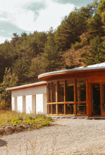
Orisson is a popular stopping point for pilgrims splitting the mountain crossing into two days. The Refuge Orisson is a purpose-built gîte with bunks, a restaurant, and a terrace with sweeping views back toward Saint Jean and the French Basque Country. Dinner is communal and lively — it's where many pilgrim friendships begin.
Booking is essential, especially from April to October. The refuge fills up weeks in advance in peak season. If you can't get a bed here, your options are to push on to Roncesvalles (another 19 km with 800 m more of climbing) or to go back down to Honto or Saint Jean.
A small shop sells basic supplies and cold drinks. There's no other commercial service between here and Roncesvalles.
If you arrive here late in the day, stop and ask about conditions ahead. Don't push on into deteriorating weather. Make sure someone at the refuge knows your plan if you continue — in bad conditions, people do get lost on the mountain above. Mobile phone reception is unreliable beyond this point.
Accommodation in Orisson.
| Refuge Orisson 45**€ 38 |
|

Borda is a small cluster of buildings on the Napoleon Route between Orisson and the Pic d'Orisson. No services. The climb continues steadily from here as you leave the tree line behind and enter open mountain pasture.
Accommodation in Borda.
| Auberge Borda 43**€ 12 Booking.com |
|
A statue of the Virgin stands at the Pic d'Orisson (1,060 m), marking the point where the route leaves the last of the trees behind and enters fully exposed terrain. From here to the descent into Roncesvalles there's no shelter of any kind. On a clear day the views in every direction are immense — the Basque hills rolling north into France, the high Pyrenees to the east.

The Collado de Bentartea (1,340 m) is the high point of the ridgeline walk, sometimes called Napoleon's Pass. A food truck often parks here selling drinks, snacks, and bocadillos — welcome relief after the long exposed climb from Orisson. This is also the last chance for a stamp on the French side.
From here the route follows the ridge southward with Spain opening up to your left and France falling away to your right. On a clear day it's one of the finest stretches of walking on any Camino. In fog, it's disorienting and potentially dangerous — follow the markers carefully.

Navarra is the first of Spain's autonomous communities along the Camino Francés. You'll cross it from the Pyrenees to just beyond Viana, where La Rioja begins — roughly 140 km of walking.
It's a region of sharp contrasts. The green, rain-soaked Pyrenean valleys around Roncesvalles and Burguete give way to rolling farmland around Pamplona, then to the drier, vine-covered hills approaching the Ebro. The Basque influence is strong in the north (you'll see Basque place names and hear Euskara in the mountain villages), fading as you move south into more Castilian territory.
Navarra's food is exceptional. Pimientos de piquillo, chistorra sausage, migas, espárragos de Tudela, and the region's rosado wines are all worth seeking out. Pamplona is the culinary capital, but even small-town bars serve pintxos that rival San Sebastián.
The Navarrese sections of the Camino are generally well-maintained and well-marked. Albergues tend to be modern and clean, many run by municipalities. The climate transitions from Atlantic (wet, mild) in the mountains to Mediterranean (drier, hotter) as you approach the Ebro.
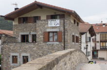
Arnéguy sits right on the French-Spanish border, straddling the Nive river. It's the first settlement on the Valcarlos Route after leaving Saint Jean Pied de Port, about 8 km down the valley. A couple of bars, a few shops, and some accommodation options. The border crossing itself is unmarked and unremarkable — you simply walk across the bridge and you're in Spain.
Cross the main road (D933/N-135) and the bridge into Spain. The route follows a country road lower in the valley, bringing you into Valcarlos from below. The walking is flat and easy along the river.
Accommodation in Arnéguy.
| Hotel Le Clementenia | 
|

Valcarlos (Luzaide in Basque) is the main town on the valley route, sitting in a deep green gorge along the Nive de Arnéguy. It's a quiet, slightly faded border town with the essentials: a couple of bars, a small shop, a pharmacy, and a few accommodation options including the Albergue Municipal and several casas rurales.
The modern church is often locked. Most services are along the main road — if you've entered from the lower valley path, you may need to walk a short distance back toward Arnéguy to reach them.
This is where Charlemagne's rearguard was ambushed by Basque forces in 778, the historical event behind the Song of Roland. The narrow valley makes the tactical logic of the ambush immediately obvious.
Easter Sunday (Domingo de Resurrección) is celebrated with traditional Basque dancing and singing and draws a considerable crowd.
Leave town along the main road, eventually branching left onto a smaller road. Gañecoleta is less than 1 km from this junction. From there the serious climbing begins.
Accommodation in Valcarlos.
| Albergue municipal de Valcarlos 15€ 24 |
|
| Casa Rural Etxezuria Booking.com |
|

Gañecoleta is a tiny settlement on the Valcarlos Route where the serious climbing begins. A few scattered farmhouses, no services. From here the route climbs steeply — and relentlessly — toward the Puerto de Ibañeta, gaining over 600 m in roughly 8 km. The final few kilometers are particularly steep.
If you started in Valcarlos, this is where you begin to understand why the Napoleon Route is considered the harder option for its views rather than its difficulty — the Valcarlos Route has its own brutal climb.
The Puerto de Ibañeta (1,057 m) is where the two routes from Saint Jean Pied de Port converge — the Napoleon Route descending from the Collado de Lepoeder through beech forest, and the Valcarlos Route climbing steeply from Gañecoleta.
The modern Ermita de San Salvador marks the site of an older monastery that once received pilgrims at this pass. A stone monument to Roland stands nearby, commemorating the battle of 778. The views south toward the valley of Roncesvalles are a welcome sight after either crossing.
This pass has been an important crossing point since Roman times and was one of the principal routes into the Iberian peninsula. The chapel is usually open and makes for a quiet moment before the final descent.
Roncesvalles (Orreaga in Basque) is where the Camino Francés truly begins for many pilgrims. Those who walked from Saint Jean arrive exhausted and triumphant; those starting here begin fresh-legged and wide-eyed. You can tell them apart by the length of their stride.
The village is tiny — essentially the Collegiate church complex, the albergue, the Posada hotel, and a handful of other buildings along a single road. Everything revolves around the Colegiata de Santa María, a 13th-century Gothic church where the pilgrim mass and blessing take place each evening. Don't miss it.
The albergue is one of the largest on the Francés with nearly 200 beds in a renovated medieval hospital. Dinner tickets are sold at reception; the communal dining room is a chaotic, multilingual affair and a great introduction to Camino social life. The Posada restaurant is the other dining option — more refined, with a solid menu del día.
It doesn't take long to see everything here, and almost every building has historical or artistic value. The Silo de Carlomagno (the oldest structure), the chapter house with its Romanesque capitals, and the 14th-century cloister are all worth a wander.
The Battle of Roncesvalles (778) is the founding legend. Charlemagne's rearguard, led by the paladin Roland, was ambushed and destroyed by Basque forces as it retreated through these mountains. The event was transformed into the epic Song of Roland, one of the oldest surviving works of French literature, though the poem replaced the Basques with Saracens for dramatic effect.
The Collegiate of Roncesvalles was founded in 1132 as a monastery and pilgrim hospital, and it has served pilgrims continuously since. The Gothic church of Santa María Real houses the silver-clad Romanesque Virgin of Roncesvalles. The 13th-century chapter house, known as the Silo de Carlomagno, is where tradition places the burial of the battle's fallen.
The Virgen de Roncesvalles is celebrated on September 8. Romerías take place on Sundays in May and June, and on the Wednesday before September 8.
The camino starts on a path to the west of the main road, heading into beech forest before returning to the road as you approach Burguete. It's a gentle, flat walk of about 3 km — a merciful start after the mountain.
Accommodation in Roncesvalles.


A stone pilgrim cross on the roadside between Roncesvalles and Burguete, set among the beech trees. A traditional spot to pause, though there's nothing here beyond the cross itself and the quiet forest.
Burguete (Auritz in Basque) sits at 890 m in a broad valley, with wide streets lined by traditional Navarrese houses — whitewashed stone with dark timber balconies. The town is little changed since Ernest Hemingway stayed here in 1924 on a fishing trip that would make its way into The Sun Also Rises.
The Hotel Burguete (formerly Hotel Juandeaburre) where Hemingway lodged still operates, though it's been modernized. Several bars and restaurants serve the town, and the trout from these rivers still ends up on dinner tables. There's a small grocery shop for supplies.
The architecture here is distinctly Pyrenean — look for the massive stone houses with their wide eaves, designed to shed heavy snow. The parish church of San Nicolás de Bari anchors the village.
San Juan is celebrated June 24-26. An arts festival takes place on the second Sunday of August, and a farming festival on the last Sunday of September.
Watch carefully through town — the camino takes a sharp right turn about halfway through. There are plenty of arrows marking it, but distracted walkers still miss it. The route continues on flat terrain toward Espinal.
Accommodation in Burguete.
| Lorentx Aterpea 17€ 36 Booking.com |
|
| Casa Rural Txiki Polit | 
|
| Casa Rural Don Jáuregui de Burguete | 
|
| Casa Rural Iturrialdea | |
| Casa Rural Bergara | 
|
| Casa Rural Pedroarena | 
|
| Hostal Burguete | 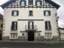
|
| Hotel Rural Loizu ★★★ Booking.com |
|

Espinal (Aurizberri in Basque) is a compact village in the valley of the Erro river, with a couple of bars, a small albergue, and a welcoming atmosphere. Between here and Pamplona you'll notice villages perched above the valley floor — a pattern driven by the need to keep fertile riverside farmland available for crops while building homes on higher, more defensible ground.
The parish church retains some Romanesque elements. The village is a good stopping point if Roncesvalles was full or if you want a shorter first day.
Espinal was founded specifically to protect pilgrims. This river valley has a long history of battle and banditry, and the Navarrese kings — in this case Teobaldo II in the 13th century — established fortified settlements along the route to provide safe passage. The founding charter explicitly mentions protection of pilgrims as its purpose.
Village festival on the last Sunday in August.
Accommodation in Espinal.
| Irugoienea 16€ 21 Booking.com |
|
| Albergue Haizea ★★★ 15€ 30 Booking.com |

|
| Camping Urrobi 5.15€ |
|


A gentle pass between Espinal and Bizkarreta. The climb is modest and the terrain wooded. No services, but a pleasant stretch of walking through mixed forest.
Bizkarreta-Gerendiáin is the next valley village, with a few bars including El Dragón Peregrino which has vegetarian and vegan options — a rarity this early on the Francés. A small supermarket sits at the far end of town.
The village's stone houses cluster around the road, and the parish church of San Pedro has a Romanesque doorway worth a glance. A functional stop rather than a destination, but the food options make it a reasonable place to pause.
Accommodation in Bizkarreta.

![Photo of Bizkarreta [Gerendiain] on the Camino de Santiago](/sites/default/files/styles/max_650x650/public/newimages/819-134837.jpg.webp?itok=wx7dQTOS "Photo of Bizkarreta [Gerendiain] on the Camino de Santiago")
Lintzoain is a tiny hamlet tucked into the valley. The bar has highly irregular hours and isn't generally open to the public, so don't count on refreshments here. A few stone houses, a small Romanesque church, and not much else — but it's a peaceful spot.
The bar has irregular hours and is not reliably open. Carry supplies from Bizkarreta or Espinal.
Follow the arrows through town — they direct you right and uphill. Don't continue straight to the main road (N-135); that's the wrong way. The climb out of Lintzoain is fairly steep but flattens out through forest, bringing you to the Alto de Erro.
Accommodation in Lintzoain.
| Posada El Camino | 
|

The Alto de Erro (801 m) is a forested pass with a food truck that provides seasonal service to pilgrims — drinks, snacks, and a colorful stamp for your credencial. On busy days it's a social gathering point; on quiet days it might not be here at all.
From here it's a steep descent to Zubiri. The path has been paved in recent years, making it less slippery than it once was, but the steepness remains. Watch your knees.
The descent from here to Zubiri has been paved over and is not longer as slippery as it once was. The steepness remains the same!
The descent drops steadily through forest to the valley floor. Zubiri sits adjacent to the camino but not strictly on it — you'll reach a bridge over the Río Arga. You don't need to cross if you're pressing on, but if you're stopping, cross and head into town. When leaving, retrace your steps over the bridge and turn right.

Zubiri is the first town of any real size after the Pyrenees crossing, sitting in the valley of the Arga river. It's a working town rather than a tourist one — a Magnesitas factory dominates the approach — but it has the services you need after the mountains.
Two restaurants serve pilgrim menus on opposite ends of town. A well-stocked shop near the church has everything to assemble your own meal. Several albergues operate here; on extremely busy days the municipal facilities sometimes set up overflow capacity.
The town makes a practical stopping point if you started in Roncesvalles and want a manageable first (or second) day. It's about 22 km from Roncesvalles, or 6 km short of Larrasoaña.
The name Zubiri comes from the Basque for 'village of the bridge,' and the bridge in question is the medieval Puente de la Rabia over the Arga. Legend holds that animals led three times around the bridge's central pillar would be cured of rabies — a folk tradition that persisted well into the modern era.
Accommodation in Zubiri.
| Agotzenea - Alojamiento Con Encanto En Un Entorno Rural Booking.com |
|
| Cabañas Agotzenea Booking.com |
|
| Albergue de Peregrinos de Zubiri 16€ 72 |
|
| Albergue Zaldiko 15€ 24 |
|
| Albergue El Palo de Avellano 19-22*€ 59 |
|
| Albergue Río Arga Ibaia 17€ 18 |
|
| Suseia 17€ 12 Booking.com |
|
| Albergue Segunda Etapa 16€ 12 Booking.com |
|
| Txantxorena Booking.com |
|

| Hostal Gau Txori |
| Hostería de Zubiri | 
|

You can take the road or the trail out of Zubiri. The trail passes a magnesium processing plant — you'll smell it before you see it — and can get muddy in wet weather. Both options follow the Arga valley downstream, and the walking is mostly flat with gentle ups and downs through the riverside woodland.
Ilarratz is a small hamlet along the Arga. About 400 m past the village on the right-hand side of the road stands the Abadía de Ilarratz, a medieval building rumored to have been a fort before its conversion to a church. The structure still has a fortress-like quality, with thick walls and small windows.
An albergue operates here in an old stone house. A couple of bars along the road serve pilgrims. This stretch of the Arga valley is pretty — river, forest, stone villages — and sets the tone for the day's walking.
Accommodation in Ilarratz.
| Hostel Acá y Allá 20€ 12 Booking.com |
|

A tiny hamlet on the road between Ilarratz and Larrasoaña. A handful of stone houses and not much else. The walking continues along the Arga valley.

Going into Larrasoaña isn't strictly necessary unless you're staying at the albergue or stopping for food. The camino proper runs along the opposite bank. If you've been following the road from Zubiri, you can cross the bridge into town or stay on the trail without descending.
If you do go in, the albergue is at the far end of the village. Retrace your steps to the bridge to rejoin the camino heading toward Pamplona.
Larrasoaña is a historic pilgrim village strung along a single main street above the Arga. It was once an important stop on the medieval Camino, with multiple pilgrim hospitals. Today it's a small, quiet place with an albergue, a couple of basic bars, and a grocery with limited hours and stock.
The village has the characteristic Navarrese stone architecture, and the medieval bridge — Puente de los Bandidos — tells its own story. It was a notorious spot for bandits who preyed on pilgrims crossing the river. The name stuck.
Larrasoaña makes a reasonable alternative to Zubiri if you're looking for a shorter or longer first day from Roncesvalles. It's quieter and has more historical character, though fewer services.
Larrasoaña held a strategic position on the medieval Camino, with at least two pilgrim hospitals operating by the 12th century. The town received a charter (fuero) in 1174 from King Sancho VI of Navarre, specifically to support the pilgrim traffic. The Puente de los Bandidos (Bridge of Bandits) earned its name from centuries of robbery — the narrow crossing made pilgrims easy targets.
Accommodation in Larrasoaña.

| Albergue de Larrasoaña 15+€ 32 Booking.com |

|
| Albergue San Nicolás 17-19€ 38 Booking.com |
|

A small Basque hamlet on the hillside above the Arga. Notable mainly for a large rural hotel. The camino leaves the paved road here for a dirt track, which makes for more pleasant walking through the riverside landscape.
Accommodation in Aquerreta.

Zuriain is little more than a scattering of houses along the Arga, but the Parada de Zuriain bar-restaurant has made it a popular breakfast stop. Good food, artisan tortillas, and a deck overlooking the garden and river make it worth a pause. You can easily lose an hour here watching the water.
The camino follows the Arga valley downstream, alternating between riverside path and minor road. The terrain is gentle and the walking pleasant. Small Navarrese villages appear at regular intervals, each with stone houses and a parish church. You'll cross the river several times before reaching the outskirts of Pamplona.
Accommodation in Zuriain.
| Albergue La Parada de Zuriain 20€ 5 |
|

A small village on the road where the camino briefly touches asphalt. No services, but the medieval bridge over the Arga is a fine example of the river crossings that punctuate this valley. The walking continues flat and easy toward Zabaldika.
From Irotz the camino continues along the Arga valley, passing through increasingly built-up terrain as Pamplona approaches. The river remains your companion, and the path alternates between gravel track and minor road.

Zabaldika sits on a hill above the river, with the Romanesque Iglesia de San Esteban as its centerpiece. The church has a beautiful semicircular apse and a carved doorway — worth a stop if it's open.
The village has had its share of confusing waymarking, the result of local politics redirecting arrows away from the traditional route past the church. Follow the arrows as they are, but if you can, take the path that passes the church rather than bypassing it.
A small parish albergue operates near the church, offering a donativo bed and a communal dinner. It's a simple, hospitable setup that many pilgrims remember fondly.
Accommodation in Zabaldika.
| Albergue Parroquial de Zabaldika Donativo€ 18 |
|


At the picnic area by the road you have a choice. The main camino continues straight ahead, climbing briefly before descending toward Trinidad de Arre and the urban approach to Pamplona.
Alternatively, you can follow the river downstream on a flat path to Huarte and Villava, then walk into Pamplona along the river. This variant avoids some road walking and is pleasant, though slightly longer. Both routes converge at Trinidad de Arre.
The two buildings of note here are the Palacio de los Señores (Palace of the Lords) and the Iglesia de Santa Marina. Neither is open to the public, but they make a handsome pair of medieval stone structures. There's enough space for a rest or a picnic in the shade before tackling the suburbs of Pamplona.
A short walk from here brings you to the bridge over the Ulzama at Trinidad de Arre. The urban approach to Pamplona begins.
Crossing the medieval bridge over the Río Ulzama, you arrive at the Basílica de la Trinidad de Arre, which also operates as a pilgrim albergue run by the Padres Maristas. It's a popular stop with a pleasant garden and a communal atmosphere.
This is where the camino from Bayonne (the Route des Ports de Cize) joins the main Francés. From here the walk into Pamplona is mostly urban — through Villava, Burlada, and across the Puente de la Magdalena into the old city. It's about 5 km of suburb.
From Trinidad de Arre the camino follows the road through Villava and Burlada into Pamplona. The terrain is flat. Industrial and commercial zones give way to residential neighborhoods, then the old city appears across the Arga.
Accommodation in Trinidad de Arre.
| Albergue de Trinidad de Arre 10€ 32 |
|

Villava is the first of the Pamplona suburbs you'll walk through after Trinidad de Arre. It's a residential town that has grown into the Pamplona sprawl. All services are available — supermarkets, pharmacies, bars — but most pilgrims press on to Pamplona itself. The cyclist Miguel Induráin, five-time Tour de France winner, was born here.
Accommodation in Villava.
| Albergue Municipal de Villava 19+*€ 54 Booking.com |
|
| Pensión Obel |
The border between Burlada and Pamplona is the Río Arga, crossed by the Puente de la Magdalena. Since Trinidad de Arre the terrain has been flat suburban road. From the bridge you get your first sight of Pamplona's old walls and the beginning of the old city. All services available in Burlada, though most pilgrims walk straight through.
The Puente de la Magdalena is a beautiful 14th-century bridge over the Arga, restored in the 1960s. It marks the formal entrance to Pamplona's old city, and the point where the camino passes through the medieval walls via the Portal de Francia.
The albergue Casa Paderborn sits along the river — turn left after crossing the bridge if you plan to stay there. It's a well-run German-founded albergue with a good reputation.
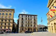
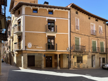
Pamplona (Iruña in Basque) is the first major city on the Francés and the capital of Navarra. It's a beautiful, walkable city with a well-preserved old quarter, excellent food, and a lively atmosphere year-round — not just during the San Fermín festival.
The old city is compact. The Plaza del Castillo is the heart of it, ringed by cafés with outdoor seating. From here the narrow streets radiate outward, packed with pintxos bars that rival anything in San Sebastián. Calle Estafeta — the famous bull-running street — is worth walking even without the bulls. The cathedral of Santa María la Real is a Gothic masterpiece with a cloister considered one of the finest in Spain.
The city walls and the Ciudadela (the star-shaped fortress turned public park) are perfect for an afternoon stroll. The parks along the Arga river offer green space and running paths.
For services, Pamplona has everything: hospitals, pharmacies, outdoor gear shops (useful for replacing anything that broke in the Pyrenees), banks, and a major bus and train station. The Pilgrim Office near the cathedral issues credenciales and stamps.
Multiple albergues operate in the old city. The municipal albergue Jesús y María is centrally located. Several private albergues and hostels offer more comfort. Hotels range from budget to luxury. Book ahead during San Fermín (July 6-14) when the city is impossibly full and prices triple.
Pamplona is the first city along the way with a post office (Correos ⨠), perfect for lightening your pack. The post office here can help you send your stuff to the Santiago post office, or to Casa Ivar (the same Ivar as the popular ‘Camino Forums’’). He offers package and luggage receiving & storage in Santiago. Prices range from 15-25€, depending on the size of the package. When you arrive in Santiago, stop by Ivar´s office and pick it up. Opening hours are listed on casaivar.com, or you can email Ivar at ivar@casaivar.com.
Pamplona was founded by the Roman general Pompey in 75 BC as Pompaelo. It became the capital of the Kingdom of Navarre in the 10th century and has been the political heart of the region ever since.
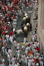
The city's most famous event, the Running of the Bulls during the San Fermín festival, was immortalized by Hemingway in The Sun Also Rises. The festival dates to the 14th century, though the bull runs themselves evolved from the practical need to move bulls from corrals to the bullring. It's become one of the world's most famous festivals, for better and worse.
San Fermín (July 6-14) is the big one — the encierro (bull running) takes place at 8:00 each morning along Calle Estafeta. The city explodes into non-stop celebration. Book accommodation months ahead or plan to arrive early; beds become scarce. Outside July, Pamplona's pintxos scene and cultural life make it worth a rest day anytime.
The camino exits through the old city, passing the university campus and climbing gently through the suburbs of Iturrama and Cizur Mayor before reaching Cizur Menor. The way out of Pamplona is well-marked but the urban sprawl can feel long after the intimacy of the Navarrese villages.
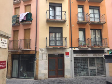
Accommodation in Pamplona.


| Albergue Municipal de Peregrinos - Iglesia de Jesús y Maria 12€ 112 |
|
| Albergue Plaza Catedral 19€ 42 Booking.com |
|
| Albergue de Pamplona-Iruñako Aterpea 16€ 22 Booking.com |
|
| Albergue Casa Ibarrola 25€ 20 Booking.com |
|
| Aloha Hostel 25€ 26 Booking.com |
|
| Betania Donativo€ 20 |
|
| Albergue Casa Paderborn 7.50€ 26 |
|


![Photo of Pamplona [Iruña] on the Camino de Santiago](/sites/default/files/styles/max_650x650/public/newimages/833-133795.jpg.webp?itok=G-s2zsOw "Photo of Pamplona [Iruña] on the Camino de Santiago")
![Photo of Pamplona [Iruña] on the Camino de Santiago](/sites/default/files/styles/max_650x650/public/newimages/833-133796.jpg.webp?itok=tgbSR_z- "Photo of Pamplona [Iruña] on the Camino de Santiago")
Cizur Menor has been swallowed by Pamplona's suburban expansion, but it retains a village identity of its own. The albergue is run by the Knights of Malta — the modern descendants of the Hospitallers who cared for pilgrims along this stretch in the Middle Ages. It's a good operation with a communal dinner and a sense of ceremony that connects you to something older than the suburban sprawl outside.
The Iglesia de San Miguel Arcangel, a late 12th-century Romanesque church, sits at the center of the village. The doorway has a tympanum carved with the chi-rho monogram of Christ. The church was part of a monastery complex belonging to the Hospitallers, and though the monastery is long gone, the church stands solid.
For food, the Asador El Tremendo does a solid pilgrim menu. The nearest full supermarket is in Cizur Mayor, a short walk west, though a small shop in town covers basics. There's a fountain for refilling water bottles near the albergue.
The Hospitallers of St. John of Jerusalem (later the Knights of Malta) established a monastery and pilgrim hospital here in the 12th century, managing the route between Cizur Menor and the Alto del Perdon. The Navarrese crown also held interests in the area — records mention royal property in nearby Zariquiegui as early as 1280.
When the Knights Templar were suppressed in 1312, the Hospitallers assumed responsibility for their operations west of here in Puente la Reina as well. The monastery was abandoned in 1836 during the Mendizabal disentailment, when church properties across Spain were seized and sold. The property was eventually recovered by the Government of Navarra, and in 1999 the Knights of Malta returned, reopening the albergue and resuming a pilgrim hospitality tradition that had been interrupted for over 160 years.
The Romeria to the Santuario de Nuestra Senora del Perdon is held on Easter Monday. The village fiesta is in late September.
The camino leaves Cizur Menor on a track through farmland, climbing gradually toward the Sierra del Perdon. You'll pass through the abandoned hamlet of Guendulain before reaching Zariquiegui, about 6 km ahead. The ascent is steady but not steep at first, gaining elevation through open terrain with expansive views back toward Pamplona and the Pyrenees beyond. There's no shade and no water between Cizur Menor and Zariquiegui, so fill up before you leave.
Accommodation in Cizur Menor.
| Quiet Bright Room with Sunny Terrace 25€ Booking.com |
|
| Hostal Ardoi Booking.com |
|

| Albergue de peregrinos de la Orden de Malta 10€ 27 |

|

Zariquiegui is the last village before the climb to the Alto del Perdon, about 11 km from Pamplona. A small cluster of stone houses along a single street, with a bar that opens seasonally and a fountain for water. Fill up here — there's nothing between Zariquiegui and Uterga on the far side of the pass.
The Iglesia de San Andres is the village's landmark, a 13th-century church in late Romanesque style with a recessed doorway and capitals decorated with plant motifs. The tympanum carries a chi-rho symbol. If you've seen the movie The Way, you may recognize the facade — it was used as a location in the film.
From here the climb gets more serious, gaining about 300 m over 3 km to the pass. It's not the hardest climb on the Frances by any measure, but on a hot day with a fresh pack from Pamplona it can feel like it.
Records from 1280 show the Navarrese Crown owned a monastery called San Salvador de Zariquiegui, which served pilgrims passing through. The current Iglesia de San Andres dates to the 13th century in its Romanesque core, though it was significantly modified in the 16th century when the walls were widened, the vaults rebuilt, and a sacristy added. What survives from the original building is the recessed Romanesque portal with its carved capitals and the chi-rho tympanum.
Beyond Zariquiegui the path climbs steadily on a rocky track through scrubland and low trees. The terrain is exposed — no shade, no water. The final approach to the Alto del Perdon is steep and can be windy. The wind turbines appear first, growing louder as you approach, then the famous pilgrim sculpture comes into view at the summit. Allow 45 minutes to an hour for the climb from Zariquiegui.
Accommodation in Zariquiegui.
| Albergue San Andrés 15€ 30 |
|


The Alto del Perdon (756 m) is crowned by a line of wind turbines and a famous iron sculpture by the Navarrese artist Vicente Galbete, installed in 1996. It shows a procession of pilgrims through the ages — medieval walkers, merchants on horseback, a solitary figure representing the centuries of decline, and modern pilgrims at the rear. The inscription reads: "Donde se cruza el camino del viento con el de las estrellas" — where the path of the wind crosses that of the stars.
On a clear day the views from the summit are outstanding: the Pyrenees behind you to the east, the route ahead dropping into the valley toward Puente la Reina, and nearly 40 wind turbines sharing the ridgeline. This is the highest point for the next 170 km.
The descent on the far side deserves respect. The path drops steeply on loose, rocky ground that becomes slippery when wet. The worst section is the first kilometer — more rocky than steep, but it demands careful footing. Take your time, especially if it's been raining. Trekking poles earn their weight here. The surface has been improved in recent years but it still punishes rushed footwork.
The pass is exposed and wind can be fierce — gusts strong enough to knock you off balance are not uncommon. In winter or bad weather, the descent can be genuinely dangerous. There is no water, no shade, and no shelter between Zariquiegui and Uterga — plan accordingly.
The name comes from the Ermita de Nuestra Senora del Perdon that once stood at the summit. A legend tells of a thirsty pilgrim who was tempted by the devil on the climb — the devil offered to reveal a hidden spring in exchange for the pilgrim's soul. The pilgrim refused, and Santiago himself appeared to offer water at a better price.
The legend captures something real about this exposed ridge: water has always been scarce here, and the pass has been a test for pilgrims since the earliest days of the route. The Hospitallers maintained the path on the Pamplona side, providing what protection they could on an inherently exposed crossing.
The descent from the Alto del Perdon is steep and rocky — the most challenging footing on this section of the Frances. Allow about 45 minutes to reach Uterga. The surface is loose stone and compacted earth, rutted by runoff. In wet weather it becomes genuinely treacherous. Once you reach the valley floor the walking eases dramatically, and from Uterga onward the terrain is flat farmland all the way to Puente la Reina.


Uterga is a small village of about 170 people at the base of the Sierra del Perdon's western slope, about 19 km from Pamplona. After the rocky descent from the pass, it feels like a reward. A couple of bars serve food — the Gastrobar Camino del Perdon has earned a good reputation among pilgrims — and a small shop covers basics.
The village has attractive stone architecture and a quiet atmosphere. The Iglesia de la Asuncion anchors the old center. Most pilgrims pass through quickly, but it's a pleasant spot for a coffee and a rest before the flat walk to Murozabal. There's a fountain with fresh water in the village.
Like much of the Valdizarbe valley, Uterga sits on land that was worked in Roman times — traces of Roman roads and settlements have been found throughout the area between here and Puente la Reina. The village's agricultural character has remained essentially unchanged for centuries, with farming and viticulture defining the landscape.
From Uterga the camino follows a gentle track across open agricultural land toward Murozabal. The terrain is flat and easy, a welcome change after the descent. About 2 km of walking with the Sierra del Perdon now behind you.
Accommodation in Uterga.
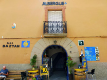
| Albergue Casa Baztan 14*€ 24 Booking.com |
|
| Hostal Camino del Perdón | 
|


Murozabal is a small farming village of about 250 people in the Valdizarbe valley, notable mainly as the access point for the Church of Eunate. A bar on the main road provides basic refreshment. The village has a few examples of the traditional Navarrese stone houses with their carved escutcheons, and the Iglesia de San Esteban — a Gothic church with a three-arched portico — sits at the center.
If you're planning to visit Eunate, the detour begins here. It's about 1.5 km south off the camino. You can rejoin the main route by continuing from Eunate directly to Obanos, making it a loop rather than an out-and-back. The detour adds perhaps 2 km total to the day, and it's flat walking on farm tracks.
The Iglesia de San Esteban dates from the Gothic period with later Baroque additions. The village also has a Baroque palace that has been converted into a winery — the Palacio de Murozabal. The area has been cultivated since Roman times, and the valley's agricultural character is evident in every direction.
From Murozabal the camino continues on flat terrain toward Obanos, about 2 km ahead. If you're taking the Eunate variant, turn south at the edge of the village — the path to the church is signed and easy to follow across open fields. From Eunate, another path leads directly to Obanos without returning to the main route.
Accommodation in Muruzábal.

The Iglesia de Santa Maria de Eunate is one of the most remarkable buildings on the Camino Frances, standing alone in a field about 1.5 km south of Murozabal. It's an octagonal 12th-century Romanesque church surrounded by a freestanding arcade of arches — a design so unusual that scholars have been arguing about its origins for centuries.
The name Eunate likely derives from the Basque for "hundred gates," a reference to the arcade's many openings. That arcade — roughly octagonal itself, with carved capitals and semicircular arches — surrounds the church at a slight distance, creating a covered walkway. It's unlike anything else in Navarra.
The Templar theory is popular but unproven. No documentary evidence links the church to the Knights Templar, though the octagonal form inevitably invites the comparison. The more likely builders were the Hospitallers, whose presence in this area is well documented. The church may have served as a funerary chapel for pilgrims who died on the road — pilgrim burials have been excavated in the surrounding field, and the octagonal plan echoes the Church of the Holy Sepulchre in Jerusalem, a common model for funerary architecture.
Inside, the church is bare and austere. The eight-ribbed vault rises to about 12 meters, with star-shaped openings in the ceiling that admit thin shafts of light. The alabaster windows keep the interior deliberately dark — appropriate for a church whose function may have been the performance of funerary rites. The Cordoban influence in the vault ribbing is unmistakable.
The church operates as a small museum with seasonal hours (generally 10:30-14:00 and 15:00-19:00 from late March through mid-October, with extended afternoon hours in July and August). A path connects Eunate directly to Obanos, so you can visit without backtracking to Murozabal.
The church dates to around 1170. Its octagonal plan and detached cloister arcade are unique in Navarra and rare in all of Europe. The 26 decorated capitals of the interior columns show a mix of geometric, vegetal, and figural motifs. The eight-ribbed vault, with each rib meeting at a different angle because the octagon is slightly irregular, shows sophisticated engineering and a clear debt to Islamic architecture from Cordoba.
The pilgrim burials found around the church support the funerary chapel theory, as does its position near the junction of the Frances and Aragones routes — a natural place for a pilgrim cemetery. The name Eunate is generally understood as Basque for "hundred gates," referring to the arcade's arches. The Hospitallers of St. John are the most likely patrons, though definitive proof remains elusive.

Obanos sits at the junction where the Camino Aragones merges with the Camino Frances — a meeting point of routes that has defined this village for centuries. It's a compact hilltop settlement of about 850 people, with narrow streets, stone houses bearing carved coats of arms, and a small plaza around the Iglesia de San Juan Bautista, a neo-Gothic church rebuilt in the early 20th century.
A couple of bars and a small shop serve pilgrims. There's an albergue in town. The Ermita de Arnotegui, about 2.5 km up the hill, serves as a viewpoint over the Valdizarbe valley — it's the hermitage where, according to legend, the remorseful Guillen lived out his days.
The village is best known for the Misterio de Obanos, a passion play performed every other year (even-numbered years, end of July) that tells the tale of San Guillen and Santa Felicia — a medieval fratricide and redemption story rooted in this village. Over 700 actors in period costumes perform the outdoor production, which has been running since 1965.
The Misterio de Obanos dramatizes a 14th-century legend. Santa Felicia, sister of the Duke of Aquitaine, left home on pilgrimage to Santiago. She never returned — arriving in Obanos, she chose to stay and devote herself to helping pilgrims. Her brother Guillen came to bring her home, and when she refused, he killed her in a rage. Overcome with remorse, he completed her pilgrimage as penance, then retreated to the nearby Ermita de Arnotegui where he lived as a hermit for the rest of his days. The Iglesia de San Juan Bautista preserves what is claimed to be Guillen's skull.
The play was created by the local priest Santos Beguiristain in 1962 and first performed in 1965. It ran annually until 1977, drawing over 130,000 spectators in those years. It was revived and now runs biennially, with a cast of over 700 local volunteers wearing more than 1,000 handmade medieval costumes.
The Misterio de Obanos is performed at the end of July in even-numbered years — a large-scale theatrical production with hundreds of local participants in medieval costume. The village fiesta for San Juan Bautista is June 24.
From Obanos the camino descends gently to Puente la Reina, about 2 km. Just outside Obanos, you'll see the monument marking the confluence of the Aragonés and Francés routes — from here onward there's a single Camino Francés all the way to Santiago.
Accommodation in Obanos.
| Casa Raichu Booking.com |
|
| Gure Ametza Booking.com |
|
| Casa Rural Raichu 9 |
|
| Casa Rural Villazón Ii Booking.com |
|
| Estudio Villazón Booking.com |
|
| Hostal Rural Mamerto |

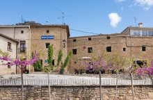
Puente la Reina (Gares in Basque) is built along a single main street — the Calle Mayor — that runs from the Iglesia del Crucifijo at the eastern entrance to the famous medieval bridge at the western exit. In between lies a handsome town of stone houses, arcaded streets, and two churches worth seeing. The town's medieval grid of three parallel streets, laid out in the French bastide style, survives largely intact.
The Iglesia del Crucifijo, at the entrance to town, was founded by the Knights Templar in the late 12th century. It houses a striking Y-shaped crucifix — a 14th-century work, likely of German Rhineland origin, that arrived here via pilgrim hands. The unusual shape, with Christ's arms raised above his head on a tree-like cross, makes it unlike any other crucifix on the Camino. The church has two naves: the original Romanesque nave and a Gothic addition from the 14th century.
Further along the Calle Mayor, the Iglesia de Santiago has a Romanesque doorway with a multilobed arch showing Moorish influence — one of the finest carved portals in Navarra. Inside is the Santiago Beltza, a 14th-century Gothic wooden statue of Santiago Peregrino, darkened by age and once coated in soot. The name means "Black Santiago" in Basque.
The bridge itself — the Puente de los Peregrinos — is a six-arched Romanesque span over the Arga, 110 meters long, with smaller vent arches between the main arches to handle flood waters. It originally had three defensive towers, though only fragments of one survive. Cross it at the end of the day when the light hits the stone and you'll understand the fuss.
Several albergues operate in town, along with a handful of hotels and pensiones. Bars and restaurants line the main street, and there's a supermarket for provisions. The town has a pharmacy and an ATM. If you're arriving from the Camino Aragones via Eunate, you'll enter from the south and join the Frances here.
The bridge was built in the 11th century, commissioned — according to tradition — by a queen of Navarra. Historians debate which queen: the leading candidates are Dona Mayor (wife of Sancho III el Mayor) and Dona Estefania (wife of Garcia el de Najera). Whoever ordered it, the bridge was built specifically to serve pilgrims crossing the Arga.
The town received its fuero (charter) in 1122 from Alfonso el Batallador, designed to encourage settlement. The town grew up around the bridge with its French-style bastide layout of parallel streets. It was fortified in the 13th century with a rectilinear wall of 26 towers. Most of the wall has been absorbed into private houses — the Hotel El Cerco incorporates stonework from one of the original towers, and the Calle Cerco ("wall street") traces the old perimeter. Of the four original gates, only the one opening onto the bridge survives.
The Knights Templar maintained a presence here from the mid-12th century, when King Garcia Ramirez IV donated land to the order. They built the Iglesia del Crucifijo and its attached pilgrim hospital. When the order was dissolved in 1312, the facility passed to the Hospitallers (Order of St. John), who added the Gothic nave to the church in the 14th century.
Santiago is the patron saint — fiestas run from July 24 to 30 with music, processions, and bullfights. Harvest festivals in September celebrate the piquillo peppers grown in the surrounding hills between here and Eunate.
The camino crosses the bridge and turns left, crossing the main road and picking up a footpath. Almost immediately it begins a short, steep climb on terrain that gets slippery when wet — a common sight here is cyclists pushing their bikes up. The footing improves quickly and the route continues through pleasant agricultural land toward Maneru, about 5 km ahead.
Accommodation in Puente la Reina.
| Casa Maitetxu Booking.com |

|
| Casa Maitetxu 2 Booking.com |
|
| Apartamentos Puente La Reina Booking.com |
|
| Ganbara Booking.com |
|

| Albergue De Peregrinos Santiago Apostol 12-14€ 100 Booking.com |

|
| Albergue Jakue 25€ 16 Booking.com |

|
| Albergue Puente Para Peregrinos 16€ 32 Booking.com |

|
| Albergue Estrella Guia Solo Peregrinos 25€ 6 Booking.com |
|
| Albergue Gares 15€ 40 Booking.com |
|
| Albergue de los Padres Reparadores 9€ 100 |

|
| Hotel Rural Bidean Booking.com |
|

![Photo of Puente la Reina [Gares] on the Camino de Santiago](/sites/default/files/styles/max_650x650/public/newimages/840-200.jpg.webp?itok=sIctMG6K "Photo of Puente la Reina [Gares] on the Camino de Santiago")
![Photo of Puente la Reina [Gares] on the Camino de Santiago](/sites/default/files/styles/max_650x650/public/newimages/840-133359.jpg.webp?itok=7HPS8Shy "Photo of Puente la Reina [Gares] on the Camino de Santiago")
Mañeru is a small village whose labyrinthine streets seem designed to confuse. Every turn leads uphill, and the coats of arms carved into the facades of the larger houses suggest this was once a wealthier place than it appears today. A bar near the plaza and a small shop cover essentials.
The Iglesia de San Pedro sits at the heart of the village. The medieval street pattern is intact and worth a wander if you're not in a rush — it gives a sense of how these Navarrese hilltop villages were laid out for defense rather than convenience.
A celebration on the last weekend of June, and a larger fiesta during the last week of August.

Cirauqui is perched on a conical hill and seems to go uphill in every direction. The camino enters through a medieval archway and climbs steeply to the Iglesia de San Román at the top, where the plaza and a small albergue provide a resting point. Don't forget to get your credencial stamped under the archway.
Like Mañeru, the village has impressive coats of arms carved into stone facades. The Iglesia de San Román preserves a 2,000-year-old Roman milestone inside — evidence of how old these routes really are. The views from the top of the village across the surrounding farmland and toward the Sierra del Perdón are excellent.
A bar operates on the main street. The descent from Cirauqui is one of the highlights of this stretch — the path drops down through a stone archway and onto an ancient Roman road, still paved with original stones in places, before crossing a Roman bridge over a small stream.
Excavations in the area have uncovered traces of Roman settlement. The Roman road leaving the village — its original paving stones visible for a stretch — and the Roman bridge below confirm that this hilltop was a waypoint long before the Camino existed. The village name is Basque in origin.
The Day of the Cross is September 14, with celebrations running from September 13 to 19.
Accommodation in Cirauqui.
| Albergue de Peregrinos Maralotx de Cirauqui 19-23€ 25 Booking.com |
|


A well-preserved Roman bridge sits below Cirauqui where the ancient road crosses a small stream. The paving stones of the Roman calzada are visible on the approach, giving a tangible sense of walking the same route that travelers have used for two millennia. The bridge is a single arch of good masonry — functional rather than decorative, like most Roman engineering.
From here the path continues through farmland toward Lorca, with the terrain gently undulating through fields of wheat and sunflowers.
Lorca is a small village where the two bars are clustered at the far end near the main plaza and frontón court. It's a practical stop for a drink and a rest, but there's not much reason to linger unless you're interested in the historical footnotes.
The camino passes through quickly. A fountain provides water.
King García Ramírez — the grandson of El Cid — died here in November 1150. The Codex Calixtinus, the 12th-century pilgrim guidebook, warned that the water between here and Estella was poisonous to horses. This was medieval propaganda rather than hydrology — the waters are perfectly safe, and always were. The warning was likely designed to funnel pilgrims toward specific establishments along the route.
Accommodation in Lorca.
| Albergue de Lorca 15€ 14 |
|
| La Bodega Del Camino 16.50€ 40 Booking.com |
|

You'll cross the Río Iranzu on a double-arched Romanesque bridge to enter the old part of Villatuerta. The Iglesia de Nuestra Señora de la Asunción is worth a visit for its Romanesque elements and the carved capitals inside.
For food, Bar Lara has a local reputation for good cooking. Bar El Rebote is another option. If you're just passing through and need a coffee, the polideportivo (sports hall) at the entrance to town or the panadería will do. A small shop covers basics.
The village sits in the valley of the Iranzu, with Estella visible ahead to the northwest. The terrain between here and Estella is flat and easy.
Artifacts confirming Roman occupation have been uncovered here and along much of the road back to Puente la Reina. Sections of the route between the two towns follow the original Roman road, and the A-12 motorway has obliterated other stretches. The Romanesque bridge over the Iranzu is a fine example of the medieval river crossings that mark this section of the Francés.
The Virgen de la Asunción is celebrated on August 15. San Veremundo is honored on March 8.
Accommodation in Villatuerta.

| Albergue Etxeurdina 19*€ 8 |
|

Before entering Estella, a variant route branches off to the south, bypassing the city entirely and heading directly to Villamayor de Monjardín and Los Arcos. It's a rural alternative that avoids urban walking but also skips everything Estella has to offer — which is considerable.
The variant follows farm tracks and minor roads through open countryside. It's quieter and less marked than the main route. Unless you have a specific reason to skip Estella (or have already seen it on a previous walk), the main route through the city is the better option. Estella is one of the more interesting towns on the Francés.
Estella (Lizarra in Basque) has more historical architecture per square meter than most cities twice its size. The camino enters along the west bank of the Río Ega, but to see the best of the town you'll need to cross the river.
The two buildings not to miss are the Palacio de los Reyes de Navarra — a rare example of Romanesque civic architecture, with a carved capital depicting Roland's battle with the Saracen giant Ferragut — and the Iglesia de San Pedro de la Rúa, whose cloister is one of the finest Romanesque cloisters in Navarra. Two of its four galleries were destroyed when the castle above was demolished in the 16th century, but what remains is exceptional.
Other churches worth seeking out include the Iglesia del Santo Sepulcro (closed since 1881 but with a magnificent Gothic doorway), the Iglesia de San Miguel with its Romanesque tympanum, and the Basílica del Puy at the top of town. The climb to the Basílica is rewarded with views over the entire valley.
The old quarter is compact and pleasant for wandering. Several albergues operate on both sides of the river. Bars and restaurants line the streets, and the pintxos are solid. A supermarket and all basic services are available. The tourist office next to the Palacio has maps for walking trails in the surrounding area — useful if you're taking a rest day.
Public bathrooms and a drinking fountain are at the entrance to Estella, just past the first albergue.
Estella's growth as a commercial center was driven not by pilgrims but by royal decree. King Sancho Ramírez founded the settlement at the end of the 11th century, granting it a charter to attract Frankish merchants. The town thrived as a trading post and eventually became a seat of Navarrese power. The concentration of Romanesque buildings reflects that period of prosperity.
Thursday is market day — as it has been for 900 years. The Plaza de los Fueros (opposite the Iglesia de San Juan) fills with stalls selling fresh produce from across the region.
Estella has two patron celebrations. San Andrés is honored on the first Friday before the first Sunday in August — known as El Viernes de Gigantes, with giant figures parading through the streets and a running of the bulls. La Virgen del Puy is celebrated on May 25.
The camino exits Estella along the river, crossing to the west bank. If you stayed in one of the albergues on the east side, cross back over the river to rejoin the route. The path passes through Ayegui and continues to the Fuente de Vino and Monasterio de Irache — about 3 km of easy walking.
Accommodation in Estella.


| Iraipe Estella Rooms Booking.com |
|
| Hotel Restaurante Casa Luisa Booking.com |
|
| Hotel Yerri ★★ Booking.com |
|
| Habitación Doble Con Vistas Al Centro Booking.com |

|
| Pensión Ibai Ega Booking.com |
|
| Pensión Buen Camino Booking.com |

|
| Hospederia Chapitel ★★★★ Booking.com |
|
| B&B Los Llanos Booking.com |
|
| B&B Zaldu Booking.com |
|
| Hostal La Rúa Booking.com |
|
| Agora Hostel 18-20€ 20-22 Booking.com |
|
| Hostal Cristina Booking.com |

|
| Hostal El Volante ★★ Booking.com |
|
| Hospital de Peregrinos de Estella 8€ 78 |
| Albergue La Hostería de Curtidores 20€ 30 Booking.com |
|
| Alda Estella Hostel 11€ 30 Booking.com |
|
| Albergue Capuchinos Rocamador 15€ 54 Booking.com |
|
| Albergue Parroquial San Miguel Archangel Donativo€ 28 |
|
| Albergue de ANFAS de Estella 12€ 24 |
|
| Camping Lizarra 5.62€ |

|


Ayegui has grown to merge with Estella and barely registers as a separate village. A few bars, a small park, and then you're through. The real interest lies ahead: the Fuente de Vino and the Monasterio de Irache are less than a kilometer away.
Watch for the arrows at the second roundabout, which direct you off the road and onto a track running uphill to the right, behind the commercial zone. At the end of town, blue arrow signs point downhill to the left — follow them, cross the main road, and continue toward the Fuente de Vino.
Accommodation in Ayegui.
| Albergue San Cipriano de Ayegui 12€ 26 Booking.com |
|
| Camping Iratxe Booking.com |

|
Sponsored by the Bodegas Irache, this is a fountain that dispenses both water and wine. Yes, really. A plaque on the wall reads: "If you want to go to Santiago with strength and vitality, of this great wine have a drink and toast to happiness." Another sign reminds you not to abuse the generosity.
The wine is Irache's basic table wine — perfectly drinkable if not exactly a revelation. The fountain operates during daylight hours and the supply occasionally runs dry on very busy days. A webcam lets armchair pilgrims watch from home.
The fountain sits beside the entrance to the Monasterio de Irache. Fill your bottle with water (from the water tap, not the wine one) and move on, or sit at the picnic tables opposite and enjoy the absurdity of free wine at 10 in the morning.

The Monasterio de Irache is a large monastic complex set among vineyards, its documented history reaching back to 958. It was the site of Navarra's first pilgrim hospital, and its buildings span Romanesque through Baroque periods. The church has a fine Romanesque apse; the Renaissance cloister is elegant; the Baroque additions are grand if less subtle.
Like many Spanish monasteries, Irache served as barracks for Napoleon's troops during the Peninsular War and as a military hospital during the Carlist Wars. It was abandoned in the 19th century and has been partially restored.
Free admission, though the monastery opens at 10:00 — later than most pilgrims departing from Estella would like. The park opposite has picnic tables and shade trees, making it a good rest stop regardless of whether the monastery is open.
The earliest documented reference to Irache dates to 958. The Benedictine monastery became one of the most powerful religious houses in Navarra, with the first pilgrim hospital on the Camino Francés within Navarra. The Romanesque church dates to the 12th century, with later additions in Renaissance and Baroque styles. The associated Bodegas Irache continue the monastery's winemaking tradition.
500 meters beyond the Monasterio de Irache, the camino splits. The camino turns right, but the natural inclination is to continue going straight along the alternate route via Luquin.
via Luquin - 17.8 KM
If you continue straight you will be rewarded with a more diverse hike with better views. The drawback is a lack of dependable services along this stretch of trail at the base of the Montejurra mountain. Luquin is the only town with a bar, and it is open irregularly. If you plan to go this way be sure to include extra food and drink. This lesser traveled route is the more scenic and peaceful option. Outside of Luquin it passes back under the A-12 and rejoins the first option during its zigging and zagging.
via Villamayor de Monjardín - 18.2 KM
Following the camino to the right will take you past the campgrounds of Irache, Azqueta, and Villamayor de Monjardin, before zig-zagging through the broad countryside that surrounds Los Arcos.

Azqueta is a tiny village with a handful of houses and no reliable services. The Fuente de los Moros — a medieval cistern with a double-arched entrance and a long stone staircase descending to the water — sits just off the camino near the village. It dates to around 1200 and is worth a quick look if you notice the sign.
From here it's less than 2 km to Villamayor de Monjardín, with the castle ruins visible on the hilltop ahead.
Accommodation in Azqueta.
| La Perla Negra 12€ Booking.com |
|

Villamayor de Monjardín sits below the Monjardín peak (890 m), where the ruins of the 10th-century Castillo de San Esteban still command the hilltop. The climb to the ruins is short and steep, and the views from the top stretch across the vineyards and olive groves of the Ega valley — worth the detour if you have the energy.
The 12th-century Iglesia de San Andrés is Romanesque, with a barrel-vaulted nave and a semicircular apse. Inside, a silver Romanesque processional cross from the 12th century is the church's most valued possession. A small shop in front of the church operates from March through October, selling food and drinks.
A couple of albergues and a casa rural provide accommodation. This is your last chance to stock up before Los Arcos — the 12 km stretch ahead has no services, no shade, and no water. On hot days it can feel endless.
The castle is associated with Sancho Garcés I, who is said to have conquered it from the Moors in the early 10th century. Tradition holds that his remains were interred here. The Fuente de los Moros near Azqueta and the castle ruins together suggest this hilltop was strategically important for controlling the valley route.
The 12 km between Villamayor de Monjardín and Los Arcos is one of the more tedious stretches on this section of the Francés. The terrain is open and exposed, with long straight tracks through farmland and almost no shade. Stock up with water and food before leaving. The walking is flat but the monotony and heat (in summer) make it feel longer than the distance suggests.
Accommodation in Villamayor de Monjardín.
| Markiola Booking.com |
|
| Albergue Villamayor de Monjardín 14€ 20 |
|
| Oasis Trails 12€ 21 |
|

Luquin is a small village about 3 km south of the main camino, accessible by a variant path that branches off between Villamayor de Monjardín and Los Arcos. It has a couple of bars and a basic shop, but most pilgrims won't pass through unless they've taken the southern variant.
The village produces good wine from the surrounding vineyards. If you find yourself here, the local rosado is worth trying.
Accommodation in Luquin.
| Albergue Casa Tiago 14€ 14 |
Los Arcos is a frontier town strung along streets that run parallel to the Río Odrón. You enter from the north, and the first thing you notice is that the place has the solid, well-built feel of a town that once had money and strategic importance.
The Iglesia de Santa María de la Asunción dominates the main plaza. It's a far grander church than a town this size would normally warrant — the Plateresque facade, the late Gothic cloister decorated with animal and plant carvings, and the extraordinary 1760 organ (possibly the most elaborate in Navarra, with three tiers of pipes and carved musician angels) all speak to the town's prosperous past. If the church is open, go in.
Several albergues, hotels, and pensiones operate in town. Bars and restaurants line the main street. A couple of bars near the main road on the southeast side open early for pilgrims and truck drivers. Saturday is market day.
Los Arcos dates to the Roman period and sits on the frontier between Navarra and La Rioja. Its hilltop castle (now gone) stood to the east of the approach. As a border town, it saw repeated destruction by land-hungry nobility and corresponding prosperity from the toll and currency exchange that every border crossing demanded. The Arco de Felipe V, through which the camino exits, bears the coat of arms of the first Bourbon king of Spain.
Market day is Saturday. The patronal fiesta for Santa María runs from August 14 to 20.
The camino exits through the Arco de Felipe V and crosses the Río Odrón. A few albergues are on the west side of the river. From here the route heads through rolling country toward Sansol and Torres del Río — about 7 km with some ups and downs that earn this stretch the local nickname 'The Knee Wrecker.'
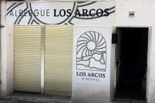
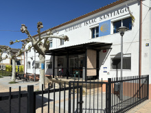
Accommodation in Los Arcos.
| Casa Alberdi 15€ 30 |

|
| Albergue de la Fuente - Casa de Austria 12€ 35 |
|
| Albergue Casa de la Abuela 15€ 20 |
|
| Albergue Casa Arqueña 12 Booking.com |
|
| Albergue Los Arcos 22€ 18 Booking.com |
|
| Albergue de Peregrinos Isaac Santiago 8€ 70 |
|
| Hostal Suetxe Booking.com |
|


Sansol is a small hilltop village that the arrows rush you through along the road. To see anything of interest — the church, the old baroque houses with their carved facades, and what remains of the village center — turn right at the ceramic tile sign at the entrance.
A small shop and a bar with a terrace near the Palacio albergue make this a reasonable place for a quick stop. The views from the upper village over the surrounding countryside are good.
Named after San Zoilo, a young man martyred in Córdoba under Diocletian in 304. His relics ended up in the Benedictine Monasterio de San Zoilo in Carrión de los Condes, which you'll reach in a few weeks. The parish church here is also dedicated to him.
The descent from Sansol to Torres del Río is steep and short. You'll wonder why anyone built a town at the bottom of a valley with so little defensive advantage — the answer is the Río Linares and easy access to water.
Accommodation in Sansol.
| La Vespa Hostel 23€ 24 Booking.com |
|
| Albergue Sansol 16-18€ 24 Booking.com |

|
| Palacio De Sansol 12-17€ 32 Booking.com |
|
| Casa Rural Martintxo | |
| El Olivo De Sansol Booking.com |
|

Torres del Río sits in the valley of the Río Linares, its buildings restored to a state that makes the village look more populated than it actually is. The reason to stop here is the Iglesia del Santo Sepulcro — an octagonal Romanesque church built between 1160 and 1180 that ranks among the most remarkable small buildings on the Camino.
Like Eunate, the octagonal plan echoes the Church of the Holy Sepulchre in Jerusalem. But it's the interior that sets this church apart: the vault is a Hispano-Muslim design, its ribs crossing to form an eight-pointed star. Small openings between the ribs filter light through delicate grillwork, creating a play of light and shadow that changes through the day. A 13th-century crucifix — the Cristo de los Caballeros del Sepulcro — hangs in the apse.
The debate over its origins mirrors Eunate's: Templar, Hospitaller, or funerary? The scholarly consensus leans toward the Knights of the Holy Sepulchre, but certainty remains elusive. What's certain is that the building is exceptional. Ask at the bar about visiting hours — the church is kept locked but someone in the village holds the key.
A couple of albergues and bars serve the village. Basic supplies available.
The stretch between here and Viana — about 11 km — has frequent ups and downs on exposed terrain. The only shade and service point is at the Capilla de la Virgen del Poyo, where a seasonal food kiosk sets up. Carry water.
Accommodation in Torres del Río.


Viana is the last town in Navarra and it wants you to know it has been here a while. The fortifications are obvious — the town perches on a ridge, its walls built high and thick to defend the Navarrese border against Castile and, later, La Rioja. The strategic logic is visible in every street.
The Iglesia de Santa María has a magnificent Renaissance facade — one of the finest in Navarra. At its base, a marble slab marks the grave of Cesare Borgia, who was killed in the fields outside Viana on March 11, 1507. The son of Pope Alexander VI and the model for Machiavelli's Prince, Borgia died in an ambush during a siege — a suitably dramatic end for a dramatic life. The epitaph reads simply: "Generalísimo de los ejércitos de Navarra y Pontificios."
The ruins of the Iglesia de San Pedro sit at the west end of town near a small park with views over the plains to the west and the mountains to the north. Several albergues, a handful of bars, and a few good restaurants (the Armendariz has a sidrería in the basement where you serve your own cider — a two-person operation involving careful aim and a bucket) make Viana worth more than a quick pass-through.
All services are available: pharmacy, ATM, supermarket.
Viana was founded in 1219 as a frontier fortress, and its walls held off several prolonged sieges over the following centuries. The town changed hands repeatedly as the border between Navarra and Castile shifted. The concentration of fortifications — the high perch, the thick walls, the multiple gates — reflects centuries of contested territory.
Cesare Borgia arrived in Viana as a general in the service of his brother-in-law, King Juan III of Navarra. He was killed on March 11, 1507, during a skirmish outside the town walls. He was originally buried inside the church, but his remains were later moved to the entrance — whether as a mark of respect for his rank or disrespect for his character depends on which version of the story you prefer.
Viana celebrates with enthusiasm. The major fiestas include San Felices (February 1), the combined Magdalena and Santiago celebrations (July 21-25), and the Fiesta de la Virgen de Nieva — a movable feast held from the Saturday to Wednesday that includes the first Sunday after September 8. The town occasionally closes its streets for a running of the bulls, so don't be surprised if your arrival coincides with temporary barricades and the sound of hooves.
Leaving Viana, you cross the border into La Rioja. The transition is gradual — the landscape opens up as you descend from Viana's ridge toward the Ebro valley. The Ermita de la Virgen de las Cuevas marks the old boundary, and from there the approach to Logroño is flat and increasingly urban.
Accommodation in Viana.
| Pensión San Pedro ★★ 18-25€ Booking.com |
| Alberguería Andrés Muñoz 9€ 46 |
|
| Albergue Izar 15*€ 44 |
|


A 17th-century ermita by the river, traditionally considered the border between Navarra and La Rioja (the official modern boundary is closer to Logroño, but nobody uses a paper factory as a landmark). A picnic area with shade trees and benches makes this a pleasant rest stop before the urban approach to Logroño.
The ermita is usually locked but the setting is the draw — riverside, shaded, and quiet.
