San Pedro de Cansoles is a small village near Guardo. No services. The camino passes through on the direct route toward Puente Almuhey.
Cegoñal is a small village between Guardo and Velilla del Rio Carrion. No services. The camino passes through on the approach to the Carrion river valley.
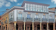
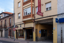
Velilla del Rio Carrion is on the mountain alternative route from Guardo. The town's main attraction is the ancient Tamaricas Fountains, mentioned by Pliny the Elder in the 1st century AD — he claimed that if the fountains ran dry, death would follow within a week. The surrounding area has abandoned mining infrastructure.
Hostal Stop and Casa Moura (+34 979 861 098) offer accommodation. Velilla has basic services.
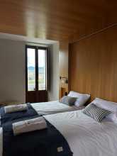
Accommodation in Velilla del río Carrión.
| Casa Rural Anti | |
| Casas Rurales Casán |

Caminayo is a small mountain village on the alternative route between Guardo and Puente Almuhey. No services. The mountain walking through here is the reward for taking the longer alternative — spectacular views of Leon's mountain peaks.
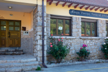
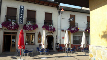
Puente Almuhey marks the convergence of the direct and mountain routes from Guardo. El Duende de Carricuende is the recommended accommodation — the owners are committed to welcoming pilgrims and offer good-value apartments. They also run a bar and restaurant next door that's a notch above average camino fare, with a bit of a foodie sensibility. An early morning breakfast in the bar may be included in the price.
The municipal albergue has been closed due to accessibility complaints.
The stage from Puente Almuhey to Cistierna (21 km) is one of the best days on the entire Olvidado. One pilgrim summed it up: "If I wanted to show someone the essence of a camino, I would take them on this stage." It has gentle strolls through pastures with cowbells, forests, good tracks, panoramic views, and romanesque churches.
Don't miss the mermaids carved on the wall of the Romanesque church in San Martin de Valdetuéjar — legend says peregrinas seduced the monks, so the abbot turned them into mermaids.
The 17th-century Sanctuary of Our Lady of La Velilla has a Santiago Matamoros on one end. After the sanctuary, a beautiful ascent begins through wild mountain country with Leon's peaks in your sights. The only way to break up the day would be a stop near the Velilla sanctuary at Hotel la Velilla in Mata de Monteagudo, if it's still operating.
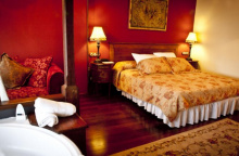
Accommodation in Puente Almuhey.

Taranilla is a small village between Puente Almuhey and San Martin de Valdetuéjar. No services. The walking through here is part of one of the Olvidado's best stages — pastoral scenery with cowbells and mountain views.
Accommodation in Taranilla.
| Casa Rural Valle del Tuejar ⭑⭑ Booking.com |

|
Don't miss the mermaids carved on the wall of the Romanesque church in San Martin de Valdetuéjar. Legend has it that several peregrinas on the way to Santiago seduced the monks. The enraged abbot turned the women into mermaids and threw them into the river, then ordered the monks to build the church with stone mermaid carvings as a reminder of their sins.
No services in the village.
Accommodation in San Martín de Valdetuéjar.
| Casa Rural Casa Lara |
Renedo de Valdetuéjar is a small village between San Martin de Valdetuéjar and the Velilla sanctuary. No services. The beautiful pastoral walking continues.
El Otero de Valdetuéjar is a tiny hamlet in the Valdetuéjar valley. No services. The camino passes through on its way to the Sanctuary of La Velilla.
La Mata de Monteagudo is near the 17th-century Sanctuary of Nuestra Senora de La Velilla, established as a pilgrimage site in honor of the Virgin's miracles. The sanctuary has a Santiago Matamoros on one end of the building. It's a pleasant spot even if the sanctuary isn't open.
Hotel la Velilla may offer accommodation here, which would break the Puente Almuhey to Cistierna stage roughly in half, leaving the mountain ascent for fresh legs in the morning.
Cistierna is where the Olvidado and the Vadiniense caminos cross. It's a former mining town that's seen better days but the people are wonderfully welcoming. The albergue is adequate, and the Hostal Moderno is a basic hotel with excellent staff — don't miss their restaurant's menu del dia. There's a park and playground up the hill beyond the albergue where locals gather in the afternoons.
The town has supermarkets, cafes along the main street, and all basic services. This is the first ATM since Guardo, so stock up on cash.
Two different routes lead from Cistierna. The longer route goes uphill through San Pedro de Foncollada and is reportedly very pretty with romanesque churches. Both routes meet in La Ercina, about 11 km from Cistierna.
Even the shorter "old route" has a nice start crossing the Rio Esla. The Vadiniense/Olvidado split is well marked at the bridge. This is a mostly flat transitional day as you move from the mountains behind Cistierna to those behind Bonar.
To break the stage: La Ercina has an albergue (tel. +34 987 712 051 / +34 648 032 831) at 11 km. Hotel Rural Monasterio de Ara-Mada in Santa Colomba de las Arrimadas (slightly off-route, 15-minute walk from La Devesa) is another option at about 22 km — the owners actively promote the Olvidado.
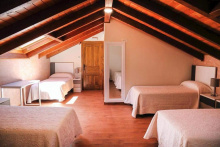
Accommodation in Cistierna.

La Ercina has an albergue (tel. +34 987 712 051 / +34 648 032 831) and an ethnographic museum with old mining implements and a tribute to the "Ercina 14" — miners who died in the local mines. The town sits where the two variant routes from Cistierna rejoin.
If you arrive early and have energy, several short walking circuits lead to old castros (hill forts) in the surrounding hills, with good views from the top.
Accommodation in La Ercina.
| Albergue Municipal La Ercina |
Acisa de las Arrimadas is a small village between La Ercina and La Devesa. No services. The camino passes through on flat terrain.
Barrillos de las Arrimadas is a small hamlet near La Ercina. No services. The walking is easy and flat through this stretch.
La Devesa de Bonar is a small village about 15 minutes' walk from the Hotel Rural Monasterio de Ara-Mada in Santa Colomba de las Arrimadas. The hotel owners are actively involved in promoting the Olvidado and their website shows directions from La Devesa. No services in the village itself.
La Losilla is a small village on the approach to Bonar. No services. The camino continues through the transition zone between the two mountain ranges.
Bonar is where the camino splits into two major variants: a mountain route through Vegacervera (typically three stages to La Magdalena) and a flatter route through La Robla (two stages to La Magdalena). Both routes rejoin in La Magdalena.
Pension Nisi has rooms on the top floor. Below, the owner provides rooms and care to elderly people without resources, funding the operation through the pension and restaurant. She's a remarkable woman constantly on the go.
Bonar has all services — supermarkets, cafes, restaurants, and a pharmacy.
The mountain route from Bonar to Vegacervera (27 km) is a five-star day. The walk starts off-road and climbs through pretty countryside to La Mata de la Berbula, where there's a cafe. From La Mata to the viewpoint is only 6 km, but it's a steep 300 m ascent — the view from the top, spreading across valleys and mountain peaks, is spectacular and worth soaking in.
For shorter options: Ranedo de Curueno (8 km from Bonar) has Hotel Rural El Canto de Gallo. Valdepiélago (9 km) has several casas rurales. Or take a taxi to La Mata de la Berbula and walk the spectacular 12 km from there.
The flat route to La Robla (33 km) avoids the mountains. Shorter stops: La Vecilla (9.5 km, Hostal Las Hoces), Aviados (14 km, Albergue Fuente de Oso, tel. +34 666 605 835 — reserve in advance), Robles de la Valcueva (20 km, Hotel Rural el Arriero), Candanedo de Fenar (25 km, Hostal el Valle).
Accommodation in Boñar.
| Albergue Camping Juvenil |
| Casa Rural La Solana | |
| Casa Rural El Negrillón |
| Las Caldas de Boñar |
| Hostal Ines | |
| Hostal Nisi |

Barrio de las Ollas is a small village between Bonar and the mountain/flat route split. No services. The camino begins its departure from Bonar through increasingly pretty countryside.
Sorribos de Alba is a small village between La Robla and the mountain route. No services. Another of the former mining villages in this area.
Olleros de Alba is a small village near Carrocera. No services. The camino passes through on quiet roads.
Carrocera is a small village between La Robla and La Magdalena. No services. The camino passes through on the route toward the junction at La Magdalena.
Ranedo de Curueno, about 8 km from Bonar on the mountain route, has Hotel Rural El Canto de Gallo. The village sits in the Curueno valley at the start of what becomes spectacular mountain walking. A useful stop for those who want to break the mountain route into shorter segments.
Accommodation in Ranedo de Curueño.
| El Canto del Gallo Booking.com |

|
Valdepiélago is about 9 km from Bonar on the mountain route and has several casas rurales. One option for two people showed a price of about 75 euros. An alternative to Ranedo for splitting the mountain route.
Accommodation in Valdepielago.
| Casas Rurales La Maestra y El Refugio |
La Mata de la Berbula has a cafe and marks the start of the most spectacular ascent on the mountain route — a steep 300 m climb in about 2 km. The views from the top, spreading across the valley behind you and mountain peaks ahead, are the reward. If you want a taste of the mountain route without the full stage, consider taking a taxi from Bonar to La Mata and walking the 12 km from here to Vegacervera.
Villalfeide is a small village on the descent from the mountain viewpoint toward Vegacervera. No services. The descent through shade and beautiful views is enjoyable after the climb.
Vegacervera has the Albergue El Chalten, whose owner is a real camino supporter. The albergue consists of cabins with bunks for 12-16 people. When the albergue is full, the owner takes pilgrims into his own home — he promised Ender he'd take care of pilgrims, and he does.
Hotel Chousa Verde is supposed to give a pilgrim rate, but results vary. Meson La Cocinona, affiliated with a family-run embutidos factory, is the best place to eat in town — not ideal for vegetarians, but the quality is excellent.
For artisan yoghurt fans, Coladilla yoghurt (made 2 km further along the camino) is goat milk yoghurt from a young couple who took over the family operation and went artisanal. You can find some for sale at the embutidos factory shops in Vegacervera, along with fruit and dried snacks.
Another great day with one very difficult descent that can be avoided. About 7 km from Vegacervera, in the village of Villar, there's a hairy descent — not a path, just sharp jagged rocks. It takes 30-40 minutes to descend about 100 m.
Go out from Villar to the start of the descent, judge for yourself, and if it looks too risky, go back to Villar and take the 5 km road walk into La Vid de Gordon instead.
If you can handle it, you'll be rewarded with a stroll through a gorge, a beautiful beech forest, and abandoned mines. The first town after is Cinera, with bars and a mine elevator in the plaza commemorating 6 miners killed in a 2013 methane explosion.
Between La Vid and Buiza, markings are few and the path can be unclear — GPS is helpful here.
Accommodation in Vegacervera.
| Albergue Valporquero |
| Camping Las Hoces |
| Casa Rural La esquina (I y II) |
| El Chaltén |
| El Molino de la Ropería Booking.com |

|
| Chousa Verde |
Coladilla is a tiny hamlet about 2 km past Vegacervera, notable for its artisanal goat milk yoghurt creamery. A young couple took over the family operation and the results are outstanding. The route from Coladilla has been moved off-road and is apparently very pleasant.
Cinera is a mining village with bars — a welcome sight after the descent (or road walk) from Villar. In the plaza, a mine elevator sits with a plaque reading "it wasn't an accident, it was a murder" — referring to a 2013 methane explosion that killed 6 miners. A stark reminder of the region's mining heritage.
Cinera has a couple of bars for refreshment.
Buiza has an albergue but you should bring food with you. The village is also on the Camino del Salvador, which goes from Leon to Oviedo. If you plan to switch to the Salvador, stay in Buiza rather than continuing to Pola de Gordon — Pola is 7.5 km to the south, taking you back toward Leon.
From Buiza, it's 7.5 km of road walking to Pola de Gordon, with very little traffic.
Accommodation in Buiza (via Olvidado).
| Albergue de peregrinos de Buiza 5€ 12 |
|
Pola de Gordon has basic services — groceries, a couple of pensiones, and bars. Meson de Miguel has rooms above the restaurant and serves adequate meals. Pension 15 de Mayo is similar — cheap, decent, perfectly adequate pilgrim accommodation. Neither is special but both do the job.
If you stayed in Buiza, note that Pola de Gordon is 7.5 km south — you'd have to backtrack north to continue the Olvidado.
One taxi in Pola de Gordon: Alvarez Suarez, tel. +34 987 586 058.
Castillo de Piedrasecha is a small village between Pola de Gordon and the route toward La Magdalena. No services. The camino passes through on quiet roads in the transition from the mountain variant back toward the main route.
Accommodation in Castillo de Piedrasecha.
| Casa Rural Los Calderones (I y II) | |
| La Parra |

Vinayo is a small village between Castillo de Piedrasecha and Otero de las Duenas. No services. The terrain is becoming gentler as you leave the mountain variant behind.
Otero de Curueno is a small village on the mountain route between Bonar and Vegacervera. No services. The mountain scenery is beginning to assert itself as the route climbs into the Curueno valley.
La Vecilla de Curueno is a small town about 9.5 km from Bonar on the flat (non-mountain) route. Hostal Las Hoces provides accommodation. The town has basic services — a few bars and shops.
Accommodation in La Vecilla de Curueño.
Campohermoso is a small village between La Vecilla and Aviados on the flat route. No services. The name ("beautiful field") suits the gentle countryside.
Aviados has the Albergue Fuente de Oso, which takes pilgrims for a night. Reserve in advance by calling +34 666 605 835. The village is about 14 km from Bonar on the flat route.
Aviados also has the ruins of a medieval castle perched on a rocky outcrop above the village — worth a look if you have the energy.
Accommodation in Aviados.
| Albergue Fuente del Oso |
| Hotel Fuente del Oso ⭑⭑ |
La Valcueva is a small village between Aviados and Robles de la Valcueva on the flat route. No services. The walking is pleasant through this valley.
Robles de la Valcueva is about 20 km from Bonar and has Hotel Rural el Arriero, providing an option for those who want to break the flat route into shorter segments. No other notable services.
Accommodation in Robles de la Valcueva.
| Hotel Rural El Arriero |
Robledo de Fenar is a small village approaching La Robla on the flat route. No services. The landscape is becoming more industrial as you near the mining area around La Robla.
Solana de Fenar is a tiny hamlet near La Robla. No services. The camino passes through on the final approach to La Robla.
Candanedo de Fenar, about 25 km from Bonar, has Hostal el Valle — a useful overnight option that would position you for about a 24 km day to La Magdalena the next day.
Accommodation in Candanedo de Fenar.
| Hostal-Restaurante El Valle |
La Robla has a good pilgrim albergue, a pension, Meson La Bogadera (a good restaurant), stores, and cafes. It's a former mining town — large banners once flew from the ayuntamiento reading "Save Coal Mining!" — and the evidence of that struggle is still visible. The first thing you see leaving town is a mine.
La Robla has basic services — supermarket, cafes, and a pharmacy.
From La Robla to La Magdalena (16 km), the route passes through several small villages struggling with the collapse of the mining industry. The houses tell the story: some abandoned and in ruins, others beautifully renovated but locked up tight as holiday homes, and a few still inhabited by year-round residents. It's not a particularly remarkable stage for scenery, but the human dimension is compelling.
The last kilometers into La Magdalena have some pleasant walking. The mountain and flat routes converge at La Magdalena.
Accommodation in La Robla (Olvidado).
Llanos de Alba is a small village between La Robla and the mountain route junction. No services. The mining heritage is visible in the surrounding landscape.
Otero de las Duenas is a small village where the mountain and flat routes converge on their way to La Magdalena. No services of note for pilgrims.
Accommodation in Otero de las Dueñas.
| Hotel Santa Lucía |
La Magdalena is where both the mountain and flat variants from Bonar converge. The town has basic services — a cafe and some small shops. Accommodation options are limited, so it's worth checking in advance.
From La Magdalena to Pandorado (20 km) is an idyllic off-road stage. Pine and oak forests, parts of the Transhumancia (the official livestock path used for centuries to drive flocks to Extremadura for winter), ancient bridges, and bits of Roman road. Not dramatic scenery but consistently pleasant.
The only refreshment along the way is a cafe in Riello, about 17.5 km along. For those wanting longer stages, Vegarienza is about 28 km from La Magdalena and has a good albergue.
Accommodation in La Magdalena (León).

Canales is a small village between La Magdalena and the Omana valley. No services. The camino is entering the beautiful, sparsely populated Omana region.
Villayuste is a small village in the Omana valley between La Magdalena and Lago de Omana. No services. The walking is pleasant — pine and oak forests with occasional bits of Roman road.
Lago de Omana is a small village in the Omana valley. No services. Don't expect a lake — the "lago" in the name is misleading. The village sits in a quiet stretch of the valley.
Oterico is a tiny hamlet between Lago de Omana and Riello. No services. The camino continues through the increasingly remote Omana valley.
Riello has a nice cafe-bar with an outdoor terrace — the only refreshment option for many kilometers in either direction. The locals here have been eager to talk about the camino and their hopes for the village's future.
Accommodation is limited. The casa rural in Riello is a whole-house rental with a two-day minimum, so it's not practical for most pilgrims. Most continue 2.5 km to Pandorado, which involves a short ascent.
The shop in Riello is the last one before Iguena, 46 km further on. Other food options are scarce — the restaurant in Vegarienza may or may not be open, and Fasgar's restaurant is closed roughly 300 days a year. Stock up here.
Accommodation in Riello.
Pandorado has Resthy's — a small complex with a bar, restaurant, and tourist apartments (with washing machines). Across the street is the Gran Hotel Pandorado, which may or may not be taking reservations.
Pandorado has no other services to speak of.
From Pandorado to Fasgar (26 km) is a beautiful walk through the upper Omana valley. You'll pass through Vegarienza (8 km) and then turn onto a small road that ends in Fasgar. The camino is mainly off-road, with the road never far away, passing through tiny riverside villages. The approach from Vegapujin into Fasgar is particularly lovely.
If the long Riello-to-Iguena food gap concerns you, buy what you need before leaving Riello. Don't count on finding anything open in the small villages between here and Iguena.
Accommodation in Pandorado.
| Casa Rural Resthy | |
| Casa Rural El Rozo |

La Omanuela is a pretty village along the river after the initial descent from Pandorado. No services. The Omana valley is at its most peaceful through here.
Accommodation in La Omañuela.

Guisatecha is a tiny hamlet in the Omana valley between La Omanuela and El Castillo. No services. The camino continues through this sparsely populated valley.
El Castillo is a tiny hamlet in the Omana valley. No services. The name suggests a fortification once stood here, but nothing remains.
Vegarienza has a nice albergue above the medical center, set up with the help of Olvidado supporters. Estela, who grew up in the village, worked in Madrid, and returned to care for her ailing brother, has the keys and will check you in. Her passion is for her village, not the camino per se — she hopes the albergue will help bring some life back to this tiny hamlet.
Restaurante Maxi, run by an elderly mother-daughter team, has been the only restaurant in the area for years. They've been trying to retire but can't bring themselves to leave the village with nothing. The kitchen is in the middle of the restaurant, giving you a front-row seat to the action. Check ahead to confirm it's open.
Accommodation in Vegarienza.
| Casa de Acogida |
Cirujales is a tiny hamlet shortly after Vegarienza, on the small road that leads to Fasgar. No services. The valley is beautiful — river walking, ancient bridges, and total quiet.
Villaverde de Omana is a tiny village along the river in the upper Omana valley. No services. The village looks like a great vacation spot in summer, but there's no accommodation for pilgrims.
Marzan is a tiny hamlet in the upper Omana valley. No services. The camino continues along the river, alternating between off-road paths and the very quiet valley road.
Barrio de la Puente takes its name from a medieval bridge over the river. No services. The bridge itself is picturesque — one of several ancient crossings in this valley.
Posada de Omana is a small village in the upper Omana valley. No services. The valley is narrowing as it approaches the mountains and Fasgar.
Vegapujin is the last village before Fasgar. No services. Take the camino path rather than the road for the final approach to Fasgar — it's lovely and avoids any cow encounters on the road.
Fasgar sits at the end of the road — literally — and is one of the most memorable stops on the Olvidado. With no more than 10 full-time residents in winter and weeks of snow-bound isolation, it's about as remote as Spain gets.
Rosi returned to her pueblo from Oviedo years ago and now runs the show: an albergue in the old school, a casa rural, and a restaurant that's wildly popular on weekends (book ahead). The restaurant is closed roughly 300 days a year, so check before counting on it for dinner. The albergue is the reliable option.
Fasgar is a beautiful mountain village that fills up in summer. The fun fact: it's 12 km on foot to Colinas del Campo, the next village, but 79 km by car.
The Aires de Fasgar Rural House and its restaurant have closed.
The stage from Fasgar to Iguena (18 km) is the etapa reina (crown jewel) of the Olvidado, though the Bonar-Vegacervera mountain variant now gives it competition. You ascend on a dirt road, then cross the Campo de Santiago, where according to legend Santiago appeared in 981 to help defeat about 70,000 Moors.
From the ermita commemorating the battle, a beautiful trail follows the river through a gorge. The wooden bridges crossing back and forth have been rebuilt since the early days. The camino emerges 12 km later in Colinas del Campo de Martin Moro Toledano — the village with the longest name in Spain.
From Colinas, it's pleasant riverside walking, mostly off-road and all shaded, into Iguena.
Accommodation in Fasgar.
| Albergue Turístico La Escuela 5€ 10 |
Collado de Campo is the mountain pass between Fasgar and the Campo de Santiago valley. No services. This is the high point of the etapa reina, with expansive views before the descent into the valley where Santiago's legendary battle took place in 981.
Colinas del Campo de Martin Moro Toledano — the town with the longest name in all of Spain — is a beautiful mountain village. The name refers to the leader of the Moors in the 981 battle at the nearby Campo de Santiago. In summer there may be a bar or meson with a terrace open, but don't count on it.
No reliable services.
Accommodation in Colinas del Campo de Martín Moro.

Iguena has a modern albergue run by the adjacent bar/restaurant — the owners will cook you a plato combinado at any reasonable hour. The mural at the entrance to town makes a big impact and reminds you that you're in the part of Spain still struggling to find life after mining.
This is the first reliable food stop since Riello, over 46 km back. Stock up.
The mountain walking is now officially over. The terrain shifts to logging forests, pleasant tracks, and views of the Bierzo hills. Vineyards begin to appear as you descend toward the Bierzo region.
About 7 km beyond Iguena is Quintana de Fuseros, then 12 km more to Labaniego. The Cruz Cercenada (broken cross) on the ascent to a forest after Quintana represents the cross broken by Almanzor's sword during a 10th-century battle.
Accommodation in Igüeña.
| Albergue del Catoute |
| Casa Rural Begoña Booking.com |

|
Quintana de Fuseros has a bar and a casa rural. The people here are wonderfully welcoming — if the casa rural owner isn't around, the bar will make a phone call and get you sorted. Bring food as there's nothing in the way of shops.
Between Quintana and Labaniego, look for the Cruz Cercenada — a broken crucifix representing the cross broken by Almanzor's sword in a 10th-century battle. There are ambitions to make it something like a Cruz de Fierro, but for now it stands alone.
Accommodation in Quintana de Fuseros.
| Casa Rural El Caruzal |
Labaniego has acogida de peregrinos (basic pilgrim hosting — expect a place to sleep but no guarantees about beds, showers, or hot water). There are also several casas rurales, some available on booking platforms. The village is small with nicely restored homes but no shops or services — bring food.
If you can walk 5 km more, there's a small hostal-bar in Losada.
Beautiful views over the Bierzo region to the left. The terrain shifts to vineyards and green, even lush, countryside. You're now firmly in El Bierzo, one of the most attractive parts of the entire route. Such contrasts between beautifully preserved and nearly abandoned houses in every village.
Accommodation in Labaniego.
| El Sardón I y II | |
| La Nogala Booking.com |
|
| Casa Rural Dora |
Arlanza is a small village between Iguena and Losada. No services. The camino passes through pleasant Bierzo countryside with views of the surrounding hills.
Accommodation in Arlanza.
| El Mayulón |
Losada has a small hostal-bar, about 5 km beyond Labaniego. The hospitality here is genuine — a dripping wet pilgrim arriving on a rainy day will be welcomed without a second thought about the puddles. Two hot cafes con leche never tasted so good.
Rodanillo is a small village between Losada and Cobrana in the Bierzo. No services. The landscape is increasingly attractive — vineyards and chestnut groves.
In Cobrana, La Vieja Fragua is a tiny house with a loft that the owner rents to pilgrims. The bar owners handle the arrangements — a WhatsApp message will set things up. The bar can also prepare a meal for delivery to the house; expect generous portions of local cheese, bread, and sausage.
The locals here, as throughout the Olvidado, are hoping the camino will bring some life back to the village.
From Cobrana to Congosto is forest with beautiful chestnut groves. Before reaching Congosto, there's an ascent to the Sanctuary of the Virgen de la Pena for views over the Barcena Reservoir — weather permitting.
Congosto has several casas rurales. Casa Rural Alvaro de Mendana is recommended — the owner goes out of her way for pilgrims. Call ahead to arrange access. Across the street is a restaurant where the menu del dia has been as cheap as 5 euros.
Note that Pola de Gordon was the last ATM many stages back. Make sure you have cash, or ask about card payment when booking accommodation.
The official Camino Olvidado continues from Congosto to Cabanas Raras (20 km) and then onto the Frances at Cacabelos. However, most pilgrims heading for the Invierno leave the Olvidado here and walk into Ponferrada instead (16-19 km).
To reach Ponferrada, two options exist: one follows the Olvidado route along the reservoir and across the dam before cutting south; the other leaves directly from Congosto (shorter, but misses Santo Tomas de las Ollas). The Mozarabe church of Santo Tomas de las Ollas, with its horseshoe arches and almost circular apse, is a hidden gem — knock at the houses on the square or call the tourist office (+34 987 424 236) to get it opened.
Accommodation in Congosto.
| Casa Rural La Calzada real |
Presa de Barcena is the dam area of the Barcena Reservoir. The camino crosses or passes near the dam depending on which route you take into Ponferrada. No services.
This is where most pilgrims heading for Santiago leave the Olvidado to walk into Ponferrada and join either the Camino Frances or the Camino de Invierno. The split from the official Olvidado route is obvious but someone has tried to erase the arrows — a GPS is helpful.
For those continuing on the Invierno from Ponferrada, the Olvidado-Invierno combination is considered by many to be one of the finest camino experiences in Spain.
Cubillos del Sil is on the official Olvidado route continuing toward Cacabelos (rather than the Ponferrada detour). The village sits near the Barcena Reservoir. No notable services for pilgrims.
Accommodation in Cubillos del Sil.
| El Bayo |
Cabanas Raras, on the official Olvidado route, is eager to welcome pilgrims and offers acogida (basic hosting) in town. The village is one stage from Cacabelos, where the Olvidado joins the Frances. Contact the local association in advance to arrange accommodation.
Cacabelos marks the end of the Camino Olvidado, where it joins the Camino Frances. The town is best known for wine production — a modern building at the entrance was built to promote the Bierzo wine region.
The municipal albergue has a distinctive horseshoe shape wrapping around the church, with semi-private two-person rooms. Wander the side streets for restaurants that are better than the ones on the main road.
Cacabelos has all services — supermarkets, restaurants, banks, and accommodation.
Cacabelos owes its prosperity to Archbishop Diego Gelmirez of Santiago de Compostela, who ordered its rebuilding in 1108. Few of the original churches remain, but the Iglesia de La Quinta Angustia near the river houses a unique sculpture of Baby Jesus and Saint Anthony of Padua playing cards.
During the Peninsular War, Sir John Moore's retreating army scored a small victory here at the Battle of Cacabelos. Rifleman Thomas Plunket famously shot French Brigadier General Auguste Colbert from 500 m, then hit the officer who came to Colbert's aid — an extraordinary feat of marksmanship.
The camino leaves Cacabelos along the road over the Rio Cua, past the church and albergue. From here, you're on the Camino Frances heading west toward Santiago.
Accommodation in Cacabelos at the end of the Camino Olvidado.
| Albergue de Cacabelos Donativo€ 60 |
|
| Albergue La Gallega 19€ 26 Booking.com |
|
| Albergue-Pensión El Molino 15€ 16 |
|
| Saint James Way 22€ 15 Booking.com |
|