The bar here is the last place to stock up on food and water before the paths diverge. If you're heading to Finisterre, there's a fountain between here and Cee but very little else. If you're heading to Muxia, Dumbria has a small shop but it's a good distance ahead. Either way, eat and drink here.
If you are continuing to Finisterre then the bar here is the last place to stock up on water or grab a sandwich. There is a fountain between here and Cee but very little else.
Accommodation in Hospital.
| Albergue O Casteliño 14€ 18 |

|

Shortly after Hospital, in the middle of a large roundabout, a double mojon marks the choice between Finisterre and Muxia. This is where the two routes diverge.
Left takes you to Finisterre -- roughly 30 km, descending dramatically from the highlands to the coast at Cee, then following the shoreline to the end of the world. Right takes you to Muxia -- roughly 30 km through quieter inland territory, arriving at the Atlantic sanctuary from above.
Most pilgrims walk both, either as an out-and-back from Finisterre or as a loop connecting the two. The connecting route between Finisterre and Muxia is roughly 29 km and runs along the Costa da Morte.
From the roundabout with the twin markers, take the paved road to the left and alongside the massive factory. The camino follows the road for 300m before leaving it to join a trail on your right. IF you are headed to Finisterra from this point, all the way to the first building in Cee, the camino remains well isolated from the road and any form of development beyond the two chapels mentioned below.

A tiny hamlet on the road between The Great Divide and Dumbria. No services. The camino follows quiet roads through increasingly remote countryside.
Accommodation in As Carizas.
| Casa A Pichona ★★★ | 
|
Dumbria is small, but it's the only town on the Muxia branch with a shop for staples. There are a few restaurants as well. If you need anything between The Great Divide and Muxia, this is your chance.
The name comes from a Celtic root meaning "dark waters," a reference to the Rio Xallas that runs through the valley. The town sits in one of the least populated corners of Galicia, which is saying something.
The camino between Dumbría and Trasufe requires you to cross the busy AC-552 road, nothing too major be it is in a bend where drivers can easily overlook a crossing pilgrim.
Accommodation in Dumbría.
| Albergue de Peregrinos de Dumbría 5€ 26 |

|
A hamlet between Dumbria and Senande. The camino requires you to cross the busy AC-552 road here -- it's in a bend where drivers can easily overlook a crossing pilgrim. Be careful.
Two bars along the main road, and a third with a small shop after you leave the road toward A Grixa. A useful resupply point, though don't expect a wide selection.
A hamlet on the trail between Senande and Quintans. No services. The walking through here is quiet Galician countryside -- eucalyptus groves, stone walls, the occasional farm dog.
Accommodation in A Grixa.
| Albergue O Cabanel 18€ 14 Booking.com |
|
Not to be confused with the other Quintans near Santiago. This one is a small hamlet on the Muxia branch with no services.
There's a donative-based cafe here, adjacent to one of the longest horreos in the area -- worth a look even if you don't stop for coffee. If that's not your speed, a roadside bar sits a short way off the camino, easy to find if you follow the signs.
The climb ahead to Vilar de Sobremonte is fairly steep, but not far beyond the top you're rewarded with your first view of the sea.
The way to Vilar de Sobremonte and beyond is a fairly steep climb, but not far beyond the top you are rewarded with the first view of the sea.
A hamlet near the top of the climb from San Martino de Ozon. If the weather is clear, the Atlantic is visible ahead. The descent from here toward Moraime begins shortly.
The signage here is misleading. Stick to the smaller road downhill and avoid the road that goes uphill. Both bring you to Moraime, but the smaller road is the safer of the two.
The signage here is a bit misleading, stick to the smaller road downhill and avoid the road which goes uphill. Both bring you to Moraime but the smaller road is the safer of the two.
The Iglesia de San Xulian de Moraime is what remains of a 12th-century Benedictine monastery, and the Romanesque portal is genuine -- carved capitals, archivolts, and a tympanum that survived because nobody thought to renovate them. The church sits in a grove of trees with the kind of quiet that only comes from eight centuries of patience.
The albergue occupies a well-restored building but lacks proper cooking facilities, and there are no restaurants nearby. Bring food if you're staying.
The Monasterio de San Xulian de Moraime was founded in the early 12th century, though a religious community likely existed here earlier. It was a Benedictine house, and the church is one of the better-preserved examples of Romanesque architecture on the Costa da Morte. Viking raids along this coast are well documented, and the monastery's position -- close to shore but partially hidden by the hills -- may not have been accidental.
Ahead is the last real ascent, up to the Capela de San Roque, and from there it is a much needed descent through Chorente and then the beaches at the edge of Muxía.
Accommodation in Moraime.
| Hostel Monasterio de Moraime 15€ 58 Booking.com |

The last real ascent before Muxia. From the chapel the terrain tilts downhill through Chorente, and from there it's a descent to the beaches at the edge of town. You can see the Santuario da Virxe da Barca in the distance if the weather cooperates.
A hamlet on the descent into Muxia. The ocean is close now, and you can smell the salt.
Muxia is the quieter ending. Where Finisterre attracts crowds and has something of a festival atmosphere, Muxia skips the show and gets straight to the essential business of sitting on rocks and staring at the Atlantic. Give it a try -- the massive granite boulders surrounding the Santuario da Virxe da Barca at the far end of the cape are yours for as long as you can keep your feet on them.
The Santuario itself sits on the rocks at the tip of the cape, exposed to the full force of the ocean. It was destroyed by a lightning strike on Christmas Day 2013 -- a fire that felt like a judgment to the community. The rebuilding was completed by 2015, and the restored sanctuary stands exactly where the old one did, facing the same Atlantic.
The legend says the Virgin Mary arrived here in a stone boat to encourage Santiago during his preaching. The remains of her vessel are the stones around the sanctuary: the Pedra da Barca (the hull) and the Pedra de Abalar (the sail), which tradition said would rock if a person of pure faith stood on it. The Pedra de Abalar no longer oscillates -- storms broke it in 2014 -- but the stones themselves remain, massive and ancient. Pre-Christian stone worship was widespread along this coast, and the Virgin's arrival by boat is almost certainly a Christianization of much older traditions.
Near the sanctuary stands A Ferida -- the Wound -- an 11-meter monolithic sculpture weighing 400 tonnes of granite, the largest sculpture in Spain. It was installed as a memorial to the Prestige oil spill of 2002. The tanker broke apart off this coast in November of that year, releasing 77,000 tonnes of fuel oil that devastated the Galician coastline. The cleanup took years, mobilized 65,000 volunteers, and the Nunca Mais (Never Again) movement it spawned permanently changed Galician politics. The monument is a split stone, an open wound that doesn't close.
There are two small beaches in Muxia, both on the camino from Hospital and both reasonably protected from wind and waves.
The Muxiana certificate is available at the tourism office.
Bus service back to Santiago operates daily.
The Costa da Morte -- the Coast of Death -- earned its name from centuries of shipwrecks along these rocky, fog-bound shores. The treacherous waters, fierce Atlantic storms, and unmarked reefs made this one of the most dangerous stretches of coastline in Europe. The Prestige disaster in 2002 was only the most recent catastrophe; the coast's history is written in lost ships and drowned sailors.
The pre-Christian worship of stones at Muxia predates any church by millennia. The oscillating stones -- rocks that appear to move with the wind or the touch of a hand -- were sacred sites long before anyone thought to build a sanctuary nearby. The Christianization of these stones as fragments of the Virgin's boat is a classic example of how the Church absorbed what it couldn't eliminate.
The Romeria da Virxe da Barca, held on the second Sunday of September, is the major celebration. It includes a procession to the sanctuary, fireworks over the Atlantic, and traditional Galician music. The festival draws large crowds -- book accommodation ahead.
Accommodation in Muxía.
| Albergue de peregrinos de Muxía 10€ 32 |
| Bela Muxia 17€ 36 Booking.com |
|
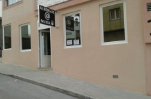
| Albergue A Muxía 13€ 42 Booking.com |
|
| Albergue Da Costa 16€ 10 Booking.com |
|
| Albergue Arribada 18-20€ 40 Booking.com |
|