
The bar here is the last place to stock up on food and water before the paths diverge. If you're heading to Finisterre, there's a fountain between here and Cee but very little else. If you're heading to Muxia, Dumbria has a small shop but it's a good distance ahead. Either way, eat and drink here.
If you are continuing to Finisterre then the bar here is the last place to stock up on water or grab a sandwich. There is a fountain between here and Cee but very little else.
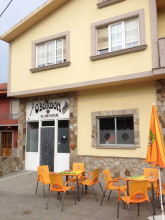
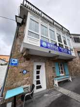
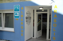
Accommodation in Hospital.
| Albergue O Casteliño 14€ 18 |

|

Shortly after Hospital, in the middle of a large roundabout, a double mojon marks the choice between Finisterre and Muxia. This is where the two routes diverge.
Left takes you to Finisterre -- roughly 30 km, descending dramatically from the highlands to the coast at Cee, then following the shoreline to the end of the world. Right takes you to Muxia -- roughly 30 km through quieter inland territory, arriving at the Atlantic sanctuary from above.
Most pilgrims walk both, either as an out-and-back from Finisterre or as a loop connecting the two. The connecting route between Finisterre and Muxia is roughly 29 km and runs along the Costa da Morte.
From the roundabout with the twin markers, take the paved road to the left and alongside the massive factory. The camino follows the road for 300m before leaving it to join a trail on your right. IF you are headed to Finisterra from this point, all the way to the first building in Cee, the camino remains well isolated from the road and any form of development beyond the two chapels mentioned below.

No fountain here -- just a chapel, a picnic area, and a quiet place to rest. The isolation from here to Cee is almost complete, and if the weather is clear the walking through this section is exceptional.
Chapel and fountain. Shortly beyond this point you'll catch your first glimpse of Cabo Finisterre -- and with it, the Atlantic.
After the chapel the camino forks. Yellow arrows take you left and downhill. The option to the right follows a dead-end trail 50 m to the Cruceiro de Armada, which marks the medieval pilgrim's first view of the sea. Worth the brief detour.
The descent into Cee from this high plateau is dramatic -- steep and sustained. It starts rocky, then turns to asphalt for most of the way down. Your knees will remember this stretch.
After the Capela de San Pedro the camino comes to a fork, with the yellow arrows taking you left and downhill. The option to the right follows a dead-end trail 50m to the Cruceiro de Armada, a point which marks the medieval pilgrim’s first glimpse of the sea.
The camino leaves this high plateau quite dramatically via a steep descent into Cee. Very steep. It starts off rocky but quickly turns into an asphalted road for the majority of the descent. The camino follows the road into Cee but has a very confusing set of arrows through town. They have been painted and painted over by competing albergues. No matter which way you choose you will get through town, but the shortest distance follows closest to the beach.
Cee, with its crescent beach, is where the camino first reaches the Atlantic. After the solitary highland walking, the salt air and sound of waves feel like an arrival -- even though Finisterre is still 15 km ahead.
The town has everything you need: supermarkets, pharmacy, hospital, inexpensive accommodation, and a small shopping center. A bus terminal offers service to Finisterre and Santiago.
The arrows through town are a mess -- painted and painted over by competing albergues. No matter which way you choose, you'll get through. The shortest route follows closest to the beach.
Accommodation in Cee.
| Albergue O Bordón 15€ 24 Booking.com |
|
| Albergue A Casa da Fonte 15€ 40 |
|
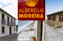
| Albergue Moreira 17€ 14 |
|
| Albergue Tequerón 17€ 14 Booking.com |
|
| Pension Beiramar Booking.com |
|


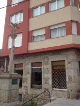
Corcubion is a historic fishing port that wraps around a small bay, and it has more character than its size suggests. The Iglesia de San Marcos anchors the town, and the stone houses that climb from the waterfront retain a quiet, maritime dignity.
Be mindful of the arrows: the camino bears right shortly after the road begins to ascend. It does not continue along the main road but shortcuts over the hills behind town. If you lose the arrows, head for the Iglesia de San Marcos. With the water at your back, leave the square from the rear left corner. You'll find a narrow rocky trail with tall walls on either side -- follow it uphill, and within a kilometer you'll pass through Vilar and reach the picnic area at San Roque.
Accommodation in Corcubión.


A few houses at the intersection where the trail over the Corcubion hills meets the road. The camino continues toward San Roque.
More picnic area than village, San Roque sits in the curve of a disused former road that once wound over the hill. It's a good place for a rest, and the albergue here -- friendly but late to open -- occupies a pleasant spot. From here the camino winds downhill through Amarela toward the coast at Estorde.
The camino passes the hamlet of Amarela as it winds its way downhill, trying at every opportunity to avoid the main road until it arrives at Estorde.
Accommodation in San Roque.
| Albergue San Roque Donativo€ 14 |
|

A hamlet on the descent from San Roque to the coast. The camino tries to avoid the main road at every opportunity through here.
Accommodation in A Amarela.
| Albergue San Pedro 15-20€ 4 Booking.com |
|
A small coastal village where the camino meets the shoreline again. The beach at Estorde is the first on the approach to Finisterre, and the walking from here follows the coast.
Accommodation in Estorde.
| Camping Ruta Finisterre |
| Hotel Playa de Estorde | 
|

The camino doesn't pass the beach here, but it's an easy detour for a rest or a soak. If you go that way, pay close attention to the arrows out of town -- don't follow the main road. The camino takes a trail on the upper side of town, which is considerably more comfortable walking.
Be mindful not to follow the main road out of town, the camino follows a trail on the upper (your right) side of town and is much more comfortable walking.
Accommodation in Sardiñeiro.


Finisterre is the end of the world, and for anyone walking west, the destination that completes the pilgrimage in a way Santiago sometimes doesn't. The name comes from the Latin finis terrae -- the edge of the known earth. Pilgrimage to this point predates Santiago by centuries, rooted in pre-Christian traditions of traveling to the westernmost point of the continent to watch the sun disappear into the ocean.
From the town center, 3 km remain to the lighthouse at Cabo Finisterre. Another 29 km lead north to Muxia if you're continuing.
The tourism office, just up from the Xunta albergue, issues the Fisterrana -- the official certificate of completion. Have your stamps in order; they check.
This is a place where salty air mixes with pilgrim farewells and the particular mood that comes from reaching a genuine end point. The harbor restaurants, recently rebuilt, continue to do grilled sardines and pimientos de padron the way they always have. The port is small but active, and the fishing fleet still goes out.
A quick geography lesson: the walk to the lighthouse is actually south, not west. The beach approaching town -- Playa Langosteira -- faces east. The setting sun, and any nostalgic westward gazes, are on the other side of the peninsula, about a kilometer from the municipal albergue. If you want to watch the sunset over the Atlantic, that's where to go.
Bus service back to Santiago runs several times daily from in front of the municipal albergue. The schedule is posted at most albergues. Watch for "Enlace" on the timetable, which means a bus change en route. Taxi service is also available.
The official certificate of completion, known as the Fisterrana, can be obtained at the tourism office. You are advised to have all of your stamps in order, for they are on the lookout for anybody who might have taken the bus.
The most famous son of Finisterre is simultaneously its most obscure. Alexandre Campos Ramirez, also known as Alejandro Finisterre, was a poet and inventor born here in 1919. Injured during the Battle of Madrid at the onset of the Spanish Civil War, he was evacuated to the hospital at Montserrat. A similar injury had brought Ignatius of Loyola to the same monastery four centuries earlier, and though Alejandro didn't write his own Spiritual Exercises, he did dream up the design for the first foosball table -- reportedly inspired by watching fellow patients who could no longer play football.
Pilgrimage to this cape long predates Christianity. The Romans knew it as finis terrae and are believed to have maintained an Ara Solis -- an altar to the sun -- near the lighthouse, where they watched the sun die into the western ocean. The tradition of walking to the end of the known world, witnessing the sunset, and returning transformed is older than any saint's bones in Santiago.
Holy Week is the biggest event in Finisterre, when thousands of Galicians descend on the village for celebrations and processions. Book accommodation well in advance if you're arriving during this time. Nuestra Senora del Carmen is celebrated from the 8th to 10th of September.
TO MUXÍA: The route to Muxía has matured over the last five years, but services along the 29km stretch way remain scarce. Lires and Frixe both have bars, and Lires has a few guesthouses if you wish to split the walk into two days.To find the way to Muxía, head back along the road you came in on. At the cruceiro that marks the end of the beach stay on the road. It curves left at the cruceiro, and then curves right. Turn left (uphill) at the second street when you get to the first signs indicating the way. Between here and Muxía you will find the new markers installed in pairs and indicating the ways to Muxía and Finisterre, and you will also find double ended yellow arrows with M and F on either end.The walk is along paved road from Finisterre to San Salvador, but from there it joins a gravel trail for most of the way, only joining paved surfaces as it passes through the smaller villages.
Accommodation in Finisterre - Fisterra.
| Albergue de Peregrinos de Fisterra 10€ 26 |
|
| Albergue O Encontro 17€ 5 Booking.com |
|
| Albergue Mar del Plata 16€ 20 Booking.com |
|
| Albergue La Espiral 15€ 14 |

|
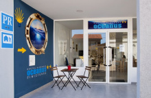
| Albergue Oceanus Finisterre 20€ 36 Booking.com |
|
| Albergue Buen Camino de Sonia 15-17€ 50 Booking.com |
|
| Albergue Mar de Fora 18-20€ 38 Booking.com |
|
| Albergue Arasolis 17€ 16 |
|
| Albergue Mar de Rostro 16-17€ 27 |
|
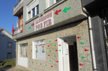
| Albergue Por Fin 18+€ 11 Booking.com |
|
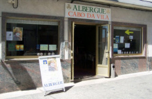
| Albergue Cabo da Vila 15€ 32 Booking.com |
|
| Albergue Finistellae 14€ 20 |
|
| Albergue Fin da Terra e do Camiño 15€ 12 |

| Hostal Mariquito Booking.com |
|


Three kilometers from the center of Finisterre, the lighthouse at Cabo Finisterre marks the point beyond which medieval Europeans believed there was nothing. The Romans called it finis terrae. For pre-Christian pilgrims, this was the Ara Solis -- the place where the sun died each evening into the western sea.
The lighthouse itself is an octagonal granite tower built in 1853, its beam visible for 23 nautical miles. It replaced earlier fire beacons that had guided -- and failed to guide -- ships along this treacherous coast for centuries.
A geographical note: despite the mythology, this is not actually the westernmost point of continental Europe. That distinction belongs to Cabo da Roca in Portugal. What Finisterre is, and what gives it its power, is the point where the ancient world believed the earth ended.
The cape can be busy, and the number of vendors grows every year. Climb carefully down from the lighthouse area to a quieter lookout point, and you'll find enough solitude to sit with whatever the walk has meant to you.
The tradition of burning boots, clothes, or other possessions at the lighthouse is more recent than most pilgrims assume -- it appears to have started in the 1980s among foreign visitors, not in the Middle Ages. Regardless of its origins, it's now strictly prohibited due to fire risk. A brush fire in 2016 near the lighthouse made the ban permanent. The blackened rocks near the 0.00 km marker are evidence of how popular -- and how destructive -- the practice became.
The scallop shell you've been following for weeks or months appears one final time on the 0.00 km marker at the end of the cape. Behind it, the Atlantic.
The cape has been a destination since before recorded history. Celtic pilgrims traveled here over a thousand years before the Santiago tradition existed, drawn by sun worship and the belief that paradise lay beyond the sunset. The Romans maintained what tradition calls an Ara Solis -- an altar to the sun -- though no archaeological evidence has been found. Roman soldiers who reached this point reported seeing the sun hiss as it sank into the ocean, larger here than anywhere else in the empire.
The Costa da Morte -- the Coast of Death -- has claimed over 600 documented ships since the 14th century. The HMS Serpent sank off nearby Cape Vilan in 1890, drowning 172 crew, and the disaster led directly to the electrification of that lighthouse. The Prestige oil tanker broke apart off this coast in 2002, releasing 77,000 tonnes of fuel oil in what became Spain's worst environmental disaster.