
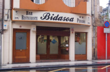
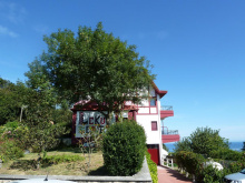
Irún sits on the Spanish bank of the Río Bidasoa, directly across from France. It's the starting point of the Camino del Norte, though you could just as accurately call it the first city of the Basque Country — the language, the food, and the politics all shift the moment you cross the river.
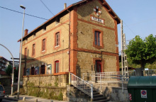
The Puente de Santiago is the traditional starting marker. From there, waymarking through the city is thin — be alert and don't hesitate to ask locals for directions. The train station (often abbreviated ff.cc.) provides a useful orientation point.
The churches are worth a look if you're spending the night. Nuestra Señora del Juncal holds the oldest statue of the Virgin in the region. The Ermita de Santa Elena is one of the city's oldest buildings. And the hilltop Ermita de San Marcial rewards the climb with sweeping views over the Bidasoa valley and the border.
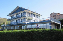
Irún functions more as a departure point than a destination. Services are solid — supermarkets, pharmacies, ATMs, and transport connections — and most pilgrims pass through in a morning. If accommodation is full, Hondarribia across the bay has good alternatives.
The name Irún is often confused with Irúña (the Basque name for Pamplona), something to keep in mind when booking tickets.Irún is also the starting point for the Basque Interior Camino, which travels southwest to join the Camino Francés in Santo Domingo de la Calzada or Burgos. Do not confuse the two, you are heading northwest from Irún.
Irún was one of three major Roman outposts in Basque territory, alongside Irúña (Pamplona) and Iruña de Oca. Two significant battles took place at nearby San Marcial: in 1522, a few hundred local Basques defended the city against 3,000 mercenaries sent by the King of Navarra, and in 1813 Spanish troops and the Duke of Wellington defeated Napoleonic forces on the same hill.
Of the major Basque coastal cities, Irún was the least industrialized. Its economy ran instead on cross-border trade — since the 19th century, Spanish and French railways have operated on different gauge tracks, requiring all passengers and goods to transfer here.
The fiestas of San Pedro and San Marcial, known collectively as Sanmarciales, are held at the end of June. San Marcos is celebrated on the 25th of April.
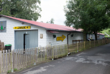
Getting started in Irún is easiest from the train station or the municipal albergue, both are located in the Barrio San Miguel (though there is no church dedicated to the Saint).From the terminal head straight towards the dome of the nearby Iglesia San Gabriel and Santa Gema, passing the Correos (post office) along the way. Continue straight past the church to the first intersection with a traffic light, the Paseo Colon.From here you have two choices:1. The old town of Irún; turn right and over the tracks to get to most of the churches, parks, and hotels.2. The municipal albergue and the camino; turn left and you are officially on the camino. At the first roundabout the camino continues straight and heads under the overpass. Alternatively, turn right at the roundabout to get to the municipal albergue.When the opportunity to cross to the left-hand side presents itself do so; the camino turns left 500m ahead immediately after crossing the river.NOTE: If going to Hondarribia was your plan, keep going straight after the bridge. Once you have left the main road, the camino begins the climb, first on secondary roads and then on trails, to the Santuario de Guadalupe.
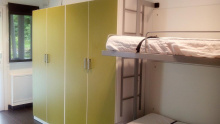
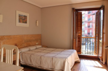
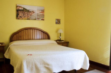
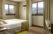
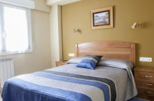
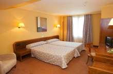
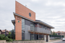
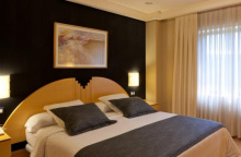
Accommodation in Irún.
| Albergue de peregrinos Jakobi Donativo€ 60 |


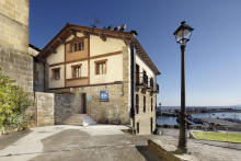
Hondarribia sits across the Txingudi Bay from Irún and is worth the detour — or makes a perfectly good alternative starting point if accommodation in Irún is full. The old town occupies a fortified hilltop overlooking the bay, and it's considerably more atmospheric than its neighbor.
The Puerta de Santa María is the main gate through the Muralla — the walls that still encircle the old quarter. Inside, the Calle Mayor climbs steeply between stone townhouses with wrought-iron balconies and carved coats of arms. At the top sits the castle of Carlos V, now a parador with views across to France.
The lower town spreads along the waterfront, where the Barrio de la Marina has a different character entirely — brightly painted fishermen's houses, seafood restaurants, and a working harbor. The contrast between the fortress above and the fishing village below gives Hondarribia its particular appeal.
A water taxi crosses the bay to Pasajes, connecting to the camino without backtracking through Irún.
Hondarribia's walls tell a violent story. The town was besieged repeatedly — by the French alone at least nine times between the 16th and 19th centuries. Its strategic position at the mouth of the Bidasoa made it the key to Spain's northeastern border. The current walls date mostly to the 16th century, reinforced under Carlos V and Felipe II. Legend holds that the Apostle Santiago himself passed through Hondarribia on his way to Galicia.
June: A Medieval market is held on the second Sunday of June.July: Santiago is celebrated on the 25th of July.August: Several neighborhood fiestas on the 15th to celebrate the Assumption of Mary.October: San Francisco de Asís on the 5th.
The Santuario de Guadalupe sits on the hillside above the coast, maintained by an Italian fraternity. Hours are limited — if you find the door open, step in. The 16th-century sanctuary houses a Black Virgin, discovered on this hillside by two children according to local tradition. Ship models hang from the ceiling, placed by sailors grateful for the Virgin's protection on the dangerous Cantabrian seas.
Behind the sanctuary, a side road leads to the well-concealed Forte de Guadalupe. Built in the late 19th century, it carries the distinction of being one of the last fortifications of its kind ever constructed — and one of the first rendered obsolete by aircraft.
The climb up from the coast is steep — 600 meters of ascent to the Jaizkibel ridge. Carry water and food. The alternative Purgatorio route follows the ridgeline to the 545 m Jaizkibel peak, with ocean views on a clear day.
ATTENTION: Do not underestimate the steep climb of 600 meters to the summit of the Jazkibel, take plenty of water and something to eat with you and keep in mind that you will be on the way for several hours to the next place.
La Virgen de Guadalupe is celebrated on September 8th.
The way from the Santuario splits into three, one road and two trails. There is a sign and a map illustrating the differences. The official camino follows a trail just to the south of the ridge line, while an alternative known as the Purgatorio Route follows along the ridge line. Both routes are through fairly remote mountainside. The Purgatorio route reaches 645m at the Jaizkibel peak and offers views of the ocean. The descent into town brings you directly to the main road, a narrow street that hugs the coastline. On your right is the small boat landing and the ferry across the harbor to San Pedro.


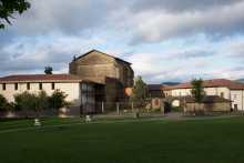
Pasajes de San Juan (Pasai Donibane in Basque) is one of the most unusual places on the entire Norte. The village is a single street wide, wedged between the harbor and the cliff, with houses stacked five stories tall and their balconies nearly touching overhead. There's no room for cars — everything arrives by foot or by water.
The harbor is a natural inlet so narrow and deep that it served as one of Spain's most important naval bases for centuries. The village sits on the east bank; the working port of Pasajes de San Pedro faces it on the west. A small ferry connects the two — a crossing of barely two minutes that feels like traveling between centuries.
Victor Hugo lived here in 1843, in a house on the waterfront now marked with a plaque. The fresh seafood restaurants along the quay are a strong argument for a longer stop.
The albergue is located high up on the hillside above the village.
The harbor of Pasajes was one of the most strategically important on the Cantabrian coast. Ships for the Spanish Armada were outfitted here. Whale oil was processed in these streets, and the fleets that sailed to the New World were supplied from this port. The harbor's natural concealment — invisible from the open sea — made it invaluable in an age of naval warfare.
June: San Juan on the 24th and San Pedro on the 29th. July: The patron, San Fermín, on the 7th. Followed by Santiago on the 25th and San Pantaleón on the 27th.
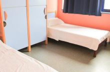
Accommodation in Pasajes de San Juan.
| Hospital de peregrinos Santa Ana Donativo€ 14 |
|

Pasajes de San Pedro is the working side of the harbor — boat yards, cranes, and a commercial port that still handles significant cargo. It lacks the postcard atmosphere of San Juan across the water, but you won't linger here. The ferry drops you off, and the camino begins climbing almost immediately toward the Faro de la Plata.
Once off the ferry, the official camino turns right while a road variant turns left. Turn right to follow the coastline to the sea, passing a boat yard along the way. Where the road ends, the path and climb (on steps) begins. At the top the camino returns to a paved road, turn right when it does and follow it until it widens into a parking lot for the nearby Faro de la Plata (straight ahead if you want to visit).

The Faro de la Plata and a matching lighthouse on the opposite bank were built to guide ships through the dangerously narrow passage into Pasajes harbor. In rough weather the channel was treacherous — but once through, the harbor offered some of the best natural protection on the coast.
The parking lot by the lighthouse is a natural rest stop, with views back east along the cliffs. From here the camino turns inland through forest, running parallel to the coast but out of sight of it. Pay attention at trail junctions — the GR-121 long-distance path shares ground with the camino here and occasionally splits off in its own direction.
From the parking lot the camino turns left to return to a trail. Pay close attention to the various forks in the trail; although they are well marked there are many options through the forest.Along this stretch you will also see markings for the GR-121, a 300km circuit that shares ground with the Camino and on several occasions offers an alternative to the official camino.You will eventually come to a fork in the trail at a point where indeed the GR-121 turns right where the camino turns left. Both are acceptable, the GR follows the coastline through the forest while the camino joins the paved road. They converge before arriving in San Sebastián.NOTE: Only the camino path passes the Ulía albergue which is located on the hillside overlooking the city. The trail descends into San Sebastián, and where it meets the Avenida de Navarra the municipal albergue is on your right.
San Sebastián (Donostia in Basque) is the first major city on the Norte and one you could happily lose a day in. The setting alone justifies the stop — a perfect crescent bay flanked by Monte Urgull to the east and Monte Igueldo to the west, with the Isla de Santa Clara anchored in between. La Concha beach fills the curve, and the city arranges itself around it like an amphitheater.
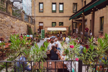
The Parte Vieja (old town) is where you eat. The narrow streets below Monte Urgull contain one of the densest concentrations of pintxo bars in the world, and the quality is staggering. This isn't bar food — this is a city with more Michelin stars per capita than almost anywhere on earth, and that ambition filters down to every counter. Order txakoli (poured from height to aerate it), point at what looks good, and repeat. The Plaza de la Constitución, with its numbered balconies from its days as a bullring, is the center of it all.
The Catedral del Buen Pastor is a neo-Gothic church whose spire dominates the newer part of the city south of the Río Urumea. Monte Urgull is worth the climb — the Castillo de la Mota at the summit houses a small museum and provides the defining views of the bay. On the western end, the funicular up Monte Igueldo has been running since 1912 and offers the rival panorama.
The city hosts the San Sebastián International Film Festival in September, one of Europe's oldest. In January, the Tamborrada sees the entire city drumming through the streets for 24 hours — spectacular but unlikely to coincide with your walk.
All services. RENFE trains connect to Madrid and the French border. EuskoTren serves the Basque coast.
San Sebastián was founded in the late 12th century by Sancho the Wise of Navarra as a maritime port. Within decades, Castile wrested control — the larger kingdom's naval ambitions suited the city's potential better. The port thrived, and burned. The city was rebuilt from ashes at least half a dozen times, the last after a catastrophic fire in 1489 that finally prompted a shift from wood to stone construction.
Commerce gave way to military purpose. Fortresses were built, a navy was stationed, and for four centuries San Sebastián was besieged, bombarded, and periodically occupied. British and Portuguese forces burned most of the city during the Peninsular War in 1813 — supposedly by accident.
The reinvention as a resort began when Queen Isabel II chose San Sebastián for her summer holidays in the 1840s. Queen María Cristina later built the Miramar Palace on the headland between the two beaches. The Belle Époque left the elegant Ensanche (new town) that now frames the bay. The city's last occupation was during the Civil War, when Franco's forces took it in 1936.
Although a bit too early in the year for the majority of passing pilgrims, the Tamborrada is held on the day of San Sebastián, January 20th.August makes up for the rest of the year with the Assumption of Mary on the 15th followed by the Basque Fiestas at the end of the month through the start of September.
Turn right on the Avenida de Navarra towards the sea, the road follows it and you follow the road. You can walk in the sand of the Playa Zurriola if it suits you, the way ahead is evident as it crosses the bridge over the Río Uramea.Once over the bridge continue straight ahead, past the municipal gardens and towards the Playa de la Concha which you will follow all the way to its end. At the end of the beach cut across the park separating it from the road (Satrustegi) and turn right on the road towards the tree covered hillside ahead, and then left where it ends to follow the road signs to Igueldo.The Ondarreta Albergue is along this road, straight ahead and on your left-hand side. The camino, however, turns right off of the road before it arrives at the albergue. The way is uphill along a paved road which turns into a trail, twisting and turning all the way to the top. Before long you will be on a small paved road which connects with a larger one, and in front of you will be the gravel parking lot for the hotel Leku Eder, cut across it and walk past the hotel along the main road.NOTE: If you were to turn right at the parking lot, you could go uphill to visit Monte Igueldo. Follow the road as far as the next hotel, turning right at the sign for the Buenavista Hotel at the start of Igueldo.
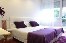
Accommodation in San Sebastián.
| Albergue Juvenil Ulía 17-25€ 54 Booking.com |
|
| Pensión San Fermín ⭑ Booking.com |
|
| Pensión Donostiarra ⭑⭑ Booking.com |
|
| Pensión Artea ⭑⭑ Booking.com |
|
| Pensión Kaia ⭑⭑ Booking.com |
|
| Downtown River Hostel 30/40€ Booking.com |

|
| Koba Hostel 20+€ Booking.com |

|
| Hostel A Room In The City 18+€ Booking.com |
|


Monte Igueldo is the western bookend of La Concha bay. At the top you'll find a lighthouse dating to 1855, an amusement park that's been running since 1912, and views that justify either the climb or the funicular.
The funicular itself is worth the ride — inaugurated in 1912 by Queen María Cristina, it's the third-oldest in Spain and still runs on its original mechanism and cable. The amusement park was built the same year as a casino; when gambling was banned in 1924, it was converted to rides. The Montaña Suiza roller coaster, installed in 1928, is the oldest steel roller coaster in the world still in operation.
But you're here for the panorama. On a clear day, the sweep of La Concha bay, the old town, Monte Urgull, and the coast stretching east toward France is one of the finest views on the Norte.
Getting from the monte to the camino is a simple matter. From the parking lot at the top of the monte, make like a car and roll downhill along the road. When you get to the small gravel parking lot on your right, cut across it to pass the Hotel Leku Eder and keep on that road.
The barrio of Igueldo occupies the slopes of the massif west of San Sebastián. Services — a bar, a small shop — sit along the main road south of the camino. The walking through here follows a mix of paved roads, centuries-old cobbled paths, and forest trails before descending past the Iglesia de San Martín and dropping into Orio.
From the Buenavista Hotel the camino keeps to the paved roads for several more kilometers but eventually heads back into the forest along trails and even along centuries old cobbled roads as it descends to the AP-8. After passing under the AP-8 turn right to follow the road steeply uphill. At the top is the Iglesia de San Martín. Follow the road straight into Orio.
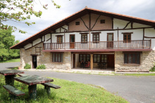
Accommodation in Igueldo.


Orio is squeezed between the Río Oria and the hills behind it — a compact fishing village where the primary catch is bream and the primary way to eat it is grilled over charcoal. The restaurants along the waterfront take this seriously; if you're here at lunchtime, so should you.
The Iglesia de San Nicolás de Bari, patron saint of fishermen, sits in Baroque style at the top of the old town. Below it the village clusters around the harbor and the river, which pilgrims once crossed by boat. You'll use a bridge now, but the fishing boats along the waterfront are a reminder that this is still a working port.
Orio's other point of pride is trainera rowing — the traditional boat races that are serious competitive sport in the Basque Country. The rowing club, founded in 1941, has produced champions, and during regatta season the atmosphere on the river is electric.
Orio's history is inseparable from the sea. The village grew around the Iglesia de San Nicolás, established by 1180, and developed as a fishing port. The trainera rowing tradition evolved from competitions between fishing crews in the 19th century — the boats were the same ones used for work, raced by the men who pulled them.
The Day of the Fishermen, San Pedro, is celebrated on the 29th of June. The patron of Orio, San Nicolás de Bari, is celebrated on the 6th of December.
The camino reaches the riverfront and turns left (inland) towards the nearest bridge over the river. Once across the bridge, it turns right to follow the N-634 a short distance. Where the road bends left, the camino exits to the right to follow the waterfront and the Portua. Stay along the road and head towards and under the AP-8 visible in the distance. Once past the bridge overhead, the camino reaches a small beach (on your right). Turn left at the first road, keeping the tall hedge to your left. Follow this road all the way past the Gran Camping de Zarautz; the way is uphill as you climb Mount Talaimendi. As you begin to descend along the road, with Zarautz visible in the distance, the camino turns right towards town along a foot path. It meets the road and turns right.
Accommodation in Orio.


Zarautz has the longest beach in the Basque Country — 2.5 km of sand stretching the full length of town. In summer it fills with surfers; the consistent waves have drawn them since the 1960s, and several international competitions are held here annually. Outside surfing season, the beach is your promenade into and out of town.
The old quarter sits back from the waterfront. The Iglesia de Santa María la Real is a 15th-century Gothic church with an imposing bell tower 50 meters high — one of the town's oldest buildings. Adjacent is the Torre de los Zarautz, which serves as both bell tower and the Museum of Art and History. Inside the church, a tomb marks an unknown pilgrim who, realizing he was too ill to reach Santiago, requested burial here — a quiet reminder of the route's deeper history.
The beach palaces that once lined the promenade are gone, replaced by apartment blocks, but Zarautz retains its reputation as a food town. The surrounding hills produce txakoli, and the restaurants serve as a good introduction to the serious pintxo culture that intensifies as you continue west.
Zarautz is a popular event town and plays host to several surfing competitions and bike races throughout the summer. Both can put a crunch on the number of beds available.
Zarautz was a whaling town long before it became a surf town. From the 13th to 16th centuries, its men hunted whales in the Bay of Biscay, processing oil, meat, and baleen that sustained the local economy. When the whales disappeared, the town turned to other fishing. In the 19th century, the bourgeoisie discovered the beach and built summer palaces along the promenade, establishing Zarautz as a resort — a role it still plays, now with wetsuits instead of parasols.
January: San Sebastián on the 20th, as well as a few wine celebrations throughout the month. February: Santa Águeda, patroness of the Basque Country, on the 4th. The town also celebrates Carnaval. May: Santa Marina is celebrated on the 21st. June: San Pelayo from the 25th to the 27th. July: Santiago on the 25th. August: Santa Clara on the 12th, and La Virgen from the 14th to the 16th. September: Semana Vasca, or Basque Week, from the 1st to the 9th.
The marked way through Zarautz is along the Nafarroa Kalea, about two blocks from the waterfront and parallel to it. As an alternate, you can turn right towards the beach and follow it to the end of town.
Leaving Zarautz can be a confusing affair and the local information office doesn’t do much to clarify matters.
There are two options out of town:
Option 1: The Official Camino to upper Getaria - 5.2
The official camino through the hillside; this option also splits so read ahead to find out more. At the end of the beach or road turn left (south, away from the sea) onto San Inazio Kalea. Keep to the right-hand side and continue a short distance, keeping an eye out for the small road that ramps up to the right and nearly parallel to San Inazio. That road is the one you want, and it will take you upwards.
Near the top, there are signs for the Ermita de Santa Barbara (and an excellent view back east). Not far from the Ermita the camino leaves the road along a path to the right which offers views of the sea. A short distance down this trail the camino joins a different paved road and quickly arrives at a junction. At this point, you have the option of bypassing Getaria entirely. Keep straight for Getaria, or turn sharply left to follow the GR-121. This second option rejoins the first slightly beyond Askizu.
Option 2: The road to lower Getaria - 4.1
The alternate road route along the N-634 coastal road to Getaria. At the end of the Nafarroa Kalea or the end of the beach, turn right and follow the pedestrian path adjacent to the road as it hugs the coastline all the way to Getaria. Simple and straightforward.
Accommodation in Zarautz.
| Zarautz Hostel 27+€ Booking.com |
|
| Blai Blai Hostel 24+€ 24 Booking.com |
|
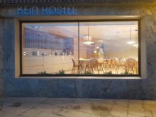
| Kein Hostel 30+€ Booking.com |
|
| Hostel Gran Cámping Zarautz 19-35€ 20 Booking.com |

|
Getaria is built on the narrow strip of land connecting the mainland to Monte San Antón — a hump-backed headland the locals call El Ratón (the mouse) because of its shape. The old town is tiny and can be walked through in minutes, but it packs in an outsized amount of history.
The Iglesia de San Salvador is the first stop. It's a Gothic church built on sloping rock, giving the interior a disorienting tilt. A tunnel bored through the rock beneath the church once served as a defensive passage when the church was part of the town wall.
Two native sons define Getaria's fame. Juan Sebastián Elcano was born here and completed the first circumnavigation of the globe in 1522, finishing the voyage that Magellan started but didn't survive. His statue faces the harbor. Cristóbal Balenciaga, born here in 1895 to a fisherman and a seamstress, became the most influential fashion designer of the 20th century. The Cristóbal Balenciaga Museoa, built around his childhood home, houses over 1,600 pieces — even if fashion isn't your interest, the building is worth seeing.
The harbor still lands fish daily, and Getaria's grilled turbot and anchovies are locally famous. The town sits at the heart of the Getariako Txakolina wine denomination — the vineyards climb the hillsides behind town, and every restaurant pours it freely.
Getaria's relationship with the sea runs deep. The town was a whaling port, a naval base, and a fishing village, sometimes all at once. Elcano's expedition — three years, 60,000 nautical miles, and only 18 survivors of the original 270 crew — remains one of the most remarkable voyages in human history. Carlos V granted him a coat of arms reading Primus circumdedisti me — 'You were the first to encircle me.'
Until the 15th century, Monte San Antón was actually an island. Sediment gradually connected it to the mainland, creating the tombolo on which the old town sits.
April: San Prudencio on the 27th.May: Antxoa on the 3rd, San Isidro on the 4th, and the Day of the Fisherman on the 5th.June: San Juan on the 23rd and 24th.August: San Salvador on the 6th.November: San Martín on the 11th.
If you came into Getaria along the N-634 you will have to climb up to rejoin the camino.If you came into Getaria along the trail you will have to decide whether you want to descend into town (and then return) or whether to keep on walking.The camino passes the Kanpaia Albergue at the highest point in town and continues along country lanes. It passes the Ermita de San Prudenzio (300 meters off the trail, has a fountain but is usually closed) and brings you directly to Askizu.
Accommodation in Getaria.

Askizu is a tiny hilltop hamlet between Getaria and Zumaia with no services but fine views of the coast. The camino passes through on country lanes, and at the far end the trail forks — the path to the right offers sweeping views as it descends toward the Playa de Santiago and Zumaia beyond.
At the far end of Askizu the camino forks at a house, turn right. The trail here affords excellent views of the sea. It will begin to descend, passing the Playa de Santiago far below. At sea level it rejoins the N-634 along a pedestrian walkway into Zumaia. The walkway bears right at the river to cross along a foot bridge. Once over the bridge it turns right through a small park to arrive at another footbridge over a different river and into the old town of Zumaia.
At the far end of Askizu the camino forks at a house, turn right. The trail here affords excellent views of the sea. It will begin to descend, passing the Playa de Santiago far below. At sea level it rejoins the N-634 along a pedestrian walkway into Zumaia. The walkway bears right at the river to cross along a foot bridge. Once over the bridge it turns right through a small park to arrive at another footbridge over a different river and into the old town of Zumaia.
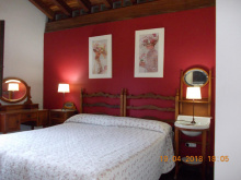
Accommodation in Askizu.
| Casa Rural Agote Aundi 20-25€ 12 |
|
Zumaia sits at the confluence of two rivers and is best known for what lies just offshore: the Flysch formations, layers of sedimentary rock tilted nearly vertical by tectonic forces and exposed by erosion into dramatic alternating bands of hard and soft stone. These cliffs record over 60 million years of geological history, including the K-Pg boundary layer — the thin band of iridium-rich clay that marks the asteroid impact that ended the dinosaurs. The Basque Coast Geopark, a UNESCO Global Geopark, is centered here, and the Algorri Interpretation Centre explains the science.
In town, the Iglesia de San Pedro Apostol is austere but contains oil paintings of 15th-century merchant ships and several side chapels. On the north end, near the coast, the Ermita de San Telmo occupies a dramatic cliff-edge position above a small cove. The ermita gained modern fame as the wedding location in Ocho Apellidos Vascos — the highest-grossing Spanish film ever — and tour buses arrive regularly.
Good services — bars, restaurants, shops, accommodation. The alternative Ruta del Flysch follows the GR-121 along the coast from here, passing San Telmo and the rock formations before rejoining the main camino near Deba.
The flysch formations along the coast between Zumaia and Deba were studied from the 19th century, but their global significance wasn't fully recognized until the discovery of the K-Pg boundary layer here — physical evidence of the mass extinction event 66 million years ago. The Basque Coast Geopark was admitted to the European Geoparks Network in 2010 and subsequently designated a UNESCO Global Geopark.
San Pedro on the 29th of June.
Just over this second footbridge, the camino splits. The official camino continues straight ahead and upwards through town. The alternate route again follows the GR-121 by turning right. They rejoin within 3.5km. The alternate route, known as the Ruta de Flysch because it crosses the sedimentary rock formations characteristic of this coast, is way marked and passes the Ermita de San Telmo. Both routes pass a public restroom shortly before arriving in Elorriaga.
Accommodation in Zumaia.
A small hamlet between Zumaia and Deba where the camino splits again — the GR-121 coastal alternate turns right toward the sea, while the official route continues through to Itziar. A bar provides basic refreshment. The road crossing here requires care; traffic moves fast around the bend.
In Elorriaga the camino splits again. The GR-121 turns off to the right just before you get to the bar in town, and follows the coastline once more and in doing so it does not pass Itziar. The official camino follows the road out of Elorriaga, descending towards the N-634. Cross with care here, the traffic moves fast around the bend in the road. The camino continues up the road on the opposite side. The way is well marked and will bring you back around to meet and follow the N-634 (bar). At the bar it crosses over the AP-8 and continues along the N-634. Try to keep to the right-hand side along this stretch because the camino leaves the road to follow a quieter path on that side. It will again meet up with the N-634, this time at a large junction. The village of Itziar is on the hilltop on the opposite side of the N-634, the Santuario church tower is visible from a distance. Climb up the road into Itziar, following the most direct route to the church.
Itziar occupies a hilltop above the coast, centered on the Santuario de Santa María de Itziar whose tower is visible long before you arrive. The sanctuary houses a venerated statue of the Virgin, patron of both sailors and pilgrims, with roots in an 8th-century temple built on this site.
The name Itziar — and its variants — is one of the most popular names given to Basque women, drawn from this hilltop and the devotion to its Virgin.
From here the camino turns north, descending through quiet countryside back to the coast at Deba. The highways below have been tunneled underground, so the walk is peaceful despite the hidden infrastructure beneath you.
The name Itziar, and a few derivations of it, is a popular name given to Basque women. Its origin goes back to the 8th century when a temple was built in reverence to Santa Maria de Itziar. Her statue remains here, and is venerated as much by sailors as by pilgrims.
From Itziar the camino turns north to return to the sea at Deba. Past the church turn right at the first fork and follow the country lane. You won’t notice any more highways as you wind your way towards Deba, but they are none-the-less tunneling beneath you.
Accommodation in Itziar.
| Agroturismo Donibane ⭑ | 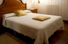
|

Lastur is a quiet mountain village about 5 km off the camino — too far for a casual detour, but the albergue here offers a peaceful alternative to the busier coastal stops. The owners will drive you back to the trail in the morning. If solitude after the populated Basque coast appeals, this is the place.

Deba marks the end of the coastal walking. Wave goodbye to the sea — it won't return for 80 km, until the approach to Bilbao. Worth knowing as you take one last look at the beach.
The town is built on steep terrain, steep enough that public elevators have been installed to connect the upper and lower levels. The Ermita de San Roque, on the hillside above town, is the first thing you see on the descent in — historically, it marked Deba as a boarding point for pilgrims arriving by sea to begin the overland walk to Santiago.
The Iglesia de Santa María la Real, down in town, has a remarkable Gothic portal with detailed stone carvings that have survived the centuries better than you'd expect in a coastal climate. The cloister is worth a look. Several municipal buildings and even the bridge out of town show unexpectedly fine stonework for a place this size.
Bars and restaurants line the compact center. The beach is broad and popular in summer. The train station provides connections along the Basque coast.
Wave goodbye to the sea. It will be exactly 80km before it returns into view in Bilbao. Between here and there are several mountainous stretches.
Deba was once a significant port, busy enough to receive pilgrims arriving by sea who began their overland journey to Santiago from the Ermita de San Roque. The town's medieval wealth shows in its architecture — particularly the elaborate portal of Santa María, which speaks to a community with means and ambitions beyond its modest size.
San Roque is celebrated from the 14th to the 18th of August.
The camino and the GR-121 alternate route meet in Deba near the ermita. The camino crosses the river along a footbridge near the train station and on the opposite bank turns right. A short distance later it crosses the road and just beyond that it turns left, going upwards once again along a combination of well marked roads and paths.Keep to the marked camino at this point, ignoring all other trails until you reach the Galbario Ermita.
Accommodation in Deba.
| Albergue de Peregrinos Geltoki 8€ 56 |
|
| Pensión Zumardi ⭑⭑ Booking.com |
|
The Ermita de Galbario sits on the hillside above Deba with views back to the coast — your last glimpse of the sea for a while. The ermita is ordinarily locked, but the spot makes a good rest stop. From here the camino follows the road to Ibiri Auzoa.
The camino joins the road when it reaches the ermita, and follows it to the small village of Ibiri Auzoa.

A small settlement with an albergue that doubles as the local bar (opens at 12:30). Fill your water bottle — the next stretch to Markina-Xemein is long and without services.
Just beyond the Albergue and bar turn left at the fork to follow a trail instead of the road. You will rejoin the asphalt road shortly before Olatz.
Accommodation in Ibiri Auzoa.
| Albergue Izarbide Aterpetxea 15€ 32 |
|
Olatz has a bar and a small park — your last chance to refill water and grab something to eat before the serviceless stretch to Markina-Xemein. The countryside walking from here is through rolling green hills, classic Basque interior landscape, with a steep descent into Markina at the end.
The distance from Olatz to Markina is without services of any kind. Be sure to re-fill your water here.
Follow the road past the bar and small park, and when it forks keep to your right uphill on the narrower option. From here to Markina the camino twists and turns quite a bit. It is countryside walking all the way to Markina, where a steep descent brings you into the city from the north.
Markina-Xemein is the first town of substance after crossing into Bizkaia, and it has more to offer than its modest size suggests.
The star attraction is San Miguel de Arretxinaga — a hexagonal 18th-century chapel built around three enormous boulders that lean against each other to form a natural chamber. The Archangel Michael stands at the center of this geological accident, and the effect is genuinely unlike anything else on any camino. The name Arretxinaga means 'place where the stones lie.' According to local legend, an unmarried man who passes beneath the boulders three times will find a wife within the year.
Markina is also the self-proclaimed University of Pelota. The municipal frontón, inaugurated in 1798 and seating nearly 1,000, has produced so many professional jai alai players of international fame that the nickname stuck. If you're here in the evening, watching a match is time well spent — the speed and violence of the ball is startling.
Other monuments include the Convento e Iglesia de la Merced and the Iglesia de Santa María de la Asunción de Xemein. The town has bars, restaurants, a small supermarket, and accommodation.
Markina's frontón has been the proving ground for Basque pelota players since 1798. Champions like Narciso Salazar, Arnedillo Mayor, and Cazalis Menor emerged from here at the turn of the 20th century, followed by Andrinua, Muguerza I, and Orbea I. Many emigrated to play professionally in Florida and Latin America, spreading Basque culture through the sport. The town's connection to pelota runs deeper than mere tradition — it's an identity.
Market day is Thursday, in the Plaza del Mercado. June: San Juan is celebrated on the 24th and San Pedro the 29th. July: San Martín on the 7th, San Cristóbal on the 10th, and San Ignacio de Loyola the 31st. August: Goerria on the 1st, Nuestra Señora de las Nieves on the 5th, and San Jacinto on the 17th. September: Nuestra Señora de Erdotza on the 8th and San Miguel Arcángel on the 29th. October: Santa Teresa de Jesús on the 15th.
The marked camino passes the church and convent and turns right at the first street past them. Follow the road across a small river and turn left at the first road, keeping close to the nearby building to follow a park trail as is wiggles its way along the river. The camino will take you back over the river (though it is covered so you might not notice) and then under the BI-633. It follows along a smaller river past an industrial park and into Iruzubieta.
Accommodation in Markina-Xemein.
| Albergue Intxauspe 16€ 26 |
| Albergue de peregrinos Convento del Carmen Markina 10€ 40 |
|

A hamlet between Markina-Xemein and Bolibar. No services. The camino passes through on back roads, crossing a river and then turning quickly back into the countryside.
You will enter town from a back road. There is a car park on your right when you get to the main road. Turn left here (facing east) to get to the bridge over the river. Cross the river and then turn right again, quickly followed by another right to leave the road and the town. More mountain roads will deliver you to Bolibar.

Bolibar is a tiny Basque village with an outsized claim to fame. Simón Bolívar — liberator of Venezuela, Colombia, Ecuador, Peru, and Bolivia — was not born here, nor were any of his immediate relatives. But his ancestors came from near enough to adopt the village name as their own, and some 800 years later that name became synonymous with independence across an entire continent.
A museum and monument in the village honor the connection. The church marks the center of what is otherwise a quiet hamlet. The camino passes through on its way to Ziortza and the Monasterio de Zenarruza.
The Bolívar family's connection to this village is documented but distant — the name was adopted as a surname generations before Simón Bolívar was born in Caracas in 1783. The village itself has leaned into the association, and the museum traces the genealogical link.
At the roundabout at the start of town, follow the road sign to Urua (the only option which crosses the river). This is only to get you off of the main road, which you could just as easily follow to the end of town. The camino passes the Simon Bolivar Museum and arrives at the church where it crosses the main road, and shortly after another smaller road.From here it is back into the countryside. The camino next meets the road in the two building town of Ziortza, if you plan on staying there turn left at the road. The only buildings in town are visible from here.
Accommodation in Bolibar.
| Albergue Usandi Auto Check-in 15€ 26 Booking.com |
|
| Casa Rural Monte Baserria 25*€ Booking.com |

Ziortza is barely a hamlet — a bar and the nearby Monasterio de Zenarruza are its only features. The bar is 50 meters to the left where the camino meets the road; the monastery is 300 meters to the right.
Where the camino meets the road in Ziortza, it is 50m to your left to the bar or less than 300 to your right to get to the Monastery.
The Monasterio de Zenarruza is a Collegiate church and former Augustinian monastery set in a quiet valley between Bolibar and Munitibar. The cloister and church date primarily to the 14th and 15th centuries, though the foundation is older. The monastery has been restored and operates a pilgrim albergue — one of the more peaceful places to spend a night on the Norte.
The west gate of the monastery carries a carved relief of an eagle clutching a skull in its talons — an unusual motif that illustrates the foundation legend.
According to tradition, on the feast of the Assumption in 968, residents of nearby Munitibar were celebrating mass when an eagle flew into an open tomb and seized a skull. They tracked the bird to this spot, where it released its prize. Recognizing a divine sign, they built a church, which grew into a town and eventually the monastery. The 14th-century collegiate church preserves this origin story in stone on its west gate.
Beyond the monastery the camino turns right and into the forest again.
Accommodation in Monasterio de Zenarruza.
| Albergue de peregrinos del monasterio de Zenarruza Donativo€ 21 |
|
Munitibar sits in the green heart of the Basque interior, and the locals — who will volunteer their opinion whether or not you ask — consider it the very center of the Basque Country. It has that feeling too: a compact village square, a church, a frontón, and the hills closing in on all sides.
The village has a bar and basic services. Old trading routes once passed through here, carrying wool and wine from Logroño to the coast and hauling fish back on the return trip — a reminder that these interior valleys were always connected to the wider world.
The old trading routes once passed through here, sending wool and wine from Logroño up to the sea while hauling back fish on the return trip.
January: San Vicente on the 22nd. June: San Pedro on the 29th. July: San Cristobal on the 10th. September: Nuestra Señora de Gerrikaitz on the 8th.
After crossing the main square in Munitibar, the camino turns left at the church to follow the main road out of town, though only for a short distance. Less than 50m beyond the river it turns left up a side road, climbing up to and beyond the Ermita de Santiago. From the ermita it descends towards Olabe.
Accommodation in Munitibar.
| Casa Rural Garro Booking.com |
|


The camino passes the albergue in Olabe and continues through forest to the Iglesia de Santo Tomás. At the church, the trail has been rerouted — it now turns left and climbs to Marmiz rather than descending right toward the old route. If you accidentally take the old path, arrows in the next village will redirect you to Gernika via the original route.
There are several points along this stretch of the road where you may see an errant arrow or two pointing in a direction which doesn’t feel like the camino. This is because in years past the camino followed a different route into Gernika. Follow the freshest arrows and the wooden post signs. The official camino passes the Albergue in Olabe, through the forest to the Iglesia de Santo Tómas. Shortly beyond the church is where the old camino kept to the right and downhill to the nearby village. It now turns left and heads uphill to Marmiz. Note: If you turned the wrong way at the church, and ended up back on the road, there is no need to retrace your steps. There are arrows in the next town which will direct you along the old route to Gernika, a blend of countryside and pedestrian walkways.
Accommodation in Olabe.
| Albergue Andiketxe 18€ 20 |
|

Elejalde is located 1 km off the camino on a marked trail to the left. There's no need to backtrack if you visit — the road from Elejalde rejoins the camino in Marmiz.
The camino barely touches Marmiz, skirting the edge of the settlement near the main road before turning right to traverse the hillside. The descent from here leads to Ajangiz.
The camino only touches the edge of town, nearing the main road but turning right before it gets to it. It climbs a bit and traverses the hillside before descending to Ajangiz.
A small village where the camino crosses the main road, cuts through the square past the church, and continues along the road down into Gernika. A small park precedes the main road into the city.
In town the camino crosses the main road to cut through the square and around the church. It will make its way back to the road and follow it all the way down into Gernika, passing a small park just before arriving at the main road. Upon reaching the main road, the city of Gernika is to your left over the bridge but the private albergue is to your right and well signed.
Gernika is a name that resonates far beyond the Basque Country. On April 26, 1937 — a Monday, market day — the German Condor Legion and Italian aircraft bombed this undefended town for over three hours. Between 10,000 and 12,000 people, mostly civilians, were in Gernika for the market. Three-quarters of the buildings were destroyed. The Basque government recorded 1,654 dead.
Picasso's massive painting, commissioned by the Spanish Republic to commemorate the atrocity, became one of the most important works of the 20th century. A large mural reproduction greets you as you enter town. The original hangs in the Reina Sofía Museum in Madrid.
The Museo de la Paz (Peace Museum) is the essential stop — an exhibition that is both frightening and enlightening, placing the bombing in the context of civilian warfare from 1937 to the present. Don't skip it.
The Casa de Juntas, seat of the Basque parliament, survived the bombing and can be toured. In its grounds stands the Tree of Gernika — an oak under which the Lords of Bizkaia met for centuries, and which symbolizes Basque self-governance. The current tree is a descendant of the medieval original, but the tradition is unbroken.
The Iglesia de Santa María de la Antigua is a Basque Gothic church on the way into town. Between it and the Peace Museum, the Museo de Euskal Herria covers broader Basque culture and history.
The town has all services. The layout feels anomalous — a legacy of postwar reconstruction that shoehorned new buildings into the gaps left by bombs. It remains walkable and pedestrian-friendly, large enough to occupy an afternoon.
Beyond Gernika the camino is without any services for 15km, pack accordingly.
The bombing of Gernika on April 26, 1937 was organized by Colonel Wolfram von Richthofen of the Condor Legion, lasting from approximately 4:20 PM to 7:40 PM. The town served as a communications center near the Republican front line, and the stated military objective was to destroy bridges and roads — but the scale of the attack far exceeded any tactical purpose. It was among the first deliberate aerial bombardments of a civilian population in European history.
The Casa de Juntas and the Tree of Gernika were not destroyed — whether by accident or design remains debated. The arms factories on the outskirts were also spared. The town's symbolic importance to Basque identity, as the ancient seat of self-governance, made the attack doubly devastating.
Picasso's painting was exhibited at the 1937 World's Fair in Paris. It traveled the world for decades before finally arriving in Spain in 1981, after Franco's death and the restoration of democracy — a condition Picasso himself had set.
Andra Mari y San Roque from the 9th to 18th of August. Monday remains the Market day, as it has for centuries.
Keep going straight after crossing the bridge into Gernika, following the road to where it ends at a large mural recreating Picasso’s famous painting depicting the city under bombardment. Turn left there, uphill and against traffic, passing the Iglesia de Santa María de la Antigua. A few buildings later you will turn right to pass between the park and the Convento de Santa Clara. When this road ends at a larger one, turn left. Further on keep left at the fork in the road, heading downhill to a roundabout.
At this point, you are surrounded by residential buildings on all sides. Go straight through the roundabout to the next one, and turn right when you get to it. Keep straight along this road, and straight again through the park when the road ends in a bend. Past the ermita in the park it is a left turn and a right immediately after, past the last of Gernika’s urban expansion and into the countryside. From here you begin to wind your way steeply up to the Alto de Morga.
Accommodation in Gernika.
The Alto de Morga is a large and fairly dangerous highway crossing — traffic comes faster than expected. Once across, the camino heads toward Larrabetzu along country lanes, passing the small Ermita de San Esteban before returning to woodland. The views from the ridge are good on a clear day.
Mind the traffic at the Alto, which comes faster than expected.
You will arrive at the Alto at a large and fairly dangerous highway crossing. The way ahead is marked, and you are heading towards the signs marked Larrabetzu. After crossing the highway, turn left at the first junction, uphill. You will pass the small Ermita de San Esteban and return to a woodland setting. The next place with a name is Eskerika, but you would not recognize it for much more than a single building.
Accommodation in Alto de Morga.
| Albergue Caserío Pozueta 17€ 20 |
|
| Albergue Gerekiz Amagi 20-22*€ 30 Booking.com |
|
Barely more than a single building. The camino passes through and descends toward Goikolexea.
Follow the arrows through this place, eventually descending to Goikolexea and the Iglesia de San Hemeterius and Celedonius at the entrance to town.
The Iglesia de San Emeterio and San Celedonio is the most massive building for miles — a disproportionately large church for the hamlet it serves. Like the Tree in Gernika, it was historically a meeting point for the Lords of Bizkaia. A bar near the church provides refreshment before the walk to Larrabetzu.
After passing the church and bar at the start of town the camino comes to the main road where it turns left and follows the road all the way to nearby Larrabetzu.

Larrabetzu is a small, outspoken village in the Basque fight for independence. Walk through and you'll notice it — the walls are painted with murals, the lampposts are plastered with political banners, and the sentiment is unmistakable. During the Civil War, this area was part of the Cinturón de Hierro (Iron Belt) — a line of trenches and fortified bunkers on the surrounding hillsides designed to defend Bilbao from the Nationalist advance. The defense failed, but the political conviction never waned.
Beyond the politics, it's a pleasant village surrounded by txakoli vineyards. A bar and basic services are available.
The Cinturón de Hierro was a system of fortifications built around Bilbao by the Republican government in 1936-37. The defensive line, which passed through the hills around Larrabetzu, was betrayed when its architect, Captain Alejandro Goicoechea, defected to the Nationalists with the plans. Bilbao fell in June 1937. Remnants of the trenches and bunkers can still be found on the hillsides.
San Isidro, the patron of the town, is celebrated on the 15th of May.
The camino turns right at the entrance to Larrabetzu, leaving the main road behind. In town it turns right and begins to follow a different road directly to Lezama.
Accommodation in Larrabetzu.
| Albergue de peregrinos de Larrabetzu Donativo€ 20 |
|
| Casa Rural Miamendi Booking.com |
|

Lezama is the last village before the sprawl of Bilbao begins. It's also where Athletic Club de Bilbao — one of the most distinctive football clubs in the world, famously fielding only Basque players — has its training ground. The connection runs deep; in the Basque Country, Athletic is not a football club so much as an institution.
The village has rail access to Bilbao, making it a possible stop for those who want to ride into the city and save their legs for the walking on the other side. Basic services are available.
The camino keeps to the main road, passing straight through Lezama. It goes straight through two large roundabouts and turns left at the third to pass underneath the railway lines. After doing so it arrives at another roundabout, on the right-hand side is a trail that will take you under the AP-8. The route ahead climbs over the hillside, affording panoramic views of Bilbao. The way into Bilbao is well marked, and you enter the historic center via the Barrio Santa Cruz.
Accommodation in Lezama.
| Albergue de Lezama Donativo€ 20 |
|
| Casa Rural Madarian Booking.com |
|

Zamudio sits along the road between Lezama and Bilbao and can be reached by continuing straight at the roundabout where the camino turns off toward the hillside. No particular reason to detour here unless you need the services.
Accommodation in Zamudio.
A suburb near the Bilbao airport, located 1.5 km off the camino. Useful only if you need airport access.
Bilbao is the largest city on the Camino del Norte and the one that's undergone the most dramatic transformation in living memory. In 1980, it was a grim industrial city of blast furnaces, polluted river water, and declining steel mills that had shed 60,000 jobs in fifteen years. Today it's a cultural destination that draws millions.
The catalyst was the Guggenheim Museum, designed by Frank Gehry and opened in 1997 on a former wharf along the Río Nervión. The titanium-clad building drew 1.3 million visitors in its first year — triple expectations — and triggered a wholesale reinvention of the city. The river was cleaned up, new bridges were built, public transport was modernized, and the post-industrial wastelands became parks and cultural spaces.
But Bilbao is more than the Guggenheim. The Casco Viejo (old town), on the right bank of the Nervión, is where the city began in 1300 when Don Diego López de Haro founded it. The original seven streets — Las Siete Calles — date to the 1400s and still form the grid of the old quarter. The Catedral de Santiago, the only cathedral in Spain consecrated to the apostle, has a 14th-century Gothic core and a Renaissance portico. The Plaza Nueva, a neoclassical square that opened in 1851, is ringed by pintxo bars on all four sides. The Basílica de Begoña overlooks the city from a hilltop — you'll pass it on the descent in, which is fortunate because most tourists have to make the climb up.
The Bilbao Fine Arts Museum, near the Doña Casilda Iturrizar Park, holds a collection that rivals many national museums. The Iglesia de San Nicolás, the Parroquia de San Antón (which appears with its adjacent bridge on Bilbao's coat of arms), and the Baroque Iglesia de los Santos Juanes round out the monuments.
For food, the Casco Viejo is where you want to be. The streets around the Plaza Nueva — particularly Calle del Perro, Jardines, and Santa María — are lined with pintxo bars that make San Sebastián's look like a warm-up. Order a zurito (small beer), point and eat, move on, repeat.
The EuskoTran tram follows the river and is the best way to see the new Bilbao if you're short on time. The Metro, designed by Norman Foster, is worth a ride for the architecture alone. All services are available. Transport connections to everywhere.
Though settled by Romans, modern Bilbao dates to 1300 and the founding charter of Don Diego López de Haro. Iron ore in the surrounding mountains drove industrialization on a scale unmatched in Spain — steel, machine engineering, and shipbuilding dominated for centuries. The city grew rich and grimy, its river lined with foundries and shipyards.
The decline began in the 1970s. Globalization undercut the steel industry, and by 1995 Bilbao had lost half its industrial employment. The response was radical: the city relocated its shipping and manufacturing to the coast, cleaned the Nervión, and invested in culture and infrastructure. The Guggenheim was the centerpiece, but the transformation ran far deeper — new bridges, a metro system, parks along the river, and a rebuilt waterfront. The 'Bilbao Effect' became a model studied by declining industrial cities worldwide.
The main festival of Bilbao is known as La Semana Grande (though you will more likely see posters for ‘Aste Nagusia’); it celebrates the Assumption of Mary on the 15th of August. The 9-day celebration kicks off the following Saturday.
The route through Bilbao is not singular. Indeed if you spend any time wandering off the camino (and you should) you are likely to find yellow arrows pointing a way. There is no wrong way, but there are many. There are essentially three different options ahead; all routes cross the river near the Iglesia de San Antón to leave the old town over the cities oldest and most frequently rebuilt bridge, the Puente de San Antón. Option 1: The Official Camino The official camino turns away from the river and crosses the city due west along one of its busiest Avenidas. As it nears the Basurto Hospital it splits, creating the second option below. To keep on the official camino requires you to cross the road to your left to follow a road uphill a short distance before crossing left again to get to the nearby stairs which will take you around the hospital and set you on a course to pass underneath the A-8. From here the camino begins to climb up to the municipal albergue, which is located well out of town on the hillside overlooking the city. The idea here is to go up and over the hillside. Winding down the other side you will pass under a highway and then over a river before climbing up another hillside. On the other side of this second hill you will descend into Barakaldo, passing several of its suburbs as well as the very large Bilbao Exhibition Center. The camino is well marked and winds its way through the center of Barakaldo. It will eventually bring you to a riverside pedestrian path. Not far ahead, where the path bends to the right, is a confusing split. There is an option at this point to cross the river (left, marked Sestao) and more or less avoid both Sestao and Portugalete altogether, by following a path along the river just to the south of both cities. The option is shorter and flatter and it follows a cycle path. Otherwise, the official camino bends right to follow the river and crosses into Sestao at a different bridge. Option 2: Through Bilbao but avoid the hills - A new route Possibly the least traveled option, this route follows the official camino as far as the hospital but keeps on the N-634. It is considerably flatter than the official camino, and only half as long. It is also recently waymarked so you may find it to be more commonly used by the time you get there. It essentially follows the west bank of the river all the way to Sestao, bypassing Barakaldo. Option 3: Direct to Portugalete on the east bank After crossing from the old town to the new town, simply follow the road that follows the curve of the river (which means turn right at the end of the bridge). You are essentially walking counterclockwise around Bilbao and will pass the Guggenheim Museum along the way. Beyond the museum you walk through a city park, and cross back over the river at the second bridge. Access to the bridge is elevated, so wind your way up the helical ramp. Once on the other side, wind back down to the road level and head towards the river. From there follow along the park path adjacent to the river. Where the park ends the camino turns to the right (north) at a large roundabout and then left onto the Calle Morgan. A few blocks later the road bends to the right and heads into a tunnel; at the same time the camino is above the tunnel, which is obvious when you see it. At the next road it turns left and then right again, taking you around a large sports complex. Before long you will arrive at another busy road and turn left. From that turn it is a more or less straight path all the way to the Viscaya Bridge over the river and into Portugalete. This last section follows close to the river and passes through several industrial parks; these are perhaps the only downside to this route. The bridge over the river into Portugalete is probably the highlight of the route. The locals call it the hanging bridge (puente colgante) and it is the first of its kind ever to be built, a distinction which earned it a UNESCO World Heritage Site designation. It operates every 8 minutes.
Accommodation in Bilbao.
| Albergue de peregrinos de Zabalbide Donativo€ 60 |
| Albergue Moon Hostel Bio 10€ 92 Booking.com |

|
| Albergue Bilbao Akelarre Hostel 18€ 30 Booking.com |
|
| Bilbao Hostel 19*€ 142 Booking.com |
|


Barakaldo is the largest of Bilbao's satellite cities and the first you'll pass through on the official camino route heading west. It's a functional place — residential blocks, commercial streets, and the massive Bilbao Exhibition Center — that the camino winds through on well-marked paths. A riverside pedestrian path eventually leads out toward Sestao. Basic services throughout.
January: San Vicente on the 22nd. February: Santa Águeda on the 5th. July: Santiago on the 25th and San Ignacio on the 31st. August: San Roque on the 16th October: Santa Teresa on the 15th.
Accommodation in Barakaldo.
| Albergue del Polideportivo de Gorostiza Donativo€ 20 |
| Pensión Zeus ⭑⭑ Booking.com |

|


Sestao is another former industrial suburb on the left bank of the Nervión. The camino passes through on its way to Portugalete. The old shipyards and steelworks have been replaced by residential developments, but the industrial heritage is visible in the scale of the infrastructure. Basic services.
June: San Juan and San Pedro, patrons of the city, on the 29th with a party that runs into the 30th. July: Santiago on the 25th and San Ignacio on the 31st. August: Santa Rosa de Lima on the 30th.
Portugalete was Bilbao's main rival for port supremacy in the medieval period — a competition it lost early on. What remains is a compact, atmospheric old town with medieval arches and narrow streets that feel like a miniaturized version of the capital.
The Puente de Vizcaya (Puente Colgante) is the main attraction — the world's first transporter bridge, built in 1893 and now a UNESCO World Heritage Site. The gondola carries pedestrians and vehicles across the river every eight minutes. Walking across the upper walkway (if you have a head for heights) provides better views.
The 15th-century Basílica de Santa María, the Torre de Salazar, and the town hall are all worth a glance as you pass through. The old town's medieval layout, stacked on a hillside above the river, is more charming than the industrial surroundings suggest.
The Puente de Vizcaya was designed by Alberto de Palacio, a student of Gustave Eiffel, and opened in 1893. It was the first transporter bridge ever built — a solution to the problem of connecting the two banks of a shipping river without blocking tall-masted vessels. The UNESCO designation came in 2006, recognizing it as an outstanding example of 19th-century engineering.
La Virgen de la Guía is celebrated on the 1st of July, San Roque and La Virgen from August 15th to 17th.
The route from Portugalete to La Arena is almost entirely on paved surfaces, and getting out of the expanses of the city require twisting and turning your way around and under the complex network of highways that crowd out green space. Much of the trail is along a dedicated bike path, separated from the highway by a tall glass divider and decorated with the silhouettes of birds. This bike path is part of a larger network of paths that connect many of the suburbs, so pay close attention at every junction. See notice below for possible confusion near La Arena.
Accommodation in Portugalete.
| Albergue de peregrinos de Portugalete Donativo€ 30 |
| Albergue Bide Ona 20€ 34 Booking.com |
|
| Pensión Buenavista |

La Arena has a long boardwalk and a broad beach — the second-largest in Bizkaia, stretching nearly a kilometer between the municipalities of Muskiz and Zierbena. Bars and shops cluster at the eastern end of the boardwalk. The camino follows the boardwalk to a footbridge over the estuary and into Pobeña. A good place for a final rest before the coastal walking resumes.
Just prior to arriving in La Arena, you may notice old arrows directing you to your left. They occur shortly before passing under a bridge and should be ignored. Continue straight into La Arena.
The camino follows the boardwalk in La Arena, where it eventually joins a new foot bridge over the small estuary and into Pobeña. After crossing the bridge you have the option of going across the parking lot to the town, where you will find the albergue and several restaurants.


Pobeña is a tiny coastal village — fewer than 200 inhabitants — with a handful of restaurants ranging from simple to surprisingly upscale. Scout them before committing. An albergue serves pilgrims.
From here the camino follows a beautiful cliff-edge path along the headlands, one of the better stretches of coastal walking on the Norte. The path turns inland to pass under the A-8 before arriving in Ontón, where you cross into Cantabria.
To keep on the camino, do not cross the parking lot. Instead look to your right; just past the Residencia Pobeña is a narrow path that takes you uphill for a beautiful walk along the headlands.The camino turns inland and passes under the A-8 just before arriving into Ontón, and along the way you cross into Cantabria.
Accommodation in Pobeña.
| Albergue de Pobeña Donativo€ 40 |
|


