
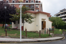
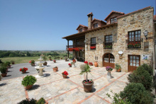
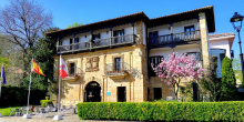
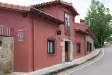
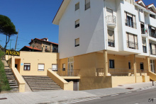
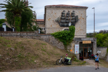
Castro Urdiales is the first substantial town in Cantabria and one of the finer medieval ports on this coast. The old town — the puebla vieja — sits on a headland above the harbor, and the cluster of monuments at its tip is genuinely impressive.
The Iglesia de Santa María de la Asunción dominates from the highest point — a 13th-century Gothic church built under the protection of Alfonso VIII of Castile, with a basilica plan of three naves and flying buttresses that wouldn't look out of place in northern France. Below it, the medieval Castillo de Santa Ana and lighthouse stand together on the rocky point, connected to the Ermita de Santa Ana by a restored Roman bridge. The whole ensemble — church, castle, ermita, bridge — is best seen from the harbor below.
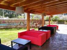
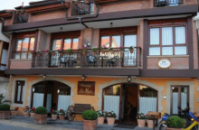
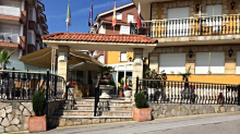
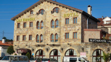
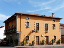
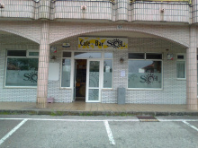
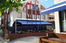
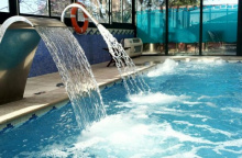
The town has all services: bars, restaurants, supermarkets, pharmacy, accommodation. The harbor-side restaurants do excellent seafood, as you'd expect from a port that's been landing fish for eight centuries.
Castro Urdiales was settled first by the Romans, who named it Flaviobriga and valued it more for its iron than its harbor. The town prospered under Castile and became one of the four original Villas de la Costa, the port towns that formed the maritime backbone of the kingdom. In 1813, the French Army destroyed much of the city during the Peninsular War. It was quickly rebuilt and fortified, though the medieval core survived.
June: San Juan on the 24th, and San Pelayo Mártir (the patron of Castro Urdiales) on the 26th. July: La Virgen del Carmen on the 16th, and Santa Ana on the 26th. August: The Assumption of Mary is celebrated on the 14th. November: San Andrés on the 30th.
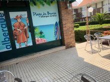
The camino through Castro Urdiales follows the N-634 but it is possible to walk the coastline, a route which is a great deal more scenic. It can be followed as far as the beach at which point you will need to turn back towards the main road. A short distance later the camino turns left towards the Plaza de Toros; the municipal albergue is located at this end of town behind the bull ring.
After passing the Plaza de Toros (on your right) the camino arrives at a tunnel under the A-8; large signs for CAMPING let you know that you are on the right track. Eventually, you will pass the camping, and a short distance afterward, Allendelagua.
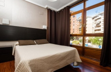
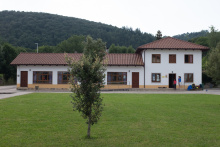
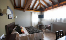
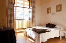
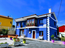
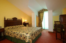
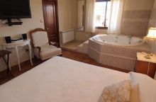
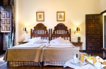
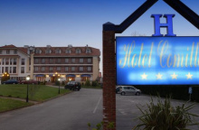
Accommodation in Castro Urdiales.
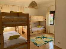
| Albergue de peregrinos de Castro Urdiales 5€ 16 |
|
| Camping de Castro 20€ 24 Booking.com |
|


A hamlet east of Castro Urdiales with no services. The camino turns left here and follows a road parallel to the A-8 before cutting through forest toward Cerdigo.
From Allendelagua the camino turns left, and follows a road that is parallel to the A-8. It turns right to cross under it at the first opportunity. After the underpass it leaves the paved road for a path that cuts up through the forest and into Cerdigo, passing the Iglesia de San Juan Evanjelista along the way.
A small village where the camino crosses the N-634 and picks up a coastal path. The cemetery is visible as you pass, and the trail eventually meets a smaller road that leads into Islares.
At the far end of Cerdigo the camino crosses the N-634 where it picks up a coastal path. You will pass the Cerdigo cemetery along the way, eventually rejoining a smaller road that parallels the N-634 and into the town of Islares. The first building you come to in Islares is the church, and to your right is the albergue (which may or may not be open). The hotels in town are located along the N-634, which you will eventually rejoin as the camino reaches the end of the town.
Accommodation in Cerdigo.
| Alojamiento Villa Pangea Booking.com |

|
Islares is stretched along the coast between the road and the mountain. The Iglesia de San Martín is one of the first buildings you encounter. The village has a bar and basic services. An albergue has operated here intermittently — check current status.
When leaving Islares exercise caution along the N-634. There is no dedicated place for pedestrians along this stretch.
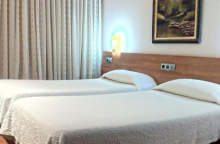
Accommodation in Islares.
| Islares Hostel 25€ 14 |
|
| Camping Playa Arenillas 12€ Booking.com |
| Hotel Arenillas ★★ |

A small village where the camino splits — the official route continues south along a pedestrian path beside the main road, while a coastal option follows the N-634 across the river. The albergue is currently closed, but a bar may offer a private room. Basic services.
January: San Vicente Mártir on the 22nd.May: San Isidro Labrador on the 15th.June: San Juan on the 24th.August: Las Nieves, patron of El Pontarrón, on the 5th. San Mamés on the 7th.
The camino splits in El Pontarrón. The official route continues due south along a pedestrian path adjacent to the main road (which becomes the CA-151) and a coastal option follows the N-634 across the river.
Accommodation in El Pontarrón de Guriezo.
| La Casa del Pontarrón | 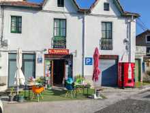
|
Rioseco has the 17th-century Iglesia de San Vicente de la Maza high on the hillside south of town, in a forest setting that means it's seldom unlocked. A bar in the village. The camino continues to the first roundabout and turns right to cross the river toward La Magdalena.
After Rioseco, the camino continues to the first roundabout and turns right to cross the river and enter the small hamlet of La Magdalena.
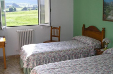
Accommodation in Rioseco.
| Posada Valle de Guriezo Booking.com |


A small hamlet with the 17th-century Iglesia de La Magdalena. The camino leaves the main road at the church, turning right and climbing over the hillside before descending under the A-8 into the Liendo valley.
La Magdalena is celebrated on the 22nd of July.
The camino leaves the main road at the church in La Magdalena, turning right and uphill to follow the trail over the hillside. When it descends it passes under the A-8 and enters the area known as Liendo.

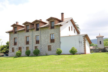
Hazas is the center of the Liendo area — a broad valley with several scattered settlements. The Iglesia de Nuestra Señora de la Asunción stands opposite the albergue. Basic services are available. From here the camino climbs to the N-634 before splitting — the official route descends to Tarrueza, while a shorter option stays on the main road directly to Laredo.
From the albergue the camino climbs up to join the N-634, turning left to follow it a short distance. When it splits the official camino turns left to leave the main road and descend to Tarrueza. You can alternatively keep on the N-634 on a shorter course to Laredo; this option will rejoin the official camino at a large junction.
Accommodation in Hazas - Liendo.
| Albergue de peregrinos Saturnino Candina 10€ 17 |
|

A hamlet between Liendo and Laredo on the official camino route. No services. After Tarrueza the camino crosses back over the A-8 and navigates a large roundabout before climbing to a side road. The descent into Laredo passes through the Puerta de San Lorenzo, dropping directly into the old town.
After Tarrueza the camino crosses back over the A-8 and at a large roundabout junction with the N-634 it leaves the busy road for a side road uphill. There is only one clear way across this large roundabout, to your right, and the road uphill is the first obvious choice. The road takes you towards an unsightly tower. Immediately after it turns left downhill to cross directly over the N-634 to a set of stairs. These stairs descend through the Puerta de San Lorenzo directly into the old town of Laredo.
Laredo is a popular beach resort backed by 5 km of sand — one of the longest stretches on the Cantabrian coast. The tourists come for the beach, but the camino brings you through the old town, and that's where the interest lies.
The Puebla Vieja (old town) is a compact medieval quarter of narrow streets climbing a hillside. The Iglesia de Santa María de la Asunción, a Gothic church at its heart, is worth a stop. The old town is easy to miss if you follow the camino arrows too closely — take the time to wander.
The route out of Laredo follows the full length of the beach to El Puntal, where a ferry crosses the estuary to Santoña. If the ferry doesn't suit you, alternatives exist by road through Colindres. The estuary crossing is straightforward but check ferry schedules in advance.
Laredo was one of the Four Villas de la Costa of Cantabria — the port towns granted special privileges by Castile. Carlos V landed here in 1556 on his final return to Spain before retiring to the monastery of Yuste. The town's medieval importance is reflected in its old quarter, though centuries of beach tourism have shifted the center of gravity toward the waterfront.
July: Día del Carmen on the 16th.August: La Batalla de Flores (the battle of flowers) sees large flower covered floats parading and is held on the last Friday, and San Roque (the patron of Laredo) on the 16th of August.
In Laredo the camino follows two options, and in this instance the alternate route is part of a series of options that appear further to the west.At issue is the best way to cross the broad estuary between Laredo and Santoña. The official camino requires the use of a ferry between the two, a journey which may not suit everyone.As a result, a web of alternative routes has been created. Between them, there does not appear to be any preferred way to rejoin the official camino. There is an option to rejoin in Santoña (passing the municipal albergue west of town) and another to rejoin in San Miguel de Meruelo. Adding to these options is the fact that beyond Santoña, in Berria, the camino splits again for safety reasons. The options from Berria can merge with the second option above, also to rejoin the official camino in San Miguel. Those options are described with Berria.Distances in [brackets] are the total from Laredo to San Miguel de Meruelo.Option 1: To Satoña via ferry (official) - 5.9 [20.6]On your left after passing under the Puerta de San Lorenzo is the Convento de las Trinitarias, on the Calle San Francisco. This road ends at a large intersection and a plaza of sorts with a fountain in the middle. You need to get to the other side and the easiest way to do that is to walk counter clockwise around the intersection. After passing the old Ayuntamiento with the 3 arches, cross one more street to follow the Calle de López Seña. You want to be going in the direction of the Paseo Maritimo and the Playas, NOT the Puerto. Note that at this point you are leaving the old town behind. Soon you will begin walking along the Paseo Maritimo, the path adjacent to Laredo’s long beach. At the far end of the beach, over 4km later, is the restaurant and boat launch at El Puntal.Option 2: To Santoña by land - 13.9 [28.7]The shortest route to rejoin the official camino is to follow the road to Colindres, and then again to Santoña. This brings you into town over the bridge, passing the Municipal Albergue along the way.Option 3: To San Miguel de Meruelo - 19.4 [19.4]If you did not take the ferry, it is more likely that you chose this option to rejoin the camino in San Miguel de Meruelos; and in so doing bypass Santoña, Berria, and Noja. The route is along the road and there are two albergues along the way.
Accommodation in Laredo.


The ferry terminal at El Puntal sits at the far end of Laredo's beach, a 4+ km walk along the sand. The crossing to Santoña covers about 600 m of estuary water. Check ferry schedules in advance.
Note that the distance to the center of Santoña includes the water crossing, a distance of about 600m. The ferry will deliver you to the south shores of Santoña, where you cross through the park and into the city.

Santoña is surrounded by the sea on three sides and a mountain on the fourth — geography that made it a natural fishing and canning port. The anchovies from Santoña are famous throughout Spain, and the canneries along the harbor are still operating. If you eat one anchovy on the entire Norte, make it here.
The Iglesia de Santa María del Puerto is not on the camino but merits a detour. The monument at the port honors Juan de la Cosa, the cartographer who created the first map of the Americas — he was captain and owner of the Santa María on Columbus's first voyage, a fact the history books tend to underplay.
The town has solid services: bars, restaurants, shops. The municipal albergue is west of town center, on the road to Berria.
The Iglesia de Santa María del Puerto, dating to the 13th century, was built over an 8th-century Benedictine monastery which itself supposedly occupied the site of a church founded by Santiago in the year 37 — a claim that connects Santoña to the very origins of the pilgrimage tradition.
Juan de la Cosa's map, commissioned by the Catholic Monarchs, is the only chart of the New World created by someone who witnessed Columbus's first voyage firsthand. Five centuries after Juan de la Cosa left Santoña by ship, Charles Lindbergh landed his seaplane Albatros offshore in 1933, forced down by weather while en route to Lisbon. The town spared no expense to accommodate him and his wife.
From the ferry terminal, with your back to the water, walk straight into the city. You will pass through the Plaza San Antonio and then the large Manzanedo Park. Keep going straight when you get to the first roundabout (bus terminal here) and at the next one do the same; you are looking for the least busy northbound road. From this roundabout, it is a straight path to Berria. At the entrance to town is the high-walled El Dueso prison.
Accommodation in Santoña.


Berria sits on an isthmus shaped by competing north winds, with a popular beach on its northern flank. The town marks a decision point: the official camino climbs 100 m up the steep, sandy El Brusco headland — excellent panoramic views from the top, but the terrain is loose and not for the faint of heart. The alternative follows the road to Noja, considerably easier on the legs.
The high-walled El Dueso prison is visible at the entrance to town — an unusual landmark but hard to miss.
At the end of Berria, the camino splits. This is one of the rare points where the official camino might not be the best option. Where the main road turns left at the end of town, the camino turns right onto a trail which climbs 100m up to the top of the El Brusco headland. Although this climb affords excellent panoramic views from the top, its steep sandy terrain is not for the faint of heart.
The alternative is to follow the road to Noja.
The official camino over the Alto de Brusco is straightforward. To follow the alternative along the road, turn left at the bend to follow a pedestrian path past the first roundabout. At the second roundabout bear right to follow the CA-141 in the direction of Somo. There exist several variants of the camino along this stretch, which may accidentally take you away from Noja and to San Miguel de Meruelo.
All of these options require you to turn left off of the CA-141 so if Noja is your destination, keep on the main road and ignore all left-hand turns. When you do leave the CA-141 it will be to the right and is marked Helgueras 2km.
If neither Helgueras, Noja, nor Castillo are on your agenda you can follow the left facing arrows and continue directly to San Miguel.
Accommodation in Berria.
| Albergue Playa de Berria 22€ 22 Booking.com |
|
| Posada Las Garzas Booking.com |
|
Helgueras marks the start of Noja's long beach. It's a quiet surfer's hideout. The camino resumes across the sands and climbs up into Noja.
When you get to the beach in Helgueras the camino resumes across the sands and up to Noja.

Noja sits between two fine beaches, hemmed in by its topography. It's a resort town in summer, quiet the rest of the year. The Iglesia de San Pedro occupies the highest point, surrounded by a small park — a good resting spot. The tourist information office and Plaza de la Villa are across the street.
The marshlands flanking the town — the Marismas de Victoria and Marismas de Joyel — are protected wetlands with significant birdlife. Worth a look if you arrive early enough to wander.
San Emeterio and San Celedonio are celebrated on the 29th of August.
The camino enters Noja along the park adjacent to the beach, and turns left at the far end to follow the road uphill into the center of town. It passes around the Iglesia de San Pedro and then winds its way back down to the CA-141 which it crosses into Castillo.
Accommodation in Noja.


A hamlet between Noja and San Miguel de Meruelo. The area was historically known for its tower houses — fortified residences built by local nobility. The camino follows a paved side road through to San Miguel.
The camino winds along a paved side road between Castillo and San Miguel.
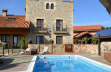
Accommodation in Castillo Siete Villas (Arnuero).

Colindres sits at the head of the estuary between Laredo and Santoña. It's on the land route for pilgrims who skip the ferry. A small town with basic services but not much reason to linger.
June: San Juan, the patron of Colindres, on the 24th.July: El Carmen on the 16th and Santiago on the 25th.August: San Roque on the 16th and San Ginés on the 25th.
Accommodation in Colindres.
| Hospedería el Puerto Booking.com |
|
A hamlet on the land route between Colindres and the inland alternatives. No services.
Accommodation in Treto.
A hamlet on the inland route. No services.
A hamlet on the inland route. The Palacio de Elsedo, a 17th-century baroque manor, is the only notable building. No pilgrim services.
Accommodation in Gama.
| Albergue de peregrinos de Gama 4€ 12 |
Escalante is a small town on the inland route with more history than its size suggests. A Franciscan monastery and several medieval buildings survive. A bar provides refreshment.
Accommodation in Escalante.

San Miguel de Meruelo is where the alternative routes from Laredo converge with the official camino. Most services sit along the main road, including a bar and basic provisions. Signs for the Museo de la Campana (bell museum) are visible but misleading — the museum is actually in the next town over.
The camino passes through on a small country road at the upper edge of town, passing the church before descending into the valley.
If you need any of the shops in town, stay on the main road when you reach the town. All of the services are located at the start of town along this road, which you can follow to the end of town and resume the official camino.
San Mamés is celebrated on the 7th of August.
The camino passes through San Miguel on a small country road at the upper side of town. It passes the church before descending back to the CA-454 which it follows a short distance before turning left downhill at the end of town. From here it descends to the bottom of the valley, where the albergue is located, and then climbs back up to the road in Bareyo.
Accommodation in San Miguel de Meruelo.
| Hostería Sol Booking.com |
|
Bareyo is the heart of a district once famous for producing world-class stone masons, bell makers, and retablists whose work can be found throughout the peninsula — though, incredibly, little of it remains in Cantabria itself. The 12th-century Iglesia de Santa María is one of the few Romanesque churches in the area and has been well preserved. A short detour off the camino to visit it is worthwhile.
From Bareyo the camino takes a long route around Güemes — it barely enters the town. This is fine if you're staying at the albergue, which sits on the camino, but if you want the village center you'll need to follow the road shortcut.
Bareyo is the heart of a district know for having produced world class stone masons, bell makers, and retablists whose work can be seen and heard throughout the peninsula. Among them is Juan de Herrera who was responsible for the cloister that is part of the Cathedral in Santiago. Incredibly, little of their work can be found in Cantabria itself. The nearby 12th century Iglesia de Santa María is one of the few examples of Romanesque architecture to be found in the area, and it has been well preserved.
In Bareyo it is possible to take a small detour (signposted and along the road) to visit the 12th century Iglesia de Santa Maria. Otherwise, turn left at the road. Ahead the camino takes a long route around Güemes, in fact it doesn’t much go through town at all. This is fine if you are planning on staying at the albergue here as it is on the camino, but otherwise it is possible to keep on the road as it passes through Güemes on a shorter route to rejoin the camino. If you follow the official camino it is along the CA-447 from Bareyo but turns left to leave the road for a quieter one a few kilometers later.


Güemes is famous among pilgrims for one reason: the albergue. Run by Father Ernesto Bustio and a small group of volunteers, it has a reputation as one of the essential overnight experiences on the Camino del Norte. The hospitality is genuine, the evening meal is communal, and the atmosphere tends to stay with people long after they leave.
The albergue is on the camino itself, so you won't miss it. The village is small — a church, a handful of houses, and the surrounding farmland.
San Lorenzo is celebrated on the 10th of August and Nuestra Señora de Consolación on the first Saturday of September.
The route from the church in Güemes (along the shortcut) and the official camino rejoin on the CA-443 at the west end of town. This is the same road that led into town, but the number changed at the church. Where it reaches a junction with another main road, turn left. Galizano is ahead and on your right. You will turn off the road to pass through it.
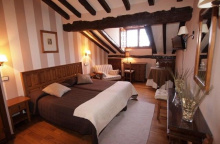
Accommodation in Güemes.
| Albergue La Cabaña del abuelo Peuto Donativo€ 100 |

|
| Posada El Ángel de la Guarda ⭑⭑ Booking.com |
|


Galizano supplements its cattle farming and dairy economy with tourism. The Iglesia de Nuestra Señora de la Asunción stands at the center of town. The camino splits here again — one option follows the main road to Somo, the other heads north to the coast for a scenic route along the Loredo beach.
May: San Isidro Labrador on the 15th, with a large fair celebrating farming. July: San Pantaleón on the 27th, including a romería to the ermita in his name. August: Nuestra Señora de la Asunción, patroness of the city, on the 14th and 15th. San Roque on the 16th.
The camino splits again in Galizano. One option is to return to the main road and follow it all the way into Somo. The quieter option is to pass through town and continue north to the sea to follow a coastal route which enters Somo at the edge of the Loredo beach.


Loredo is on the coastal route variant between Galizano and Somo. A quiet beach settlement. The path along the coast here is pleasant walking.
Accommodation in Loredo.
Somo is a laid-back surfer town on the eastern side of the Bahía de Santander. The Somo surf school operates from the beachfront, and even if surfing isn't your thing, the walk along the beach into town has an easy rhythm to it.
At the western edge of town sits the ferry terminal. The majority of pilgrims take the ferry directly to Santander — a 5.6 km water crossing that delivers you to the heart of the city. The alternative by land through Astillero is 23.6 km, mostly city walking, and doesn't actually pass through Santander — making it the less popular choice by a wide margin.
La Virgen de Latas is celebrated on the 8th of September.
Both the road route and the coastal route will take you through Somo. At the western edge of town are the Miera Estuary and the ferry terminal. Again the camino splits, and the majority of pilgrims choose the option to take the ferry all the way to Santander. The distance of 5.6km to Santander is covered entirely by boat.Option 1: Santander via ferry (official) - 5.9The ferry leaves from the terminal on the west end of Somo, south of the sandbar and near the bridge leaving town.Option 2: To Peñacastillo by land - 23.6The route through Astillero, though there is an albergue, is the least traveled option due in large part because it does not pass through Santander. It is mostly city walking and rejoins the official camino near the church in Peñacastillo. Taking this route prohibits you from taking the alternate route along the coast around Santander.
Accommodation in Somo.


Astillero is on the land route from Somo to Peñacastillo — the alternative that avoids the ferry to Santander. An albergue is available, but the route is mostly city walking and doesn't pass through Santander itself. Most pilgrims take the ferry.
Santander is the capital of Cantabria and the largest city between Bilbao and Gijón. The ferry from Somo deposits you on the Paseo de Pereda, a café-lined waterfront boulevard that serves as the city's front door. If you've been looking for a rest day, this is the place.
The Catedral de Nuestra Señora de la Asunción sits to the left of the ferry terminal — built over the site of the earlier Abbey of the Holy Bodies, which held the relics of saints Emeterio and Celedonio (from whose name, Sant Emeter, the city takes its own). The Gothic lower church is the older and more atmospheric of its two levels.
From the cathedral, cross the park and walk through the massive arch in the Banco Santander building. The Mercado del Este, a small market hall, is the next building on the right — good for a casual lunch. For a proper market experience, the Mercado de La Esperanza is better.
The Palacio de la Magdalena, the city's most emblematic building, sits on the peninsula at the far eastern end. Built by public subscription as a summer residence for Alfonso XIII, it's now a university and cultural center. The grounds are open and the views are excellent, though the palace interior requires a tour. The Playa del Sardinero, north of the palace, is the city's best beach.
All services are available. Santander has rail, bus, and ferry connections (including to the UK via Brittany Ferries). A well-connected city for arrivals and departures.
The city's origin story begins in the 8th century, when the mortal remains of two Roman soldiers martyred for their Christian faith — San Emeterio and San Celedonio — were brought here by boat from North Africa for safekeeping from the Moors. The abbey built to house the relics became the nucleus around which the city grew. The Romans had already named the harbor Portus Victoriae, but it was Emeterio who gave the city its name — Sant Emeter becoming Santander through centuries of pronunciation.
The most devastating event in Santander's modern history was the great fire of February 1941, which burned for two days and destroyed much of the old city center. Fanned by south winds reaching 180 km/h, the fire left 10,000 people homeless and obliterated the medieval core. The reconstruction reshaped the city center into the wider, more modern layout you see today. Unlike the bombing of Gernika, this was a catastrophe of wind and fire, not war — though it came in the middle of the grim postwar years, making recovery painfully slow.
San Juan is celebrated, and bonfires are lit, on the 24th of June.Santiago is celebrated on the 25th of July. San Emeterio and San Celedonio, patrons of Santander, are celebrated on the 29th of August.The Fiestas de la Virgen de la Bien Aparecida are held on the 15th of September
Between Santander and Boo de Piélagos there are two routes, the official camino and the Senda Litoral (coastal trail) that follows the coastline north of the city.The Senda Litoral starts at the ferry terminal and continues along the coast, with the water on your right, all the way around the city. The option is a great deal more scenic than the official camino and it is growing in popularity among pilgrims. At 33km it is the longer option. The official camino turns left at the ferry dock and across the adjacent city park. The path through town is clear and city walking from here to the far end of Santander. At the edge of the park turn left and follow this road; it is the Paseo de Pereda when you begin but changes names along the way. Officially it is the N-611. After passing the large university hospital complex on your left the camino goes through two large roundabouts. At the second roundabout follow the signs in the direction of the Avenida de Cajo, which will take you to the start of Peñacastillo.
Accommodation in Santander.
| Santander Central Hostel 23+€ 40 Booking.com |
|
| Hostel Santander 19-29€ 20 Booking.com |
|
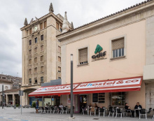
| Hostel & Co 27€ 25 Booking.com |
|
| Albergue de peregrinos Santos Mártires 15€ 12 |
| Plaza Pombo B&B ⭑⭑⭑ Booking.com |
|


Peñacastillo is the western fringe of Santander where the official camino and the Astillero land route converge. The 19th-century Iglesia de San Lorenzo (Loreto) sits high on the hill to the left as you enter. The camino follows the N-611 through before turning off into quieter suburban roads toward Santa Cruz de Bezana.
Nuestra Señora de Loreta, patroness of the city, is celebrated at the start of July.
The camino does not leave the N-611 until it gets to the border between Santander and Peñacastillo, a point which is marked. Here it turns right and then immediately after crossing over the railway it turns left. This road winds a bit but is well marked, taking you under two large highways and into Santa Cruz de Bezana.
Accommodation in Peñacastillo.
A Santander suburb with most services located off the camino. The albergues require a detour — a left turn at the church onto the CA-300, crossing back over the railway and the A-67. The official camino keeps straight at the church toward Mompía.
Día de la Cruz is celebrated on the 3rd of May and San Roque is celebrated on the 16th of August.
The only tricky part about Santa Cruz is getting to the albergue, which requires a detour from the official camino. It is left-hand turn at the church, at a junction with the CA-300. This will take you back over the railway, and then over the A-67. Immediately after the A-67, where it bends to the right, a set of stairs on your left take you down to the level of the N-611. If you choose this route note that it is not necessary to retrace your steps, this option will rejoin the official camino further down the N-611. The official camino keeps going straight at the church and to Mompia.
Accommodation in Santa Cruz de Bezana.

Mompía is a collection of residential neighborhoods and a hospital with little to detain you. Be warned: the local utility company has taken to marking their infrastructure with yellow arrows that look alarmingly like camino waymarks. Their arrows are drawn upside down with the arrowhead at the bottom and usually include a bend and adjacent numbers — but in the field, the confusion is real.
It is near Mompía that the local utility company has taken to marking their services with yellow arrows. As you would imagine this creates a bit of confusion and it might lead you astray if you are not paying enough attention. Although the yellow is the same their orientation is usually not; they are drawn upside down with the arrowhead at the bottom. They almost alway involve a bend in the arrow, and they are adjacent to a series of stenciled numbers.
La Virgen del Rosario is celebrated on the first Sunday of October.
The road into Mompía ends and the camino turns left past several residential areas, the Mortera train station, and the Mompía hospital. Past the hospital it turns right at the roundabout. When it gets to the Barrio Vivero it leaves this road for another on the right.
Accommodation in Mompía.
Boo de Piélagos marks a navigational challenge. The FEVE train station, church, and albergue cluster around a curve in the road. The problem lies ahead: the camino once crossed the Río Pas on the narrow FEVE railway bridge, but this is now prohibited and enforced.
Three options remain: ride the FEVE train one stop across the river (two minutes, cheap, easy); walk south to cross at Puente Arce and loop back north to Mogro (9.4 km); or take the newly marked alternate from Puente Arce that continues west without returning to the coast.
Once upon a time the camino between Boo and Mogro required pilgrims to cross the river along the very narrow FEVE railway bridge. This is now prohibited and enforced by the locals and the police. It is dangerous and very much to be avoided. This leaves pilgrims with three options:1. Hop on the train at Boo for a two minute journey across the bridge the legit way.2. Follow the arrows south to cross the river at Arce and then turn back north to Mogro, a well marked journey of 9.4km. 3. Follow the arrows south to cross the river at Arce and then continue on a newly marked alternate from Puente Arce.
Although the town of Boo is new the camino has always passed through this point. Modern travelers have the luxury of a quick train across the Río Pas but ancient pilgrims relied on the Barco de Mogro (the boat of Mogro) to get across; a service which was free to pilgrims.
San José Obrero is celebrated on the 19th of March and San Juan Bautista on the 24th of June.
Once in Boo it is possible to cross the train tracks at the platforms, though do exercise caution. This is the shortest path to the Albergue Piedad. The arrows will otherwise take you around town (it is a small town) on the main road and over the railway.
Accommodation in Boo de Piélagos.
| Albergue Piedad 17€ 16 Booking.com |
|

Arce and Puente Arce are technically the same town but spread out enough to feel separate. The grocery store is near the church at the upper end; the restaurants cluster closer to the river and bridge.
Nuestra Señora de la Soledad on the 2nd of July, Santa Ana on the 26th of July, and Nuestra Señora de la Anunciación on the 15th of August.
Puente Arce is the river crossing point for those who can't (or won't) take the train from Boo. A newly marked alternate route now continues from here to Requejada without the northward loop to Mogro — watch for arrows at the junction after the bridge. This alternate follows near the N-611 through Oruña and Mar.
There is now an alternate route for the second half of this option, which goe from Puente Arce to Requejada without having to turn north to go to Mogro. This option would follow near the N-611 which connects Arce to Requejada and Polanco.Be mindful that new arrows have been painted at a junction after crossing the bridge. This alternate route will take you through Oruña and Mar before entering Requejada via Polanco.
After crossing the bridge in Puente Arce the camino turns right to follow the paved CA-232 all the way to Mogro.


If you arrived from Boo by train, follow the road from the station up to the CA-232. Arrows on the stone retaining wall on the opposite side direct you left and uphill. The path through town curves counterclockwise around the conical hillside, passing the Iglesia de San Martín before heading toward Cudón. Ignore signs for the Senda Litoral here.
If you have arrived in Mogro via the train from Boo, follow the road from the train station up to the CA-232. On the opposite side of the roundabout there are arrows painted on the stone retaining wall, directing you to the left and uphill to rejoin the official route as it too climbs into town.The path through town is essentially counter clockwise around the conical hillside to your left. When you get to the far end of town avoid all signs directing you to the Senda Litoral. The camino passes to the left of the Iglesia de San Martín and follows the signs to Cudón, a course which has its ups and downs.
Accommodation in Mogro.
| Casa Rural La Joyuca del Pás ⭑ Booking.com |
|
| Posada Condado de la Mota ⭑⭑⭑ 14 Booking.com |
|
A bar sits where the camino meets the busy CA-232. Once across, the camino turns left and follows a gravel side street parallel to supply pipelines all the way into Requejada.
The entrance to Cudón is marked by the crossing of the CA-232 at which point you will find the bar. Once across this busy road turn left to follow a gravel side street. This path parallels a set of supply pipelines all the way into Requejada; when they head underground you are near the train station, and on your left is an elevated crossing that takes you over the railway and into town.
Accommodation in Cudón.
| Posada La Victoria ⭑⭑ Booking.com |
|
A small town on the alternate route between Puente Arce and Requejada. No particular services for pilgrims.
Accommodation in Polanco.
| Albergue Regato de las Anguilas 5€ 4 |
Requejada is a factory town on the river — originally developed to receive iron ore and dispatch wheat, now dealing in plastics, soda ash, and brewery machinery. The going is noisy. The camino follows the N-611 through town toward the river crossing into Viveda.
San José is celebrated on the 19th of March.
In Requejada the camino turns right to follow along the busy and noisy N-611 all the way to Barreda.
The camino passes the Barreda train station and crosses the Río Saja into Viveda. Be aware of potentially conflicting arrows here — the route was recently changed, and businesses along the old route through Queveda still post their own waymarks.
Note that there may be conflicting arrows after crossing the river. In recent years the camino has changed course and the businesses along the old route through Quevada are still promoting the original way with adverts and arrows. The official camino follows a slightly longer course which avoids very busy road walking for less busy road walking.
The camino passes the entrance to the Barreda train station and comes to a roundabout, turn right here to follow the road over the Río Saja and into Viveda.
Viveda has two centers separated by urban sprawl. The Iglesia de El Salvador and the Palacio de Peredo are the buildings of historical note. The church began construction as early as 878 — making it nearly a century older than the famous Colegiata in nearby Santillana del Mar. A fact the locals mention with some frequency.
The camino follows the CA-340 from here toward Santillana.
Viveda was founded by King Alfonso I of Asturias to be a stop along the old Roman road and the Camino de Santiago. The Iglesia de El Salvador began construction as early as 878, making it almost a full century older than the one in Santillana del Mar.
Once over the bridge into Viveda keep to the right at the first roundabout, heading uphill. A short distance later it turns left onto the CA-340 in the direction of Camplengo. This new route is well marked and almost entirely along the road, leading you directly to the Plaza de las Arenas and the Colegiata in Santillana del Mar.
Accommodation in Viveda.
Queveda is on the old camino route, now bypassed by the official trail. No particular reason to come here unless you followed outdated arrows.
Accommodation in Queveda.
| Albergue Osa de Andara 15€ 20 |
| Posada la Leyenda ⭑ Booking.com |
|
Santillana del Mar is the showpiece of the Cantabrian camino — a medieval village so well preserved it feels like a film set, which is why so many productions use it as one. It's also a mandatory stop on the tourist bus circuit, so take a breath and learn to share the cobblestones.
The Colegiata de Santa Juliana is the main monument — a Romanesque collegiate church with a magnificent cloister whose carved capitals are among the finest in northern Spain. At the opposite end of town, the Convento de las Dominicas (also known as the Convento de San Ildefonso) bookends the main street. In between, nearly every building carries some historical significance, and the stone mansions and carved coats of arms lining the cobbled streets justify the crowds.
If you're looking for something darker, the Museo de la Tortura offers a grimly comprehensive collection. It's sometimes misleadingly billed as an Inquisition museum.
The Museo de Altamira, on the outskirts, is the real reason the tour buses come. The original Altamira cave paintings — the Sistine Chapel of the Paleolithic — are closed to the general public, but the museum's replica cave is a remarkable reproduction that conveys the scale and artistry of the originals. Don't skip it.
Restaurants and bars are plentiful and slightly more expensive than neighboring towns. Multiple albergues and hotels serve the large visitor population.
The Altamira Caves, discovered in 1868 and recognized in 1879, are the most important prehistoric site in Spain and among the most significant in the world. The polychrome bison painted on the cave ceiling are estimated at 14,000-20,000 years old. The discovery was initially dismissed as a hoax — the art was considered too sophisticated for prehistoric people — and the discoverer, Marcelino Sanz de Sautuola, died before his work was vindicated.
Santillana itself grew around the relics of Santa Juliana (Saint Juliana), a 4th-century martyr from Nicomedia whose remains arrived here in the early medieval period. The Colegiata was built to house them and became the nucleus of the village. The town was never large, but the nobility who settled here built the stone mansions that give it its current character. Jean-Paul Sartre allegedly called it 'the prettiest village in Spain' — a quote attributed so widely it may well be apocryphal, but the sentiment is hard to argue with.
Santa Juliana, the patroness, is celebrated on the 28th of June and San Roque on the 15th and 16th of August.
The path through Santillana is well marked with wooden plaques on the stone walls, but they may be difficult to see with the crowds. If you get as far as the CA-131 you have gone too far, turn back and veer to your left towards the main square. The camino passes the nearby Santillana campsite, climbing up to Arroyo before descending into Oreña.
Accommodation in Santillana del Mar.
| Albergue El Convento 16-19€ 60 |
| Camping Santillana |
| B&B Posada Santa Juliana ⭑ Booking.com |
|
| Albergue Gándara 15€ 10 Booking.com |
|


A hamlet between Santillana del Mar and Oreña. No services. The camino passes through on its climb out of Santillana.
A small village between Santillana and Caborredondo. The camino follows back roads through farmland with sea views, climbing to the 16th-century Iglesia de San Pedro before descending into Caborredondo.
The camino keeps to smaller back roads between Oreña and Caborredondo, across farmlands with views to the sea. Along the way you climb up to and pass the 16th century Iglesia de San Pedro before descending into Caborredondo.
Accommodation in Oreña.

A hamlet the camino passes through on a straight road. An overpass crossing, and then a trail on the right leads directly to Cigüenza.
Keep on going straight through town and across an overpass. Not far after the camino leaves the road for a path on your right which takes you directly to Cigüenza.
Accommodation in Caborredondo.

| Albergue de Peregrinos Izarra Donativo€ 16 |
|

Cigüenza sits in a valley between two hills with a population under 100 — which makes the 18th-century Baroque Iglesia de San Martín de Tours all the more surprising. The church was modeled after one in Lima, Peru, funded by a native of Cigüenza who made his fortune in the Americas — one of the Indianos whose returning wealth transformed villages across this coast.
A handful of large estates surrounding the church hint at similar stories.
San Pantaleón is celebrated on the 27th of July and San Martín on the 11th of November.
After passing the Iglesia de San Martín the camino rejoins the CA-353 into Cóbreces.

Cóbreces has an unexpected density of architectural heritage sites, nearly all of them along the camino. From east to west: the Colegio de San José (home to the Viejo Lucas albergue), the Ermita de Santa Ana, the Iglesia de San Pedro ad Vincula (Saint Peter in Chains), the Abadía de Santa María de Viaceli — possibly the first building of its kind constructed with reinforced concrete — and the Iglesia de San Felices de Mies.
The Playa de Luaña is a short walk north and serves as an alternative dining spot. A bar at the beach and others in town provide services.
There is an alternate route which may cause some confusion in Cóbreces. It turns left at the Iglesia de San Pedro and follows a more southerly path to La Iglesia.
July: Santa Ana on the 26th. August: San Pedrucu on the 1st and San Roque on the 16th. On the last Saturday of August there is a pilgrimage to the Ermita de Virgen de la Peña, a journey of 18km meant to rid the penitent of all epidemics.
The camino follows the CA-353 all the way through town. It passes all of the albergues as well as the abbey. When it reaches the first main intersection (after the abbey) it turns left and then right again, following the road to the nearby beach. From the beach it climbs up to a small hamlet. Beyond this hamlet it splits into two paths of equal length, to the right is the town of Liandres and to the left is the way to La Iglesia passing the campsite. The path into La Iglesia is downhill, crossing the CA-131 along the way.
Accommodation in Cóbreces.
| Albergue El Pino 18€ 11 Booking.com |
|
| Albergue Viejo Lucas 18€ 159 |
|


Bars at the campsite (before town) and in town. The 17th-century Iglesia Parroquial de la Asunción is the endpoint of an annual procession held each July.
Turn right before arriving at the church to the nearby town of Pando.
Accommodation in Barrio de La Iglesia (Ruiloba).
| Camping El Helguero Booking.com |

|
 on the Camino de Santiago")
A hamlet between Ruiloba and Comillas. The camino turns right onto the main road at the church.
The camino turns right onto the main road in Pando at the church.
A hamlet on the approach to Comillas. The camino follows a short trail back to the main road before entering town.
From Concha the camino turns left to follow a short trail back to the main road as it enters Comillas, turning left at the campsite.

Comillas is where Catalan architecture meets the Cantabrian coast, and the result is unlike anything else on the Norte. At the end of the 19th century, a group of Catalan architects — including Antoni Gaudí himself — were commissioned to build here, and their work transformed a whaling-and-fishing village into an architectural showcase.
El Capricho de Gaudí is the headline act — one of only a handful of buildings Gaudí designed outside Catalonia. Built as a villa in the 1880s, its ceramic sunflower façade and minaret-like tower are unmistakable. After decades of abandonment, it's now a museum. Adjacent stands the Palacio de Sobrellano, designed by Joan Martorell, a neo-Gothic palace whose chapel contains furniture designed by Gaudí. Both can be toured and neither should be skipped.
At the highest point of town, follow signs for the cemetery to find the ruins of the old parish church. When the parish feuded with the Duke, the church was abandoned, and the expanding cemetery filled the nave — a curious sight. But the real discovery is the modernist sculpture that adorns it, known as El Ángel Exterminador, by Josep Llimona.
The camino cuts through the old town center but doesn't reach the beaches or the harbor. If you're staying the night, make the loop — the headland views are excellent. The Iglesia de San Cristóbal is the working parish church. Bars, restaurants, and shops serve both pilgrims and the steady tourist traffic. Multiple accommodation options.
The camino has recently changed and now follows the road north. The new route bypasses El Tejo and La Revilla and instead continues along a pedestrian path adjacent to the road. It continues to Oaymbre beach (bar) and then onward to San Vicente de la Barquera along the road.
Comillas was a whaling port from the 17th to 18th centuries — the free whale was hunted to local extinction, and the men traded harpoons for sardine nets. The transformation came in the late 19th century when the first Marqués de Comillas, Antonio López y López, returned from his fortune-making in the Americas and brought Catalan architects to redesign the town. The Catalan connection — architects, sculptors, and craftsmen — was his doing, and the buildings they left behind are now protected heritage.
Gaudí built a third project in Comillas: a smoking kiosk for the palace garden, purpose-built for the visit of King Alfonso XII. It was later moved to Barcelona and has since disappeared.
Comillas keeps a comprehensive festival calendar, starting with the Cabalgata de Reyes Magos for winter pilgrims passing through on the 5th of January. Later in the year it celebrates Carnaval for the three weeks leading up to Semana Santa (Holy Week). Bonfires on the beach for San Juan on the 23rd of June. Later the local fiesta celebrates San Pedro on the 28th and 29th. San Cristóbal, patron of Comillas, is celebrated on the 10th of July; and less than a week later Santo Cristo del Amparo is celebrated on the 16th. And lastly, on the final weekend of August, the Día del Indiano celebrates the intrepid explorers who set out from Comillas in the mid 19th century to find their fortune in the Americas and the Philippines.
The camino passes through the center of the old town, and does not go near any of the beaches in Comillas; however it is worthwhile to make the detour to visit as the views are exceptional.After passing through the old town the camino emerges onto the Calle del Marqués de Comillas at a broad park. High up on the hillside to your left is the Capricho de Gaudi and the Palace and Chapel de Sobrellano. Follow the road past these landmarks and straight through the roundabout at the end of the park. You are now in the CA-131 and 2.3km from here the camino splits.
Accommodation in Comillas.


A hamlet on the road between Comillas and San Vicente de la Barquera. The camino has been rerouted and now bypasses this area, following a pedestrian path along the road instead. No services.
Accommodation in El Tejo - Santa Ana.
| Posada El Teju ⭑ Booking.com |
|
A hamlet recognizable mainly for its golf course. The camino now bypasses this area on its rerouted path to San Vicente de la Barquera.
Accommodation in La Revilla.
| Surf House Gerra 25€ 22 |
| Posada La Vieja Escuela ⭑⭑ Booking.com |
|
San Vicente de la Barquera is one of the most photogenic towns on the Norte — a medieval port on a headland between two estuaries, with the Picos de Europa often visible as a backdrop. The approach across the long bridge, with the old town rising above the marshes, is one of the better arrivals on the entire route.
The old quarter climbs a hillside to the Iglesia de Santa María de los Ángeles, a 13th-century Gothic church containing the tomb of Antonio del Corro — the writer and inquisitor is depicted reclining and reading a book, a posture that has charmed visitors for centuries. Next to the church stands the twin-towered Castillo de San Vicente, whose museum is worth less than the views from its ramparts. Old city walls and a Pilgrim Gate surround the old town.
On the far side of town, across the second bridge, the Santuario de la Barquera is set in gardens that make for a peaceful detour.
Note: this is where the Camino del Norte meets the Camino Lebaniego, which heads south into the Picos de Europa to the Monastery of Santo Toribio de Liébana. You'll start seeing red cross waymarks for the Lebaniego — don't follow them unless that's your plan.
The camino bypasses the old town by going straight through the roundabout at the bridge. To see the town, turn right at the roundabout and retrace your steps to continue.
San Vicente Mártir is celebrated on the 22nd of January with a farming fair. El Carmen is celebrated on the 16th of July, it is the place to be if sardines are your thing.The biggest celebration, that of La Folía, is held the second Sunday following Easter Sunday.
After crossing the estuary into San Vicente, the camino proceeds directly through the roundabout at the end of the bridge, and in so doing it doesn’t really go into town. To get to any of the services and transportation, turn right at the roundabout and then retrace your steps to leave San Vicente.It climbs slightly and crosses over the A-8 into Acebosa.
Accommodation in San Vicente de la Barquera.


A hamlet west of San Vicente de la Barquera. No services. The way through isn't entirely clear — turn right when you reach the road and follow it to Hortigal.
Entering Acebosa, the way isn’t entirely clear. Turn right when you get to the road and follow it all the way to Hortigal.
A hamlet on the road west of San Vicente. No services. At the fork at the far end, keep right toward Serdió.
At the fork at the far end of town, keep to the right and follow the road through Estrada and on to Serdío.
A hamlet where signs for the Camino Lebaniego may tempt you off the trail — ignore them and keep to the road toward Pesués. A bar in nearby Muñorrodero (100 m off camino) provides refreshment.
Keep on the road through Serdió and be mindful that signs for the Camino Lebaniego are tempting you to leave the trail. Simply keep on the road towards Pesués, passing under the A-8 and over the Río Nansa turn left at the first house. Note: prior to arriving, you pass near Muñorrodero with bar 100m off the camino.
Accommodation in Serdió.
| Hostería El Corralucu Booking.com |

|
| Posada La Torre Booking.com |
|
A small village where the camino follows along the railway tracks. No services of note.
From Pesués the camino follows along the tracks, avoiding the traffic along the nearby service road.
Accommodation in Pesués.
| Hostal Baviera ⭑⭑ Booking.com |
|