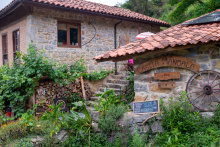
The town of Colloto derives its name from “collis-altus,” a reference to the hilltop location.
Between Colloto and Oviedo it is mostly urban walking, and entirely along the trajectory of the N-634 into Oviedo.

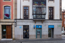
If you're starting your camino in Oviedo, leave enough time to visit the Cathedral -- it's the origin of the camino itself. This is also where you pick up your credential (pilgrim passport), which costs 2.50 euros but includes admission to the Camara Santa, the oldest part of the Cathedral. Built originally as a stronghold for relics, the Camara Santa houses the Arca Santa (Holy Chest), a 9th-century reliquary said to contain pieces of the True Cross, the Santo Sudario (a cloth tradition links to Christ's burial), and relics from various apostles and saints. The Romanesque apostle columns inside are among the finest sculpture of their era in Spain.
The greater Oviedo area holds more pre-Romanesque architecture than anywhere else in Europe. Three structures carry UNESCO World Heritage status: the Iglesia de San Julian de los Prados (9th century, with its original fresco program largely intact), Santa Maria del Naranco (originally a royal reception hall for Ramiro I, converted to a church), and San Miguel de Lillo (remains of a palatial chapel). The last two sit on Monte Naranco, about 3 kilometers from the center -- they require a small detour when leaving Oviedo but are genuinely worth the extra steps.
Closer to the center, the Monasterio de San Vicente and the adjacent Monasterio de San Pelayo anchor the city's monastic history. At the other end of the architectural timeline, Calatrava's Palacio de Congresos provides a sharp modern counterpoint.
Oviedo is cider country. The traditional pour -- the escanciado, where the bartender holds the bottle above their head and the glass at their hip to aerate the cider -- is a performance you'll see repeated in every sidreria. The Calle Gascona, known locally as the Boulevard de la Sidra, is lined with them.
Oviedo was founded in 761 by two monks, Fromestano and his uncle Maximo, who dedicated their church to San Vicente. Within twenty years it had grown into a monastery, and the settlement around it became the capital of the Kingdom of Asturias -- the only Christian stronghold to resist the Moorish conquest of Iberia.
It was in this monastery that the future King Alfonso II was born. During his reign, the remains of the Apostle Santiago were discovered in a field in Galicia. Alfonso made the pilgrimage to see them, and the mountainous path he followed between Oviedo and Santiago became the Camino Primitivo -- the Original Way, the oldest of all the pilgrimage routes to Compostela.
The saying goes: whoever goes to Santiago and not to the Salvador, visits the servant and ignores the master. The Camara Santa's relics drew pilgrims to Oviedo for centuries, and many walked from here to Santiago as Alfonso did. You're following in the footsteps of a 9th-century king.
The road out of Oviedo is notoriously confusing. To make matters worse, there are too many shells on the ground to be helpful, especially in the center. They mark several of the caminos into, and out of, Oviedo. There is no distinction between the two directions.
This is how it is done:
1. With the main facade of the Cathedral to your back, walk to the opposite end of the plaza and take the exit on the right. This is the Calle San Francisco.
2. San Francisco ends when it meets Calle de Uría (350m from Cathedral). Turn right and follow Calle de Uría. For the first 250m, the Parque de San Francisco will be on your left. Stay on this road, regardless of arrows or shells. It is about 700m long and ends at the train station.
3. At the train station, turn left along the Calle de la Independencia. Stay on the right-hand side of the road. You will pass 7 cubist looking apartment buildings before the sidewalk turns sharply back to the right. Follow the turn and cross the road towards another cluster of 4 similar buildings with a plaza in front. From here it is safe to follow the arrows.
4. At the end of the plaza is a roundabout. Cross to the left (clockwise) twice and turn left along the Calle de la Argañosa. When it turns to the left (700m) you should turn towards the right, looking out for the pedestrian bridge which crosses the train tracks.
5. The arrows from here zigzag you through new development which ends quickly. By the time you get to an urban looking track and have left Oviedo behind, you will have covered about 3.6km.
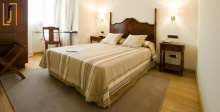
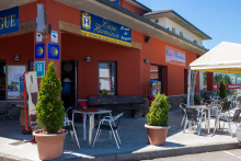
Accommodation in Oviedo and the Start of the Camino Primitivo.
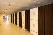
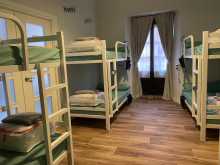
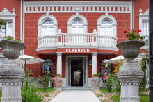
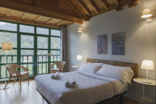
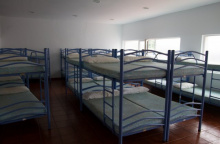
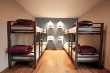
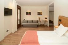
| Albergue-Hostel Gascona 27€ 24 Booking.com |
|
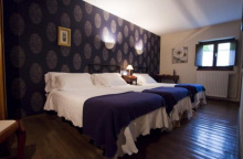
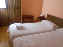
| La Hospedería Oviedo 20-25€ 10 Booking.com |
|
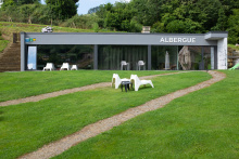
| Albergue de El Salvador de Oviedo 9€ 51 |
|


The first hamlet after the suburbs of Oviedo. This area is popular with day hikers from the city, so don't accidentally follow someone who has a very different destination in mind. The name San Lazaro recalls the leper hospital tradition -- a common feature at the edges of medieval towns.
The camino goes straight through the hamlet along the road but leaves it in favor of a track on the right. This track crosses the countryside into Lampajúa.


A small cluster of houses with the Capilla de Carmen, where you can get a stamp. A fountain and picnic area sit just beyond the chapel.
Follow the track in front of the chapel as it veers to the right and away from the road. There are a fountain and picnic area a short distance ahead.


Follow the road through Lloriana. It will merge with the larger AS-232 in La Bolguina.

Beyond La Bolguina the camino keeps to the road, passing through Fabaria, and only leaves it just before the río Nora. It does so in favor of crossing the river via the Puente de Gallegos and quickly returns to the road as it passes through Gallegos.
The Puente de Gallegos originally dated to the 13th century but was destroyed in 1934 during the buildup to the Civil War. Blowing bridges was a deliberate strategy to slow advancing forces, and many along this route met the same fate. The current bridge is a reconstruction, but the setting -- a quiet river crossing below a wooded hillside -- hasn't changed.
If you chose to stay on the road, remember that drivers expect you to be on the trail.
After crossing the bridge, continue along the road. It will take you uphill and straight through town. The arrows at the end of town turn right into the forested countryside. This is officially the camino, but on very wet days it is very muddy and it is just as easy to stay on the road into Escamplero.

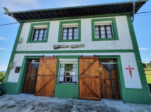
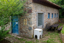
Two bars: one at the start of town and another, El Tendejon, closer to the albergue. El Tendejon keeps the keys to the albergue and is closed on Wednesdays, when the key is available at the shop on the road. The albergue occupies the old school building; its 14th-century predecessor, which served pilgrims on this same route, is now a private home.
Exit town via the road (turn left from the albergue). Before Valsera, the camino will leave the road for 400m.
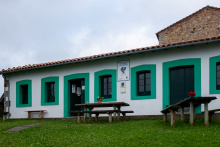
Accommodation in Escamplero.
| Albergue del Escamplero 7€ 16 |
|
| Pensión El Tendejón de Fernando | 
|

A tiny hamlet with the Capilla de Fatima. The camino briefly rejoins the road here before ducking back onto countryside tracks.
The camino rejoins the road in the small hamlet of Valsera, be on the lookout for a marker on your left where you will once again leave the road and follow a track through the countryside. You will once again meet a road shortly before arriving in Premoño.


There's a small picnic area on the way into town. At the end of Premono the camino turns right near a large horreo -- the distinctive Asturian grain store raised on stilts -- and onto a country track. You'll be seeing a lot of these along the Primitivo, both the smaller horreos and the wider, longer paneras.
At the end of town, the camino turns to the right near a large horreo (the square plan structure on stilts) and onto a country track. Cyclists should leave town by staying on the road, down the hill, and to the right at the first junction (PALADIN 1km). It is the same distance and well marked but avoids some unfriendly (for bikes) terrain. Both options descend to the río Nalón.
Paladin offers a bench and shaded rest area, plus a fountain (the fuente lavadero la sierra) tucked about 20 meters behind a house -- turn right at the first road, right again at the entrance to the first house, then straight back. Between here and Penaflor the walking follows the Rio Nalon with the FEVE train tracks on your left, passing through the roadside villages of Puerma and Laracha.
Between Paladin and Peñaflor you will be walking with the río Nalón and the train tracks on your left-hand side. You will pass through the roadside villages of Puerma and Laracha. Peñaflor is on the opposite side of the river when you get to the first bridge. Once you have passed the church on the opposite side of the river, the camino immediately leaves the road to the right to follow signs in the direction of the FEVE railway station.
Accommodation in Paládin.
| Villa Palatina Hostel 22+€ 30 Booking.com |
|

If you rely on road signs to know where you are, Penaflor will confuse you -- it's signed twice, once before the bridge and again after. The bar is the one before the bridge. The town itself sits on the far side of the river. From here the camino ducks under the railway and follows quieter tracks through to Grado.
The camino leaves the main roads and crosses underneath the railway in Peñaflor, and will cross back over them at the outskirts of Grado.


With close to 10,000 inhabitants, Grado is the first proper town since leaving Oviedo and the place to stock up on supplies. A tourist information office sits in the park at the start of town. If you want to explore, cut through the park toward the pedestrian streets to your left, where you'll pass the Capilla de los Dolores and the Iglesia Parroquial de San Pedro.
Grado is known throughout Asturias for its cheese. The Wednesday and Sunday markets are the best time to sample the local varieties, and the quality justifies the detour from the camino. The town's compact center has a pleasant, unhurried feel -- a good place to linger over a coffee before the increasingly rural walking ahead.
Beware guidebooks which erroneously place the Villapañada albergue in Grado, when it is in fact 3.5 km outside of town.
Los Indianos. In the late 19th century, during a period of severe poverty, a great many Asturians, Galicians, Cantabrians, and Basques emigrated to Central and South America. A few struck it rich, and when they returned they poured their fortunes into building elaborate manor homes and financing public works in their birth villages. These Indianos -- named for the Indias, as the Americas were called -- left a distinctive architectural legacy: eclectic, sometimes colonial-styled mansions with palm trees planted as a tribute to their tropical years abroad. The Indianos houses in Asturias are among the finest examples, and you'll spot them throughout Grado and the towns ahead. Many of the schools, hospitals, and public fountains along this route exist because an Indiano paid for them.
A traditional market is held every Wednesday and Sunday.
Leave Grado along the main road (N-634). You will pass the 18th century Fuente de Arriba, from which the people of Grado drew their water before the installation of running water, on your right. Shortly beyond a cruceiro (stone cross) on your left the camino turns left and begins climbing, first on a concrete road and then on a gravel path.
The camino emerges onto the road, turns right, and passes over a newly constructed roadway. It then passes through the hamlets of Cascayal and El Valle (a place with no buildings whatsoever, but which does have a dumpster). At the next road junction is the turn to San Juan de Villapañada.
Accommodation in Grado.
| Albergue de peregrinos Villa de Grado Donativo€ 16 |

|
| Albergue La Quintana 15€ 32 |
|

San Juan de Villapañada and the albergue are about 700m up the road and off the camino. If you spend the night there, retrace your steps to rejoin the camino.
On the way up to El Friesnu you will pass through La Pelona.

The albergue at San Juan de Villapanada is about 700 meters off the camino, up the road. In the 13th century the Order of St. John operated a pilgrim hospital here. These days the hospitality comes from Domingo, who runs the modest albergue.
In the 13th century the Order of St. John operated a hospital for the poor and for pilgrims here, one of several along the Primitivo. The tradition of sheltering pilgrims at this spot has persisted, in one form or another, for over 700 years.
Retrace your steps to get back to the camino as it ascends to El Friesnu.
Accommodation in San Juan de Villapañada .
| Albergue de San Juan de Villapañada 7.50€ 22 |
|

Note: several yellow arrows still direct you uphill from the church in El Friesnu. These are leftover from a detour during construction of the nearby A63 highway. The camino has returned to its original route, which goes downhill from here. Where the camino meets the road, an information board confirms your options -- descend to the left along the old access road.

At the far end of Samarciellu, where the road meets a roundabout, the camino turns left onto a trail to Reaz, and beyond it Doriga.
Accommodation in Samarciellu.
| Casita Mandala Donativo€ 4 |
|

At first sight there appears to be little of note in the tiny village of Doriga -- a church and a bar face each other across the road. But a few meters east (turn right at the church) stands the Palacio de Doriga, an impressive manor whose earliest section, the tower, dates to the 14th century. It's private property, but you can walk up to the gate and admire the garden and facade from a respectful distance. The setting, with the Rio Narcea nearby, gives the palace an elegance that catches you off guard in a hamlet this small.
Shortly beyond Doriga, the camino passes under the highway and on the other side it meets up with the alternate route that went through Cabruñana. Be mindful not to walk the wrong way back up to Cabruñana. The camino turns left sharply onto a narrow trail and descends to the quarry/village of Las Casas del Puente.

With the recent road works in the area, Cabrunana finds itself off the camino proper once again. You can still reach it -- and the albergue is still open -- but it requires a deliberate detour. Beyond the albergue, keep on the road for 2.3 kilometers to rejoin the main route.
Keep on the road beyond the albergue for 2.3km. At that point the camino leaves the N-634 for a side road in the direction of Moratín.
Accommodation in Cabruñana.
| Albergue de Cabruñana 5€ 18 |
|

The large plantations to your left as you walk through Las Casas are often mistaken for vineyards. They're actually kiwi orchards -- grapes grow poorly in this climate, but kiwis thrive. Asturias has become one of Spain's major kiwi producers, and this stretch of the river valley is prime growing territory.
After crossing the bridge into Cornellana there is a sign indicating a trail to your left. This option takes you directly to the albergue without first passing through town. It is the same distance.
There is a large traffic interchange at the end of Las Casas, in the hamlet of La Rodriga. The camino keeps to the left and towards the river. In the summer months there may be a bar open in the park alongside the river.

La Rodriga is the small cluster of buildings at the roundabout before Cornellana. In summer months there may be a bar open in the park alongside the river.

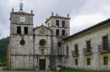
Cornellana sits at the confluence of the Rio Narcea and the Rio Nonaya, a suitably strategic position for a monastery. The Monasterio de San Salvador has been the centerpiece of the town for nearly a thousand years, and the municipal albergue is now housed within it. The church's Romanesque portal, with its carved capitals and archivolts, is worth a careful look before heading inside.
The town itself is small and quiet, essentially the monastery and the services that cluster around it. If you're arriving in the afternoon, the riverside setting is pleasant for an evening stroll.
A monastery has stood here since the early 11th century, founded by Infanta Cristina, daughter of King Bermudo II. In its early centuries it operated as a Cluniac house -- the French monastic reform movement that reshaped religious life across medieval Europe -- and became one of the most important monasteries in Asturias. It was a key stopping point for pilgrims on the Primitivo. The community is now considerably smaller and follows the Benedictine rule.
San Juan is celebrated on the 24th of June, and Nuestra Señora on the 15th of August.
The camino leaves town from the road behind the monastery. Arrows are weakly painted here. Simply follow the road to the left of the monastery, and turn right at the first junction to follow the property line behind the monastery and uphill.
Accommodation in Cornellana.
| Albergue de Cornellana 9€ 31 |
|


600m after Sobrerriba, at a point where the houses crowd the road, the camino turns right onto a mountain track. The track uphill curves to the left and around the mount before descending near a sand pit and the town of Llamas.

Picnic area and the Fuente de Santiago -- a pilgrims' fountain whose name leaves no doubt about its purpose.
Beyond the town you will pass under a roadway. Shortly beyond that you will leave the road and continue by trail, passing over the Puente de Casazorrina.
Just past the fuente the camino leaves the road for a riverside trail on your left.
Gas station on main road.
Between Casazorrina and Mallecín the camino follows a trail, which crosses under the autopista (highway).
Accommodation in Casazorrina.
| Alojamiento La Figal de Xugabolos 15-20€ 6 Booking.com |
|
San Pedro is celebrated on the 28th of June.
Almost everything worth seeing in Salas centers on the Colegiata de Santa Maria la Mayor, a 16th-century church built at the order of Fernando de Valdes-Salas, one of the most powerful and feared men in Spanish history. The Colegiata houses his tomb, an elaborate alabaster work. Adjacent to it stands the Palacio de Valdes-Salas, whose medieval tower -- the oldest structure in town, dating to the 14th century -- now serves as a museum for pre-Romanesque pieces.
The town sits in a narrow valley and has a compact, walkable center. If you've been counting the days since a proper restaurant meal, Salas will oblige.
Fernando de Valdes-Salas (1483-1568) was born here and rose to become Archbishop of Seville and, more consequentially, Inquisitor General of Spain. In that role he oversaw the Spanish Inquisition at the height of its power, personally directing the prosecution of suspected heretics. His legacy is complex: the same man who funded the Colegiata and the University of Oviedo also maintained one of history's most efficient persecution machines.
In 1586, an Italian pilgrim named Bartholomeus Cassanu was caught stealing from the Colegiata. He had a history -- he'd already robbed a church in Zarautz on the Camino del Norte. The judge in Salas showed no leniency. Bartholomeus was hanged, quartered, and his remains displayed along the camino as a warning. Pilgrim crime has declined since.
The Romeria del Viso is held on the 15th of August.
To exit town, carry on under the archway and up the road. There is a fair amount of climbing ahead of you. The climb meets the road at El Llanón, which is easy to miss as its infrastructure counts for little more than an abandoned factory along the road.
Accommodation in Salas.
| Albergue Cielito Lindo 16€ 28 |
|
| Albergue Valle del Nonaya 16*€ 20 Booking.com |

|
| Albergue Casa Sueño 20€ 14 Booking.com |
|
| Albergue de la Campa de Salas 12€ 21 |
|
| Albergue de Salas 9€ 16 |

|

The upward climb out of Salas meets the road at El Llanón, which is easy to miss as its infrastructure counts for little more than an abandoned rest stop along the road. Not long ago this junction posed problems, but the way is now clear. Turn right here and follow the road. You will cross under a pair of large elevated roadways, take a wide turn in the road, and then pass back under the same roadways. Shortly afterwards the camino abandons the road and turns up to the left.

Accommodation in Porciles (Salas).
| Casa de Acogida Tradicional Fontenonaya Donativo€ 19 |
|
Bodenaya doesn't amount to much more than the albergue, but it's a decent albergue and you're welcome to stop for a break. The increasingly rural landscape around here -- chestnut forests, scattered hamlets, cider orchards -- is the Primitivo settling into its character.
Accommodation in Bodenaya.
| Albergue de peregrinos de Bodenaya Donativo€ 10 |
|
The camino passes through La Espina on a secondary street parallel to the main road. If you need services, head to the main road on your left. This is the last place to buy anything until Tineo.
This is the last place to buy anything until Tineo.
At the far end of La Espina keep on straight, do not follow the curve of the N-634.
Accommodation in La Espina.
| Albergue El Texu 22€ 16 |
|
| Albergue Casa Aladino 15€ 18 |

|
| Pensión Dakar ⭑ | 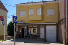
|

Accommodation in La Pereda.
| Albergue El Minero 10€ 20 |
|
El Pedregal no longer offers services to passing pilgrims, but it has two notable camino landmarks. Where the camino turns right off the road, you'll pass El Humilladero, a stone cross installed in the early 18th century to mark the route. Behind it stands the Casa de la Torre o del Hospital, a 16th-century estate with a rectangular tower that once served as a pilgrim hospital. The Iglesia de Justo y Pastor, the parish church, dates from the same century.
Approximately 3.5km beyond Pedregal, the camino nears but does not enter the village of Santa Eulalia de Tineo. Turn sharply right when the camino meets the road at this point.
To reach the municipal albergue in Tineo: from the Capilla de San Roque at the park before town, follow the road and turn left at the first fork (towards the pool). Follow this to the first intersection and turn to the left sharply and downhill. The municipal albergue is the second building.


Tineo was built on the side of a steep valley and everywhere you go feels like a climb, but don't let that keep you in the albergue. The Iglesia de San Pedro anchors the town center, and adjacent to it the Museo de Arte Sacro holds a modest but worthwhile collection of sacred art. The town has enough bars and shops to fill an afternoon.
A detour from Piedratecha (the next village) leads to the ruins of the Monasterio de Santa Maria la Real de Obona, a Benedictine foundation that dates to at least the 11th century. The Romanesque church survives, and the setting in a narrow mountain valley is appropriately atmospheric.
Buy supplies. Between Tineo and Campiello there are no services apart from a fountain at the edge of Tineo.
Tineo's growth traces back to King Alfonso IX, who in the early 13th century mandated that all pilgrims pass through here. At that time the largest pilgrim hospital on this entire route was built -- the Mater Christi. The hospital itself is gone, but remnants of its chapel and exterior walls survive.
San Pedro, patron of the town, is celebrated on the 29th of June. A longer fiesta runs from the 12th to the 18th of August in honor of San Roque.
The camino descends to the center of Tineo as far as the church. From there it turns right and begins the uphill climb out of town on the Calle la Fuente; the fuente is the fountain at the edge of town near a small picnic area.
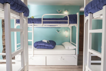
Accommodation in Tineo.
| Albergue El Quinto Pino 18-20€ 26 |
|
| Albergue Palacio de Merás 22*€ 50 |
|
| Albergue La Plaza 18€ 16 Booking.com |
| Albergue Mater Christi de Tineo 9€ 24 |
|
| Pensión La Posada ⭑⭑ Booking.com |

|


After descending from the alto you emerge onto the AS-350 at Piedratecha, which no longer has a bar. About 600 meters along the road, the camino bears left onto a trail. Halfway down the hill to Villaluz there's an optional detour to the ruins of the Monasterio de Obona -- it adds distance but the Romanesque remains are worth it if you have the time and energy.

From Villaluz the camino rejoins the road and passes through the small hamlet of Berrugoso and the abandoned aldea of Las Tiendas. It continues along the road into Campiello.

Two bars in Campiello, and between them they cover everything. Casa Ricardo on the left is a grocery, bar, restaurant, and albergue -- the family has been running it for three generations. Across the street, Casa Herminia operates the other albergue, restaurant, and now a Hotel Rural. Take the dire warnings from the latter's owner about the albergue in Borres with a healthy grain of salt -- it's not luxurious, but you'll survive.
This is the last reliable stop for supplies before Borres and beyond. If you're heading for the Hospitales route, stock up here.
If you plan on continuing to Borres, stock up on food in Campiello.
Keep on the road through and out of town.
Accommodation in Campiello.
| Albergue Hotel Casa Herminia 18€ 18 Booking.com |
|
| Albergue Casa Ricardo 16€ 26 |
|
| Hotel Rural Casa Herminia | 
|

El Espin / El Fresno sits along the road, with the albergue about 150 meters into the village. At the far end of El Fresno the camino turns left onto a smaller road, leaving it 300 meters later for a countryside track into Borres.
At the end of El Fresno the camino turns left onto a smaller road, and then leaves that road 300m later to follow a track through the countryside and into Borres.
Accommodation in El Espin / Fresno.
| Albergue de peregrinos Casa Pascual Donativo€ 11 |
The camino returns to the road in Borres, and immediately crosses it to climb up and out of town on the other side.
Accommodation in Borres.
| Albergue Santa María de Borres 9€ 20 |
|
| Albergue La Montera 19€ 10 |
|

The high point of the Hospitales route. On clear days the panorama extends across the entire Cantabrian range. On bad days you'll see nothing but your own feet and the path ahead. Either way, from here it's downhill.

This is the last bar, and source of water, for quite a distance for anybody following the route through hospitales.
The bar is no longer open -- plan accordingly. This is where the Hospitales route and the valley route through Pola de Allande rejoin.
Cross the road in front of the bar and turn right (uphill) on the first road. Where it ends, turn left and soon you will rejoin the camino that arrives from the first split.

Accommodation in Colinas de Arriba.
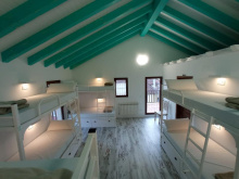
| Albergue Los Hospitales 22.5*€ 20 Booking.com |
Two friendly bars, one at the beginning and one at the end of town. Both have a stamp. The second closes on Sunday evenings and Saturdays.

At the Alto the Chavadoira the camino leaves the road on a track to your left. From there it descends to Pola through Ferroy.

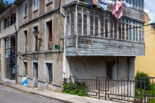
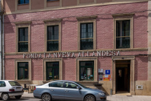
Pola de Allande sits on the bank of the Rio Nison and has never been easy to reach -- which explains why the medieval pilgrim hospitals were built up on the mountain passes rather than down here. The town is small but welcoming, and the Hotel La Nueva Allandesa routinely earns praise from pilgrims for generous portions of Asturian home cooking.
The Palacio de Cienfuegos de Penalba, a Renaissance manor, stands at the edge of town. Pola has been the historical capital of the Allande concejo -- a municipality that encompasses some of the most rugged terrain in western Asturias.
The camino leaves Pola along the road and passes the village of El Mazo.
Accommodation in Pola de Allande.
| Albergue de Peregrinos de Pola de Allande 10€ 24 |
|
| Albergue La Casita de Aba 22€ 28 |
|
| Polagrino Donativo€ 15 |
|

Turn left off the road towards the village of El Mazo.
Penasieta and its albergue are not on the camino -- signs point the way, and the albergue notes explain how to get the keys from the bar on the road. If you're staying here, resist the temptation to follow the road out in the morning. The trail option, while steeper, is considerably more beautiful. The climb ahead gains about 600 meters up to the Alto de Palo, with several brutally steep sections.
From Peñasieta, the climb begins. The preferred, and more beautiful, route is along the trail so if you spent the night in Peñasieta avoid the temptation of following the road (even though it will get you there). The elevation gain is about 600 meters up to the Alto de Palo, with a few particularly steep sections along the way.
Accommodation in Peñasieta.
| Albergue de Peñaseita 5€ 12 |
|

There is now a food truck at the alto, a much needed service along this stretch.
Welcome to the top. Be mindful of the way down, which is poorly signed.The best way is to keep the road, and the guard rail, to your left while following the curve in the road. It soon joins a track and descends into Montefurado.

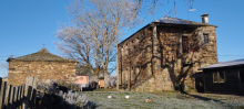
Montefurado is largely abandoned, with only a handful of occupied houses remaining. One has a tap you can use for drinking water -- ask first as a courtesy. A small chapel dedicated to Santiago stands as a reminder that pilgrims have been passing through here for over a thousand years. The name likely derives from the Latin mons foratus -- pierced mountain -- a reference to Roman mining tunnels in the area.
Pass through town and follow the trail to your left. You will have to step over a small wall. When the trail rejoins the road (AS-14) a few km onward, you can either stay on the track or follow along the road to Lago.


Just beyond town the camino again leaves the road in favor of a trail to your right. It will rejoin the road and then leave it again for a smaller side road to your left towards Berducedo.
Berducedo is roughly halfway between Pola de Allande and Grandas de Salime, making it a natural stopping point. The village is small but has the essentials. Nearby, the Chao San Martin archaeological site preserves a settlement with Bronze and Iron Age layers -- evidence that these mountain passes have been traveled for millennia.
The camino follows the road uphill for a quick ascent of about 80m and then descends another 100m into La Mesa.
Accommodation in Berducedo.
| Albergue de peregrinos de Berducedo 10€ 24 |
|
| Albergue Camino Primitivo 20€ 38 |
|
| Casa de Aldea Araceli Booking.com |
|

The albergue in La Mesa comes with a bar and restaurant attached -- a welcome combination at this altitude. Pay close attention to the arrows when leaving: four roads meet here besides the one you came in on. The camino follows the road steeply uphill to Buspol.
Pay close attention to the arrows when leaving town, there are 4 roads not including the one you walked into town on. The camino follows the road steeply uphill all the way to Buspol.
Accommodation in La Mesa.
| Albergue Miguelín 20€ 21 Booking.com |
|

The Capilla de Santa Marina de Buspol is the only building of note. The weather here frequently wraps the hilltop in a rainy mist that obscures what would otherwise be a dramatic view of the Embalse de Salime reservoir below. The descent ahead -- over 750 meters of elevation loss to the dam -- is steep and relentless.
At the sharp curve in the road in Buspol, the camino finally leaves the road in favor of a mountain track.
NOTE: It is almost entirely downhill to the dam of the reservoir, a descent of over 750m and often very steep. Furthermore, the trail crisscrosses several other mountain tracks, look carefully for the arrows and avoid the temptation to shortcut the switchbacks.

A bar and restaurant sit about 1 kilometer from the dam on the way back up. The dam itself is an imposing structure of raw concrete, built in a narrow gorge.
The hydroelectric dam was completed in the early 1950s, one of Franco's massive infrastructure projects. The abandoned concrete structures on the north side are leftovers from its construction -- most of the materials, particularly the concrete, had to be produced on site in this remote mountain valley. Building it required flooding villages and displacing communities, a story repeated at reservoirs across Spain during the dictatorship.
What goes down must go up, in this case it is about 300m back up to Grandas de Salime. It is mostly, but not entirely, along the road. Along the way is a scenic overlook (about 2km from the dam). Shortly after the most severe turn in the road (a 180 degree bend) the camino turns left to follow a trail uphill.
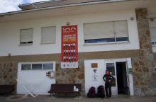
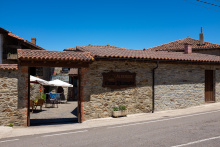
Accommodation in Embalse de Salime.
| Albergue & Hotel Las Grandas 15€ 6 Booking.com |
|


Grandas de Salime is the largest town since Salas and the first place in a while where you can properly stock up. The Iglesia de San Salvador stands at the center, and several 18th-century manor homes -- built by returning Indianos -- are scattered through the streets.
The gem of the town is the Museo Etnografico de Grandas de Salime, one of the finest ethnographic museums in Asturias. It has more objects in its collection than you could possibly take in during a single visit, documenting every aspect of traditional rural life in these mountains -- from cider-making to linen-weaving to cattle-herding. If you have an afternoon to spare, this is where to spend it.
Nuestra Senora del Carmen is celebrated on the 2nd and 3rd of July. San Salvador is celebrated during the first weekend in August.
The camino leaves town along Calle Carmen and passes the Capilla de Carmen before joining the AS-28 highway for several parts; leaving and rejoining between towns on its way up to the alto that marks the border between Asturias and Galicia. There is one more albergue on the Asturian side of the border, in Castro. The first hamlet you come to, that of La Farrapa, has no services for pilgrims.
Accommodation in Grandas de Salime.
| Albergue de El Salvador (Grandas de Salime) 10€ 28 |
")
|
| Albergue Casa Sánchez 17-18€ 16 |
|
| Albergue Porta de Grandas 17€ 26 |
|
| Restrepo | |
| Pensión Arreigada Booking.com |
|
| Hostal Occidente |
| Hotel La Barra ⭑⭑ | 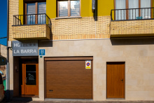
|

Two bars: Casa Federico in the village center, which also doubles as a small shop, and another at the far end of town on the main road. Between here and Castro you'll pass the Capilla de la Esperanza de Malneira, a small roadside chapel.
Just past the bar located on the main road the camino turns right to follow a quieter path. Between Cereijeira and Castro is the small Capilla de la Esperanza de Malneira.


The ruins of the Castro de Chao Samartin are visible to the west when leaving town -- a prehistoric hillfort with occupation layers spanning the Bronze Age through the Roman period. A small museum adjacent to the camino offers guided visits to the site. The excavations have revealed sophisticated stonework and metalworking that challenge assumptions about the capabilities of pre-Roman communities in these mountains.
This is the last settlement in Asturias. The alto ahead marks the border with Galicia, and with it a shift in landscape, language, and architecture that you'll notice almost immediately.
Accommodation in Castro.
| Alojamiento Casa Bubela 30*€ 5 Booking.com |
|
| Albergue de Castro 15€ 16 |
|
| Hotel Rural Chao San Martín ⭑⭑⭑⭑ | 
|
