Atalaia is a small village between Vila Velha de Rodao and Sarnadas. No notable services for pilgrims. The camino passes through on its way north through the pine forests of the Beira Baixa.
Sarnadas is a small village on the road to Amarelos. No services of note. The landscape is transitioning from the flat Alentejo to the hillier terrain of the Beiras.
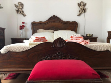
Amarelos is a small but welcoming village whose only services are a bakery and a basic albergue. To stay at the albergue, call Sebastiao on +351 272 989 560. Dinner can also be arranged through Sebastiao.
The last 8 km into Castelo Branco is on asphalt through industrial and commercial zones before finally reaching the town center.
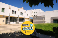
Castelo Branco is a large town with all services. Not much remains of the castle itself, but it's worth a look for the views. The Jardim do Paco Episcopal is the town's most distinctive attraction — a hedge maze containing statues of Portuguese monarchs and other figures, unlike anything else you'll see on the Nascente.
The town has accommodation at every level, supermarkets, restaurants, and good transport connections.


There is a worthwhile detour to a two-arch Roman bridge about 600 m off the camino in Cafede. Turn left off the main road past the blue-and-white fountain, and the Roman bridge is just past a modern bridge. No services.
Povoa de Rio de Moinhos is a small village between Cafede and Soalheira. No notable services for pilgrims. The village sits in the foothills below the Serra da Gardunha, and the terrain is beginning to shift from the flat expanses of the Beira Baixa plains toward the mountains ahead.
Soalheira takes its name from its position on the sun-facing southern slope of the Serra da Gardunha. It's a proper village with a restaurant, an ATM, shops, and a gas station. The Beira Baixa railway line stops here, and there are daily buses to Fundao, Castelo Branco, and Covilha.
The area is known for sheep's milk cheese production — Queijaria Quinta do Pomar, just outside the village, has won international awards for its queijo de ovelha.
Castelo Novo is a delightful village and the first of the Aldeias Historicas (Historic Villages) on this camino. Belmonte and Trancoso are the other two on the Nascente; there are 12 in total in this region, all connected by the GR22 trail. Castelo Novo is small and can be explored in half an hour or so, and there are great views from the castle ruins.
O Lagarto is the only restaurant in the village. Outside the peak months of July through September, it's only open for lunch but will open for dinner for pilgrims if notified in advance. The number is +351 275 567 406.
The camino from Castelo Novo to Alcongosta is a spectacular mountain stage. On the way down, just before the white domes of the Natura Glamping site, the arrows turn right on the road. A better trail is to go straight (with the domes to the right) and shortly after turn left onto a switchback trail down the mountain.

Alcongosta is the heart of Portugal's cherry-growing region. If you pass through around the end of May, cherries will be ripe and readily available. Note the cherry mosaics in the calcada portuguesa pavement throughout the village — a tribute to the fruit that defines the local economy. The broader Fundao region produces over 60% of Portugal's cherries, and the Cereja do Fundao carries a Protected Geographical Indication (PGI) dating back to 1994.
The village has a cafe and limited services.
Fundao is the largest town between Castelo Branco and Guarda, and the self-proclaimed cherry capital of Portugal — though nearby Alcongosta might dispute that. The annual Festa da Cereja in late May or early June draws over 100,000 visitors.
Beyond cherries, Fundao has all the services you'd expect from a regional center — supermarkets, restaurants, banks, pharmacies, accommodation at various levels, and good transport connections by bus and rail.
Leaving Fundao requires crossing a railway line. Earlier accounts suggest crossing at the station itself, while the arrows point further north. Either way, you're likely to find yourself at a roundabout or two on a busy road before the camino becomes more rural again.
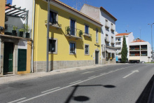
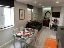
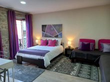
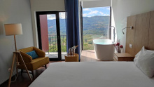
Accommodation in Fundão.

Valverde is a village on the outskirts of Fundao with a small ethnographic museum and an Intermarche supermarket — useful if you need to stock up. No other notable services for pilgrims.
Pero Viseu is worth a stop for its Roman bridge, a three-arched span with the original flagstone paving still intact. Nearby, a Roman territorial boundary stone marks the ancient frontier between the Igaeditani and Lancienses Oppidani peoples. A Moagem - Cidade do Engenho e das Artes, an arts center in a converted mill, is also worth a look if it's open.
No services of note for pilgrims.
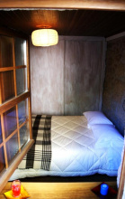
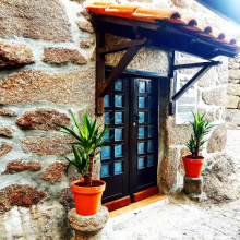
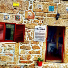
Ferro is a fairly nondescript village but it has a simple albergue in the former house of the village priest. The albergue has a kitchen, and there's a Mais Perto mini-market nearby for supplies. Call +351 964 302 817 in advance to confirm availability.
Peraboa has a Cheese Museum (Museu do Queijo) that's worth a visit if it's open — the Beira region is serious cheese country, and this is a good introduction to artisan production methods. The village also has a pharmacy, bakeries, and a couple of restaurants.
Peraboa is administratively part of the Covilha municipality, and you're now on the eastern flanks of the Serra da Estrela.
Caria is a village in the Belmonte municipality with roots going back millennia — archaeological sites in the area date back 6,000 years, and King Manuel I granted Caria its charter in 1512. Today it's a quiet place with a cultural center, a philharmonic band, and a couple of cafes.
The hamlet of Malpique, the next stop on the camino, falls within the Caria parish.
Malpique is a hamlet within the Caria parish. There's a heritage fountain (Fonte de Malpique, built 1936), a small chapel, and a cultural center — but no services for pilgrims. Roman vestiges have been found nearby.
Belmonte Gare is the railway station area, not the historic center of Belmonte itself. The station serves the Beira Baixa line with Intercidades, Regional, and InterRegional services — useful if you need to reach Covilha, Fundao, or Castelo Branco by train. The historic center of Belmonte is about 3 km uphill.
Belmonte is the second of the Aldeias Historicas on the Nascente, larger and more touristy than Castelo Novo. The castle is well preserved and worth visiting, and the Igreja de Santiago near the castle entrance is a fitting stop for pilgrims. Several sites relate to the town's centuries-old Jewish community — the Museu Judaico de Belmonte and a synagogue that was only opened publicly in 1996, after the community practiced in secret for nearly 500 years.
Pedro Alvares Cabral, who reached Brazil in 1500, was born here. There's a monument to him and a small museum of discovery-era artifacts.
Belmonte has accommodation, restaurants, cafes, and a supermarket.


Catraia da Torre is a small village with no services. The name refers to the nearby Roman tower.
The camino passes a mysterious Roman tower from the 1st century AD. Its exact function is unknown, but the architecture suggests a military purpose — possibly a watchtower or signal station on the Roman road network.
Valhelhas sits at the entrance to the Serra da Estrela, continental Portugal's highest mountain range. The village has a river beach on the Zezere and basic services — a cafe and a mini-market. From here, the terrain becomes noticeably more mountainous.
About 1.5 km after Valhelhas, the camino turns left onto a secondary asphalt road. After 250 m, turn right onto the dirt road (there is no arrow) instead of continuing straight.