Aguiar is a small village on the long stage between Viana do Alentejo and Evora. No pilgrim services. After Aguiar, the camino follows the N254 for about 15 km — a busy road that can be unpleasant.
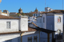
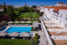
Evora is the capital of the Alentejo and a UNESCO World Heritage Site. It has plenty of attractions, including a Roman temple (the so-called Temple of Diana), an impressive cathedral, and the Capela dos Ossos (Bone Chapel) at the Igreja de Sao Francisco — its walls and columns lined with the bones and skulls of 5,000 monks. The uniform whitewashed architecture with yellow trimmings makes Evora a delight for wandering, sore pilgrim feet permitting.
Pane e Vino is an excellent Italian restaurant in the center, while Salsa Verde is a popular vegetarian option with a buffet lunch and dinner.
Evora has all services — accommodation at every level, restaurants, supermarkets, a bus station, and a train station. It's worth spending a full day here if your schedule allows.
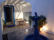
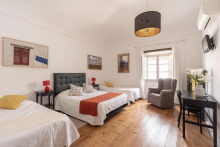
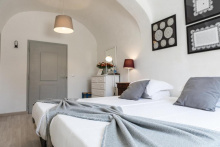
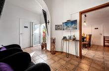
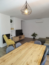
Accommodation in Évora.


Nossa Senhora de Machede is a small village east of Evora. No notable services for pilgrims. The camino passes through on its way to Sao Miguel de Machede.
For a true camino experience, call Dona Joana in advance on +351 961 687 306 and arrange to stay with her in Sao Miguel de Machede. She has set up a remarkable pilgrim annex in her backyard as a donativo — a room with a double bed and two bunk beds, an attached bathroom, and a basic outdoor kitchen for cooking. It's a handy option as there aren't many places to eat out.
The village has limited services beyond Joana's hospitality.
During the first part of the next stage to Azaruja, there's a gate that is often closed. Joana will make a point of trying to arrange for it to be opened, but if you have to climb it, it's not that hard.
Azaruja is home to Portugal's oldest bullring, though it's abandoned now.
If you're interested in cork, consider a 1.3 km detour (each way) from the bullring to Corticarte. There, David will explain the process of cork extraction and production, and there are interesting items in the shop. Call English-speaking David in advance on +351 967 790 218 to confirm a visit.
Azaruja has a cafe and limited services.
The camino doesn't go up to the castle of Evora Monte, but it's a must for the exceptional views of the countryside as well as the fortifications.
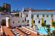
Consider splurging to stay at The Place, the only accommodation inside the castle walls. The charming hotel takes full advantage of multiple terraces for fabulous views, and expatriate owners Vicky and Mitch are extremely welcoming, give personal attention, and serve excellent food.

Defesa is a tiny hamlet between Evora Monte and Estremoz. No services. The camino passes through on quiet roads with views of the marble-quarry landscape that characterizes this part of the Alentejo.
Estremoz is an interesting town well worth exploring. Entering through the Evora Gate reveals a characterful neighborhood containing some abandoned buildings, while the northeastern part of the old town is more affluent. Inside the castle, a 16th-century Manueline prison has been tastefully converted into the bar and restaurant A Cadeia Quinhentista.
The Museu Berardo Estremoz (opened July 2020) showcases 800 years of Portugal's famous azulejos (polished tiles). It contains the largest private collection in the country and is fabulously presented.
There are several workshops and shops showcasing bonecos (dolls or figurines), a local Estremoz tradition. Afonso Ginja, one block west of the castle entrance, is worth a look. To get an official stamp, go to the Museu Municipal inside the castle.
Estremoz has all services — accommodation, restaurants, supermarkets, and a pharmacy.
Leaving Estremoz, the old route went through Santo Amaro, but the newer, more rural route goes through Sousel — both join up before Fronteira. To take the Sousel route, follow the arrows left off the road at Monte da Granja.

Silveirona is a small hamlet on the road between Estremoz and Sousel. No services. The camino passes through on quiet rural roads.
Sousel is a fairly nondescript town with one interesting quirk for pilgrims: an abandoned building at Rua de Sao Pedro 30 with two scallop shells and two swords carved into the facade, thought to have been a medieval albergue. Nearby, Hospedaria de Roda is a 3-star hotel with a modern shell and sword on its facade as an homage.
Sousel has basic services — cafes, small shops, and accommodation.
Leaving Sousel, an easy-to-miss arrow on the N372 directs pilgrims off the road to the left.
About 6.5 km before Fronteira, the camino turns off the road to the left and follows the disused railway line. The first 2 km is on ballast and quite difficult, especially the initial stretch. Consider staying on the road for those 2 km, then joining the railway tracks at the sign for the Monument to the Battle of Atoleiros. From there, the tracks become a walking-friendly eco path all the way to Cabeco de Vide.
After slightly more than 2 km on the eco path, the camino turns left and makes a large loop through the center of Fronteira — not strictly necessary. If you're staying at the Bombeiros or continuing past town, stay on the more direct eco path.
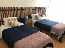
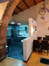
Accommodation in Sousel.

The Bombeiros (fire department) offer free accommodation to pilgrims in an annex across the road from the fire station in the southern part of town. The rooms are twin rooms with private bathrooms — simple but adequate. The bombeiros also have an official stamp.
Fronteira has basic services — cafes, a small supermarket, and a pharmacy.
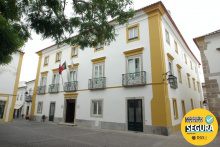
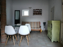
Accommodation in Fronteira.
The Termas da Sulfurea hotel offers a significant discount for pilgrims. Other than this, there's not much reason to stay here — the baths are for health purposes rather than recreation.
Cabeco de Vide has limited services.
The camino path doesn't go up to the castle at Alter Pedroso, but it's worth the short detour for beautiful views over the valley below and down to Alter do Chao. The castle itself is in ruins, but the panorama is the point.
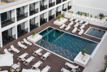
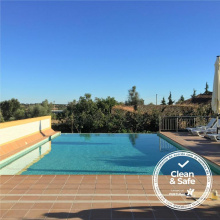
The Hotel Convento D'Alter, a 17th-century convent turned 4-star hotel, is good value, and the pool is very welcome on a hot Alentejo day.
Visiting the Roman Casa da Medusa is by infrequent guided tour only. Call the Palacio do Alamo in advance on +351 245 612 385 for the tour schedule.
Alter do Chao has basic services — cafes, small shops, and accommodation.
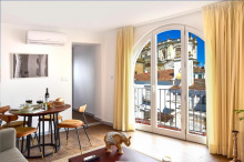
Accommodation in Alter do Chão.
Crato is a small town with basic services. Maria Isabel offers accommodation to pilgrims but lives 10 km from Crato. She can be reached at +351 910 129 003.
The town has cafes, shops, and a pharmacy.
There is no shop in Vale do Peso, despite some sources claiming it's the last place to stock up before Alpalhao. Buy what you need in Crato. If the timing is right, there's a picnic area just past Vale do Peso.

The impressive medieval fortress-church at Flor da Rosa only opens at 9:30/10 am depending on the day and season — too late for most pilgrims staying in Crato to visit in the morning. An alternative is to visit the afternoon before, as it's only a 25-30 minute walk from Crato. You can also stay in the pousada at the monastery.
Vale do Peso is a small village between Flor de Rosa and Alpalhao. Despite some guidebook claims, there is no shop here. There's a picnic area just past the village.
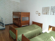
Accommodation in Vale do Peso.
| Casa do Peso ⭑⭑⭑⭑ Booking.com |
|
In Alpalhao, Regata is a good and popular restaurant. On weekends, a reservation may be necessary. The village has basic services.
The local government in Nisa is keen to promote the town's camino connection, as evidenced by information boards about the Caminho Portugues Interior throughout the municipality. Way-marking shells in and around Nisa pay homage to the town's pottery tradition — look for the distinctive ceramic shells.
Residencial Sao Luis is a good budget accommodation option, owned by Jose, a pilgrim himself who is knowledgeable about the camino in this area.
Nisa has basic services — cafes, shops, a pharmacy, and accommodation.
Just before entering Pe da Serra, the camino turns left off the road and skirts the village. To enter the village, stay on the road.
Pe da Serra is a small village on the descent toward Vila Velha de Rodao and the Tejo river crossing. No notable services. The camino skirts the edge of the village unless you stay on the road to enter it.
Vila Velha de Rodao makes for a spectacular entry into the Beiras — not for the town itself, which is nothing special, but for its location. The town sits on the north side of the Tejo river, and the final approach from the Alentejo side offers fabulous views of the river and the Portas de Rodao, giant rock formations rising from both banks.
To appreciate the scenery further, there are boat trips to the "gates" organized by the Vila Portuguesa restaurant (Tuesday through Sunday, last trip at 3 pm). Alternatively, a marked trail leads to the castle atop the rocks on the Beiras side (about 40 minutes each way from the bridge). Only one tower remains — said to have been built by the Visigothic king Wamba in the 7th century — but the views are worth the climb.
The town has basic services.
Leaving town, the first 4 km is on a paved road in sight of large factories. After this, the surface and views improve significantly as the camino becomes a dirt road through pine forest.
