San Martín de Valdeiglesias is a sizeable town in the foothills of the Sierra de Gredos, with all basic services. The Castillo de la Coracera — a well-preserved 15th-century castle — is the main attraction. Isabel la Católica was proclaimed Queen of Castile within its walls in 1467, a rehearsal for the formal coronation that followed in Segovia.
The surrounding area produces Garnacha wines under the Vinos de Madrid denomination. The town has a pleasant, lived-in character and makes a good overnight stop before the mountain crossing to Ávila.
The Castillo de la Coracera was built in the 15th century by Don Álvaro de Luna (the same figure who built Escalona's castle). After his execution, the castle passed to the Crown. In 1467, a group of Castilian nobles staged a symbolic ceremony here, proclaiming the young Princess Isabel as the rightful Queen of Castile over her brother's choice of successor — a political act that would eventually reshape Spanish and world history.
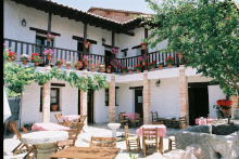
Accommodation in San Martín de Valdeiglesias.
| Hostal El Pilar |
Cebreros is the last substantial town before the climb into the mountains. It's a wine town — the Garnacha vineyards on the surrounding slopes produce wines that are gaining recognition beyond the region. The town has all basic services including accommodation, bars, restaurants, and supermarkets.
Stock up here. The next section involves a serious mountain crossing through the Sierra de la Paramera to Ávila, and services are minimal between Cebreros and the city.
Accommodation in Cebreros.


San Bartolomé de Pinares is a small mountain village famous for one extraordinary tradition: the Luminarias de San Antón, held every January 16th. Riders on horseback leap over bonfires in the village streets — a purification ritual for the animals that dates back centuries. Outside of January, the village is quiet and has minimal services.
The camino passes through pine forests and increasingly mountainous terrain. You're climbing now, and the air is noticeably cooler than on the meseta.
The Luminarias de San Antón (January 16) is one of Spain's most visually spectacular local fiestas. Horses and their riders jump through bonfires lit in the village streets, in a purification ritual dedicated to San Antón, the patron saint of animals. The tradition has drawn controversy from animal welfare groups but continues with strong local support.
Accommodation in San Bartolomé de Pinares.
| Municipal Pilgrims’ Hostel in Health Centre 8 |
| Casa Rural El Molino |
| Hostal El Patio |
Herradón de Pinares is a small mountain village surrounded by pine forests. Minimal services — there may be a bar. The village sits at altitude, and the walking through here is mountainous and beautiful. Ávila is close now — the next section crosses the Sierra de la Paramera and drops down to the walled city.
Accommodation in Herradón de Pinares.
| Casa Rural El Médico I and II Booking.com |
Tornadizos de Ávila is a small village on the eastern approach to Ávila. No notable services. The village sits on high ground, and you can already see Ávila's walls in the distance — one of the most iconic skylines in Spain. The walking through here is on open, exposed terrain at altitude. Expect wind.
Accommodation in Tornadizos de Ávila.
Ávila's medieval walls are the best-preserved in Europe — 2.5 km of unbroken fortification, 88 towers, and 9 gates encircling the old town. The first sight of them from the meseta is unforgettable, and walking along the top gives you a soldier's-eye view of the Castilian plain stretching in every direction.
Inside the walls, the Cathedral doubles as a fortress — its apse is built directly into the city wall, forming one of the defensive towers. The interior is a fine example of transitional Romanesque-Gothic architecture. The Basílica de San Vicente, outside the walls, is one of the most important Romanesque churches in Spain.
Ávila is the city of Santa Teresa, the 16th-century mystic and reformer who was born here. The Convento de Santa Teresa marks her birthplace, and sites related to her life and the Carmelite reform are scattered across the city.
The city has all services — good restaurants, accommodation at every level (the Parador is inside the walls), supermarkets, and transport connections. The local specialty is chuletón de Ávila — a massive grilled T-bone steak from the local breed of cattle. The yemas de Santa Teresa, egg-yolk sweets, are the traditional dessert.
At 1,131 m above sea level, Ávila is one of the highest provincial capitals in Spain. Pack warm clothes — even in summer, evenings can be cool.
Ávila's walls were built in the late 11th century as the Christian frontier advanced south during the Reconquista. The city was repopulated by settlers from northern Castile, and its position on the meseta made it both strategically important and brutally cold. Santa Teresa de Jesús (1515-1582), born here, reformed the Carmelite order and produced some of the finest mystical literature in any language. She was declared a Doctor of the Church in 1970.
The Fiesta de Santa Teresa (October 15) celebrates the city's patron saint with religious ceremonies, processions, and cultural events. Summer festivals in June-July feature medieval markets and theatrical performances in the streets around the walls.
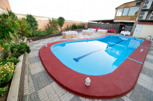
Accommodation in Ávila.


Narrillos de San Leonardo is a small village on the meseta north of Ávila. No services. The landscape is open and flat — you've crossed the mountains and are now on the Castilian meseta proper. The terrain is agricultural, with cereal fields and scattered villages connected by straight roads.
Cardeñosa is a small village on the meseta. There may be a bar, but don't rely on it. The village is known locally for its association with the Verracos — pre-Roman stone sculptures of bulls and boars that dot the Ávila countryside. These mysterious Celtiberian monuments are among the oldest human artifacts in the region.
Accommodation in Cardeñosa.
| Casa Rural La Granja |
Peñalba de Ávila is a small village on the meseta between Cardeñosa and Gotarrendura. No notable services. The landscape is classic Castilian meseta — flat, cereal-covered, and enormous. The sky feels bigger here than anywhere else on the Levante.
Gotarrendura has a connection to Santa Teresa — the family had a country house here, and the young Teresa spent time in the village. A small museum and the Ermita de la Encarnación mark the connection. Beyond the Teresan connection, the village is a typical Castilian meseta settlement — small, quiet, and agricultural.
Minimal services — there may be a bar.
Accommodation in Gotarrendura.
| Albergue de Peregrinos Entre adobes Donativo€ 4 |
Hernansancho is a small village on the meseta. No notable services. The walking through this part of Ávila province is flat and straight — the kind of walking that's meditative if you let it be and tedious if you don't. The horizon line is unbroken in every direction.
Accommodation in Hernansancho.

Villanueva de Gómez is a tiny village on the meseta between Hernansancho and El Bohodón. No services. These small meseta villages share a common architecture — stone or adobe houses, a church square, a few streets, and silence.
Accommodation in Villanueva de Gómez.
| Casa Rural la Fragua |
El Bohodón is a small village on the meseta approaching Arévalo. No notable services. The landscape is beginning to show the influence of the Mudéjar architecture that defines Arévalo and the surrounding towns — brick and stone combinations that reflect the region's mixed Christian-Moorish heritage.
Accommodation in El Bohodón.
| Casa Doña Anita |
Tiñosillos is a small village on the final approach to Arévalo. No notable services. Arévalo is close now — you can see its towers from the meseta. The walking is flat and straightforward.
Arévalo is a fine Mudéjar town at the confluence of the Adaja and Arevalillo rivers. The Mudéjar architecture here — brick churches with geometric patterns and ornamental towers — is some of the best in Castile. The Plaza de la Villa, with its arcaded medieval square, is particularly handsome.
The Castillo de Arévalo, where Isabel la Católica spent part of her childhood, sits at the point where the two rivers meet. The castle is being restored and can sometimes be visited.
Several churches are worth entering: San Martín, San Miguel, and Santa María la Mayor all have fine Mudéjar elements. The town has all basic services — supermarkets, bars, restaurants, pharmacy, and accommodation.
Arévalo is also known for its roast suckling pig (tostón) — the local restaurants compete fiercely for the title of best in town.
Arévalo was an important medieval town, partly because of its position on the route between Ávila and Valladolid and partly because of its strong Mudéjar community. The term "Mudéjar" refers to Muslims who remained in Christian-controlled territory, and their architectural influence — blending Islamic geometry with Christian building forms — defines the town's character. Isabel la Católica lived here as a girl, and the memory of her childhood in Arévalo is still a source of local pride.
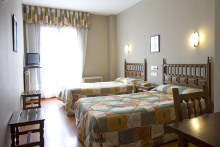
Accommodation in Arévalo.

Polígono Tierra de Arévalo is an industrial/commercial zone on the outskirts of Arévalo. No pilgrim services. The camino passes through briefly on the way out of town. It's not scenic, but it's short.
Palacios de Goda is a small village on the meseta between Arévalo and Ataquines. No notable services. The landscape is flat cereal country — the Tierra de Arévalo, a sub-region of the Castilian meseta known for its wheat and its silence.
Ataquines is a small village on the meseta with minimal services — a bar may be available. The village sits on the flat, open plain between Arévalo and Medina del Campo. The walking is straight and exposed, but Medina del Campo is getting closer.
San Vicente del Palacio is a tiny village on the approach to Medina del Campo. No services. The towers and walls of Medina's Castillo de la Mota may already be visible on the horizon — one of the most impressive castles in Castile, and a fitting reward for the long meseta crossing.
Accommodation in San Vicente del Palacio.
Medina del Campo is one of the great historic towns of Castile, and the Castillo de la Mota — a massive 15th-century brick fortress with a distinctive keep — is one of the finest castles in Spain. The castle served as a state prison (Cesare Borgia was held here) and as a royal residence. It can be visited, and the interior is impressive.
The town was one of the most important trading centers in medieval Europe. The Ferias de Medina — great commercial fairs held here from the 15th century — drew merchants from across the continent and helped establish modern banking practices.
Isabel la Católica died here in 1504, in the Palacio Real Testamentario, which is now a small museum. The Plaza Mayor is one of the largest in Spain — its vast dimensions reflect the market fairs that once filled it.
Medina has all services — good restaurants, accommodation, supermarkets, and a railway station with connections to Valladolid and Madrid.
Medina del Campo's commercial fairs, established in the 15th century, were among the most important in Europe. The fairs pioneered financial instruments that are considered precursors to modern banking — letters of exchange, credit notes, and insurance contracts were all developed or refined here. The expression "there's law in Medina" (hay ley en Medina) became a byword for commercial justice. Isabel la Católica chose Medina as her final resting place, dying here on November 26, 1504.
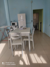
Accommodation in Medina del Campo.
| Youth hostel 120 |
| Hostel in the Convent of Carmelitas Donativo€ |
|
| Hostal El Orensano ⭑ | |
| Hostal Doña Alicia | |
| Hostal La Plaza ⭑ |
| Hotel San Roque ⭑⭑⭑ |
Nava del Rey is a wine town on the edge of the Rueda denomination — the white wines from this region, made primarily from the Verdejo grape, are among the best in Spain. The town has a handsome Plaza Mayor, several churches, and the relaxed atmosphere of a Castilian agricultural center.
All basic services are available — bars, restaurants, supermarket, pharmacy. The local wine is reason enough to stay for dinner.
Accommodation in Nava del Rey.


Siete Iglesias de Trabancos — "Seven Churches of Trabancos" — takes its name from the seven churches the town once had, though not all survive. The town is small and has minimal services, but the name alone is worth the stop. The Castilian meseta continues, flat and vine-covered in this Rueda wine region.
Accommodation in Siete Iglesias de Trabancos.
Castronuño sits on dramatic cliffs above the Río Duero — the views over the river valley are the best you'll see on this stretch of the Levante. The Mirador del Duero is worth a pause. The town has a ruined castle and a church with a fine retablo.
Basic services are available. Castronuño is one of the more scenic stops on the Castilian meseta — the cliff-edge position gives it a character that the flat villages behind you lack.
Accommodation in Castronuño.
| Albergue Municipal de Castronuño 5€ 9 |
| Casa Rural Casamona | |
| Casa Rural Beautiful Alamedas |
Villafranca de Duero is a small village on the Río Duero between Castronuño and Toro. Basic services may be available — a bar if you're lucky. The Duero river is a constant companion through this section, and the surrounding vineyards produce some of the grapes that go into the powerful reds of the Toro denomination.
Toro is a wine town with a magnificent church. The Colegiata de Santa María la Mayor is a Romanesque-Gothic masterpiece — its western portal, the Pórtico de la Majestad, retains original polychrome paint on its carved figures, making it one of the most vivid examples of medieval architectural color in Spain. The interior is equally impressive.
The town sits on a bluff above the Duero, and the views from the Mirador del Espolón are sweeping. Toro's wines — big, powerful reds made primarily from the Tinta de Toro grape (a local variant of Tempranillo) — have gained international recognition. You'll find them in every bar in town, and they're at their best with the local grilled meats.
Toro has all basic services — restaurants, accommodation, supermarkets, pharmacy. It's the most rewarding town between Medina del Campo and Zamora, and worth an overnight stop.
Toro has been strategically important since Roman times. The Battle of Toro (1476) secured the throne of Castile for Isabel la Católica and Ferdinand. The Laws of Toro (1505) codified Castilian inheritance law and remained in force for centuries. The town's wines were famous in the Middle Ages — they were reportedly served to Columbus's crew and traveled well on long voyages.
Accommodation in Toro.
Granja Florencia is a small hamlet between Toro and Villalazán. No services. The name ("Florencia farm") suggests a former agricultural estate. The camino follows the Duero valley, and the landscape is a mix of vineyards, cereal fields, and river vegetation.
Villalazán is a small village on the road to Zamora. Basic services may be available — a bar. The village sits on the Duero, and the river is your guide for the final stretch into Zamora. The Roman bridge at Zamora is not far ahead.
Accommodation in Villalazán.
| Albergue Municipal de Villalazán Donativo€ 6 |
|
Madridanos is a small village between Villalazán and Zamora. No notable services. You're close to Zamora now — the city's cathedral dome and castle towers are beginning to emerge on the horizon. The walking is flat along the Duero valley.
Villaralbo is on the eastern outskirts of Zamora. No notable pilgrim services. The camino passes through on the final approach to the city. Zamora's Romanesque skyline is visible ahead — the distinctive dome of the cathedral and the many church towers that give the city its reputation as the Romanesque capital of Spain.
Accommodation in Villaralbo.
Zamora is the Romanesque capital of Europe, and the claim is not hyperbole. There are 14 Romanesque churches in the old town alone, and countless more in the surrounding region. If Romanesque architecture interests you, this is one of the most important concentrations anywhere.
Start with the Catedral de San Salvador, built in just 23 years in the 12th century — an astonishingly fast construction that gives it a rare stylistic unity. The Byzantine-influenced dome, covered in fish-scale stone tiles, is unique in Spain. The castle next door is a few centuries older and has fine views over the Duero.
Three museums merit a visit: the Museo Etnográfico de Castilla y León, the Museo Catedralicio de Zamora, and the Museo de Semana Santa Zamora — the last being the best substitute for experiencing the city's famous Easter processions in person.
In the evening, cross the bridge and follow the road to the Playa de los Pelambres — a riverside beach with views back to the cathedral. Watch the sunset from there. When you're ready, cross back via the Puente de los Poetas and walk past the Iglesia de Santiago Caballero — the oldest and smallest of the Romanesque churches. At night it's illuminated, and it makes for a peaceful end to the day.
Zamora has all services — restaurants, accommodation, supermarkets, and railway connections.
There is a separate set of arrows in Zamora which direct the way along the Camino Portugués de la Plata, a route which turns westward into Portugal. Don't confuse these with the Levante arrows.
Zamora's strategic position on the Duero made it one of the most contested cities in medieval Spain. The famous siege of 1072, during which King Sancho II was assassinated outside the walls (at the Portillo de la Traición — the "Door of Treachery"), is one of the defining episodes of Castilian history. The city's saying "Zamora no se ganó en una hora" — "Zamora wasn't won in an hour" — entered the language as a proverb about patience. The Romanesque churches date from the 12th and 13th centuries, when the city flourished as a frontier stronghold.
Semana Santa in Zamora is among the most solemn and atmospheric in Spain. The processions, carrying elaborate pasos (floats with sculpted scenes), wind through the narrow streets of the old town in near-silence. The Museo de Semana Santa displays the pasos year-round.
The camino through the old town crosses the Plaza Mayor onto Calle de las Costanillas, which it follows downhill to the first roundabout. Cross directly over and continue along this road as it passes through the next intersection, passing the Iglesia de San Lázaro. Shortly after, the road splits and the camino veers to the left. This way is well marked with signs on posts, though you may see conflicting arrows for other routes.
Accommodation in Zamora (Levante).


 on the Camino de Santiago")