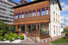
Salinas

Camino del Norte

To end of camino
311.4
Altitude
10

Avilés

5.00

Salinas

1.30

San Martín de Laspra

Services
ATM
Yes
Bar
Yes
Bus
Yes
Grocery
Yes
Pharmacy
Yes
Train
Yes

The camino does not near the beach on its path through Salinas, which is a pity because that is where the best restaurants and sidrerias are. The beach-side promenade runs the length of the 2.5km beach that is popular amongst surfers.

The Road

At the end of Salinas the camino begins one of the steepest and most challenging climbs of the camino. It is only 600m long but you will be glad to reach the Iglesia de San Martín at the top.

City Map

Comments

All Caminos App User (not verified)

Madmen made the new route!!! Half of it is very beautiful path in forest with flowers, but half of it is on the cars road with no area for pedestrians and a lot of sharp turns, where car drivers can’t see you! Possibly lethal. Some psycho thought of this new way. Cars going very fast btw.

All Caminos App User (not verified)

There is a new route that bypasses Salinas. Brand new
Camino sign posts etc. The route includes a positively lethal 2km of road walking. Sight lines are short, verges are narrow or non existent, traffic is frequent. This is a very dangerous road for walkers.

Camino de Sant…

Booked a single room with shower at Cactus Hostel for 30 euros, breakfast included (from 8.30h). 10 min walk to the (amazing!!) beach. EAT AT LA LUNA!! Not many pilgrims stop in this town, but please do!