El Rellayo
Camino del Norte
To end of camino
285.0
Altitude
130
Services
Bus
Yes
Train
Yes
The terrain becomes a series of ascents and descents, the camino tracing broad curves around hillsides on its way to Mumayor. Seldom straight, seldom level.
The Road
The terrain near El Rellayo becomes a series of ascents and descents, and is seldom on a straigh course. It tries to follow a level elevation and you will often feel as if you are walking in a broad curve as you traverse several hillsides on the way to Mumayor.
City Map
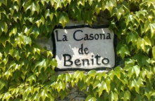
Accommodation in El Rellayo.
| Casa Rural La Casona de Benito ⭑⭑ Booking.com |
|