Granja de Moreruela is where the road forks and where you make a decision that will shape the rest of your Camino. You can continue north along the Via de la Plata to Astorga (93.8 km) and pick up the Camino Frances from there, or you can turn west onto the Camino Sanabres toward Santiago via Ourense (366 km). Most pilgrims on the Via de la Plata choose the Sanabres option, and with good reason -- it's a direct line to Santiago through some of the least populated, most quietly beautiful country in Spain.
Before you leave Granja, walk out to the ruins of the Monasterio de Santa Maria de Moreruela, about 2 km west of the village. What's left -- the apse, with its ambulatory and ring of seven chapels -- is enough to give you a sense of the scale this place once commanded. Founded in the 12th century, Moreruela was one of the earliest Cistercian monasteries on the Iberian Peninsula, a daughter house of Clairvaux itself. The church alone was 63 metres long. Most of it is gone now, but the apse still stands tall against the sky, and in the early morning light it's a fine place to start a journey.
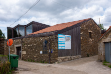
The village itself has a small shop, a bar, and an albergue. Services are basic. Stock up on what you need -- the first 18 km to Faramontanos de Tabara have nothing.
The Monasterio de Santa Maria de Moreruela was founded around 1131-1133, making it a strong candidate for the oldest Cistercian foundation in Spain. Under the patronage of Alfonso VII, the monastery became a daughter house of Clairvaux and in turn mothered Nogales Abbey (1164) and Aguiar Abbey in Portugal (1165). The Romanesque church, begun around 1170 and finished in the second quarter of the 13th century, was built in the shape of a Latin cross stretching 63 metres in length. Its ambulatory apse with seven radiating chapels followed the plan of Clairvaux itself. Like so many monastic houses in Spain, Moreruela was emptied by the ecclesiastical confiscations of 1835 and slowly crumbled. What remains of the apse is considered one of the finest examples of Cistercian architecture in the country.
The Camino Sanabres turns left and due west from Granja. It follows farm tracks to reach the Puente Quintos (6.7 km) over the Rio Esla. Once over the bridge, the route splits into two options to reach Faramontanos de Tabara. The right route follows the road and is preferred when rains have been heavy. Follow the road to the first paved left turn to descend and rejoin the left route. The left route turns left at the end of the bridge to follow a more scenic trail along the river.
There are no services for the first 18 km. Carry food and water from Granja.
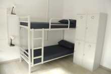
Accommodation in Granja de Moreruela to Sanabrés Route.

Once over the bridge, the route splits into two distinct paths to reach Faramontanos de Tabara. The right route follows the road and is preferred when rains have been heavy -- follow the road to the first paved left turn to descend and rejoin the left route. The left route turns left at the end of the bridge to follow a more scenic trail along the river.

Faramontanos sits at the edge of the Sierra de la Culebra, a mountain range that runs west toward Portugal and is home to the densest population of Iberian wolves in Western Europe. You won't see them, but it's good to know they're out there.
The village has a bar, a small shop, and a pharmacy. A private pilgrim hospitality called La Casa Azul y Amarilla offers beds donativo-style -- contact ahead to confirm availability, as it's a private home with only five beds. There are a few houses offering rural accommodation as well.
After 18 km of nothing since Granja, this is your first chance to sit down with a coffee. The Iglesia de San Martin is worth a look if it's open.
The camino to Tabara crosses over the AVE railway development. From this point you can see Tabara in the distance, but note that the camino does not enter Tabara directly. If you plan on stopping there, aim for the church towers.

Tabara is a small town with a big history. The municipal albergue here is one of the standouts on the entire Via de la Plata -- well-maintained, welcoming, and a natural place to end a long first day from Granja de Moreruela.
The town's claim to fame is the Monasterio de San Salvador de Tabara, or more precisely, what was produced inside it. In the 10th century, the monastery's scriptorium -- housed in a tall stone tower -- was one of the most important manuscript workshops in medieval Europe. It was here that the monk Magius, and later his disciple Emeterius, created the illuminated Beatus of Tabara, a commentary on the Book of Revelation that is now held in the National Historical Archive in Madrid. The manuscript's most famous page is a miniature of the scriptorium tower itself -- the oldest known image of a scriptorium in all of medieval European art. Emeterius described it in the colophon: 'Oh high and stony tower of Tabara, the first room where Emeterius sat bent over for three months and with all his limbs brandished the pen.'
The tower still stands, attached to the Iglesia de Santa Maria. It's Mozarabic in origin and visible from a distance as you approach town. The rest of the monastery is gone, but the tower is reason enough to stop.
Beyond the albergue, Tabara has bars, a shop, a pharmacy, and a bank. It's the last town with reliable services before Santa Croya de Tera.
The Monasterio de San Salvador de Tabara was one of the great centres of manuscript production in 10th-century Spain. The scriptorium, housed in its distinctive tower, produced the Beatus of Tabara -- an illuminated commentary on the Apocalypse completed by the scribe Emeterius on 29 July 970. Emeterius had taken over the work from Magius (also known as Maius), who died before finishing the manuscript. The illustration of the tower scriptorium within the manuscript is the oldest known depiction of a scriptorium in medieval European art. The manuscript is now held in Spain's National Historical Archive in Madrid. The tower itself is Mozarabic in style and remains attached to the Iglesia de Santa Maria.
If you entered Tabara you have two options to return to the camino. You can return to the camino where you left it, or if you stayed at the municipal albergue you can follow the alternate route from there.
The camino between here and Santa Croya offers two options, both of equal length. The original and more scenic route turns right and passes through Bercianos de Valverde, however with the closure of the bar there, this route has fallen out of favour with pilgrims. It has been replaced with the left route, which heads directly towards Villanueva de las Peras.
Accommodation in Tábara.
| Albergue de peregrinos de Tábara Donativo€ 28 |
|
| Albergue El Roble 12€ 14 |

|


A small village where the keys to the albergue are available at the bar La Mona. Basic services. The village has become the preferred route option since the bar in Bercianos de Valverde closed.
Small village squabbles and arrows pointing in two directions. The easiest way to Santa Croya de Tera is via the road out of town.
Accommodation in Villanueva de las Peras.
| Albergue La Alameda 12€ 6 |
|

The original route through Bercianos passes through vineyards and chestnut trees and is the more scenic option from Tabara. The Iglesia de San Pelayo is here but the bar has closed, which means no services at all. Most pilgrims now take the alternative through Villanueva de las Peras instead. If you do come through here, carry what you need.

Santa Croya is a wine-producing village on the right bank of the Rio Tera, just 1.5 km from Santa Marta de Tera. It has a bar, shops, and a pharmacy -- making it a serviceable stopping point even though the private albergue has been closed without any indication of reopening. A natural swimming pool by the river offers a chance to cool off in summer.
The village is larger than you'd expect for this stretch and has been a waypoint for travellers since the Tera valley served as a natural route through the mountains. If you need supplies, sort them out here before pressing on.

Stop here. Even if you're tired, even if you're behind schedule, stop. The Romanesque Iglesia de Santa Marta is the single most important piece of art on the entire Camino Sanabres, and it takes fifteen minutes to appreciate.
Around the back of the church, beside the south doorway, is the oldest known sculpture in stone of the Apostle Santiago depicted as a pilgrim. He carries a scrip and a staff, the classic pilgrim pose, carved in the mid-12th century. This image became so famous that it was used as the model for the 1993 Spanish 5-peseta coin. You've probably seen reproductions of it. Here's the original.
But the church has another trick. If you happen to be here on March 21st or September 23rd -- the spring and autumn equinoxes -- join the crowd to observe the illumination of a carved capital inside the church. As the sun aligns with an opening in the apse, a beam of light falls precisely on the carved scene. It's one of those moments where medieval engineering and faith intersect in a way that still gives you pause.
The church itself dates from the late 11th century and has a Latin cross plan with a single nave. The exterior carvings are exceptional -- look for the capitals on the doorways, each one telling a story. There's a small bar near the church but services are otherwise limited. Most pilgrims stay in Santa Croya just up the road, or press on toward Calzadilla de Tera.
The monastery at Santa Marta de Tera may date as far back as 1077. The current church was built in the late 11th to early 12th century in Romanesque style, with a Latin cross plan and a single nave. Its sculptures are its greatest treasure -- the Santiago Peregrino figure on the south doorway, dated to the mid-12th century, is considered the oldest stone sculpture of Santiago depicted as a pilgrim. The image became so iconic that it appeared on the 1993 Spanish 5-peseta coin. A companion sculpture of San Pedro flanks the same doorway. The equinox phenomenon, where sunlight illuminates a specific carved capital inside the apse, suggests the builders understood both architecture and astronomy.
The equinox illumination events on March 21st and September 23rd draw visitors to the church to watch sunlight align with the carved capitals.
The camino ahead turns westward and follows closely the Rio Tera as it runs between a string of villages. Shortly before Calzadilla de Tera the camino leaves the road to avoid a blind curve.
Accommodation in Santa Marta de Tera.
| Albergue de Peregrinos de Santa Marta de Tera 5€ 16 |
|

A small village along the Tera valley. There's a bar and basic provisions. The camino passes through without much ceremony, but the walking along the river is pleasant.
Accommodation in Camarzana de Tera.
| Hotel Juan Manuel |
Named for the Roman road -- calzada -- that once passed through here. A small village with a bar. The canal running alongside makes for peaceful walking on a warm day.
The camino from Calzadilla follows along the canal, though a number of confusing arrows might lead you to the road, which will also get you there.
Accommodation in Calzadilla de Tera.
| Albergue de peregrinos de Calzadilla de Tera Donativo€ 6 |

|

Another tiny village in the Tera valley. Bar available. From here the landscape starts to change as the camino heads toward the Embalse de Agavanzal and leaves the gentle river walking behind.
From Olleros the camino follows a path to the dam on the east side of the Embalse de Agavanzal (4.3 km). Once over the dam it turns left to follow a path along the contours of the reservoir until it reaches Villar de Farfon.
Accommodation in Olleros de Tera.
| Albergue La Trucha 7€ 6 |

|


The reservoir marks a shift in the landscape. The Tera valley opens up and you get your first real sense of the empty country ahead. No services here -- just water, sky, and the path forward.

A small village at the end of the reservoir walk. Follow the signs to the albergue on the far end of town, where you'll find coffee, tea, and conversation -- the hospitaleros here are known for making pilgrims feel welcome.
The camino returns to a rural trail until it reaches the Rio Negro, just short of reaching the N-525. It crosses the river on a small pedestrian bridge and then passes under the N-525 to enter Rionegro.
Accommodation in Villar de Farfón.
| Albergue de peregrinos Rehoboth Donativo€ 4 |

Rionegro sits at the junction where the camino crosses the N-525, and it's been a crossing point for centuries. The medieval bridge over the Rio Negro gives the town its name. There's a bar and basic services. The Santuario de Nuestra Senora de la Carballeda, built in the 12th century, was the headquarters of the Cofradia de los Falifos, one of the oldest confraternities in Spain, dedicated to protecting pilgrims and travellers on this route.
This is a good spot to refuel before the stretch to Mombuey.
The Santuario de Nuestra Senora de la Carballeda was the seat of the Cofradia de los Falifos, a confraternity founded in the 12th century to protect pilgrims and travellers on the road through Sanabria. The cofradia maintained hospices and bridges along the route -- the bridge at Rionegro being one of them. The name 'Falifos' may derive from an old term for travellers or wanderers.
The camino leaves Rionegro on the north side of the N-525 and soon crosses over the A-52 to follow a rural track until reaching the gas station and restaurant at the start of Mombuey.
Accommodation in Rionegro del Puente.
| Albergue de peregrinos Virgen de la Carballeda 10€ 32 |
|

Mombuey is the capital of the Comarca de la Carballeda, though 'capital' is a generous word for a town this size. What it does have is one genuinely remarkable thing: the Templar tower attached to the Iglesia de la Asuncion. The church itself is unremarkable -- late-18th-century rebuild of a 13th-century original -- but the tower is something else entirely. Built by the Knights Templar in the second half of the 13th century as a military watchtower, it's a solid, square, no-nonsense piece of medieval engineering that stands out against the surrounding rooflines. It's the kind of tower that was built to see trouble coming from a long way off.
The town has a private albergue, a municipal albergue, bars, a small supermarket, and a pharmacy. It's the last place with proper services before a long stretch through depopulating villages where you'll be lucky to find an open bar.
The Knights Templar maintained a presence in Mombuey during the 13th century, and the tower attached to the Iglesia de la Asuncion was built as a military watchtower during this period. The Carballeda region was a strategic corridor between the Castilian meseta and the mountains of Galicia, and the Templars were tasked with protecting pilgrims and travellers along the route. The tower survives as one of the few tangible remnants of the Templar presence on the Camino Sanabres.
As the camino gets deeper into the Zamora mountains, the villages get closer together but smaller. Few offer any services. The camino follows near the N-525 for a short distance before turning south to cross the motorway and the AVE line. After crossing, it passes through the small rural hamlets of Valdemerilla (4.6 km), Cernadilla (3.5 km), San Salvador de Palazuelo (1.8 km), and Entrepenas (3.4 km). It then turns back north to cross over the AVE, the motorway, and the N-525 into Asturianos.
Accommodation in Mombuey.
| Albergue de Mombuey Donativo€ 8 |

|
| Hotel La Ruta | 
|

A handful of stone houses along the path. No services. The depopulation of rural Zamora is visible here -- more empty buildings than occupied ones.


Another near-empty hamlet. No services. The Iglesia de la Asuncion has a simple stone facade that catches the light nicely if you're passing in the morning.
Accommodation in Cernadilla.
| Albergue de peregrinos de Cernadilla |

A tiny hamlet with no services. The name suggests a grander past than the present delivers. Press on to Entrepenas.


Between the rocks -- that's what the name means, and that's what it looks like. No services. The landscape here is increasingly rugged as you approach the Sanabria mountains.
Accommodation in Entrepeñas.
| Casa Las Peñas del Corredor |
A small village with actual signs of life. There's a shop near the church and the memorable Bar-Meson El Carmen on the main road, where you can get a proper meal. After the string of empty hamlets, this feels like civilisation.
Stock up here if you need to -- the next reliable services are in Palacios de Sanabria, though that's not too far ahead.
When the camino leaves Asturianos it picks up the N-525 but leaves it soon after to follow a paved road that turns to the right. DO NOT miss this turn, or the one just after which removes you from the road entirely. It's a country path all the way to Palacios de Sanabria.
Accommodation in Asturianos.
| Albergue de peregrinos de Nuestra Señora de la Asunción 6€ 22 |
|

A village of about 230 people on the approach to Puebla de Sanabria. There's an albergue and a bar -- enough to warrant a stop, especially if the day is getting long. The stone houses and the mountain views hint at what's coming as you enter the Sanabria region proper.
Between Palacios de Sanabria and Puebla de Sanabria the camino follows country paths and once again crosses the motorway and the AVE line. Along the way, it passes through the hamlets of Remesal (2.4 km), Otero de Sanabria (2.8 km), and Triufe (2.5 km).
After Triufe it turns south again to cross the motorway and join the N-525. Follow the road to the first roundabout and turn left, descending gently into Puebla de Sanabria.
In Puebla, the albergue and some services are on the east side of the river.
A small hamlet between Palacios and Puebla. No significant services.

Another small hamlet on the approach to Puebla. No services, but the walking through here is pleasant as the valley narrows toward the mountains.

The last hamlet before Puebla de Sanabria. No services. From here the camino drops down toward the N-525 and the descent into Puebla.
The camino through Puebla follows a path that skips entirely the oldest and best parts of town. Don't let it. Climb the hill to the old quarter -- it's short, it's steep, and it's worth every step.
Puebla de Sanabria is the finest walled town on the entire Camino Sanabres. The Castillo de los Condes de Benavente commands the hilltop, built in the 15th century by Rodrigo Alonso Pimentel, 4th Count of Benavente, over the remains of an earlier fortification. The castle has been beautifully restored and now houses a museum and visitor centre. Climb the enormous keep for views that stretch across the valley and into the mountains beyond. On a clear day you can see the Sierra de la Culebra to the south and the Galician mountains to the west -- the same mountains you'll be crossing in a day or two.
The old town within the walls is a tangle of stone houses, narrow lanes, and a 12th-century church. It feels like a place that time has been gentle with. Below the walls, the newer part of town stretches along the river with all the services you'll need: bars, restaurants, shops, pharmacy, ATM, and a municipal albergue on the east side of the river.
Lago de Sanabria, the largest natural glacial lake on the Iberian Peninsula, is about 15 km northwest of town. If you have a rest day, it's worth the trip -- the lake sits at nearly 1,000 m altitude, surrounded by mountains, and is part of a natural park. Buses run in summer, or you can arrange a taxi.
This is your last major resupply point before the mountain crossing into Galicia. Make sure you have everything you need.
Stock up on supplies here. The mountain crossing ahead has limited services, and you won't find a town this well-equipped again until La Gudina in Galicia.
Puebla de Sanabria was established as a fortified town in the 12th century to defend the kingdom of Leon against Portugal. By the 13th century it was one of the most important military strongholds in the region. The castle was begun in 1455 by the 4th Count of Benavente and completed in 1499, though construction was interrupted for decades by inheritance disputes. The town's strategic position -- controlling the only road through the mountains between Zamora and Galicia -- ensured its importance for centuries. The walled old quarter has been declared a Historic-Artistic Site.
If you stay at any of the accommodation options on the south side of town, retrace your steps to get back to the camino -- it would be easy to confuse the southern road with the northern one.
The camino follows the road north out of town but soon picks up a trail before you reach the N-525. The walk is scenic, and muddy after rain. On several occasions it joins the N-525 but never for very long, so keep an eye open for the exit points. It reaches Terroso (9.7 km) and then makes a large loop to the north before descending into Requejo de Sanabria.


A small hamlet 9.7 km from Puebla. No significant services, but the views from this elevated position are increasingly dramatic as the mountains close in.
Requejo sits in a valley between oak forests on the approach to the mountain pass. It has restaurants along the road and has served as a base for AVE high-speed rail construction crews, which has kept things livelier than they would otherwise be. There's food and accommodation available.
A new river route from Requejo to Padornelo has been established since the AVE construction was completed, offering a more pleasant alternative to the N-525. Check locally for current waymarks.
The camino has been rerouted in several places between here and Lubian due to AVE construction. The construction is now largely complete, and a new river route has been established between Requejo and Padornelo. Check locally for the latest waymarks, as the situation has been evolving.
The original AVE detours that forced pilgrims onto the busy N-525 should no longer be necessary, but keep an eye out for any remaining construction activity.
It is uphill from here to the Portela de la Canda. From Requejo the camino follows a narrow country road adjacent to the river. A new river route now offers an alternative to the N-525 -- check locally for current waymarks.
At the entrance to Padornelo you can either turn left to walk through the lower part of town or you can keep on the road (the camino returns to it).
Accommodation in Requejo de Sanabria.
| Albergue de Requejo 5€ 20 |
|
| Albergue Casa Cerviño 15€ 10 |
|
| Hostal Tu Casa |
| Hotel Maite | |
| Hotel Mar Rojo |

Padornelo sits at about 1,356 m altitude -- you've climbed significantly from Requejo and the thin mountain air is noticeable. The bar in town is located in the hotel along the road. This is your last chance for refreshment before Lubian.
The village is small and the mountains are big. From here you can feel the border with Galicia getting close.
The camino leaves Padornelo along the N-525 to a junction. Here there are signs indicating a detour (the old way turned to the right and went through Aciberos). Now the camino keeps on the road to pass over the A-52 and then a short distance later right back under it. It then turns left to follow a rural track up to Lubian.
Accommodation in Padornelo (Zamora).
| Hotel Padornelo | 
|
 on the Camino de Santiago")
Cut off from the main camino route by AVE construction changes. If you end up here, follow the road back to the N-525. No services.
Lubian is the last village in Zamora province and the last settlement before the border with Galicia. It sits at around 1,000 m altitude in the Sierra de la Culebra, surrounded by mountains and chestnut forests. The albergue is not well marked but is one of the first buildings in town. The rest of the services -- bars, a small shop -- are along the main road.
This has always been a border village, caught between Castile and Galicia, between Spain and Portugal. The Alto Sanabria region has a character all its own -- the stone houses are built heavy against the mountain winters, and the landscape is more forest than field.
The Santuario de La Tuiza, just outside town on the route ahead, is dedicated to the local patron Virgin. It's a simple building but it marks the beginning of the final climb to the Portela de la Canda and the gateway to Galicia.
Lubian and the Alto Sanabria region have been a borderland for centuries, caught between the kingdoms of Leon and Galicia, and later between Spain and Portugal. The Sierra de la Culebra, which surrounds the village, is one of the most important wildlife corridors in Western Europe and home to the highest concentration of Iberian wolves in Spain. The wolf has been a part of life here for as long as people have lived in these mountains.
Romeria to the Santuario de La Tuiza -- check locally for dates.
The camino follows the secondary road out of Lubian, downhill from the main road. It turns right after a few twists in the road to follow the signs to the Santuario de La Tuiza. It descends to pass under the A-52 and passes by the Santuario. From here it climbs to the Portela de la Canda, the gateway to Galicia.
This is a serious mountain climb. The signage after La Tuiza can be sparse -- pay close attention to waymarks. Allow about three hours for the ascent from Lubian to the pass.
Accommodation in Lubián.
| Albergue de Lubián 3€ 16 |

|
| Casa Rural Val dos Pigarros |
You're in Galicia. The Portela de la Canda (about 1,262 m) marks the boundary between the provinces of Zamora and Ourense, between Castilla y Leon and Galicia. It's a mountain pass, not a town -- there are no services here, just the satisfaction of having made the climb.
The air feels different on this side. The vegetation changes almost immediately -- more green, more moisture, more of the Atlantic influence that will define the rest of the walk to Santiago.
From here the camino begins its march through Galicia, and there's no shortage of ups and downs ahead. They mellow in altitude as you travel west but increase in frequency.
The camino emerges onto a paved road at the alto and almost immediately leaves it, turning left to descend along a track. It passes through the hamlet of A Canda (1.4 km) and soon begins its descent into Vilavella, passing beneath a railway line along the way.
From here the walking is Galician -- constant small climbs and descents, green valleys, stone villages.

The first hamlet in Galicia. A scattering of stone houses and the feeling that you've crossed into a different world. No services.

Note that both bars are off the camino, uphill from the main path. The same goes for the hotel. This is the only option to fill up between Lubian and La Gudina, so don't skip it if you need food or water.
The village is small but functional -- a few bars and accommodation in a mountain setting. The descent from the Portela de la Canda has been steep, and your knees may appreciate the pause.
The camino descends to O Pereiro (3.8 km) and then climbs to O Canizo (5.3 km). It then joins the N-525 as it enters La Gudina.
Accommodation in Vilavella.
| Hotel Spa Vilavella ⭑⭑⭑⭑ | 
|


A handful of houses in the valley between Vilavella and O Canizo. No services. The walking through here is up and down -- welcome to Galicia.
Accommodation in O Pereiro.
| Pensión Cazador |
Small hamlet on the approach to La Gudina. No services. You're getting close to the first proper Galician town now.
The first proper town in Galicia on the Camino Sanabres, and it feels it. After the mountain crossing and the string of tiny hamlets, La Gudina has a municipal albergue, bars, restaurants, shops, a pharmacy, and an ATM. Use them -- the next two stages offer only basic services.
The town sits at a crossroads where the N-525 passes through. There's an interpretation centre with permanent exhibitions on local food products and Galician handicrafts, which is a decent way to spend an afternoon if you're stopping here for the night.
From La Gudina the camino splits. The main route heads northwest through the mountains to Laza via Campobecerros -- this is the route described below. An alternative variant heads south through Verin and Xinzo de Limia. Both routes eventually reach Ourense. The northern route through Laza is shorter, more mountainous, and the one most pilgrims take.
Withdraw cash here. The next two stages have only basic services and no ATMs.
There is a variant of the Camino Sanabres which turns south and passes via Verin and Xinzo de Limia. Mind the arrows to keep to the route described below.
A Gudina has been a waypoint on the route through these mountains since Roman times, sitting at the intersection of roads connecting the Castilian meseta with the Galician coast. The town's position at the entrance to Galicia gave it strategic importance as a customs and control point.
From the albergue, pass back under the railway bridge and head back towards the N-525 but turn right onto the Rua Mayor before you get there. A few hundred metres ahead the camino splits -- the route below follows the Laza option (straight).
The way to Campobecerros begins with a climb almost entirely along a quiet paved road with excellent views all around. It passes through Venda do Espino (4.5 km), Venda da Teresa (3.2 km), Venda da Capela (2.3 km), and Venda do Bolano (3.2 km) before descending steeply into Campobecerros.
Accommodation in La Gudiña.
| Casa da Viúva 10€ 44 |
|
| Pensión Óscar |
| Hostal La Madrileña | |
| Hostal Suizo |
| Hotel Relojero |

One of the 'venda' hamlets strung along the mountain road between La Gudina and Campobecerros. The name venda comes from an old word for a roadside inn or tavern, though the inns are long gone. No services. The views from up here, at over 1,000 m altitude, are spectacular on a clear day.

Another venda hamlet along the mountain ridge. No services. The walking is exposed but the views compensate.
Named for a small chapel. No services. The mountain road continues its steady course westward.

The last venda before the steep descent into Campobecerros. No services. Brace your knees -- it's downhill from here.

Campobecerros sits in a valley at the bottom of the mountain descent from La Gudina. The village grew thanks to the construction of the Zamora-Ourense railway line, and before the railway was built, the local economy revolved around charcoal production -- the inhabitants were carboeiros, burning peat for fuel.
There are bars and basic services here, making it a natural stopping point in the middle of the La Gudina to Laza stretch. After the long, exposed mountain walk from the vendas, a coffee and a bocadillo hit differently.
The valley setting is pleasant and the village has a few stone houses worth admiring if you're taking a break.
The camino follows the road to Porto Camba (3.3 km) and then picks up a trail to the hamlet of As Eiras.
Accommodation in Campobecerros.
| Albergue da Rosario 15€ 16 |
|
| Casa Núñez |

A small hamlet between Campobecerros and As Eiras. The Romanesque Iglesia de San Cristovo is worth a look if it's open. Otherwise, keep walking -- the path is clear and the valley walking is easy.
No bar per se, but a small table set up by the local Friends of the Camino offers self-serve refreshments. The generosity of strangers keeps showing up when you need it most on this route.
The road begins again in As Eiras and the camino follows along it to Laza. Take your time here and enjoy the views -- the valley opens up ahead and the walking is gentle.


Laza is a proper Galician village, larger than you'd expect to find this deep in the mountains. A number of restaurants cluster around the centre -- La Picota is a favourite among locals. The albergue is a newer building on the edge of town, run by the local Proteccion Civil. Pick up the key at their office adjacent to the Casa do Concello as you come into town.
The village is best known for something you're unlikely to witness unless you're walking in February or March: the Entroido de Laza, one of the wildest and most ancient carnival celebrations in Galicia. The peliqueiros -- masked figures wearing spectacular costumes weighing about 15 kg, complete with wooden mitres and belts hung with heavy bells called chocos -- burst through the streets. Monday brings the farrapada, a mud-and-rag fight with no rules and no teams, followed by A Morena, a wooden cow that fills the plaza with flour and ants. The Entroido isn't a show put on for tourists. It's a community ritual with pre-Christian roots that Laza has kept alive for centuries, and the locals will tell you it belongs to them.
Even without the carnival, Laza has a quiet charm. The stone houses, the valley setting, the unhurried pace -- it's a place that rewards an evening stroll.
The Entroido de Laza has roots in pre-Christian fertility and seasonal rites, making it one of the oldest surviving carnival traditions in Europe. The peliqueiros -- whose name may derive from 'pellica' (animal skin) -- are the central figures, wearing elaborate costumes with wooden mitres decorated with animal scenes. The tradition survived centuries of church opposition and Franco-era suppression, largely because Laza was remote enough that nobody came to enforce the bans.
Entroido de Laza (Carnival) -- February/March. One of the oldest and most traditional carnival celebrations in Galicia, featuring peliqueiros (masked figures), the farrapada (mud fight), and A Morena. Declared a Festival of Tourist Interest in Galicia.
Between Laza and Soutelo Verde the camino follows the road, a mostly flat walk along the valley. It leaves the road to the left to pass through Soutelo (bar) (3.3 km). It returns to the road and then turns right onto a rural track to Tamicelas (3.2 km). From Tamicelas it begins the climb to Albergueria.
Accommodation in Laza.
| Albergue de peregrinos de Laza 10€ 34 |
|
| Pensión Blanco Conde |
A small village with a bar, 3.3 km from Laza. A chance to top up before the climb to Albergueria.
A hamlet between Soutelo Verde and Albergueria. No services. From here the climb begins in earnest.
If you visit only one bar on the whole of the camino, make it the one in Albergueria. The Rincon del Peregrino has been collecting scallop shells signed by pilgrims since it opened in 2004, and by now the walls and ceiling are covered with thousands of them. Leave your name on one and it becomes part of the bar's history. Pilgrims have been known to return years later just to find their shell still hanging.
The bar also serves as a private albergue with a handful of beds. It sits at about 900 m altitude, at the top of the climb from Laza, and the feeling of arrival -- a cold drink, a warm welcome, your name on the wall -- is one of the defining moments of the Camino Sanabres.
Beyond the shell bar, Albergueria is a tiny mountain hamlet with no other services. But you don't need anything else.
Rural walking, on the road and off again in several places, with a descent into Vilar de Barrio.
Accommodation in Alberguería.
| Albergue El Rincón del Peregrino 15€ 15 |


A municipality in the centre of Ourense province with a Xunta albergue, bars, and basic services. After the mountain walking from Laza, the terrain here starts to flatten out and the Galician lowlands begin to assert themselves.
The village has a pharmacy and a small shop. It's a serviceable stop but not a place that demands lingering.
Paved walking along the road through the hamlets of Boveda (2.2 km), Vilar do Gomareite (bar) (0.9 km), Bobadela a Pinta (5.3 km), Padroso (bar) (1.1 km), Cima de Vila (1.7 km), and Quintela (1.4 km). As you enter Xunqueira de Ambia on a back road the albergue is one of the first buildings on your right.
Accommodation in Vilar do Barrio.
| Albergue de peregrinos de Vilar de Barrio 10€ 24 |
|
| Casa Rural A Casa do Adelino |
A tiny hamlet on the road between Vilar de Barrio and Xunqueira de Ambia. No services.
Small hamlet with a bar. A welcome stop on the road to Xunqueira.
A hamlet along the road. No services. The walking through here is flat and paved -- a rest for the legs after the mountains.
A small hamlet with a bar. These Galician hamlets come in quick succession now -- the landscape is changing from mountain to valley.

A hamlet just before Xunqueira de Ambia. No services.
The Colegiata de Santa Maria la Real is the reason to stop here, and it's a beauty. Founded in 955 as a monastery, it was handed over to Augustinian canons in the 12th century and achieved collegiate status in 1164. The church is transitional Romanesque with later additions, and it's considered one of the finest examples of rural Romanesque architecture in Galicia. Inside, an 18th-century organ survives -- one of the few in the region.
The name Xunqueira comes from juncal, meaning a marshy place where rushes grow. Legend has it that the Virgin appeared in the marshes here in the 4th century, which prompted the construction of a chapel and eventually the monastery. Whatever the truth, the monks who lived here provided shelter for pilgrims on this route for centuries.
The town has a Xunta albergue (one of the first buildings on your right as you enter on the back road), bars, a pharmacy, and basic provisions. It's a good stopping point with genuine historical weight.
The Colegiata de Santa Maria la Real was founded as a monastery in 955. In the 12th century it was donated to the Augustinian canons, and in 1164 it was elevated to a collegiate church. The Romanesque church, with its later additions, has served continuously as a place of worship for over a thousand years. The monastery provided shelter for pilgrims on the road to Santiago, and the current building retains elements from its 12th-century construction alongside 18th-century additions including a notable organ. The collegiate came under the Archbishopric of Valladolid.
After passing the church the camino turns right to follow the road towards Salgueiros, but quickly leaves the road to follow a side road and track down to the Rio Arnoia (0.9 km). It then climbs up to A Pousa along another track which turns off from the road shortly after crossing the river.
Accommodation in Xunqueira de Ambía.
| Albergue de peregrinos de Xunqueira de Ambía 10€ 24 |
|
| Albergue Casa Tomás 18€ 9 |
|
| Casa Rural Do Souto |

The river crossing marks the transition from the Xunqueira valley toward the long approach to Ourense.

A small hamlet after the river crossing. No significant services. From here to Ourense the camino is almost entirely along paved roads, passing through a string of small villages and hamlets -- the suburbs of Ourense stretching further into the countryside than you'd expect.
Between A Pousa and Ourense the camino is almost entirely along paved roads. It passes through the hamlets of Salgueiros (bar) (1.6 km), Veirada (1.6 km), Ousende (0.9 km), Panelas (bar, shop) (0.9 km), Venda do Rio (2.1 km), Pereiras (bar, shop) (0.5 km), A Castellana (bar) (2.3 km), and Reboredo (bar, shop, pharmacy) (2.2 km) before reaching Ourense's nearest suburb of Seixalbo.
Accommodation in A Pousa.
| Pensión Rural A Pousa Booking.com |
|

Small hamlet with a bar. One of the string of villages on the approach to Ourense.

Small village with a bar and shop. Useful for provisions on the approach to Ourense.
Another hamlet along the road. No services.
From Verín you can rejoin the other route in Laza (due North along the Támega Valley), or continue along this more southern route to Xinzo de Limia.
Accommodation in Verín.
| Albergue de Peregrinos Casa do Asistente 10€ 37 |
|


Small village with a bar and shop. Getting closer to Ourense now -- the built environment is starting to thicken.
The urbanisation begins here. A bar marks the transition from rural Galicia to the outskirts of Ourense.
Bar, shop, pharmacy. The last hamlet before the suburb of Seixalbo. You're essentially in the Ourense metropolitan area now.
The nearest suburb of Ourense. The Capela Santa Adega marks the final approach to the city. From here it's downhill to the centre.
From Seixalbo and the Capela Santa Adega, the camino descends towards Ourense, either along the main road or a side road. It eventually reaches a large car dealership. Stop.
The official camino from here follows the road more or less straight into the centre of Ourense. To your left is an alternate route to follow the river into the city -- the Paseo Fluvial, which is recommended if you want a quieter, more scenic entrance.
Though not marked with yellow arrows, this river walk is easy to follow and used by locals for exercise and evening strolls. It follows both sides of the river, but since you'll need to exit to the east it's best to stick to the right bank.
The route requires a road crossing near the Ford factory, but the river path resumes on the other side.
From the Ford factory the river walk passes under five bridges, and after the fifth it becomes a boardwalk for a short distance. At the sixth crossing (all overhead) it's time to turn right and away from the river. With the river behind you, walk straight towards the main road and the centre of the old town on the opposite side.
What this route lacks in signage it makes up for in scenery and the absence of traffic.


Ourense is the thermal capital of Galicia, and with good reason. The city sits on top of one of the largest concentrations of geothermal water in Europe -- more than 70 springs pump an estimated three million liters of hot water every day. The Romans settled here because of it, and two thousand years later the springs are still flowing.
Your first stop should be As Burgas, the thermal fountain right in the center of the old town. The water emerges at over 60 degrees Celsius -- you can't swim in it, but there's a small pool nearby cooled to a comfortable 38-40 degrees. The plaza around it is pleasant and the thermal basin is free.
For a proper soak, head to the Miño river. The Ruta Termal do Miño runs about four kilometers along the right bank, connecting seven thermal areas. Start at Termas Chavasqueira (the closest to the center, across the Ponte do Milenio), continue to Muiño da Veiga with its four pools and excellent sunset views, and then on to the Termas de Outariz and Burga de Canedo -- the largest and most developed, also free. Bring a proper swimsuit or expect to be turned away.
The old town itself is compact and walkable. The Cathedral of San Martín is the anchor. Built in the 12th and 13th centuries in a transitional Romanesque-Gothic style, it holds the Pórtico del Paraíso -- a polychrome sculptural portal modeled on the Pórtico de la Gloria in Santiago. It was created by students of Maestro Mateo, and unlike Santiago's version, this one still retains its vivid painted colors (restored in the 18th century but believed to follow the original palette). The 24 elders of the Apocalypse and the prophets with their name-bearing scrolls are particularly fine.
The Ponte Vella, the old Roman bridge over the Miño, dates to the 1st century though it's been rebuilt several times (12th, 13th, and 17th centuries). It's now pedestrian-only and worth crossing for the views back to the city. Eight bridges cross the Miño in Ourense, but this is the one that matters.
The old town around the cathedral has a good concentration of bars and restaurants. The tapas scene here rivals any city in Galicia. Rúa do Paseo and the streets radiating from the Plaza Mayor are where you want to wander.
The Romans founded Ourense around the 1st century, drawn by the thermal springs they called Aquae Originis (or, in some accounts, Aurienses -- the city of gold, for the precious metal found in the Miño). They built baths, a sanctuary to the water divinities, and the original bridge. The city's strategic position on the Miño made it an important communication hub.
The thermal waters were the beginning. Everything that followed -- the medieval bishopric, the cathedral, the old town -- grew from that original Roman settlement around the hot springs. Today there's no gold left in the river, but the waters are arguably more valuable.
The Cathedral was begun in the second half of the 12th century and continued into the 13th. It is one of five cathedrals in Galicia. The Pórtico del Paraíso, its crowning glory, was carved in the early 13th century and depicts the journey from hell to paradise, linking Old Testament prophecy with New Testament revelation.
Corpus Christi is the big one in Ourense. It falls in June and brings two full weeks of festival -- orchestras, concerts, parades, and a grand procession through the old town. The procession route passes through Plaza del Hierro, Santo Domingo, Parque de San Lázaro, and Plaza Mayor before ending at Plaza de San Martiño.
The Festa de San Martiño, honoring the city's patron saint Martín de Tours, arrives in November. It marks the season of the Magostos -- gatherings around bonfires to roast chestnuts and drink the year's new wine. It's a deeply Galician celebration and well worth timing your walk for.
Semana Santa in Ourense has medieval roots, promoted originally by artisan and merchant guilds. Palm Sunday opens with the Procesión del Burro, a colorful procession carrying laurel, olive, and palm branches.
Just beyond the Río Miño the camino splits into two routes. The arrows here leave a bit to be desired -- there's only one fading set painted on the sidewalk to indicate the split.
Here's how to find the way: once over the Ponte Vella keep to the right side of the road and head uphill. You'll pass four streets (Rúas Ribeira de Canedo, Mercado, Ramón y Cajal, and Vicente Risco). As you near the fifth, a much larger intersection, watch the ground for arrows. From this junction, the camino either continues straight (the LEFT route) or turns right (the RIGHT route). Both merge in Casas Novas.
RIGHT ROUTE - 18.9 km: From the right turn at the split, this route follows the N-525 uphill for about 1 km. At the gas station, the camino veers right and begins to climb steeply up to Cudeiro. This is the more traditional route and offers good views back over Ourense.
LEFT ROUTE - 17.6 km: From the split, continue straight up the hill keeping to the right side. The road passes the train station (on your right, bar) and follows the road to Quinitela.
Accommodation in Ourense.


| Albergue de peregrinos de Ourense 10€ 42 |
|
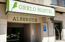
| Albergue Grelo Hostel 18*€ 32 Booking.com |
|
| Albergue Augas Quentes 18*€ 36 Booking.com |
|


Just beyond the río the camino again splits. Here again the arrows leave a bit to be desired, there is only one set of arrows to indicate the split. They are painted on the sidewalk and are fading.Here is how to find the way:Once over the Río Miño keep to the right side of the road and head uphill. You will pass 4 streets: Rúas Ribeira de Canedo, Mercado, Ramón y Cajal, and Vicente Risco). As you near the fifth (a much larger intersection) keep an eye to the ground for the arrows. From this junction, the camino either continues straight (the LEFT route) or it turns right (the RIGHT route). Both routes merge in Casas Novas.RIGHT ROUTE - 18.9kmFrom the right-hand turn at the split, this route follows the N-525 uphill for about 1km. Follow on the right side of the road to see the arrows. At the gas station, the camino veers right and begins to climb steeply up to Cudeiro.LEFT ROUTE - 17.6kmFrom the split continue straight up the hill, and keep to the right-hand side. The road passes the train station (on your right, bar) and follows the road to Quinitela.

A small hamlet perched on the hillside above Ourense. The climb up from the city is steep but rewards you with views back over the rooftops and the Miño valley. Parts of the original Camino Real survive here -- sections of ancient stone paving worn smooth by centuries of foot traffic. There's not much in the way of services, but the setting is peaceful and the worst of the climbing is behind you.
After crossing over the main road through Cudeiro the camino continues to climb, though more gently now. It passes several hamlets along the way and eventually returns to the N-525 (which wound around the mountain). It crosses the road and shortly after turns right to enter Tamallancos via a back road.

A hamlet in the municipality of Vilamarín with a few houses clustered around the 16th-century Iglesia de Santa María, which preserves fragments of an older Romanesque building. There's a handsome Baroque pazo nearby. Services are minimal -- press on to Bouzas or Cea if you need anything more than quiet.
From Tamallancos the camino follows loosely the N-525 to Casas Novas, but seldom directly on it. It passes through the hamlets of Bouzas (bar) (0.7 km), Sobreira (bar) (3.7 km), and Viduedo (bar, shop) (1.5 km).

The two route variants from Ourense merge here. A small, quiet hamlet with no services to speak of. From here it's a single path to Cea.
The camino continues through rolling Galician countryside, alternating between forest tracks and quiet country lanes. Cea is not far ahead.
Cea is a bread town. That's not a quaint description -- it's the defining fact of this place. The Pan de Cea holds one of only four Protected Geographical Indication designations for bread in all of Spain, and the bakeries here have been turning out loaves for at least seven hundred years.
At its peak, Cea had around fifty bakeries. Today roughly seventeen remain, and every one of them follows the same strict rules: stone-ground flour, local water, hand-kneaded dough, and wood-fired granite ovens using only approved wood types. Every loaf weighs the same, has the same shape and golden color, and makes the same satisfying crack when you break it open. Over 300,000 loaves leave these ovens each year.
The old part of town is a tight knot of stone streets where every other building seems to have a legacy as a bakery. A few hórreos still stand between the houses. It's impossible to get truly lost here, though you may circle a few corners more than once. Buy a loaf before you leave -- the bread keeps well and you won't find anything like it for the rest of the walk.
The connection between Cea and bread goes back to the Monasterio de Oseira, the massive Cistercian monastery in the next valley. The monks developed the grinding and baking techniques; the town supplied the bread. King Sancho IV granted the monastery dispensation to sell its bread in the 13th century, and the tradition stuck.
The first historical reference to Cea's bakeries dates from the last third of the 13th century, tied to the Cistercian monastery of Oseira nearby. The monks baked and ground; the town of Cea supplied bread to the monastery and to travelers on the road. The location at a crossroads -- and on the pilgrimage route through Sanabria -- spread the bread's fame.
The IGP (Indicación Geográfica Protegida) was granted in 2004, formalizing what seven centuries of bakers already knew: this bread is something particular. The designation covers eighteen ovens in the municipality of San Cristovo de Cea.
The Festa da Exaltación do Pan de Cea takes place on the first Sunday of July in the Campo de A Saleta. You can taste the bread, visit exhibitors of Galician products with designation of origin, and on the day before, follow the Ruta dos Fornos -- a tour through the ancient bread ovens. It's designated as a Festival of Tourist Interest of Galicia.
The camino crosses the main road in Cea and heads uphill towards a sporting facility. Around the back side of the building, the camino splits into two distinct routes. The choice here is more consequential than the split leaving Ourense. The two options merge in Castro Dozón.
OSEIRA ROUTE - 18.4 km from split: The right route is the official camino and is longer than the Piñor variant. It passes through the village of Oseira with its massive monastery and albergue. It's better waymarked and more scenic. Turn right at the split. The paved road gives way to a track through the forest. About halfway to Pielas the camino rejoins a paved road.
PIÑOR ROUTE - 14.8 km: Shorter and more direct to Castro Dozón, but without an albergue along the way. Take care along the latter half as the waymarks can be difficult to find. It follows mostly rural tracks and country lanes through the hamlets of Porto de Souto (1 km), Cotelas (bar) (1 km), Piñor (bar, pharmacy) (1.6 km), Fontelo (0.8 km), Arenteiro (bar) (0.7 km), and O Reino (1.4 km). After O Reino the camino rejoins the N-525 and passes through Carballeda. At the far end of town, just before the exit sign, the camino turns left towards the motorway, passes beneath it, and begins the climb up to Castro Dozón.
Accommodation in Cea.
| Albergue de peregrinos de Cea 10€ 40 |
|
| Casa Mañoso Booking.com |

|

The camino crosses the main road and heads uphill towards a sporting facility. Around the back side of the building, the camino once again splits into two distinct routes. Here the choice is a bit more complicated than the previous option. The two options merge in Castro-Dozón.PIÑOR ROUTE - 14.8kmShorter and more direct route to Castro Dozon, but without an albergue along the way. Take care along the latter half as the waymarks are difficult to find. It follows mostly rural tracks and country lanes and passes several names and un-named hamlets along the way. The identifiable ones are:Porto De Souto 1kmCotelas (bar) 1kmPiñor (bar, pharmacy) 1.6kmFontelo 0.8kmArenteiro(bar) 0.7km andO Reino 1.4kmAfter O Reinothe camino rejoins the N-525 and passes through the village of Carballeda. At the far end of town, just before the exiting Carballedasign, the camino turns left and heads towards the motorway. It passes beneath it and soon after turns right off of the road to begin the climb up to Castro Dozón.OSEIRA ROUTE - 18.4km from splitThe RIGHT route is the official camino and is a bit longer than the newer Piñor variant. It passes through the village of Oseira(Monastery and Albergue) and is scenic. It is better waymarked than the variant.Turn right at the split. The paved road comes to an end and you pick up a track through the forest. About halfway to Pielasthe camino rejoins a paved road.

A sleepy hamlet with a bar for pilgrims. Not much more to it, but the bar is welcome after the forest walking from Cea.
The camino follows the road out of Pielas, downhill to Oseira.
The Monasterio de Santa María la Real de Oseira is hard to miss. It looms over the valley like a fortress -- which is why it earned the nickname Escorial Gallego, the Galician Escorial. It's the architectural highlight of the entire Camino Sanabrés and worth every minute you spend here.
The abbey church, built between approximately 1200 and 1239, is considered one of the masterpieces of Cistercian architecture on the Iberian Peninsula. The style is ogival Romanesque, austere in the Cistercian tradition but with a quiet grandeur. Inside, look for the Sala de las Palmeras -- the former chapter house, where 15th-century vaulted ribs fan out from the columns like palm fronds. It's an extraordinary room.
The monastery has three cloisters, monumental staircases, and a general air of having been built for eternity. Guided visits are available (check at the entrance for times). The monks are Trappists -- Cistercians of the Strict Reform -- and they returned here in 1929 after nearly a century of absence.
Founded in 1137 and admitted to the Cistercian Order in 1141, Oseira was the engine of the region's economy for centuries. The monks developed agriculture, milling, and baking techniques that shaped the surrounding villages -- including Cea's famous bread tradition.
Almost all of the medieval monastery was destroyed in a major fire in 1552 and subsequently rebuilt. The monks were expelled in 1835 under the Royal Decree of Ecclesiastical Exclaustration that shuttered monasteries across Spain. The building deteriorated for nearly a century before the Trappists arrived in 1929 to restore and reoccupy it. They've been here ever since.
The monastery celebrates its patron saint feast day and offers periodic choral performances. Check locally for dates, as they vary.
The way out of Oseira is not along the road (though cyclists may prefer it for the gentler grade) but rather up a steep track adjacent to the road near the restaurants.
The camino passes the hamlets of Vilarello (2 km), O Outeiro (2.5 km), Carballediña (1.5 km), and A Gouxa (bar) (0.4 km) before nearing the motorway and Castro Dozón.
Accommodation in Oseira.
| Albergue del Monasterio de Oseira 8€ 40 |

|

Castro Dozón is where the two route variants from Cea -- via Oseira and via Piñor -- reunite. It's a small town straddling the N-525 with basic services. The name suggests a pre-Roman hilltop settlement (castro), though not much remains to be seen.
The town marks a transition point on the route. Behind you are the valleys of Cea and Oseira; ahead, the camino enters the rolling interior of Galicia with its characteristic patchwork of eucalyptus forest, pine groves, and stone hamlets. The ups and downs never really stop from here to Santiago, but they never reach any serious altitude either.
From Castro Dozón the camino resumes its on-again-off-again dance with the N-525. It does so for about 4.5 km before veering left off the N-525 and descending through the hamlets of Puxallos (1.5 km) and Pontenoufe (2.3 km). From there it climbs back up to the motorway, passing A Xesta (1.6 km) along the way to Estación de Lalín.

Not actually Lalín itself -- the city is a few kilometers to the north -- but the area around the old train station. There's private accommodation here. Lalín is one of the larger towns in interior Galicia and is known for its cocido, a hearty stew considered among the best in the region. If you have the energy for a detour, the Feira do Cocido in February draws thousands.
The camino continues its course through rural Galicia, through a series of small places along the way. A Eirexe (bar) (3.6 km) is the only stop for refreshments.
Accommodation in Estación de Lalín.

Donsión is a small hamlet between A Laxe and Taboada. No services. The camino passes through on wooded paths.
A Laxe is a small crossroads with an outsized importance for pilgrims. This is where the Camino de Invierno joins the Camino Sanabrés, so expect to see new faces and a bump in pilgrim traffic from here to Santiago. The Xunta albergue (30 beds, 10 euros) is the meeting point for walkers arriving from both routes.
There's a bar a bit further along the main road with meals. Buses to Santiago from Ourense also stop here -- useful to know if weather or injury forces a change of plans.
Shortly after leaving A Laxe, you'll pass the Pazo de Bendoiro, a restored manor house with spa treatments and a swimming pool. It's beautiful but pricey.
From A Laxe, the camino is well marked and well trodden all the way to Santiago. The joining of the Invierno route means more waymarks, more pilgrims, and generally better infrastructure for the remaining distance.
The Romería de San Bieito de Bendoiro takes place in the parish. Check locally for dates.
Shortly after leaving A Laxe you pass the Pazo de Bendoiro. The camino takes you into the woods and ascends to a lovely old bridge, originally Roman but much rebuilt. The bridge is hidden in the forest and inaccessible to cars -- one of those quiet surprises the camino keeps in reserve.
A bit further on, the Romanesque church at Taboada has a carving of Samson over the doorway. You have to cross the busy highway to get there, but it's worth it. Volunteers keep the church open for pilgrim visits (8:30-15:00, closed Tuesdays).
Accommodation in A Laxe.
| Albergue de peregrinos de A Laxe 10€ 28 |
|

Prado is a small hamlet on the approach to Taboada. No services.

The Romanesque Igrexa de Taboada is a short detour across the highway. The carving of Samson wrestling the lion over the doorway is particularly fine. Volunteers keep the church open for pilgrims between 8:30 and 15:00, but it's closed on Tuesdays.
Continue through the forest on well-marked paths towards Silleda.
The Romanesque church at Taboada is a small architectural gem, with a carving of Samson over the main doorway. You have to cross the busy highway to reach it — it's just a stone's throw from the camino but on the other side of the road.
Volunteers keep the church open for pilgrim visits from 8:30 to 15:10, closed Tuesdays.

Transfontao is a small hamlet between Taboada and Silleda. No services.
Accommodation in Transfontao.
| Albergue Turístico Trasfontao Booking.com |

|

Silleda is the commercial center of the Deza region and the largest town you'll pass through between Ourense and Santiago. It has all services: grocery stores, pharmacy, banks, bars, and restaurants. It's a working market town rather than a tourist destination, but that's precisely its value to pilgrims -- you can get things done here.
The Feira Internacional de Galicia, Spain's largest agricultural exhibition center, is based in Silleda. The weekly market and the various fairs throughout the year give the town a commercial energy that the smaller hamlets lack.
A recommended stop is Bar Gerardo, just before entering town. On the main street, Bar Toxa occasionally sets up a pulpo boiler outside the front door and offers pulpo with Ribeira Sacra wine -- when you see the setup, don't walk past.
One word of caution: the pharmacy here has a reputation for marking up prices for foreign pilgrims. Shop accordingly.
Silleda hosts the Semana Verde de Galicia in June, an international agriculture, livestock, forestry, and food fair. Various other trade fairs take place throughout the year at the Feira Internacional de Galicia exhibition grounds. The weekly market is also worth a browse if your timing is right.
The last 40km to Santiago is through pleasant Galician farmland. It is close enough now that the proximity to the roads and major highway interchanges means lots of crossings. The way from here is well marked and easy to follow.
Accommodation in Silleda.
| Albergue Trabazo 15-17.50€ 24 Booking.com |
|
| Albergue Turístico Silleda 10€ 20 Booking.com |

|
| Albergue El Gran Albergue Silleda 15€ 20 |

|
| Casa Novas Hostelería Booking.com |
|

Bandeira is a good-sized town with plenty of food options and a comfortable feel. Bar Arume, up the hill on a side street soon after you enter town, serves good food with warm company -- the sandwich vegetal comes recommended. Bar Plazoleta, just over the road from the Hostal Conde Rey in a small square, is also a reliable stop.
The Monasterio de San Lourenzo de Carboeiro is a worthwhile detour from near here. Founded in the 10th century by the Counts of Deza, it's a transitional Romanesque masterpiece influenced by the Compostela school of Mestre Mateo. It was nearly lost to ruin before restoration work in the late 20th century. The setting -- on the banks of the Río Deza, isolated in woodland -- is part of the appeal.
Bandeira sits in the historical Comarca de Deza, one of the interior regions of Galicia that has seen significant depopulation over the past century. The towns along this stretch of the camino give a sense of what rural Galicia looks like in practice: stone houses, small holdings, eucalyptus and pine forest pressing in on all sides.
The parish celebrates its patronal fiestas in the summer months. Check locally for dates.
Cross to the right side of the road as early as is convenient. At the end of town the camino veers right, and trying to cross at that point is dangerous with traffic.
Accommodation in Bandeira.
| Albergue de la Xunta de Bandeira 10€ 36 |
|
| Hostal Conde Rey Booking.com |

|

A small village with a privately run albergue, Casa Leiras 1866, directly on the camino. A young Italian couple, Cristina and Andrea, renovated a house to open it. A 300-meter detour down to the N-525 highway takes you to the bar/restaurant El Emigrante.
From Dornelas the camino descends to the Río Ulla, passing through San Miguel de Castro (5 km) along the way.
Accommodation in Dornelas.
| Albergue Casa Leiras 1866 15€ 10 |
|

A small hamlet with a hermitage, the Ermita de las Angustias. There's a bar here for a quick stop before the descent to the Río Ulla and Ponte Ulla.
The camino continues its descent towards the Río Ulla and the bridge town of Ponte Ulla.

Ponte Ulla marks the crossing of the Río Ulla and the boundary between the provinces of Pontevedra and A Coruña. It's also where the Camino de Invierno walkers, who joined at A Laxe, continue alongside you on the final approach to Santiago.
The town has practical value: a Día grocery store on the way out (stock up if you're heading to the albergue in Outeiro), and an excellent panadería right on the camino in the blocks after you cross the bridge. The Romanesque church in town is dedicated to Mary Magdalene and is worth a quick look.
The bridge itself is the town's reason for being. The old stone bridge over the Ulla has been a crossing point for centuries, and you can feel the weight of all that foot traffic as you walk across. The distinctive railway viaduct of Gundián, dating from the 1930s, is visible from town -- about 170 meters long, it was built as part of a rail line from Pico Sacro.
The stretch of N-525 leaving Ponte Ulla can be dangerous. Keep an eye open for the two points where the camino leaves the road.
The parish celebrates its patron saint festivities in the summer. Check locally for dates.
The camino follows briefly a section of the N-525 as it leaves Ponte Ulla. This section can be a bit dangerous, so keep an eye open for the two times it leaves the road. The first is to your left, so you'll need to cross. The second is to your right, which means crossing back. About 500 meters separate the two crossings. If these crossings sound unnecessarily dangerous, you're not alone.
After the second crossing, the camino returns to safer side roads as it climbs to Outeiro.
Accommodation in Ponte Ulla.
| Albergue-Pensión O Cruceiro da Ulla 16€ 18 |
|

The albergue here is a convenient last stop before the final push to Santiago. A bar delivers meals. Your best bet is probably to bring food up from the Día supermarket in Ponte Ulla and self-cater.
From Outeiro the camino passes through Lestedo (3.7 km), A Susana (bar, pharmacy) (3.4 km), Aldrei (3.1 km), and Santa Lucía (bar) (2.3 km).
The camino enters Santiago from the neighborhood of Sar, named for the modest river that flows through it. Here you'll find the Colegiata de Santa María a Real de Sar, a 12th-century church worth a short visit -- it's to your left just after crossing the river. From the church, the camino follows the same road and eventually climbs steeply uphill to the old town. At the top, the arrows can be hard to find. Cross the road and enter the old town through the last standing gate, the Porta de Mazarelos. Continue straight through (against traffic). You'll pass a statue of Alfonso II at the highest point of Santiago, and from here keep going straight where the road narrows. At the next crossroads, turn left steeply downhill. At the bottom stands the Cathedral.
Accommodation in Outeiro (San Pedro de Villanova).
| Albergue de peregrinos de Outeiro 10€ 32 |

|


Good lunch specials at Restaurante Vía de la Plata along the carretera. This is your last chance for a proper sit-down meal before Santiago.
The rest of the way is through the suburbs of Santiago, a mixture of modern construction and old stone houses. The camino crosses the railroad tracks very close to the spot where the RENFE train derailed in July 2013, killing 79 people. The fence has become a makeshift memorial with photos, prayers, and remembrances.
Accommodation in Lestedo (Boqueixón).
A Susana has a bar and a pharmacy — one of the last chances to stock up before Santiago.
Accommodation in A Susana.
| Albergue Reina Lupa 15€ 14 |
|
Aldrei is a small hamlet between A Susana and Santa Lucía. No services.