A 24-hour truck stop at the interchange between the A-66 and N-630, named for the small river here. The Iglesia de San Isidro, visible from the road, has an unusual modern design that catches the eye.
From the truck-stop, the camino navigates around a pair of heavily trafficked roundabouts to pass beneath the A-66. From there if follows adjacent to the N-630 all the way into Monesterio.
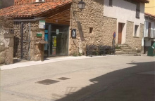
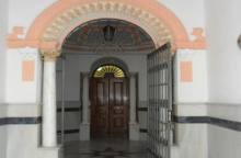
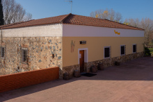
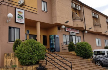
Accommodation in El Culebrín.


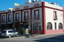
Monesterio is the capital of jamon iberico on the Via de la Plata. The town celebrates its signature product with the Dia del Jamon festival and a genuinely informative free museum in the town hall — the Museo del Jamon. Visit it for the full story of how iberico pigs are raised on acorns in the surrounding dehesa, how the hams are cured, and where to find the best tasting spots in town.
Beyond the jamon, there's not much to linger for. Services are adequate. The road beyond is another long waterless stretch — carry extra.
A new type of trail marker appears for the first time near Monesterio. It is a square bollard which depicts a Roman arch and pathway, is painted with two colored stripes, and is meant to indicate that you are following along a Roman road.
WARNING: The road beyond Monesterio is again a long one without water, be certain to carry enough with you.
The camino through Monesterio keeps along the N-630 but there are a few arrows which direct you left and into the town and the municipal albergue. At the far end of town, the camino leaves the N-630 by turning left just after the football field.
This stretch of the camino is poorly waymarked and at times there are conflicting signs; follow the yellow arrows when they are. The camino passes the Arroyo del Bodión (13.2km). Entering Fuente de Cantos there are far too many arrows, which isn’t particularly helpful given that the town is a knot of narrow streets. If you are trying to get to the albergue, follow the arrows to the left when you get to the edge of town. The albergue is located in the south-west corner and from there another set of arrows will deliver you to the correct exit point for the city.
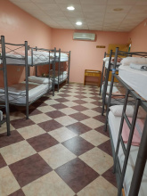
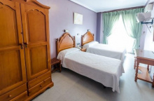
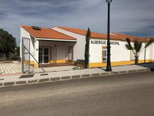
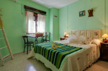
Accommodation in Monesterio.
| Albergue parroquial de Monesterio 10€ 12 |

|


Fuente de Cantos is best known as the birthplace of Francisco de Zurbaran, the 17th-century painter whose stark, shadow-drenched canvases of monks and saints hang in the Prado and in collections worldwide. The Casa Museo de Zurbaran occupies a restored house near the main square — small but worthwhile if it's open.
The Iglesia de Nuestra Senora de la Granada, directly on the camino, is a fine Baroque church with a cool interior that makes a practical rest stop in summer.
The town is a knot of narrow streets with more arrows than clarity — follow whichever set you find and they'll eventually exit the north side.
Zurbaran was born here in 1598. He trained in Sevilla and became one of the leading painters of the Spanish Golden Age, known for his dramatic use of chiaroscuro — particularly in his depictions of monastic life. His work influenced later painters including Manet and is represented in museums across Europe and the Americas.
There are as many marked routes through town as there are pilgrims to follow them, it is a bit of a mess. Follow whichever set you can find carefully and they will eventually exit the north side of town (NOT along the N-630) onto another farm track. It is level walking all the way to Calzadilla de los Barros.
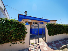
Accommodation in Fuente de Cantos.
| Pensión Casa Vicenta | 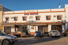
|
| Hotel La Fábrica | 
|
| El Zaguán de la Plata Booking.com |

A tiny village on a long flat stretch between Fuente de Cantos and Zafra. A bar and basic supplies. The Iglesia de El Salvador has a Mudejar tower worth a glance.
Pass straight through Calzadilla and pick up the farm track once again. It returns to the road but only for 500m before it turns left sharply away from the road to return to farm tracks all the way to Puebla de Sancho Pérez, passing the Arroyo Atarja (4.7km).
Accommodation in Calzadilla de los Barros.
| Albergue Juvenil de Calzadilla de los Barros 6€ 36 |
| Pensión Los Rodríguez | 
|

A small town dominated by the ruins of a hilltop castle visible from the approach. The Iglesia de Santa Lucia sits in the Plaza de Espana. A bar and basic services.
After passing the Plaza España and Ayuntamiento (Town Hall) the camino passes to the right of the Iglesia de Santa Lucía and heads straight to join the BA-160 out of town. It bears left after passing a gas station to follow a smaller paved road into Zafra.
Accommodation in Puebla de Sancho Pérez.
| Hostal El Monte | 
|


Zafra earned the nickname "Sevilla la Chica" (Little Sevilla) for its architecture and mercantile history. The old town is compact and handsome, centered on two linked plazas — the Plaza Grande and the Plaza Chica — both lined with arcades and outdoor tables perfect for a late-afternoon tinto de verano.
The Convento de Santa Clara houses the Museo Santa Clara, a donativo museum with a remarkable collection of medieval art and artifacts accumulated since the convent's founding in 1428. Among the highlights: a polychrome alabaster head of Saint John the Baptist from the 15th-century Nottingham school.
The Alcazar de los Duques de Feria, now the Parador, is a 15th-century castle with a striking marble courtyard. You can't miss it — it dominates the southern edge of the old town.
The Albergue Van Gogh, run by volunteers who promote the Via de la Plata, has a rooftop terrace ideal for winding down the evening. All services available.
Zafra prospered as a trading hub between Andalucia and Extremadura. Its livestock feria, the Feria de San Miguel, has been running since the 15th century and remains one of the largest in Spain — held every October around Michaelmas.
A remarkable 221 of Zafra's inhabitants joined Hernando de Soto's expedition to the New World in 1539. The town's wealth in the 15th and 16th centuries came from the Suarez de Figueroa family, Lords of Feria, who built the Alcazar and patronized the Convento de Santa Clara as their family pantheon.
The camino through Zafra crosses most of the important landmarks. It enters town near the train station (if you arrived by train, leave the station and turn right) and follows the boulevard straight towards the Plaza España and the large Parque de la Paz. It turns left at the Plaza (before the Parador/Castle) and crosses it diagonally, and on the far end it turns right onto Calle Sevilla (a pedestrian road). From here it passes through the Plaza Grande and makes a right hand turn onto Calle del Conde de la Corte. It will pass through one small triangularly shaped plaza and then exit the old part of town onto the Calle López Asme. From here turn left (the Convento Albergue is ahead on your right) and then right at the Convento Albergue. From here it is straight to and across a roundabout on the N-432. After passing to the left of a housing development the camino returns to the countryside.
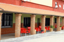
Accommodation in Zafra.
| Hotel Los Cazadores ★ | |
| Hotel La Muralla ★★ Booking.com |
|
| Hotel Casa Ruy López ★★ Booking.com |
|
| Hotel Plaza Grande ⭑ Booking.com |

|
| Hotel Victoria ⭑ Booking.com |
|
| Hotel Cervantes ⭑⭑ Booking.com |

|
| Hostal Arias ★ Booking.com |
|
| Hostal Carmen ⭑⭑ 46*€ Booking.com |

|
| Albergue de Peregrinos Van Gogh Zafra 15€ 40 |
|
| Parador de Zafra ⭑⭑⭑⭑ Booking.com |

|

A mid-sized town with all basic services. The Iglesia de Nuestra Senora de los Angeles, on the main square, has a notable 16th-century retablo. The town's name dates to a 13th-century Reconquista grant. The next water source is 15 km away — stock up.
Pack extra water when leaving Los Santos de Maimona, the next source is 15km away.
The arrows bring you through Los Santos, but near the albergue they are not too clear. In fact, they pass behind the albergue which sits like a walled island between two small roads. It returns to the countryside for a long (15km+) road to Villafranca.
Accommodation in Los Santos de Maimona.
| Albergue Turístico Vía de la Plata de Los Santos de Maimona 8€ 12 |

|
| Pensión Sanse II Michey | 
|
| Hostal Rosa | 
|


Villafranca de los Barros is a large agricultural town with all services, including four albergues for pilgrims — unusual abundance for the Plata. The Iglesia de Nuestra Senora del Valle, a 15th-century Gothic-Mudejar church, anchors the main square.
The stretch between Villafranca and Torremejia includes a long straight gravel section that follows the original Roman road — one of the best-preserved sections of the calzada on the entire route.
The stretch of the camino between Villafranca and Torremejía includes a long straight gravel section which is an original Roman road. It makes a few minor twists and turns but eventually heads directly into, through, and out of Torremejía.
Accommodation in Villafranca de los Barros.
| Albergue Extrenatura 15€ 20 |
|
| Pensión La Marina |


The stage between Villafranca de los Barros and Torremejía 26.5km can be shortened by making a detour to the nearby city of Almendralejo. This alternate route turns left off of the camino along the long straight section of the former Roman road.


Most services are located on the N-630, which runs parallel to the camino two streets to the west (your left).
If you made your way to the N-630 while in Torremejía there is no need to retrace your steps. Follow it out of town and you will rejoin the camino which emerges from your right. If follows adjacent to the road before arrows and a bollard direct you towards a path on your right. It passes the Ence Mérida factory and heads straight to the outskirts of Mérida where the arrows are a bit unclear. When you emerge onto the road you will see ahead of you a bridge over the river; you need to follow the trail (not the road) which passes underneath that bridge. It leads directly to a small riverside park and at the end of the park is the pedestrian bridge over the río into Mérida.
Accommodation in Torremejía.
| Albergue Rojo Plata 16€ 24 Booking.com |
|
| Hostal Milenium 20€ Booking.com |
|
The Puente Romano (Roman bridge) over the Río Guadiana carried cars as recently as the early 90’s before being retired to pedestrian use only. It remains the longest surviving ancient bridge and from the entrance, at the park, it is over 400m to the other side.
Once over the bridge the camino immediately turns left to follow a path along the river, avoiding altogether any meaningful entrance into the city of Mérida.

Merida was the capital of Lusitania — Rome's most important city in western Iberia — and the Romans left more here than anywhere else in Spain. The entire archaeological ensemble is a UNESCO World Heritage Site, and you need at least half a day to see it properly.
To see most of what Merida has to offer, step off the camino after it crosses the Puente Romano. Immediately after the bridge, looming on your right, is the Alcazaba — a 9th-century Islamic fortress built with reused Roman and Visigothic stone (paid). Continue up Calle Cava to the far end and turn left to find the Co-Catedral Metropolitana de Santa Maria la Mayor, unassuming from the outside.
From there, head up Calle Romero Leal to the Templo de Diana (free) — the best-preserved Roman temple in Spain, its survival owed to being incorporated into a Renaissance palace. The Portico del Foro Municipal is 100 m further.
Keep going until you reach Calle Jose Melida and turn right toward the spectacular Teatro Romano and Anfiteatro. The theatre was built in 16-15 BC, promoted by Agrippa. It seats 6,000 and is still in active use — the Festival Internacional de Teatro Clasico de Merida has been running since 1933, with Greek and Roman plays performed under the stars every July and August. The amphitheatre next door held 15,000 for gladiatorial games.
Directly opposite the entrance is the Museo Nacional de Arte Romano, designed by Rafael Moneo. The building itself would be worth the visit even without the collection.
The Acueducto de Los Milagros is the last major site, on the camino as it leaves the city heading north. All services available.
Emerita Augusta was founded in 25 BC by Emperor Augustus to settle veterans of the Cantabrian Wars. It quickly became the capital of Lusitania and one of the most important cities in the western Roman Empire. The Via de la Plata connected it to Asturica Augusta (Astorga) in the north, originally a military and trade road used to transport gold from the northern mines.
After Rome, the Visigoths made Merida an important seat. The Moors took it in 713, and the Alcazaba was built on Roman foundations. Alfonso IX reconquered it in 1230. The city then entered a long decline — its Roman infrastructure slowly crumbling, its population shrinking — until systematic archaeological work began in the 19th century. The UNESCO designation in 1993 recognized one of the largest and most extensive Roman archaeological sites in Europe.
The camino does not make any real entrance into the oldest parts of Mérida and with the exception of the Alcazaba (the castle at the end of the bridge) and the Acueducto de Los Milagros it avoids passing any of the most significant buildings in the city.
From the shadow of the aqueduct, the camino proceeds northward to a set of roundabouts. At the first roundabout it bears left, and at the second roundabout, it does the same to follow along with the Avenida del Lago to Proserpina.
Accommodation in Mérida.


The Acueducto de Los Milagros is the last major Roman site on the camino's way out of Merida, and it earns its name. The locals called it the "Aqueduct of Miracles" because they couldn't believe the thing was still standing centuries after Rome fell. Built in the 1st century AD, it once carried water from the Embalse de Proserpina 5 km to the north. What remains is a stretch of 38 pillars rising 25 m high over roughly 830 m, built in alternating bands of granite ashlar and red brick -- a construction technique called opus mixtum that gives the ruins their distinctive striped appearance. Together with the dam, the bridge, and the rest of Merida's Roman infrastructure, it's part of the UNESCO Archaeological Ensemble.
From the shadow of the aqueduct, the camino proceeds northward to a set of roundabouts. At the first roundabout it bears left, and at the second roundabout, it does the same to follow along with the Avenida del Lago to Proserpina.

Proserpina is a small settlement spread along the road north of Merida, named for the nearby reservoir. Most of the village sits to the east of the camino, but a few restaurants and bars line the road before and after the embalse. Don't expect much in the way of services -- this is a place to pause and take in what the Romans left behind, not to stock up. If you're planning to push through to Aljucen or beyond, fill your water bottles here.
The Embalse de Proserpina is one of the oldest functioning dams in the world. Built by the Romans in the 1st or 2nd century AD to supply water to Emerita Augusta via the Acueducto de Los Milagros, the dam stretches 440 m across and rises about 21 m, impounding a reservoir of roughly 5 million cubic metres. It still holds water today, though the aqueduct it once fed has long since fallen into ruin.
The dam itself is a wall of granite ashlar with a massive earth embankment behind it -- a Roman engineering approach that has proved remarkably durable. In summer the reservoir doubles as a popular swimming spot for locals from Merida. The name Proserpina comes from an 18th-century discovery: a tombstone found nearby invoking the goddess Ataecina-Proserpina, a local deity the Romans adopted.
The whole ensemble -- dam, reservoir, and the aqueduct ruins back in Merida -- is part of the UNESCO Archaeological Ensemble of Merida.
The dam was built in two phases, both Roman, using the same structural technique. Emperor Augustus founded Emerita Augusta in 25 BC as a colony for veterans of the Cantabrian Wars, and the city's growth demanded serious water infrastructure. The Proserpina system was one of two aqueduct networks feeding the capital of Lusitania -- the other ran from the Cornalvo reservoir to the east.
The camino follows a paved road away from the embalse for 4 km before turning sharply left to leave it (just before a bridge turns right). From here it follows a path for another 3.5 km into El Carrascalejo.


El Carrascalejo takes its name from the carrascas (holm oaks) that surround it, and that tells you most of what you need to know -- it's a tiny village in the dehesa. The bar adjacent to the Iglesia de la Consolacion maintains irregular hours, so don't count on it. There's a municipal albergue at the edge of the village. By the church you'll find a cruceiro built on what's said to be a Roman altar, a small reminder that this path has been walked for two thousand years.
The village sits between the Embalse de Proserpina (7.4 km back) and Aljucen (2.6 km ahead), making it a brief stop rather than a destination.
The camino climbs gently up to the village, passes counterclockwise around the church, and down the hill to the left and past the albergue. It passes beneath the A-66 before arriving at Aljucen.
Accommodation in El Carrascalejo.
| Albergue El Carrascalejo 15€ 24 Booking.com |
|

Aljucen is a small village that dates to the Al-Andalus period and has served travelers on this road for centuries. There's a shop, but the opening hours (10:00-14:00) make it impractical unless you time it right. Both bars do food, and they're your most reliable option.
The real draw here is the Termas Aqua Libera, a reconstructed Roman bathhouse that offers pilgrims discounted entry. The baths have four spaces with three pools at different temperatures and a tepidarium between them for conversation and rest. If you're a pilgrim, they'll lend you a towel and bathing suit. After days of walking through the Extremaduran heat, soaking in waters that echo what the Romans built here is a fine way to spend an afternoon.
Aljucen's name has Arabic roots, and the village was absorbed into the lands of Merida after the Reconquista. Its position on the Via de la Plata made it a natural rest stop for merchants, soldiers, and pilgrims long before the current village took shape.
The camino follows a paved road out of town and joins the N-630 before crossing the Rio Aljucen. Once over the river, it leaves the road (before the gas station) to follow a long path through the countryside.
Along the way to Alcuescar, there are two detours. The first is to the Basilica de Santa Lucia del Trampal but it is not well signposted. From the Basilica you can simply follow the road 3 km to Alcuescar. Of course, if you are not comfortable with the trails and signage you can always walk that same road from Alcuescar to visit the 7th-century Visigothic temple. Admission is free (but closed on Mondays) and there is a small exhibition explaining the archaeological findings.
The second detour is mentioned below.
Accommodation in Aljucén.
| Albergue San Andrés 15€ 22 |
| Casa Romana Aqua Libera ⭑⭑⭑⭑ Booking.com |
|


The signage for the accommodation and restaurant at Las Herrerías is unofficial and somewhat misleading. Just know that it is a detour to the left and that the official camino and Alcuéscar are to the right.
If you made this detour, follow the main road (the EX-382) in the direction of Alcuéscar.
Accommodation in Detour to Cruce de Las Herrerías.
| Hostal Canuto | 
|

Alcuescar is a modest Extremaduran town with enough services to make it a practical stop -- bars, small shops, a pharmacy, and an albergue. There are no arrows in town since the camino enters along the road and leaves at the Casa de Beneficencia, so navigating the streets is a matter of common sense rather than waymarks.
The real reason to linger is the Basilica de Santa Lucia del Trampal, located 6 km south of town along a quiet road. This Visigothic church from the second half of the 7th century is the only one of its kind still standing in southern Iberia. It was lost for centuries, buried under vegetation, and only rediscovered in 1981. The floor plan is shaped like the Greek letter tau, with three independent chapels opening onto a transept through horseshoe arches. Original stone vaults survive, along with three domes supported by transversal horseshoe arches -- architectural features that wouldn't appear again until the Asturian pre-Romanesque period. The builders reused Roman and pre-Roman materials, which you'll spot in the walls. The site has an astronomical orientation that researchers are still studying. Admission is free, closed Mondays, and there's a small exhibition explaining what archaeologists found.
If you didn't detour to the Basilica on the walk in from Aljucen, consider the 6 km round trip from Alcuescar. It's one of the most significant archaeological sites on the entire Via de la Plata.
The Basilica de Santa Lucia del Trampal dates to the late Visigothic period, likely the second half of the 7th century. Built as a monastic church, it represents the most complex surviving Visigothic architectural structure in Spain. The use of Roman spolia (reused stone from earlier buildings) and its sophisticated vaulting system make it a crucial link between late Roman architecture and the Asturian pre-Romanesque that would follow. Its horseshoe arches predate the Moorish conquest, showing that this form was already part of the Iberian architectural vocabulary before Islam arrived.
The camino leaves town at a left turn just after the albergue. It is a paved road which gives way to a dirt road to follow through the countryside to Casas de Don Antonio.
Accommodation in Alcuéscar.
| Albergue Turistico Pampejo 20€ 33 |
|
| Apartamentos Rurales Casa Grande | 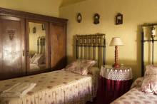
|

The camino completely bypasses Casas de Don Antonio, so you'll need to step off the marked trail to reach the village. There's a small bar and shop in the local social centre -- minimal services, but enough for a cold drink and a rest. The village itself is quiet and depopulating, like so many along this stretch of Extremadura. If you don't need to stop, you won't miss much by pressing on.
Beyond Casas de Don Antonio the camino returns to the N-630 but follows a path adjacent to it. It crosses the N road and begins to veer away from Aldea del Cano.


Aldea del Cano sits 500 m off the camino and is easy to miss if you're not paying attention. The albergue is here -- ask for the key at the bar next door (Las Vegas). The village has a couple of bars and a small shop, enough to refuel before the walk to Valdesalor and on to Caceres. It's a quiet, functional stop.
If you stayed in Aldea del Cano, take the road adjacent to the albergue to return to the camino. It follows country roads again, passes under the motorway, and over the Aerodromo de la Cervera. When it gets to the Rio Salor take the left-most bridge straight to Valdesalor.
Accommodation in Aldea del Cano.
| Albergue Miliario del Verdinal 6€ 12 |

|
| Casa Rural Vía de la Plata Booking.com |

|
Valdesalor is the last stop before Caceres, and it's a small one. The albergue is one of the first buildings in town; instructions for getting the key are posted on the door -- typically available at the ayuntamiento or the Hogar del Pensionista. A couple of bars and a small shop cover the basics. Early morning coffee is available at the Repsol gas station when leaving town, which is useful since the bars may not be open at pilgrim hours.
From here it's roughly 12 km to the centre of Caceres, an easy half-day that makes Valdesalor a good option if you want to arrive in the city with energy to spare for sightseeing.
The camino leaves town along the N-630 for a short distance. At the Repsol gas station, it turns towards the right to cross over the motorway. It climbs gently to the Puerto de las Camellas (4.9 km). The path is soft until the suburbs of Caceres begin.
The camino enters the old town of Caceres from the east.
Accommodation in Valdesalor.
| Albergue de Valdesalor 6€ 14 |

|

Caceres deserves your time. The old town was declared a UNESCO World Heritage Site in 1986 for its extraordinary blend of Roman, Moorish, Gothic, Renaissance, and Plateresque architecture, and it's considered the third best-preserved medieval centre in Europe after Prague and Tallinn. Go slow through it.
The camino enters through the Arco del Cristo, a 1st-century Roman gate and one of the few surviving openings in the original wall. Just uphill from the gate is the Casa/Museo Arabe, which offers a glimpse of domestic life for a wealthy Muslim family in the 12th century.
The first plaza you reach is the Plaza de San Jorge. The baroque church on the opposite end is the Iglesia de San Francisco Javier, commonly called the Iglesia de la Preciosa Sangre (Precious Blood), built by the Jesuits in the 18th century. Its tower can be climbed for commanding views over the rooftops.
From the Plaza de San Jorge the camino veers right, passing through a series of interconnected plazas to reach the Concatedral de Santa Maria. Built between the 15th and 16th centuries, it shares cathedral status with the one in Coria. If you don't make it inside, at least rub the toes of the bronze statue outside -- they belong to San Pedro de Alcantara, and their shine is a testament to the local belief that rubbing them brings good fortune in love.
The Palacio de los Golfines de Abajo sits nearby, a 15th-century Gothic fortress-palace where the Catholic Monarchs stayed when visiting the city. It functioned as the Golfin family's private residence for 500 years before reopening as a museum in 2015.
At this point, the Plaza Mayor is due west -- take the road to your left and through the archway. The plaza is lined with restaurants and overlooked by several medieval towers, the most prominent being the 12th-century Torre del Bujaco, a 25 m Arab-built watchtower on reused Roman ashlars that has become the city's symbol. Around 30 towers from the Islamic period still stand within the walls.
The camino follows a different path from the Concatedral, to the right, making a wide loop around the old town to pass the Iglesia de Santiago de los Caballeros, a 14th-century church built over an earlier 12th-century structure. The walled old town is encircled by 1,174 m of 12th-century Almohad walls -- compact enough to see in an afternoon, dense enough to reward a full day.
All services: hotels, pensions, restaurants, supermarkets, pharmacy, ATM, hospital. Book ahead in summer.
Caceres was founded by the Romans as Norba Caesarina in the 1st century BC. After Rome fell, it passed through Visigothic and then Moorish hands. The Almohads built the walls that still encircle the old town, and in 1229 Alfonso IX of Leon reconquered it definitively for the Christians. What followed was a golden age of construction. Rival noble families -- the Golfines, the Ovando, the Ulloa -- competed to build the most imposing fortified houses and towers. Queen Isabel I ordered many of the towers dismantled to curb the families' power, but enough survived to give the old town its distinctive skyline. The result is a city where Roman foundations support Moorish walls, which in turn are flanked by Gothic palaces and Renaissance facades -- layers of history stacked on top of each other with surprising coherence.
The best landmark for exiting Caceres is the bull ring, where the arrow visibility increases. Cross the main road at the bull ring and follow the signs to Casar de Caceres. You'll quickly find yourself leaving town along a divided colonnade with trees for shade. The pedestrian walk ends and the camino follows along the road to a large roundabout. Cross to the left and follow the roundabout clockwise. Be sure NOT to follow the N-521. You are looking for the smaller CC-38. Along the way keep an eye out for arrows which take you away from this busy road to enter Casar de Caceres along a much quieter path.
Accommodation in Cáceres.
| Albergue Municipal Ciudad de Cáceres 16€ 60 |

|
| Albergue turístico Las Veletas 16+€ 30 Booking.com |

|
| Pensión Zurbarán | 
|


Casar de Caceres is a proper town with plenty of food choices along the camino and opportunities for shopping. The local swimming pool is a welcome way to cool down in summer. But the real reason Casar is on the map -- and on every menu in Extremadura -- is the Torta del Casar.
This is one of Spain's great cheeses. Made exclusively from the milk of Merino and Entrefina sheep and curdled with wild cardoon thistle rather than animal rennet, the Torta del Casar has a creamy, almost liquid interior with a distinctive slightly bitter edge. It takes the milk of 20 sheep to make a single kilogram. The cheese holds Protected Designation of Origin status, and today only eight families still produce it. The traditional method is to cut the top off like a lid and scoop out the interior with bread. The Museo del Queso is small and has a bit of charm, though it leaves a bit to be desired after the jamon museum in Monesterio.
PACK WATER. The camino ahead is through remote pastures with little opportunity to refill. There are no services between Casar and the Rio Almonte crossing, roughly 18 km. Plan accordingly.
The cheese tradition here goes back centuries. Local shepherds discovered that the cardo -- a purple-flowered thistle that lines the paths of these old Roman roads -- could coagulate their sheep's milk. Production was originally limited to late winter and early spring, when milking was at its peak and temperatures were right. The Protected Designation of Origin was granted in 1999, formalizing what had been a village craft for generations.
Market day: check locally for the weekly schedule.
The camino leaves Casar de Caceres along the road to the north. It almost immediately turns to dirt and continues through the countryside. Along the way, you will pass beside and through walled pastures. It is a quiet stretch of road which, when dry, is rather enjoyable. It is remote, and the only signs of civilization along the way are a few farms and the ongoing construction of the AVE rail line.
You are approaching a large embalse (reservoir) and there are two large bridges which take you over two of the rivers that feed into it. The first is the Rio Almonte (17.8 km) and the second is the Rio Tajo (3.5 km). After this second crossing, the camino turns sharply uphill and to the right to leave the road. Opposite the road from this turn is the detour described below.
Accommodation in Casar de Cáceres.
| Albergue Municipal de Casar de Cáceres 5€ 22 |

|
| Albergue Turistico Ruta de la Plata Casar 24€ 20 Booking.com |

|


The Rio Almonte crossing marks the end of a long, waterless stretch from Casar de Caceres. There is a municipal albergue down the road -- a wonderful new building with an excellent view over the reservoir -- but it has a history of problems related to its construction which make it hard to predict if it will be open for the season. It's included here for the sake of completeness, but check ahead before counting on it.
The bridge itself is substantial, and the reservoir below feeds into the Embalse de Alcantara. This is wild, remote country -- dehesa as far as you can see, with black Iberian pigs and the occasional eagle overhead. The landscape between here and Canaveral is some of the emptiest on the entire Via de la Plata.
Rejoin the camino at the road, making sure to follow the trail upwards and not the road downwards.


The albergue in Alcántara is closed, making this detour less common.

Note that the albergue here is closed indefinitely and that a private Hostel exists.
Canaveral is a welcome sight after the remote crossing from Casar de Caceres. The town grew up around the Canada Real Soriana, a transhumance route for cattle and salt trade, and has served travelers on this north-south corridor for centuries. Basic services are here: a hostel, bars, small shops, an ATM, and a pharmacy.
The village sits within the buffer zone of Monfrague National Park, one of Spain's premier bird-watching sites. Imperial eagles, black storks, and black vultures are regular sightings in the surrounding dehesa. If you have binoculars, this is the stretch to use them. Monfrague itself is a detour off the camino, but the birdlife doesn't respect park boundaries -- keep your eyes on the sky.
Beyond Canaveral the camino offers several options, though they are not presented anywhere and you are most likely to just follow the arrows as you find them and that is OK. This first arrow is just a few hundred meters out of town and takes you to the left and uphill; they look mighty official but locals explain that they were painted by a German cyclist. To get to the second set of arrows just keep on the road to the first roundabout (quite possibly the only roundabout in the world with a chimney) and take it to the left following the N-630. The second set of arrows will take you off the road to your left and past the Ermita de San Cristóbal.
One more word of caution is in order. Be sure to follow the camino markers here and not any of the other popular hiking trails. You will cross a few major roads near a junction with a large CLUB.
8km from Cañaveral the camino is signposted with an optional detour to the small town of Grimaldo.
Accommodation in Cañaveral.
| Albergue Turístico Hostel Cañaveral 16€ 23 Booking.com |
|
| Posada La Campana Booking.com |

|
| Hostal Málaga |

Located off the camino, 700m to get there.
9km from Grimaldo, at a place called Cuatro Términos, the camino is signposted with a second option to Riolobos. Note that Riolobos is no longer on the camino and is a rather large detour. Continue straight instead.
Located off the camino. 700m to get there. Upon returning to the camino, you will still have an opportunity to take another optional detour via Riolobos.
Accommodation in Grimaldo.
| Albergue Municipal de Grimaldo Donativo€ 12 |

|
| La Posada de Grimaldo | 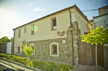
|
Accommodation in Riolobos.
| Camping Las Catalinas Booking.com |

|
| Casa Rural Abuela Maxi 20€ Booking.com |
|

Galisteo is worth slowing down for. The town walls are among the best preserved in Extremadura — you can walk atop them, though the path is narrow and uneven enough to give anyone with wobbly legs or a fear of heights second thoughts. The walls incorporate decorative bands of river stones arranged in herringbone patterns, a distinctive local construction technique.
Inside the walls you'll find a few shops, a bank, and the Iglesia de la Asuncion near the eastern gate — an oddity for not being oriented to the east. A small bar and the albergue round out the services.
Galisteo's documented history begins in 1217, though the walls predate the first written records. The Almohads built the fortifications during their period of control, and after the Christian reconquest, the town became the capital of the Galisteo Estate, a position it held from 1229 until 1837. The Mudejar apse of the church reflects the cultural mixing that defined post-reconquest Extremadura -- Christian builders working in Islamic-influenced styles, creating something that belonged to neither tradition alone.
From the albergue return to the main road and exit town by walking uphill past the walled part of town, keeping it to your right. Arrows bring you to the Rio Jerte (1.7 km) and the Puente Romano which crosses it.
From the river, the camino climbs to a pair of roundabouts which straddle the motorway. It is paved walking to Aldeahuela del Jerte.
Accommodation in Galisteo.
| Albergue Turístico de Galisteo 18€ 8 |
|


Straight through town and out again along the same road all the way to Carcaboso.
Carcaboso is a tangle of narrow streets that can be confusing to navigate. Head left along the main road from where the camino arrives for most services. The real point of interest is at the Iglesia de Santiago, where three Roman milarios (milestones) stand — from the emperors Trajan and his adopted son Hadrian, both of whom invested heavily in the roads that became the Via de la Plata.
Trajan in particular is remembered as one of Rome's great builders of public infrastructure. The milestones are a tangible reminder that the path under your feet has been a road for two thousand years.
The milarios at Carcaboso date from the early 2nd century AD, during the reigns of Trajan (98-117 AD) and Hadrian (117-138 AD). These emperors, both born in the Roman province of Hispania, were the principal promoters of the Via de la Plata as a formal Roman road. The cylindrical granite monoliths were engraved with the distance, the name of the emperor, and sometimes the name of the nearest city. Hundreds originally lined the route; those at Carcaboso are among the best-preserved survivors.
The way from Carcaboso to Ventaquemada is a return to nature with a few options along the way. The first turn to pay attention to is less than a kilometre out of town where your natural tendency is to keep on a straight path; the camino turns right at a sign for Finca Bombay (an adventure sports company, in case you're inclined to rent an e-bike). Not far beyond that turn is a split, and here both options are perfectly viable. To the left is somewhat shorter, and to the right is a trail marked H1 along the more historic path.
The two options rejoin and continue through the countryside to Ventaquemada.
Accommodation in Carcaboso.
| Albergue turístico y de peregrinos Señora Elena 11€ 12 |

|
| Albergue Los Miliarios 20*€ 20 Booking.com |


Identifiable only as a road crossing with a few buildings. The road to your right leads to Oliva de Plasencia. Continue straight to follow the trail to Cáparra.

Off the camino but a handy way to break up the stage. You can return to the camino at Cáparra for a visit.
Accommodation in Oliva de Plasencia.
| Albergue Via Caparra Confort 20€ 15 |

|
| Vía Caparra Superior ⭑⭑⭑ Booking.com |

|

Caparra is one of the most important archaeological sites on the Via de la Plata, and its centrepiece -- a four-sided Roman arch standing alone in the dehesa -- is unlike anything else you'll see on any Camino.
The city was founded as Capera by the Vetones, a pre-Roman Celtic people, before being absorbed into the province of Lusitania. Its location at a crossroads on the Via de la Plata made it strategically vital: few Roman urban centres existed in this part of Hispania, and Caparra grew to include an amphitheatre, a reservoir, and the private houses (domus) of a prosperous merchant class. The Roman road ran directly through the centre of town, and it's that intersection the famous arch commemorates.
The Arco de Caparra is a tetrapylon -- a four-sided, four-gated arch -- and it's the only surviving example of this type on the Iberian Peninsula. Built at the end of the 1st century AD, it originally stood around 13 m tall, marking the crossing point of the city's two main roads. You can walk through it from any direction, which is the whole point of a quadrifrons design. The arch has lost its upper decoration but the four massive pillars and their arches remain, and standing beneath it with the dehesa stretching away in every direction, you get a visceral sense of how important this place once was.
The site is now an open-air museum. A visitor centre and bathrooms are at the public entrance. The ruins of the forum, thermal baths, and residential blocks are partially excavated and labelled. Give yourself at least 30 minutes; an hour is better.
After periods of heavy rain, inquire about the route ahead. Several river crossings between here and Aldeanueva del Camino are made difficult by high water. In extreme cases, a detour can be made from Oliva de Plasencia to Villar de Plasencia on the other side of the N-630.
Caparra was likely a Veton settlement before the Romans arrived. Under Rome it became a stipendiary city in the province of Lusitania, eventually gaining municipal status. The arch dates to the late 1st century AD, a period of prosperity when the city was an important stop on the route between Emerita Augusta (Merida) and Asturica Augusta (Astorga). During the 3rd-century crisis that shook the empire, the city built defensive walls, and many of the original grand houses were subdivided into smaller residential blocks -- a sign of declining fortunes. By late antiquity, Caparra was largely abandoned, and the dehesa slowly reclaimed it. The arch survived simply because there was nobody left to tear it down for building materials.
8.4 km from Caparra you will find markings indicating a detour to your right. They point the way to Jarilla (2 km) where there is accommodation.

The 3.3km addition is to the roadside Hostal Asturias.
From Jarilla you do not need to retrace your steps. Follow the N-630 and you will rejoin the camino.
Accommodation in Jarilla.
| Hostal Asturias Booking.com |
|
Aldeanueva del Camino sits at the southern edge of the Valle del Ambroz, a transition zone where the dry Extremaduran plains give way to the green mountains of the Sistema Central. The town has basic services — bars, a small shop, a pharmacy — and makes a practical stop before the climb to Banos de Montemayor.
From here it's possible to make a side trip (3 km) to Hervas, a hilltop town with a well-preserved Jewish quarter (juderia) that's one of the most attractive small towns in northern Extremadura.
Aldeanueva's origins lie in a Roman camp established to service the Via de la Plata. After the Moorish invasion the village was depopulated, then resettled following the Reconquista. Its strategic position on the road made it a border town between the kingdoms of Castilla and Leon. Documents from the Monastery of Guadalupe record the expulsion of Jews from Aldeanueva in the 15th century. The French destruction during the Peninsular War left the village in ruins, but it was rebuilt along the same road that had defined it for nearly two millennia.
The camino follows the road out of town to a roundabout, where you turn right to cross over the motorway. At the roundabout on the opposite side turn left to resume walking along the road all the way to Banos de Montemayor.
Accommodation in Aldeanueva del Camino.
| Albergue de peregrinos de Aldeanueva del Camino 10 |
| Albergue La Casa de mi Abuela 13€ 26 Booking.com |
|
| Casa Rural El Caminante Booking.com |
|


Not a town but a large campground with a restaurant along the road. The side trip to Hervas (3 km) is worthwhile if you have the energy — a beautiful hilltop town with a well-preserved juderia.
Accommodation in Las Cañadas.


Banos takes its name from the thermal waters that spring up here — the Romans knew them, and a 1st-century bathhouse was excavated beneath the current balneario. If you fancy a splurge, the thermal spa is the place. The mountains surrounding the town provide a temperate microclimate that the locals enjoy and that pilgrims must climb through.
From Banos the camino begins the ascent to the Puerto de Bejar along the original Roman road on the east side of town. Avoid the temptation of following the N-630 — the old calzada is the proper route, and the climb is steep but less than 3 km.
The thermal springs here were known and used well before the Romans formalized them. Under Roman rule, Banos became a waypoint on the Via de la Plata where travelers could rest and recover. The baths that survive date from the 3rd century AD -- the vaulted underground room with its twin pools is remarkably well preserved. The town's development has always followed the road; its main axis is the ancient route itself, now paved but running the same course it has for two millennia.
From Banos the camino begins its climb to the Puerto de Bejar. It begins along the old Roman road on the east side of town -- avoid the temptation of following the N-630 (though that will also get you to both the alto and the Albergue El Solitario). The climb to the alto is fairly steep, but less than 3 km.
Accommodation in Baños de Montemayor.