The Puerto de Pajares is one of the few mountain passes that for centuries has offered passage over the Cantabrian Mountains from the meseta into Asturias. It remained the primary corridor until the construction of the A-66 motorway to the west. It's still a difficult road for drivers, and snow is not uncommon here as late as June.
The old Parador has reopened its bar — worth a stop for the views alone. Across the road, Venta Casimiro has rebuilt after a fire and is the bar "de siempre" — go there for soul and a real meal, the Parador for views. You've earned either or both after the mountain crossing.
At approximately 1,378 m elevation, the air is noticeably cooler than the meseta you left behind. From here, it's all downhill into Asturias.
Snow is possible at the Puerto de Pajares well into June. If you're crossing in spring or early summer, check conditions before setting out from Poladura. The bar at the pass may keep limited hours outside the summer season — don't count on it.
The Puerto de Pajares has been the main crossing between León and Asturias since pre-Roman times. The Romans improved the route, and it remained the primary road connection until modern highway construction. In 1884, the railway tunnel through the mountains opened, connecting León to Gijón and transforming the economy of northern Spain. The old Parador was built as a government rest house for travelers crossing the pass — a tradition of hospitality at this site that stretches back to the medieval hospice at Arbas below.
The camino leaves the main road to follow a trail behind some farm houses at the far end of the alto. If you've gone as far as the old Parador, you'll need to backtrack a bit and avoid the temptation to follow the road. At the farm buildings, turn right and begin a gentle ascent to the border between León and Asturias.
Here you'll pass through a gate and descend back to the national road — which is genuinely dangerous with fast traffic. Cross over the road with extreme caution to resume along a trail down to Pajares.
Along the way to Pajares you'll find a junction requiring you to choose between Pajares or San Miguel. The route through San Miguel also arrives at Pajares but takes 5 km longer. It's only recommended for cyclists or pilgrims who intend to sleep in Bendueños (1.5 km off camino).


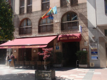
Welcome to Asturias. Pajares is a small village below the mountain pass, and after the crossing you've just done, even this modest place feels like civilization. There's one restaurant in town — El Mirador — which is recommended. Call the day before to give them notice: +34 636 933 069. It's closed on Tuesdays. There's no grocery shop, so if El Mirador is closed, you'll need to press on to Campomanes.
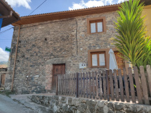
The village has a handful of accommodation options. The air is different here — wetter, greener, distinctly Asturian. You've crossed from the dry meseta into one of the greenest corners of Spain.
The only meal in town is at El Mirador. Recommended, but call the day before to give them notice: +34 636 933 069. Closed Tuesdays. No grocery in town.
Leaving Pajares, stay on the road to the village limits. The camino turns left and begins a steep descent into San Miguel del Río in the valley below. The drop is significant — take it easy on your knees.
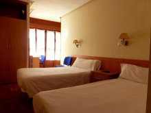
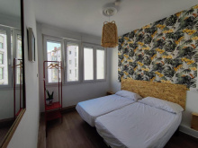
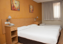
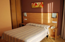
Accommodation in Pajares.
| Albergue de Pajares 5€ 16 |
|
| Pensión El Mirador | 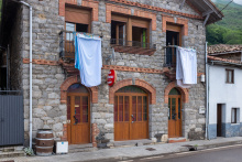
|

San Miguel del Río is a small Asturian village divided between upper and lower halves. No services, but the green valley setting after the mountain crossing is a pleasant contrast to the stark terrain behind you. Traditional stone houses with slate roofs line the narrow lanes.
From San Miguel, follow the signs toward Santa Marina. The village is divided, and you want the upper half — turn left at the first fork in the road where a shell marker on your right indicates you should keep on the road. Do not follow the granite marker that tells you to continue straight.
Later, after following the road to Santa Marina, the camino comes to a chapel where you need to pay close attention. The path goes through a gate that appears to lead to a private garage. On the other end of the farm are two more wooden gates, and beyond them another path covering the remaining 2 km to Llanos de Somerón. Trust the arrows — it looks wrong but it's right.


Santa Marina is a tiny hamlet between San Miguel del Río and Llanos de Somerón. There are no services. The village is notable mainly for the confusing camino signage at its chapel — the path passes through what appears to be a private property but is in fact the correct route. A handful of traditional Asturian stone houses cluster around the chapel.


Llanos de Somerón has a fountain and a pleasant spot to rest in front of the church. If you settle in for a break, don't be surprised if a local appears to unlock the church for you — Asturian hospitality at its quiet best. There are no formal services, but the water and the shade make it a natural pause point.
From Llanos de Somerón to Puente de los Fierros there are two options.
The road route: Before entering the small town, look for a path to your left marked "Fresnedo." You don't actually need to enter Puente de los Fierros. This route takes you through two hamlets and past the Ermita de San Miguel and a fountain. It's gentler and more scenic than the road.
The Munisteriu alternative: A more challenging route that abandons the road shortly after leaving town and follows a 4.8 km mountain trail. The elevation gain and loss is 133 m up and 387 m down. It's more rigorous, but most rewarding things are. If your legs are fresh and the weather is good, take this one.
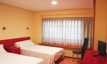
Accommodation in Llanos de Someron.
| Albergue Cascoxu 22*€ 16 |
|

At the entrance to Puente de los Fierros, the camino splits into two routes. To the right, signed "La Frecha," is the more common, less scenic option — entirely along the roadway. Over the bridge, you turn left and follow the N-630.
The better choice, in my opinion, is to turn uphill to your left toward Fresnedo. This upper route takes you through two hamlets, past the Ermita de San Miguel, and past a fountain. Both routes rejoin in Campomanes. Take the upper route via Fresnedo — the work you put into it will be worth avoiding the unforgiving asphalt.
The village itself has limited services. Its name — "Bridge of the Irons" — speaks to the mining and metalworking heritage of the valley.
The name Puente de los Fierros (Bridge of the Irons) reflects the long history of iron mining and metalworking in these Asturian valleys. Iron ore has been extracted from the Cantabrian Mountains since pre-Roman times, and the rivers that flow through these valleys powered the forges that worked it. The bridge that gives the village its name spans the Río Pajares at the point where the mountain routes converge into the main valley.
Herías is a small village along the valley road. The albergue listed here is actually in Bendueños, a 1.5 km hike uphill from the main route. Sandra, the hospitalera, may be willing to drive down to pick you up — but call ahead, preferably the day before, as this can't always be arranged. The detour is worth considering if you want a quieter night away from the road.
The albergue is in Bendueños, 1.5 km uphill from the camino. Call Sandra before you arrive — preferably the day before — to arrange pickup or confirm availability.
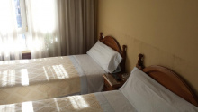
Accommodation in Herias.
| Albergue de peregrinos Santuario de Bendueños Donativo€ 8 |
|

Campomanes is the return to civilization you've been waiting for. After the mountain villages and hamlets of the past two days, a town with actual restaurants, bars, and private accommodation feels like luxury. The town sits between the old national road and the A-66 motorway, at the northern end of the convergence of two valleys.
It's a practical rather than beautiful place — the motorway infrastructure overshadows whatever charm the old village once had. But the food is real, the beds have mattresses, and you can buy groceries. After the mountains, that's enough.
Campomanes sits at the convergence of the Pajares and Lena valleys, a strategic position that made it important long before the motorway arrived. The town grew with the coal mining industry in the 19th and 20th centuries, and like many Asturian valley towns, it's been adapting to a post-industrial economy since the mines began closing. The old national road through town was once the main artery between León and Oviedo.
The camino continues straight through town, turns right to cross the N-630, and a bit later crosses the river. Just past the river it doubles back to the left to follow a road along the river toward the Iglesia de Santa Cristina de Lena — one of the most important pre-Romanesque churches in Spain, and well worth the detour.
Accommodation in Campomanes.


In Vega del Rey, keep a lookout for the black pedestrian bridge on your right. Across the highway and up a short but rigorous climb lies one of the most important little churches in Asturias — Santa Cristina de Lena. The climb is steep but brief, and the reward is a UNESCO World Heritage building that's been standing since the 9th century.
Vega del Rey itself is not technically on the current camino route from Campomanes, but it's possible you've arrived here by taking the road from Campomanes instead of crossing the river. If so, use the pedestrian bridge to cross the highway and reach the church.
Vega del Rey is no longer on the main camino from Campomanes, but it is accessible if you've followed the road instead of crossing the river. The pedestrian bridge crosses the busy highway to your right and brings you to Santa Cristina de Lena.
Santa Cristina de Lena is a UNESCO World Heritage Site and one of the finest examples of pre-Romanesque Asturian architecture in existence. Built in the mid-9th century during the reign of Ramiro I, this tiny church sits alone on a hilltop above the valley, and its proportions are so perfect that it seems larger than it is.
The interior is divided by an iconostasis — a pierced stone screen separating the nave from the sanctuary — which is unique among Asturian pre-Romanesque churches. The Visigothic-influenced carved panels, the barrel vaulting, and the triple-arched window screen are architectural treasures. The church was part of a broader building program by the Asturian monarchy that also produced Santa María del Naranco and San Miguel de Lillo near Oviedo — both of which you'll have the chance to visit when you arrive there.
Visiting hours can be limited, especially outside summer. Check locally or call the Lena tourist office for current times. The detour from the camino adds roughly 2 km round trip, but this is one you shouldn't skip.
Santa Cristina de Lena was built around 852 AD as part of the extraordinary flourishing of pre-Romanesque architecture under the Asturian monarchy. The Kingdom of Asturias, the small Christian realm that held out against Moorish expansion, developed an architectural style unlike anything else in Europe — blending Roman, Visigothic, and early medieval influences into something entirely original.
The church was inscribed as a UNESCO World Heritage Site in 1985 (extended in 1998) as part of the "Monuments of Oviedo and the Kingdom of the Asturias." Its survival for over 1,100 years on an exposed hilltop is remarkable in itself. The building served various functions over the centuries, including a period as a granary, before being recognized for its architectural significance and restored in the 19th century.

Palacio is not on the camino, but it's the access point for Santa Cristina de Lena and is included in the guide because there's a hotel here. Getting to Palacio and back adds about 2 km to your journey. If you want to combine the church visit with an overnight in a proper hotel, this is your option.
Accommodation in Palacio.
La Cobertoria is a small settlement along the route between Campomanes and Pola de Lena. There are no pilgrim services. The name may derive from the Latin "coopertorium" — a covered place or shelter — suggesting this was historically a stopping point for travelers. You'll pass through quickly.

Vega del Cielo — "meadow of the sky" — is a small hamlet with a name more evocative than the place itself. There are no services, but the green valley setting and the name itself make it a pleasant waypoint. The terrain here is gentle and the walking easy, a welcome change after the mountains.
Pola de Lena is the biggest town you've seen since León, spread lengthwise along the road through the Lena valley. There's an albergue with basic services near the train station, and plenty of bars and grocery shops to meet pilgrim needs. The town has a working-class character shaped by generations of coal mining — not glamorous, but genuine and functional.
The train station is useful if you need to bail out or if someone is joining you on the route. RENFE trains connect Pola de Lena to Oviedo, León, and beyond. Stock up here if you need anything — the next stretch through the smaller valley towns doesn't offer much.
The municipality of Lena has been inhabited since prehistoric times, with the valley serving as a natural corridor between the coast and the meseta. The Romans built roads through here, and the Asturian monarchy left its mark with Santa Cristina de Lena above. The modern town's identity was shaped by coal mining from the 19th century onward. The Asturian miners' revolts of 1934 — a precursor to the Spanish Civil War — had strong support in towns like Pola de Lena. The mines have largely closed, but the memory runs deep.
The Fiestas de San Martín are celebrated in November. Pola de Lena also participates in the broader Asturian tradition of the Antroxu (Carnival) in February, which is celebrated with particular enthusiasm in the mining valleys.
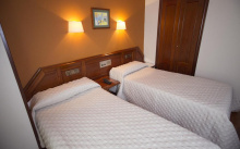
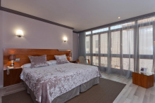
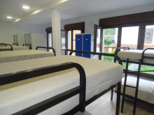
Accommodation in Pola de Lena.
| Albergue de Pola de Lena 6.75€ 36 |
|
| Albergue Roma 15€ 20 Booking.com |
|


Villallana is a small town between Pola de Lena and Ujo. There are limited services — a bar that may or may not be open. The town sits along the main valley road and has the feel of a place that was once busier when the mines were running. The walk through is quick and unremarkable.

Upon entering Ujo, keep to your left if you want to stop for coffee or breakfast. To your right is an exercise path that you can also take, but it bypasses all of Ujo's services.
The church, the train station, and the breakfast bar are all in the square to your left when you follow the road. Both routes meet up at the end of town, and from here to Mieres you'll follow the exercise trail along the river. Ujo has a quiet dignity — a mining village that's adjusted to quieter times without losing its character.
Ujo was a significant mining settlement during the coal boom. The train station connected the village to the broader mining rail network that moved coal from the valleys to the ports and steel mills. Like many villages in the Caudal valley, its population has declined as the mines closed, but the architectural legacy of the mining era — solid workers' housing, the rail infrastructure, the social clubs — remains visible.

Included in the guide for the sake of measuring distances, Santullano for pilgrims is nothing more than a train station along the valley route. Don't confuse it with San Julián de los Prados (also called Santullano), the magnificent pre-Romanesque church in Oviedo — that one you'll see when you arrive at the end of the route.

Mieres is a real town — commercially oriented, with all services a pilgrim could need. Restaurants, bars, shops, banks, pharmacies — everything is here. The town sits at the junction of the Caudal and San Juan valleys and was once the beating heart of Asturias's mining industry.
The Iglesia de San Juan is worth a visit if you're passing through the center. There's an urban park that makes for a pleasant break, and the town has enough restaurants to offer a proper Asturian meal. Try the fabada if it's on the menu — you're in its homeland now.
Mieres isn't winning any beauty contests, but it's honest and well-equipped. After the mountain hamlets, a town with actual infrastructure feels like a gift.
Mieres was the epicenter of Asturian coal mining and one of the most important industrial towns in northern Spain. The miners of Mieres played a central role in the Asturian miners' strike of 1934, which was violently suppressed and became a precursor to the tensions that erupted in the Spanish Civil War two years later. During the Franco era, the mines continued to operate under harsh conditions, and the town's identity remained inseparable from mining. The industry declined sharply from the 1990s, and Mieres has been reinventing itself since — focusing on services, education (there's a campus of the University of Oviedo here), and outdoor tourism.
San Juan festivities in late June are the main celebration, with bonfires, concerts, and traditional Asturian music. The town also celebrates the Fiesta de la Sidra in September.
Cross over the river and into town. If you're not interested in Mieres and would rather pass through quickly, continue straight after crossing the bridge, through the first major intersection. At the second intersection (with a large car park on your right), turn left. You'll pass an urban park, and at the end of the park you have two options:
1. Carry on straight, turning left at the very end of the road and rejoining the camino.
2. Reconsider your intent to rush through town and turn right to visit the Iglesia de San Juan. If you choose this, just turn left when you get to the church. The road wraps around and meets option 1 quickly.
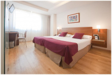
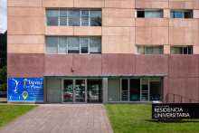
Accommodation in Mieres (Salvador).
| Residencia Universitaria del Campus de Mieres 22€ |
|
| Hostal Pachín |


La Peña is a small village at the foot of the climb to El Padrún. There are no services, but the village marks the beginning of the last significant ascent on the Camino del Salvador. Rest places appear along the way as the path passes through a few small villages on the way up.
From La Peña you begin the 5 km climb to El Padrún. It's not as demanding as the mountain crossing earlier, but it's steady uphill. Rest places and small villages break up the climb. Take it at your own pace — you've already conquered the hardest terrain on this route.
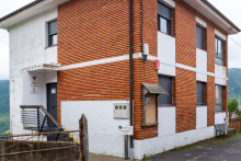
Accommodation in La Peña.
| Hostal La Peña | 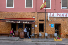
|


Rebollada is a tiny village on the climb from Mieres to El Padrún. No services, but the houses and the green hillsides provide a sense of Asturian village life. You'll pass through in minutes.

Copián is a small hamlet on the climb to El Padrún. No services. The village clings to the hillside above the valley, and on a clear day the views back toward Mieres and the Caudal valley below are worth a pause.
Cardeo de Arriba is another small hillside village on the El Padrún climb. No services. The "de Arriba" (upper) distinguishes it from a lower settlement. Traditional stone houses, green pastures, and the quiet of the Asturian hills.
Aguilar is a small village near the top of the climb to El Padrún. No services, but you're nearing the summit and the terrain is beginning to level off. The village is a handful of houses set among pastures — typical of the upper villages on this hillside.
El Padrún is the last high point on the Camino del Salvador. There's a fountain here, and beneath you — some 200 m below — runs the A-66 motorway. The contrast is striking: you're on an ancient path while traffic roars through a modern tunnel far below.
All of the steepest climbs are now behind you. From here to Oviedo the camino follows gently rolling hills through increasingly suburban terrain. The hard part is done.
El Padrún has been a strategic crossing point for centuries. Roman roads passed this way, and the name likely derives from "patronum" — a reference to a patron saint or landmark that guided travelers. This high ground offered views in all directions, making it valuable as both a lookout and a waypoint. The construction of the A-66 motorway and its tunnels through the hillside below dramatically altered the landscape but left the old path untouched.

Casares is a small village on the descent from El Padrún toward Olloniego and the Nalón valley. No services. The village sits on the southern slope of the hill, and the walking from here is increasingly easy as you descend toward the lowlands around Oviedo.
Olloniego is a village in the Nalón valley, the largest river in Asturias. The village has basic services — a bar or two along the main road. The Río Nalón, which you'll cross shortly, was once the lifeblood of the Asturian mining industry, carrying coal down from the mountain valleys to the ports. Today the valley is greener and quieter.
Continue along the main road out of Olloniego, past El Cruce, and over the bridge to El Portazgo. Stay alert for traffic — the road can be busy here.

El Portazgo is more of an outpost than a village. The neoclassic building on your left once you cross the Río Nalón was originally the toll station — the portazgo — where travelers paid for the privilege of crossing the bridge. It's an elegant little building with a story, and a reminder that these routes have been commercial corridors for centuries.
Do not stay on the road here. Look to the left for a pair of mojones directing you up a steep path. It's about 600 m uphill until you emerge on a road with a few houses. Turn left and continue on the road past a multipurpose sports field. Not far beyond the sports field, the camino leaves the road along a narrow path gently to your right. The climb is short but steep — the last real effort before Oviedo.
Toll stations like this one were common at river crossings throughout medieval and early modern Spain. The portazgo was a tax levied on goods and travelers crossing bridges and passing through controlled points. This particular toll controlled passage over the Río Nalón, one of the major rivers of Asturias. The neoclassical building dates from the 18th or 19th century, replacing what was likely an older toll structure.


All of the steepest climbs are now behind you. From here to Oviedo the camino follows gently rolling hills through an increasingly suburban landscape. Pico de Lanza is a high point with views — on a clear day you can see the outskirts of Oviedo ahead. The end is in sight.

Oviedo is now visible, weather permitting, to your north. The name Venta del Aire — "inn of the wind" — suggests this exposed hilltop has been a stopping point for travelers for a long time. There's no inn anymore, but the view of your destination on the horizon is its own kind of refreshment. Press on — you're almost there.
San Miguel is a small settlement on the approach to Oviedo. The suburban sprawl of the city is becoming apparent — houses, roads, and modern infrastructure increasingly replacing the rural landscape. No notable services for pilgrims, but the walking is easy and the destination is close.
Los Prietos is on the outskirts of Oviedo's urban area. The transition from countryside to city is well underway. Follow the arrows carefully through here — urban navigation can be trickier than mountain paths, as arrows compete with street signs and traffic.
Los Barreros marks the final approach into Oviedo proper. You're in the city's suburban fringe now. Keep following the arrows — they'll guide you through residential streets and into the old city center. The cathedral tower may already be visible ahead, drawing you in.
You've arrived. Oviedo is the reason the Camino del Salvador exists, and the Cámara Santa in the cathedral is the reason medieval pilgrims made this detour from León. "Quien va a Santiago y no al Salvador, visita al criado y no al Señor" — who goes to Santiago and not to the Salvador visits the servant and not the Master.
The Cathedral of San Salvador houses the Cámara Santa (Holy Chamber), a 9th-century pre-Romanesque structure containing some of the most venerated relics in Christendom. The Arca Santa (Holy Ark), according to tradition, contains relics brought from Jerusalem and North Africa to protect them from the Moorish conquest. Among them is the Santo Sudario — believed to be the cloth that covered Christ's face after the crucifixion. The Cruz de los Ángeles (808 AD) and the Cruz de la Victoria (908 AD) are masterworks of Asturian goldsmithery and symbols of the city and region respectively.
Beyond the cathedral, Oviedo rewards exploration. The pre-Romanesque churches on Monte Naranco — Santa María del Naranco and San Miguel de Lillo, both UNESCO World Heritage Sites — are among the most remarkable buildings in Spain. San Julián de los Prados (Santullano), closer to the city center, is the largest surviving pre-Romanesque church in the Iberian Peninsula, with original 9th-century frescoes.
The old town is compact and walkable, with the Plaza de la Catedral, the Plaza de Trascorrales, and the Plaza del Fontán forming a natural circuit. The sidrerías of the Calle Gascona (known as the Bulevar de la Sidra) are essential — sit down, order a bottle of sidra natural, and let the waiter pour it from height in the traditional Asturian style. For food, fabada asturiana is the signature dish — a rich bean stew with chorizo, morcilla, and lacón that will fortify you for whatever comes next.
The Salvadorana — the certificate of completion for the Camino del Salvador — can be obtained at the cathedral. Ask at the information desk or in the pilgrim office. If you're continuing to Santiago, most pilgrims either retrace their steps to León to rejoin the Camino Francés, or pick up the Camino Primitivo from Oviedo — the oldest pilgrimage route to Santiago, established by Alfonso II in the 9th century.
If you plan to continue to Santiago, you have two main options: return to León to rejoin the Camino Francés (by bus or train — about 2 hours), or begin the Camino Primitivo from Oviedo. The Primitivo is roughly 320 km to Santiago and is considered one of the more challenging and rewarding routes. The pilgrim office at the cathedral can provide information on both options.
Oviedo was founded by monks Máximo and Fromestano in 761 AD and quickly became the capital of the Kingdom of Asturias — the small Christian realm that survived the Moorish conquest and from which the Reconquista would eventually expand. King Alfonso II (791-842) established the city as a major pilgrimage center, building the Cámara Santa to house relics brought from Toledo and other cities that had fallen to the Moors.
The cathedral's relics made Oviedo one of the three great pilgrimage destinations of medieval Christendom, alongside Santiago de Compostela and Rome. The Holy Ark, the Cruz de los Ángeles, and the Santo Sudario drew pilgrims from across Europe. The saying "Quien va a Santiago y no al Salvador" dates from this period and reflects the genuine importance attached to the Oviedo relics.
The pre-Romanesque architecture of Oviedo and its surroundings — Santa María del Naranco, San Miguel de Lillo, San Julián de los Prados, and the Cámara Santa itself — represents a unique artistic flowering. Built in the 9th century, these structures blend late Roman, Visigothic, and Carolingian influences into an architectural style found nowhere else. They were inscribed as UNESCO World Heritage Sites in 1985 and 1998.
In the modern era, Oviedo became the administrative capital of the Principality of Asturias. The city was heavily damaged during the Spanish Civil War — the university and parts of the old town were destroyed during the 1934 miners' uprising and again in 1936-37. The Cámara Santa was dynamited in 1934 but painstakingly reconstructed. The scars are mostly healed, but the history is recent enough to remember.
San Mateo (around September 21) is Oviedo's main festival — a week of concerts, fireworks, and celebrations. The Martes de Campo (Field Tuesday), held the Tuesday after Easter, is an enormous outdoor gathering in the parks around the city. The Premios Princesa de Asturias ceremony in October brings international attention. Market: daily at the Mercado de El Fontán, Oviedo's beautiful covered market in the old town.
Arriving along the Camino del Salvador: shells and arrows will bring you right into the old quarters of Oviedo, passing a plaza and the beautiful Ayuntamiento building. Head for the cathedral — you've earned it. The Salvadorana certificate can be obtained at the cathedral's pilgrim information desk.
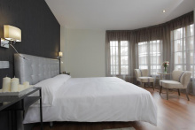
Accommodation in Oviedo at the end of the San Salvador.
| Albergue-Hostel Gascona 27€ 24 Booking.com |

|
| La Hospedería Oviedo 20-25€ 10 Booking.com |
|
| Albergue de El Salvador de Oviedo 9€ 51 |
|