León is a city that rewards those who linger. Most Camino Francés pilgrims pass through in a day and miss half of what makes it extraordinary. If you're setting off on the Camino del Salvador, give yourself at least an extra afternoon — better yet, a full rest day — before tackling the long road north to Oviedo.
The Cathedral of Santa María de la Regla is the undisputed highlight. Its Gothic interior holds some 1,800 square meters of stained glass — one of the largest collections in Europe. On a sunny day the light pouring through those windows transforms the nave into something that stops even the most jaded traveler in their tracks. The Virgen Blanca on the main portico is a reproduction; the original sits in a chapel behind the main altar. Several sculptures have been removed for ongoing restoration.
The Real Basílica de San Isidoro is the other essential visit. It houses the relics of San Isidoro and the Panteón de los Reyes, where 23 Leonese monarchs rest beneath 12th-century frescoes so vivid they've earned the nickname "the Romanesque Sistine Chapel." Entry is through the museum.
Fans of Gaudí will find the Casa de los Botines a short stroll from the cathedral, with a bronze statue of the architect seated on a bench out front. Every service you could need is here. The best food and liveliest atmosphere are in the Barrio Húmedo — a tangle of narrow streets near the Plaza Mayor whose name tells you the drinks flow freely. León is the only province in Spain that produces hops for beer, and local craft breweries like Four Lions produce Zerep, a beer worth trying.
As you walk the old city, look down. Bronze plaques in the pavement mark the boundary of the original Roman settlement — the impression of a left foot of a Roman soldier from the Legio VII Gemina. Nearer the Plaza Mayor, another plaque bears the Hebrew word ספרד (Sefarad), marking the boundary of what was the Jewish quarter before the expulsion of 1492.
The Camino del Salvador begins at the Parador San Marcos, the spectacular former monastery that now serves as one of Spain's finest state hotels. Pick up your credencial and first sello, and prepare for a route that medieval pilgrims considered essential: the detour from León to Oviedo to visit the relics in the Cámara Santa, before continuing to Santiago.
The Camino del Salvador is one of the oldest pilgrimage routes in Spain. Medieval pilgrims walking the Camino Francés would detour north from León to Oviedo to visit the holy relics housed in the Cámara Santa of Oviedo's cathedral. The saying went: "Quien va a Santiago y no al Salvador, visita al criado y no al Señor" — who goes to Santiago and not to the Salvador visits the servant and not the Master.
León itself was founded as the encampment of the Legio VII Gemina around 29 BC, and its name is a corruption of "Legio." It served as the capital of the Kingdom of León from the 10th century, one of the most powerful Christian kingdoms during the Reconquista. The city's strategic position on the meseta made it a natural hub for pilgrimage routes heading both west to Santiago and north to Oviedo.
Alfonso IX of León granted the city its famous charter in 1188, convening the Cortes of León — considered one of the earliest parliamentary assemblies in European history.
San Juan and San Pedro (June 24-29) bring León's biggest celebrations, with concerts, bullfights, and street festivities. The Semana Santa processions are among the most solemn in Castilla y León. Market day is Wednesday and Saturday at the Mercado del Conde Luna.
Leave León by way of the road behind the Parador San Marcos. Facing the parador, cross the square to your right and follow the path around the building. Arrows dedicated to the San Salvador route appear quickly, along with a distinctive mojón. The first stretch is urban but straightforward, following the N-630 north through the outskirts of the city. You'll pass through industrial areas before the landscape opens up into farmland.
Accommodation in León - Start von San Salvador.
| Albergue Unamuno 13-18€ 85 |
|
| Albergue LeonHostel 17-22€ 20 Booking.com |

|
| Albergue Muralla Leonesa 16€ 80 Booking.com |

|


Carbajal de la Lengua is a small village about 10 km from León where your options for food and drink are limited. Bar Central is the bar most likely to be open — don't pass it hoping for another. There's also a small shop for basic food supplies. If you missed breakfast in León, the Cafetería El Palacete sits on your left less than 1 km outside the city and is a reliable option.
The next place with food is Cascantes, so plan accordingly. The village itself is quiet and unremarkable, a typical Leonese farming settlement strung along the road.
The camino follows along the main road right to the end of Carbajal, where it turns to dirt. It's well marked. On the way to the next village, the path passes the Fuente de Villabura, a fountain and rest area for pilgrims.


The Fuente de Villabura marks the site of a long-abandoned medieval settlement. The fountain still provides water and the shaded rest area is a welcome stop on a hot day. Little remains of the original village beyond scattered stones, but the fountain has been maintained for the benefit of pilgrims and shepherds alike. It's a good place to fill up — services are thin between here and Cascantes.
A wayside fountain named for San Pelayo (Saint Pelagius), the 10th-century boy martyr from Galicia whose cult was widely venerated across northern Spain. The fountain is a useful water stop along this stretch where services are sparse. There's a small rest area but no other services.
No services in town, but 4 beds are available in the municipal albergue housed in a simple village building. If you plan to stay here, call ahead: 625 426 659. The village is small and quiet — little more than a handful of houses along the road. Bring food if you're spending the night.
Avoid accidentally following the road out of Cabanillas. The camino turns right at the edge of town and follows along a hiking trail through an oak forest to La Seca. It's a pleasant stretch after the road walking, with shade and soft ground underfoot.
Accommodation in Cabanillas.
| Albergue de Cabanillas Donativo€ 4 |

|


Crossing the bridge to visit La Seca is optional. The village has a bar (follow the old signs — it's still open, despite appearances) and the Ermita de San Blas, a modest chapel worth a quick look if you've crossed over. La Seca is a tiny hamlet, and the detour is short.
If you don't cross the bridge to La Seca, keep straight ahead with the bridge on your left to continue on the camino. The path continues along easy terrain toward Cascantes.


Cascantes is a small village straddling the main road, notable mainly for the Chapel of Celada at its entrance and a large power plant that dominates the skyline beyond. The town has basic services — a bar and small shop. You'll pass through a tunnel and over the railway on an elevated bridge before reaching the center.
In Cascantes the camino crosses the main road and follows a paved side road into and through the town. At the end, it rejoins the main road to La Robla. There's a large power plant at the edge of town.
There is an alternative route at the end of Cascantes signed "Por Llanos de Alba." This variant bypasses the entrance to La Robla and much of the busy road walking, taking you directly to the municipal albergue. If you're not interested in the town center, it's the better option.

La Robla is the first real town outside León, and it feels like it — services here are solid after the sparse villages behind you. There's an albergue at the far end of town, several hostals and pensions, and a tourist information office near the ayuntamiento if you need a sello or a glossy brochure.
Skip the accommodation options just over the footbridge at the entrance to town and continue into the center instead. Hostal Ordóñez de Celis, on your right before the ayuntamiento, is recommended — clean rooms, reasonable prices, and a decent restaurant attached.
Stock up on food here if you're pushing on toward the mountains. While La Robla isn't glamorous, it's functional and well-positioned for an overnight before the landscape begins to change.
Between La Robla and Buiza the Camino del Salvador coexists with the Camino Olvidado, but they run in opposite directions. It's not hard to keep them apart, but if you get disoriented easily, check your map from time to time. Follow the Salvador arrows heading north.
La Robla grew as a railway junction in the 19th century, when the narrow-gauge Ferrocarril de La Robla connected the coal mines of León and Palencia with the steel mills of the Basque Country. The 335 km line was one of the longest narrow-gauge railways in Europe. The town's industrial character dates from this period, though the mines and heavy industry have largely wound down.
The camino from La Robla, once you get past the end of town, follows a pleasant path adjacent to the river. It passes a restored aqueduct — a nice piece of industrial heritage from the mining era. The terrain begins to change here as you enter the Gordón valley and the first foothills of the Cantabrian Mountains appear ahead.
Accommodation in La Robla.
| Albergue de La Robla 8€ 16 |
|


Puente de Alba is a small village along the N-630. There are no pilgrim services here, but the setting along the river is pleasant enough. The village takes its name from the bridge over the Río Bernesga that has connected these communities for centuries.
Keep the main road (the N-630) to your left as you pass through Puente de Alba. At the end of town, turn right to follow the old national road, which remains tree-lined and far more pleasant than the highway. Pass under the high-speed railway bridge and enter Peredilla.

Peredilla is a small village in the Gordón valley with no pilgrim services. The setting is quietly pretty — traditional stone houses backed by green hillsides, with the river and railway running through the valley below.
On the way out of Peredilla, before you arrive at the road sign indicating the end of town, the camino turns left along a gravel path and heads toward an underpass for the adjacent roadway. It then meets the rail track and turns right, following this path to the Santuario del Buen Suceso. Pay attention to the left turn — it's easy to miss if you're on autopilot.


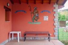
The Santuario del Buen Suceso is a modest roadside sanctuary dedicated to the Virgen del Buen Suceso, a popular devotion in the Gordón valley. The chapel sits in a pleasant spot between the villages and makes a natural rest point. The bar that once operated here appears to have closed, but is reportedly looking for a new owner. If you find it open, kindly leave a comment to let other pilgrims know.
The sanctuary has served as a waypoint for travelers crossing the Gordón valley for centuries. The devotion to the Virgen del Buen Suceso (Our Lady of Good Fortune) was common across northern Spain, particularly at sites where travelers sought protection before entering mountainous terrain.

Nocedo de Gordón sits in the valley below the camino. The route doesn't actually enter the town, so unless you make a deliberate detour, you'll pass it by. There are a few basic services in the village — a bar that keeps irregular hours and a small shop. If you need supplies, La Pola de Gordón ahead is a better bet.
The camino climbs only slightly into the Nocedo area. It doesn't go into the town itself — instead, take the first right just at the start of town to follow along the valley. The Río Bernesga remains on your right-hand side until you cross over it and into La Pola de Gordón.

La Pola de Gordón is the main service town in the valley and your last chance to stock up properly before the mountains. The plaza mayor is off the camino to your right after crossing the bridge over the river. There are several accommodation options — pensions, a campsite on the north side of the main road — and enough bars and grocery shops to resupply.
Most pilgrims push on the additional 6 km to the albergue in Buiza, but if you want a comfortable bed and a proper dinner, La Pola is the place. Whatever you decide, buy your food here. There's nothing reliable for the next couple of days once you leave.
La Pola de Gordón was chartered as a market town in the medieval period, serving as the commercial hub for the surrounding mining and agricultural communities in the Gordón valley. The municipality's name derives from the Latin "Gordonium," and the valley has been a transit corridor between the meseta and Asturias since Roman times. Coal mining shaped the region's economy from the 19th century until the mines began closing in the late 20th century.
The Fiestas Patronales in honor of the Virgen del Buen Suceso are celebrated in September. The weekly market is held on Thursdays.
When leaving town, keep to your left. The camino does not follow the main road. Instead, it turns off where the guardrail begins and passes through an industrial park. It then crosses the river and enters Beberino. The terrain begins to steepen from here — you're entering the foothills proper.
Accommodation in La Pola de Gordon.
| Pensión Rabocan | 
|


Beberino is a tiny village where the camino begins following a different river — the Casares, which flows down from the mountains to the north. There are no services here. The village is just a handful of houses along the road, but the landscape is starting to get interesting as the valley narrows and the mountains close in.
Pass through Beberino along the road and keep an eye open for a turn to your right along another road signposted "Folledo" and "Buiza." The valley narrows here and the road begins to climb, giving you a taste of what's ahead.


Buiza is your last stop before the serious mountain section begins. The albergue occupies an old school building at the entrance to town, with a fountain in front of it. If you plan to stay, bring food — the only bar in town keeps irregular hours and may well be closed when you arrive.
This is a good place to take stock. From here, the camino climbs to the Alto de San Antón and into genuinely mountainous terrain. Make sure your water bottles are full, your phone is charged, and you know what lies ahead. The next reliable services are in Poladura de la Tercia, and the stretch between there and Puerto de Pajares is the most demanding section of the entire route.
Buiza sits at the threshold between the Leonese lowlands and the Cantabrian mountain passes. For centuries, this was the last settlement where travelers, merchants, and pilgrims could prepare before crossing the mountains into Asturias. The surrounding landscape shows evidence of both mining activity and traditional mountain pastoralism.
From Buiza the camino ascends to the Alto de San Antón, passing the Forcadas de San Antón — jagged rock formations whose name translates to "pitchfork," an aptly descriptive word. It's about 2.5 km up to the pitchfork. The descent on the far side is more pleasant, passing through a pine forest.
Before the alto, you'll see a yellow arrow pointing along a non-existent path along the stream. Ignore it. A steel arrow indicating "Mieres" is the one you want to follow.
At the end of the pine forest, the camino splits and the marking isn't obvious if you've been lost in thought. On your left is a small concrete block building for pumping water. The official camino turns left here and off the road.
If you miss this turn and follow the road, you'll end up heading toward Rodiezmo. Along that wrong path you'll reach the Cruz de la Salve, where the camino turns sharply left. Miss that turn too and you'll end up in Rodiezmo, which means either following the busy national road back or retracing your steps.


The Alto de San Antón marks the high point after the climb from Buiza, with the jagged Forcadas de San Antón rock formations visible ahead. From here, the descent toward Poladura de la Tercia begins. It's easy to get confused at this point and head toward Rodiezmo — pay close attention to the arrows.
Just past the third rocky outcropping, the path continues straight toward Rodiezmo. The camino itself turns left. The last section into Poladura is rough going — a steep, uneven slog on loose ground. San Martín de la Tercia is the village just before Poladura, and there are several easily recognizable paths connecting the two. The road between them is short with little traffic.

El Barrancón is a point along the mountain route between the Alto de San Antón and the Tercia valley. There are no services here — just the path, the mountains, and the sky. The name refers to the ravine that the trail follows as it descends from the alto toward San Martín and Poladura.
San Martín de la Tercia is a tiny village in the valley below the Alto de San Antón. There are no pilgrim services here, but the village is the last sign of habitation before Poladura. A handful of stone houses cluster around a small church. The road connecting San Martín to Poladura is short and carries little traffic.

Poladura is a small mountain town and the launching point for the most demanding section of the Camino del Salvador. The albergue is located in the former schoolhouse, and the only place to eat is the Posada El Embrujo — a good meal in a warm setting. Call the day before to give them notice: +34 659 030 282.
Take this stop seriously. From here to the Puerto de Pajares, the camino climbs over 350 m through 8 km of exposed mountain terrain. There is no cell coverage along much of the path, and snow can obscure both the trail and its markers well into the summer months. Charge your phone, fill your water, eat a proper meal, and study the route description before setting out.
The section between Poladura and Puerto de Pajares is the most challenging on the entire Camino del Salvador. The 8 km climb gains over 350 m through mountainous terrain with no services, no shelter, and limited cell coverage. Snow can cover the path and its markers well into summer. If visibility is poor, conditions are icy, or you're not confident in mountain navigation, consider taking the road via Arbas instead. Your life is worth more than any stretch of Camino.
The only meal in town is at the Posada El Embrujo. Call the day before to give them notice: +34 659 030 282.
The Tercia valley takes its name from the medieval "tertia" — the third part of the territory administered under Leonese feudal divisions. These mountain settlements were historically dependent on pastoralism and the transit trade crossing the Puerto de Pajares between León and Asturias. The difficult terrain kept these communities small and isolated well into the modern era.
Leave Poladura along the road. At the first bend to the left, the camino leaves the road to cross a small field. A brown mojón is visible from the road and marks the start of the mountain route. The first 1.3 km go uphill due northwest to an opening between two rocky outcroppings.
Another 300 m of visible paths and the trail turns left, continuing around the hill in a clockwise direction — downhill on your left, uphill on your right. It reaches a low point and begins climbing the next hill to the west. The trail turns south at around 2.3 km and shortly after takes a right turn, followed by another right 300 m on.
Another 500 m on the well-worn path comes to an end, but the camino continues straight, climbing steeply. You'll reach the high point at approximately 1,580 m altitude, about 4 km from Poladura. Markers for the next section are often obscured by ground cover or snow — be extra attentive.
Descend from here due north-northwest for 300 m. The path turns right and then splits. Do not continue straight and downhill. Turn left and begin another climb to a ridge. Follow the natural curve of the ridge for 600 m and turn left toward the ridge to your west. It's that ridge you'll follow into Arbas.
Accommodation in Poladura de la Tercia.
| Albergue Antiguas Escuelas Poladura de la Tercia 9€ 12 |

|
| La Posada del Embrujo ⭑⭑⭑ | 
|

At approximately 1,580 m, this is the highest point on the Camino del Salvador. The Cruz del Salvador stands here as it has for centuries — a simple cross marking the spot where pilgrims crossed between the kingdoms of León and Asturias. The "Alto de los Romeros" means the summit of the pilgrims (romeros), and this crossing has been a pilgrimage route since at least the 9th century.
On a clear day, the views are extraordinary — the Leonese meseta stretching south behind you, the Cantabrian peaks ahead. On a bad day, you'll see nothing but fog and your own feet. Either way, the cross is a powerful marker. You've earned it.
There are no services here. This is pure mountain.
The Cruz del Salvador has marked this mountain crossing since medieval times. Pilgrims heading to Oviedo to visit the relics of the Cámara Santa would pass this point, often leaving stones or small offerings at the base of the cross. The tradition of crossing here predates the formal Camino — Roman roads and pre-Roman paths used these same mountain corridors. The cross was traditionally the point where travelers passed from the territory of León into Asturias.
The Collada del Coito is a mountain pass along the descent from the Cruz del Salvador toward Arbas. At roughly 1,500 m elevation, it's an exposed saddle between ridges with no services or shelter. In clear weather it's a straightforward passage; in fog or snow it requires careful navigation. The name "collada" refers to a mountain col or saddle — a depression between two higher points.
After the mountain crossing, the sight of Arbas is a relief. The Colegiata de Santa María de Arbas is the reason to pause here — a Romanesque collegiate church with genuine atmosphere. Unlike many churches that feel like museums, this one still has real candles for lighting, and the interior rewards a quiet visit. The church requires a short walk off the camino, but it's right there when you reach the highway.
The trail from Arbas to the Puerto de Pajares has never been great, and in recent years has gotten worse. Nowadays it's best to skip the trail and cover the 1.3 km to the mountain pass by road instead. This has the added benefit of bringing you to the bar at the pass, which you'll probably want.
The Colegiata de Santa María de Arbas was founded in the 12th century as a hospice and church for pilgrims and travelers crossing the Puerto de Pajares. The Augustinian canons who ran it provided shelter, food, and spiritual care to anyone making the dangerous mountain crossing — regardless of whether they were pilgrims, merchants, or soldiers. The church's Romanesque architecture is well preserved, with fine carved capitals and a serene cloister. It's one of the most important medieval pilgrim hospices on the León-Asturias corridor and was directly linked to the Camino del Salvador pilgrimage tradition.


The Puerto de Pajares is one of the few mountain passes that for centuries has offered passage over the Cantabrian Mountains from the meseta into Asturias. It remained the primary corridor until the construction of the A-66 motorway to the west. It's still a difficult road for drivers, and snow is not uncommon here as late as June.
The old Parador has reopened its bar — worth a stop for the views alone. Across the road, Venta Casimiro has rebuilt after a fire and is the bar "de siempre" — go there for soul and a real meal, the Parador for views. You've earned either or both after the mountain crossing.
At approximately 1,378 m elevation, the air is noticeably cooler than the meseta you left behind. From here, it's all downhill into Asturias.
Snow is possible at the Puerto de Pajares well into June. If you're crossing in spring or early summer, check conditions before setting out from Poladura. The bar at the pass may keep limited hours outside the summer season — don't count on it.
The Puerto de Pajares has been the main crossing between León and Asturias since pre-Roman times. The Romans improved the route, and it remained the primary road connection until modern highway construction. In 1884, the railway tunnel through the mountains opened, connecting León to Gijón and transforming the economy of northern Spain. The old Parador was built as a government rest house for travelers crossing the pass — a tradition of hospitality at this site that stretches back to the medieval hospice at Arbas below.
The camino leaves the main road to follow a trail behind some farm houses at the far end of the alto. If you've gone as far as the old Parador, you'll need to backtrack a bit and avoid the temptation to follow the road. At the farm buildings, turn right and begin a gentle ascent to the border between León and Asturias.
Here you'll pass through a gate and descend back to the national road — which is genuinely dangerous with fast traffic. Cross over the road with extreme caution to resume along a trail down to Pajares.
Along the way to Pajares you'll find a junction requiring you to choose between Pajares or San Miguel. The route through San Miguel also arrives at Pajares but takes 5 km longer. It's only recommended for cyclists or pilgrims who intend to sleep in Bendueños (1.5 km off camino).


Welcome to Asturias. Pajares is a small village below the mountain pass, and after the crossing you've just done, even this modest place feels like civilization. There's one restaurant in town — El Mirador — which is recommended. Call the day before to give them notice: +34 636 933 069. It's closed on Tuesdays. There's no grocery shop, so if El Mirador is closed, you'll need to press on to Campomanes.
The village has a handful of accommodation options. The air is different here — wetter, greener, distinctly Asturian. You've crossed from the dry meseta into one of the greenest corners of Spain.
The only meal in town is at El Mirador. Recommended, but call the day before to give them notice: +34 636 933 069. Closed Tuesdays. No grocery in town.
Leaving Pajares, stay on the road to the village limits. The camino turns left and begins a steep descent into San Miguel del Río in the valley below. The drop is significant — take it easy on your knees.
