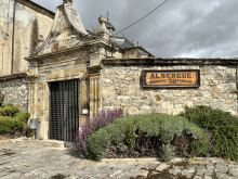
A tiny hamlet with a single bar and an albergue. The name — 'of the Royal Road' — is a reminder that this was once part of the main route across Castile. The village marks the approach to the provincial boundary with León.
From here the camino approaches the provincial border with León. The bridge over the Río Valderaduey marks the crossing — unceremonious but symbolically significant.

The crossing into the province of León comes without ceremony — you cross the bridge over the Río Valderaduey and that's it. But the change matters. León was the heart of the old kingdom that drove the Reconquista, and the province retains a distinct identity within Castilla y León.
The meseta begins to wind down ahead. The flat wheat plains will continue for a while, but the terrain gradually becomes more varied as you approach the city of León. The mountains — the Cantabrian range and the gateway to Galicia — become visible from the higher points on clear days.
León's culinary identity is distinct from Burgos and Palencia: cecina (air-dried beef), botillo (a hearty smoked meat dish from the Bierzo), and the wines of the Bierzo region (Mencía grape) appear on menus as you move west. The tapas culture in the city of León rivals any in Spain.

Sahagún isn't the prettiest town on the Francés, but it has a stubborn historical significance that rewards exploration. At its peak, it rivaled Burgos and León in importance — a claim that's hard to believe until you start counting the brick churches.
The Mudéjar architecture is the highlight. In a region where stone was scarce, medieval builders used brick to extraordinary effect. The Iglesia de San Tirso and the Iglesia de San Lorenzo both have Romanesque-Mudéjar towers that rank among the finest examples of the style in Spain. The combination of Romanesque structural forms with Islamic decorative brickwork is unique to this part of Castile.
The remains of the Monasterio de San Benito — once one of the most powerful Benedictine houses in Spain — are scattered around town. The Arco de San Benito (the monastery gateway) and the Torre del Reloj (clock tower) survive as fragments of former grandeur.
The Santuario de la Virgen Peregrina, on the way out of town, issues a 'half-way Compostela' — a certificate marking the midpoint of the Francés from SJPP. It's a bit off the camino proper, but the certificate makes a good souvenir.
Several albergues, bars, and restaurants serve the town. All basic services available.
A certificate is available from the Santuario de la Virgen Peregrina on the way out of Sahagún — a type of halfway Compostela. The sanctuary is not on the camino proper; check the map for its location.
Sahagún takes its name from San Facundo, a 4th-century martyr who, along with San Primitivo, was buried nearby. The presence of the relics attracted a monastic community that grew into one of the most powerful Benedictine abbeys in Spain. Alfonso VI made it his favorite foundation, granting it immense privileges. The town's prosperity peaked in the 11th-13th centuries.
Market day is Saturday. San Tirso on January 28. San Juan de Sahagún on June 12-13. Fiesta de la Peregrina on July 2. San Lorenzo on August 9-10.
Accommodation in Sahagún.
| Albergue de Peregrinos Cluny 9€ 64 |

|
| Albergue de la Santa Cruz 10€ 58 |

|

Leaving Sahagún, cross the Río Cea. About 4.4 km from town, near a large highway interchange before Calzada de Coto, the route splits into two options.
The Camino Real (straight ahead) follows the traditional route through Bercianos del Real Camino and El Burgo Ranero. It runs along a senda — a paved pilgrim path — that parallels the road. The walking is flat and direct, with services at regular intervals.
The Vía Trajana (right turn) takes a more rural path through Calzada de Coto and Calzadilla de los Hermanillos, following the line of an old Roman road. It's quieter, with fewer services but more solitude. Both routes converge before Mansilla de las Mulas.
The Camino Real is more popular and better serviced. The Vía Trajana appeals to those who've had enough of walking near roads. Either way, the meseta continues flat and open.

The name tells the story: the original inhabitants came from the Bierzo region, and the village sits on the Camino Real — the 'Royal Road,' a designation that refers not to royalty but to a primary public road. It's a useful distinction for understanding meseta place names.
Bercianos has a bar, an albergue, and the Iglesia de El Salvador. The village is small and agricultural, its life rhythm dictated by the wheat harvest and the passage of pilgrims. A few kilometres of pleasant tree-lined path lead to El Burgo Ranero.
Accommodation in Bercianos del Real Camino.
| Albergue Santa Clara 15€ 19 |

|

As far as the eye can tell, the camino is about the only thing keeping El Burgo Ranero on the map. The wheat and wool trade that once sustained it has been displaced by mechanization, and the town has a worn but dignified quality common to meseta settlements.
The church lost its artistic treasures to a fire, though the building itself survives. The real attraction, if you're here in late May, is the stork nests on the tower — you may catch a glimpse of chicks waiting for lunch.
A few bars and albergues provide services. The town is a practical stopping point rather than a destination.
In late May, check the stork nests on the church tower — the chicks are a highlight of the season.
The town owes its existence to wheat and wool. The name may derive from the granaries (burgos) that stored the grain, or from the Latin for 'frog' (rana), depending on which historian you ask. The wool trade connected these meseta towns to Burgos and the international markets beyond.
The path between El Burgo Ranero and Reliegos follows a manicured track lined with trees. Unfortunately, the trees are on the wrong side of the path for afternoon shade, so on sunny summer days you're fully exposed. Carry plenty of water.
Accommodation in El Burgo Ranero.
| Albergue de Peregrinos Domenico Laffi Donativo€ 28 |

|

Calzada de Coto is the first village on the Vía Trajana variant. A bar and a small albergue provide basic services. The village sits along the line of the old Roman road — calzada means 'causeway' or 'paved road,' and the name preserves the route's ancient origins.
The Vía Trajana continues through open farmland toward Calzadilla de los Hermanillos. The terrain is flat and the walking quiet — this variant sees far fewer pilgrims than the Camino Real.

A small village on the Vía Trajana with a bar and an albergue. The 'little brothers' in the name refers to the Augustinian friars who once maintained a pilgrim hospital here. The village has a peaceful, off-the-beaten-track quality that's increasingly rare on the Francés.
The Vía Trajana continues through flat farmland before converging with the Camino Real route ahead of Mansilla de las Mulas.
Accommodation in Calzadilla de los Hermanillos.
| Albergue de Calzadilla de los Hermanillos Donativo€ 22 |

|


Bar Elvis, quite possibly the most famous bar on the Camino, occupies the main square. The owner is a character, and the walls and ceiling are covered in pilgrim graffiti — this is one of the few places where writing on the walls is actively encouraged. Bring a marker.
The village is otherwise small and quiet, but Bar Elvis alone makes it a mandatory stop for the full Camino experience.

Mansilla de las Mulas is a solid meseta town with more history and character than the villages that precede it. Large sections of the medieval walls still surround the old quarter, and the town retains the feel of a proper market center — which it was, historically, for the mule trade that gives it its name.
There's a nice swimming spot in the river at the northwest corner of town: cross the small pedestrian bridge toward the campsite (not the road bridge that the camino crosses). The water is refreshing after the exposed meseta walking.
Several albergues, bars, and restaurants provide good services. A small supermarket handles provisions. The old quarter within the walls is compact and worth a wander.
Mansilla traces its roots to Roman times. The walls that still encircle most of the town attest to its importance as both a waypoint on the Roman road to León and a market town — mulas (mules) were the primary trade good that passed through here.
La Virgen de Gracia is celebrated on the second Sunday of September. San Martín on November 11.
Look back when leaving town — the best view of the walls is from the west side. Much of the road between here and Puente de Villarente runs alongside the highway.
Accommodation in Mansilla de las Mulas.
| Hotel Casa Miguel y Sally 22€ 6 Booking.com |

|

A small hamlet between Mansilla and Puente de Villarente. No services. The walking continues flat alongside the road.
Continue straight along the road toward Puente de Villarente. The terrain is flat and unvarying.

The bridge here once posed a serious threat to pilgrims when the river ran high, and as a result the town became home to several pilgrim hospices. The current bridge is long and multi-arched, spanning a broad riverbed that floods impressively in spring.
A couple of bars and basic services are available.
As you leave Puente de Villarente, watch for arrows pointing you along a trail to the right, up a small hill toward Arcahueja. It's fairly well-marked but follows a service road that's often lined with parked trucks and can be disorienting.
A small village on the approach to León. The bar is to the left — turn at the playground. Not much else here, but it's a last stop before the final climb to the Alto del Portillo and the descent into the city.
Continue straight past the playground and climb toward the Alto del Portillo.

Valdelafuente sits a few hundred meters off the camino. No reason to detour unless you're staying at accommodation here.

The Alto del Portillo provides your first view of León. The tradition at this point is to search the skyline for the spires of the cathedral — they're visible on a clear day, rising above the city like a beacon. The moment is more powerful than the modest height of the hill would suggest.
Puente de Castro has grown large enough to merge with León's outer barrio of Santa Ana. The bridge gives the neighborhood its name, and the approach through the suburbs has plenty of bars for a rest before the final few kilometers to the center.
The urban walking from here into central León isn't unpleasant — just long.
The name derives from the old Jewish quarter (castro) that once stood here. The community was destroyed in 1196 during a period of anti-Jewish violence. The bridge that replaced the crossing retains the name.
Accommodation in Puente de Castro.
| Albergue Santo Tomás de Canterbury 12€ 47 Booking.com |

|

León is a city that matches Burgos in historical weight and exceeds it in lively atmosphere. Give it at least two nights if you can — the cathedral, the Basílica de San Isidoro, the food scene, and the old quarter all deserve unhurried attention.
The Catedral de Santa María is one of the great Gothic cathedrals of Europe, and its stained glass is the defining feature. Nearly 1,800 square meters of medieval glass fill the nave with colored light — more glass than stone in places, which gives the interior an ethereal quality unlike any other Spanish cathedral. The 13th-century rose windows are extraordinary. Admission is charged.
The Basílica de San Isidoro is equally essential, though for different reasons. The Panteón Real (Royal Pantheon) beneath the church contains Romanesque frescoes so vivid and well-preserved that the vault is known as the 'Sistine Chapel of Romanesque art.' The scenes cover the ceiling: Christ in Majesty, the Annunciation to the Shepherds, the Last Supper. It's one of the finest collections of Romanesque painting in existence. The basilica museum also houses the Chalice of Doña Urraca, which some scholars controversially identify as the Holy Grail.
Beyond the churches: the Casa Botines is one of only three buildings Gaudí designed outside Catalonia — a Neo-Gothic pile that now houses a museum. The Hostal de San Marcos, a massive Renaissance plateresque building on the river, was once a pilgrim hospital and Inquisition prison; it's now a luxury parador. Even if you're not staying, the facade is one of the finest Renaissance compositions in Spain.
The Barrio Húmedo (the 'Wet Quarter') is León's answer to Calle Laurel in Logroño — a dense network of narrow streets packed with bars where the tradition is to serve a free tapa with every drink. The quality is high and the atmosphere is raucous. Budget your evening accordingly.
Multiple albergues operate. Hotels and pensiones range across all prices. Full city services: hospital, pharmacies, outdoor shops, train and bus stations. The Pilgrim Office provides credenciales and stamps.
León began as a Roman legionary camp — Legio VII Gemina — and the name derives from legio. The walls that still partially encircle the old quarter follow the original Roman footprint. In the 10th century, León became the capital of the most powerful Christian kingdom in Iberia, and the cathedral and San Isidoro reflect that period of dominance.
The kingdom of León and the kingdom of Castile had a complicated relationship — sometimes united, sometimes at war — until their final union under Ferdinand III in 1230. The Leonese have never entirely forgotten their independent identity, and the lion emblem appears everywhere.
Semana Santa in León is one of the more impressive Holy Week celebrations on the Francés. San Juan and San Pedro are celebrated from June 21 to 30 — the big party of the year. La Virgen del Camino on September 18. A romería for San Froilán on October 5.
The camino exits past the cathedral, passing the Iglesia de San Isidoro and then the Parador (the former Hostal de San Marcos) on the river. From there it crosses the Río Bernesga and heads through the western suburbs. The route is well-marked but the urban exit can feel long. The Virgen del Camino, a major pilgrimage site, is about 5 km from the center.
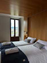
Accommodation in León.
| Albergue Unamuno 13-18€ 85 |
|
| Albergue LeonHostel 17-22€ 20 Booking.com |

|
| Albergue Muralla Leonesa 16€ 80 Booking.com |

|
| Hostel Covent Garden 20-25€ 26 Booking.com |

|
| Albergue de Peregrinos de las Benedictinas - Sta. María de Carbajal 10€ 85 |


Trobajo del Camino is a suburb of León that you'll pass through without realizing you've left the city. A few bars and shops line the road. The walking is urban and unremarkable — press on toward La Virgen del Camino.

La Virgen del Camino is one of the most important Marian pilgrimage sites in the province of León. The modern Santuario, designed by the Dominican architect Francisco Coello de Portugal and completed in 1961, is a stark concrete structure that divides opinion — you'll either find it powerful or brutal. The facade features 13 massive bronze apostle statues by the sculptor José María Subirachs (who later worked on Sagrada Familia's Passion facade).
Inside, the venerated image of the Virgen del Camino is the focus of devotion. The sanctuary draws large crowds on feast days.
The town is essentially a roadside settlement with bars, restaurants, and a pharmacy. The camino splits here into two routes toward Hospital de Órbigo.

At La Virgen del Camino, the route splits into two options.
The Road Route (left) follows the N-120 through Valverde de la Virgen, San Miguel del Camino, and Villadangos del Páramo. It's direct and well-serviced but the road walking is unpleasant — heavy traffic, asphalt, and industrial zones.
The Scenic Route (right) takes a more rural path through Fresno del Camino, Oncina, Chozas de Abajo, and Villar de Mazarife before rejoining near Hospital de Órbigo. It's longer by about 5 km but quieter, with better walking on farm tracks and through small villages.
The scenic route is the better option unless you're in a rush or the weather is terrible. The road route has more services but the walking is grim.
A village on the road route (N-120) between La Virgen del Camino and Villadangos del Páramo. A bar and a couple of shops. The road walking continues.

Another road-route village along the N-120. A bar and basic services. The terrain is flat páramo — the high plateau country of León, dry and windswept.

Villadangos sits on the N-120 and has more services than the villages before it — several bars, a supermarket, and albergues. The Iglesia de Santiago has a 16th-century altarpiece with an image of Santiago Matamoros. The town is functional but the road noise is constant.

San Martín del Camino straddles the N-120 between Villadangos and Hospital de Órbigo. A couple of bars, an albergue, and a small shop. The terrain remains flat páramo. Both the road route and the scenic route pass near here before converging at Hospital de Órbigo.
Accommodation in San Martín del Camino.
| Albergue Santa Ana 8€ 96 Booking.com |

|

A quiet village on the scenic route variant. No reliable services. The walking is on farm tracks through open country — a welcome change from the N-120.
A small hamlet on the scenic route. No services. The terrain is flat farmland with the occasional cluster of trees.
Chozas de Abajo sits on the scenic route with a bar that has uncertain hours. Check locally. The village has a quiet, agricultural character that the road-route villages lack.

Villar de Mazarife is the main village on the scenic route and has the best services between La Virgen del Camino and Hospital de Órbigo on this variant. A couple of well-regarded albergues, bars, and a small shop make it a good stopping point.
The village has a pleasant atmosphere and a slower pace than the road-route towns. The Iglesia de Santiago has some interesting carved details.


A small village where the scenic route approaches the main road again before Hospital de Órbigo. A bar provides basic refreshment.
From here it's a short walk to Puente de Órbigo and the famous bridge at Hospital de Órbigo.


Puente de Órbigo sits on the east bank of the Río Órbigo, directly across the famous bridge from Hospital de Órbigo. The two towns function as one settlement split by the river. A couple of bars and services are available on this side, but most pilgrims cross the bridge directly into Hospital.
Hospital de Órbigo takes its name from the pilgrim hospitals that once operated along the river, but its fame comes from the bridge — the Puente del Paso Honroso, one of the longest medieval bridges in Spain, with 20 arches spanning roughly 204 meters across the Río Órbigo.
In 1434, a Leonese knight named Don Suero de Quiñones staged an elaborate jousting tournament on the bridge. Claiming to be a prisoner of love (he wore an iron collar around his neck every Thursday as proof of his devotion to his lady), he challenged all comers to break 300 lances. The tournament lasted a month, attracted knights from across Europe, and ended with Suero victorious — and his iron collar removed. The story may sound absurd, but it happened, and the town still celebrates it.
The bridge itself is a beautiful piece of medieval engineering, rebuilt several times but retaining its long, low profile across the broad river. Cross it in the late afternoon when the stone glows in the light.
Several albergues, bars, and restaurants line the main street. The town is a popular stopping point with a lively pilgrim atmosphere. All basic services available.
The Paso Honroso (Passage of Honor) of 1434 is the town's defining event. Don Suero de Quiñones and nine companions held the bridge for 30 days, from July 10 to August 9, jousting against 68 knights and breaking 166 lances before declaring the challenge complete. Suero was later killed in a quarrel unrelated to the tournament — an anticlimactic end to a romantic story.
The Paso Honroso is reenacted annually during the first weekend of June, with medieval costumes, jousting, and a market. It's one of the better medieval festivals in León.
From Hospital de Órbigo, the camino heads south through flat farmland toward Astorga, about 17 km ahead. The terrain is open and exposed.
Accommodation in Hospital de Órbigo.
| Albergue Verde 20€ 26 |

|
| Albergue La Encina 15€ 16 Booking.com |

|


Villares de Órbigo is a small village on the road between Hospital de Órbigo and Astorga. A bar serves pilgrims. The Iglesia de Santiago has a modest Santiago Peregrino statue. The terrain is still flat páramo.
Accommodation in Villares de Órbigo.
| Albergue Villares de Órbigo 18-20€ 24 Booking.com |

|
| Albergue El Encanto 18€ 10 Booking.com |

|

A small village with a bar and an albergue. The walking from here to Astorga crosses rolling farmland with increasingly good views of the mountains ahead — the first indication that the meseta is ending and something bigger lies beyond.
The approach to Astorga becomes more interesting as the terrain begins to rise gently and the walls of the city come into view.
Accommodation in Santibáñez de Valdeiglesias.
| Albergue Camino Francés Pura Vida 17€ 24 |

|
| L´Abilleiru Albergue Rural 20 Booking.com |

|

San Justo de la Vega sits just across the Río Tuerto from Astorga. The town has bars, restaurants, and a supermarket — useful for stocking up before or after Astorga, where services are more spread out. The Iglesia de San Justo has a modest Baroque interior.
From here the walk into Astorga crosses the bridge and climbs to the walled city on the hilltop above.


Astorga sits at the junction of the Camino Francés and the Vía de la Plata, and it has been a crossroads since Roman times — the town was the hub of the Roman gold mining operations that extracted wealth from the nearby mountains.
The city has two unmissable buildings: the Catedral de Santa María and the Palacio Episcopal. The cathedral is a mix of Gothic, Renaissance, and Baroque, with a splendid retablo by Gaspar Becerra. The Palacio Episcopal is pure Gaudí — he designed it in 1889 for the Bishop of Astorga, and it's one of only three Gaudí works outside Catalonia (León's Casa Botines being another). The Neo-Gothic exterior looks like a fairy-tale castle; inside, it now houses the Museo de los Caminos, dedicated to the pilgrim routes that converge here.
Astorga has a chocolate tradition that dates to the 17th century, when cacao arrived from the Americas. The Museo del Chocolate tells the story. Several shops sell artisan chocolate and mantecadas (butter cakes). Try both.
The Maragato culture of the surrounding region is distinctive. The Maragatos were a closed community of muleteers who controlled trade routes across the meseta for centuries. Their most famous contribution to cuisine is cocido maragato — a hearty stew served in reverse order: meat first, then chickpeas and vegetables, then the broth. It's the opposite of the normal cocido sequence and makes more sense than you'd expect.
Multiple albergues, hotels, and restaurants serve the city. Full services available.
Astorga was the Roman city of Asturica Augusta, capital of the Conventus Asturum and a key administrative center for the gold mines of Las Médulas to the west. The Roman walls, partially preserved, give a sense of the city's original extent. The Ruta Romana walking trail connects the main archaeological sites.
The convergence of pilgrim routes here — the Francés from the east and the Vía de la Plata from the south — made Astorga a major medieval pilgrimage hub, with over 20 pilgrim hospitals operating at its peak.
Santa Marta is the patronal fiesta, celebrated in the last week of August with cocido maragato competitions, music, and processions. The Tuesday market is one of the better ones in León province.
The camino exits Astorga through the western gate and enters the Maragatería — the hilly, depopulated country that was the Maragato homeland. The terrain changes immediately: the flat meseta is behind you, and the road ahead climbs gradually through stone villages toward the mountains.


Valdeviejas is a small village immediately outside Astorga's western gate. A bar and a small shop serve as a last stop before the quieter villages ahead. The Maragato architecture — stone houses with wide doorways built for mule caravans — begins to appear.

Murias de Rechivaldo is the first proper Maragato village on the route, with the characteristic stone houses and wide entrance gates that allowed mule trains to pass through. A couple of albergues and a bar provide services. The village has a quiet, well-kept quality.
The detour to Castrillo de los Polvazares branches off here — about 3 km south.
Accommodation in Murias de Rechivaldo.
| Albergue las Águedas 15€ 40 Booking.com |

|

A 3 km detour south from Murias de Rechivaldo brings you to Castrillo de los Polvazares, the best-preserved Maragato village in the region. If you have time and interest in the Maragato culture, this is the place to see it — but it adds about 6 km round-trip to your day.
Alternatively, you can continue from Castrillo to Santa Catalina de Somoza via a marked path, which avoids backtracking. This option adds about 1.5 km to the standard route but includes the village visit.
Castrillo de los Polvazares is a perfectly preserved Maragato village — cobblestone streets, stone houses with massive wooden doors, and an atmosphere that feels like stepping into another century. It has been designated a historic-artistic site, and the restoration is meticulous without being sterile.
Several restaurants serve cocido maragato — the reverse-order stew that is the Maragato culinary signature. The village is popular with day-trippers from Astorga, so it can be busy at lunchtime. Outside meal hours, it's remarkably quiet.
A casa rural provides accommodation if you want to stay.
Accommodation in Castrillo de los Polvazares.
| Casa Rural Flores del Camino | 
|

Santa Catalina de Somoza continues the Maragato pattern: stone houses, wide doors, and a village designed around mule transport. The difference is that Santa Catalina is less restored and more lived-in — which gives it a different, more authentic feel than Castrillo.
A couple of bars and an albergue serve pilgrims. The walking ahead begins to climb more noticeably as you enter the foothills of the Montes de León.
Accommodation in Santa Catalina de Somoza.
| La Boheme Donativo€ 16 |

|


El Ganso ('The Goose') is a village in various states of ruin and restoration. Some houses have been beautifully rehabilitated; others are crumbling. The Cowboy Bar — decorated in an incongruous Wild West theme — has become a Camino institution, though opinions on the food vary.
The Ermita de Cristo de los Peregrinos, with its thatched roof, is one of the few remaining examples of traditional Maragato roofing. A couple of albergues operate in the village.
Accommodation in El Ganso.
| Albergue Gabino 14€ 24 Booking.com |

|

Rabanal del Camino is the traditional last stop before the climb over the Cruz de Ferro and the descent into the Bierzo. It's a stone village at 1,150 m with a Templar past and a contemplative present.
The Iglesia de la Asunción hosts Vespers and Compline services led by the Benedictine monks from the nearby monastery, which was restored by the German Benedictine community. The singing is plainchant in the stone church, and many pilgrims plan their day around attending.
The Refugio Gaucelmo, restored and managed by the British Confraternity of Saint James, was one of the first volunteer-run albergues on the Francés and set a standard that others followed. The confraternity has since handed over operations, but the albergue retains its reputation.
Several other albergues, bars, and a small shop serve the village. Stock up here — the next services are limited until Molinaseca on the far side of the mountain.
Rabanal was a Templar commandery in the 12th century, positioned to guard the mountain crossing. The Templar presence is reflected in the village's layout and the solidity of its buildings. After the Templar dissolution, the village declined slowly until the pilgrim revival of the late 20th century brought restoration and new life.
From Rabanal the camino climbs steadily through heath and scrubland toward Foncebadón and the Cruz de Ferro. The ascent is gradual but persistent, gaining about 350 m over 6 km. The landscape becomes increasingly wild as you climb above the tree line.
Accommodation in Rabanal del Camino.
| Refugio Guacelmo Donativo€ 37 |

|


Foncebadón was almost completely abandoned by the late 20th century — a ghost village on the mountain above the Bierzo. The pilgrim revival brought it back. Buildings have been restored, albergues and bars opened, and the village now functions as the last stop before the Cruz de Ferro.
The atmosphere is stark. At 1,440 m, the village sits above the tree line in a landscape of heather, gorse, and rock. In mist or rain it feels utterly remote. The handful of albergues and bars provide warmth, food, and company — all welcome at this altitude.
Stock up if you haven't already. The next reliable services are in El Acebo or Molinaseca, on the far side of the mountain.
Foncebadón was once a significant settlement, with a pilgrim hospital and a monastery. The hermit Gaucelmo established the hospital in the 11th century to assist pilgrims crossing the mountain. By the 1990s, only a handful of inhabitants remained. The village's resurrection is one of the more visible examples of the Camino revival's impact on depopulated rural Spain.
From Foncebadón, the Cruz de Ferro is about 2 km ahead on a gentle climb through open heath. On a clear morning, the views across the Montes de León are immense.
Accommodation in Foncebadón.
| Albergue Monte Irago 14-27€ 22 |

|
| Albergue Casa Chelo 15€ 8 |
| Albergue Parroquial Domus Dei Donativo€ 18 |

|


The Cruz de Ferro (1,505 m) is the highest point on the Camino Francés and one of its most iconic moments. A simple iron cross stands on a tall wooden pole atop a cairn of stones — stones left by pilgrims, each carrying whatever weight the bearer chose to assign it.
The tradition is old and the practice is straightforward: carry a stone from home (or pick one up along the way), add it to the pile, and leave behind whatever you need to leave behind. Some pilgrims treat it as a profound spiritual moment. Others toss a pebble and move on. The cairn doesn't judge.
Arrive early if you want solitude. By mid-morning on busy days the site can be crowded with pilgrim groups. At dawn, with mist on the mountain and nobody else around, it's one of those places that earns every word ever written about it.
A small ermita — the Ermita de Santiago — sits just below the cross.

Manjarín is a semi-ruined hamlet kept alive by a single eccentric resident who styles himself as the last Knight Templar. The 'albergue' is basic in the extreme — no electricity, no running water, mattresses on the floor — and the experience is deliberately medieval. A sign at the entrance lists the distances to Jerusalem and Santiago in equal measure.
It's not for everyone, but it's unlike anything else on the Camino. A donation is expected. Those who stay tend to have stories.
From Manjarín the descent begins in earnest. The path drops steeply toward El Acebo, passing through scrubland and then forest as you lose altitude rapidly. The footing can be loose and rocky — take care, especially if wet.


A high point on the descent between Manjarín and El Acebo. No services. The views into the Bierzo valley begin to open up — on a clear day you can see as far as Ponferrada. The vegetation changes noticeably as you descend: heath gives way to chestnut and oak.
The descent from here to El Acebo is steep, rocky, and demanding on the knees. A memorial to a cyclist who died on this descent serves as a reminder to take it slowly.
El Acebo is a beautiful mountain village strung along a single stone street, clinging to the hillside at about 1,150 m. Slate roofs, stone walls, and balconies overhanging the narrow road give it an alpine character that's quite different from the meseta villages behind you.
A memorial at the entrance honors a pilgrim cyclist who died on the steep descent from the Cruz de Ferro — a sobering reminder of how demanding this section can be.
Several albergues and bars serve the village. The Mesón El Acebo has a good reputation for home cooking. This makes a reasonable stopping point if the descent from the Cruz de Ferro has been hard on your legs.
El Acebo received a royal charter exempting its residents from taxes in exchange for maintaining the mountain path and assisting pilgrims in snow — a duty they took seriously, as the income from the exemption depended on the road staying open.
The descent continues steeply to Riego de Ambrós and then Molinaseca. The path is paved in sections but the gradient is relentless. Take your time.
Accommodation in El Acebo.
| Albergue Mesón El Acebo 10€ 16 |

|
| Albergue La Casa del Peregrino 12€ 88 Booking.com |

|
| Albergue Parroquial Apóstol Santiago Donativo€ 22 |

|
| Casa Rural La Rosa del Agua Booking.com |

|

A small village on the steep descent between El Acebo and Molinaseca. A bar and a basic albergue provide services. The slate-roofed houses continue the mountain architecture. The descent doesn't let up here — your knees won't thank you.


Molinaseca sits at the bottom of the descent from the Cruz de Ferro, and it feels like an arrival. After the exposed mountain, the steep rocky path, and the relentless downhill, this riverside town with its Romanesque bridge, its swimming spot in the Río Meruelo, and its bars with outdoor terraces is exactly what tired legs need.
The bridge — the Puente de los Peregrinos — is beautiful. In summer, pilgrims wade and swim in the river below it. The water is cold and clean and perfect.
The main street has several bars, restaurants, and albergues. The wine of the Bierzo (Mencía grape, mostly) starts appearing on menus here — it's lighter and fruitier than the Rioja you've been drinking since Logroño.
The Fiesta de la Virgen de las Angustias in mid-August is the main celebration, with processions, music, and food.
The walking from Molinaseca to Ponferrada is flat and suburban — about 7 km along the river valley. The mountain drama is behind you; the Bierzo valley lies ahead.
Accommodation in Molinaseca.


Between Molinaseca and Ponferrada, the camino offers two options. The main route continues through Campo on a path that follows the river — quieter and more pleasant. The road route follows the highway directly into Ponferrada — faster but less appealing.
Take the Campo route unless you're in a hurry.
A small village between Molinaseca and Ponferrada with a bar. The camino passes through on the river-valley route. The walking is flat and easy, with Ponferrada's suburbs appearing ahead.
Ponferrada is the capital of the Bierzo and the largest city between León and Santiago. The Castillo de los Templarios — one of the largest and best-preserved Templar castles in Europe — dominates the old quarter from its hilltop position above the Río Sil.
The castle is enormous: multiple towers, a double curtain wall, and an interior that gives a genuine sense of Templar power and ambition. It was built in the 12th century, expanded in the 13th, and largely abandoned after the Templar dissolution in 1312. Admission is charged and the visit takes at least an hour. The Templar library inside has excellent exhibitions on the order's history.
The old quarter below the castle has narrow streets, the Basílica de la Encina (patron of the Bierzo, with a Romanesque-Gothic interior), and a pleasant river walk along the Sil. The Museo del Bierzo in the old prison provides regional context.
The modern city sprawls around the old core. Full services: hospital, pharmacies, outdoor shops, supermarkets, bus and train station. Multiple albergues and hotels. The restaurant scene is improving — look for Bierzo dishes: botillo (a smoked meat stew), pimientos del Bierzo, and empanada.
The name Ponferrada comes from pons ferrata — the iron bridge that a 12th-century bishop built to help pilgrims cross the Sil. The Templars received the town in 1178 from Ferdinand II of León to protect the pilgrim route, and the castle was their base of operations. After their dissolution, the castle passed to various noble families before falling into ruin. Major restoration began in the late 20th century.
The Fiesta de la Encina in early September honors the patron. The Noche Templaria (Templar Night) in July transforms the old quarter into a medieval spectacle with fire, music, and costumes.
Leaving Ponferrada, the camino navigates the western suburbs through Compostilla, Columbrianos, and Fuentes Nuevas before reaching open country. The urban exit is long but well-marked. The Bierzo valley, with its vineyards and orchards, stretches ahead.
Accommodation in Ponferrada.
| Albergue Alea 15€ 18 |

|


Compostilla is the first suburb on the way out of Ponferrada. The name — from Compostella, or Compostela — suggests its historical connection to the pilgrim route. A few bars and shops line the road. The walking is urban but the arrows are clear.
Continue through the suburbs toward Columbrianos and Fuentes Nuevas. The route follows a mix of paths and minor roads through the urban fringe.


Another Ponferrada suburb that the camino passes through. A bar provides refreshment. The Iglesia de San Esteban has some Romanesque elements. The transition from city to countryside is gradual here.
Continue toward Fuentes Nuevas. The suburbs thin out and vineyards begin to appear.

Fuentes Nuevas marks the point where Ponferrada's suburbs finally give way to the Bierzo countryside. A couple of bars and basic services. The vineyards of the Bierzo DO begin to line the road — Mencía and Godello grapes thrive in this valley's microclimate.

Camponaraya sits amid the vineyards of the Bierzo valley. A bar and an albergue provide services. The village is functional rather than scenic, but the walking through vineyards is pleasant.
The route continues through vine country toward Cacabelos. The terrain is gently undulating and the mountains you crossed are now a dramatic backdrop to the east.
Cacabelos is the wine capital of the Bierzo. The town sits on the Río Cúa, and its main street is lined with bars and bodegas offering tastings of the local Mencía — a red that's lighter and more aromatic than the Tempranillo-based wines you've been drinking since La Rioja. The Godello whites are excellent too.
The Museo del Vino near the archaeological site of Castro Ventosa tells the story of Bierzo winemaking. The Iglesia de Santa María has a fine Baroque altarpiece.
Several albergues and bars serve the town. A supermarket handles provisions. Cacabelos makes a good stop for anyone interested in wine — and after 600 km of walking, that should be everyone.
The Roman settlement of Bergidum Flavium once stood nearby, and the Castro Ventosa ruins on the hilltop above town preserve traces of the Roman fortifications. The wine tradition here is ancient — vines have been cultivated in the Bierzo since Roman times.
From Cacabelos the camino continues through vineyards to Pieros and then Villafranca del Bierzo. The walking is easy and the scenery pleasant — orchards, vineyards, and the mountains closing in as the valley narrows.
Accommodation in Cacabelos.
| Albergue de Cacabelos Donativo€ 60 |
|
| Albergue La Gallega 19€ 26 Booking.com |
|
| Albergue-Pensión El Molino 15€ 16 |
|
| Saint James Way 22€ 15 Booking.com |
|


Pieros is a small village between Cacabelos and Villafranca del Bierzo. A bar and an albergue provide basic services. The vineyards continue on both sides of the road.
Near here, a variant route branches off through Valtuille de Arriba — a quieter path through the vineyards that adds about 1 km but avoids the road.
The main route follows the road to Villafranca. The Valtuille variant is more pleasant walking but slightly longer.

A variant route through Valtuille de Arriba branches off near Pieros, winding through vineyards before rejoining the main camino on the approach to Villafranca del Bierzo. It's about 1 km longer but the walking is quieter and more scenic — vineyard paths rather than road.
A small wine village on the variant route between Pieros and Villafranca del Bierzo. A bodega sometimes opens for tastings. The views across the vineyards to the mountains are good.
Accommodation in Valtuille de Arriba.
| Albergue la Biznaga Donativo€ 5 |

|


Villafranca del Bierzo is one of the great Camino towns — a place with enough history, architecture, and atmosphere to justify a rest day. It sits where the Río Burbia meets the Río Valcarce, and the town's position at the entrance to the mountain pass toward Galicia made it a critical stop for medieval pilgrims.
The Iglesia de Santiago, at the entrance to town, has the Puerta del Perdón — the Door of Pardon. In the Middle Ages, pilgrims who were too ill or injured to continue to Santiago could receive the same indulgences here by passing through this door. Villafranca earned the nickname 'the little Compostela' for this reason. The church is Romanesque, simple, and worth a pause — even if you're healthy enough to continue.
The Calle del Agua (Water Street) is the main pilgrim thoroughfare, climbing through the old quarter past churches, noble houses, and the Castillo-Palacio de los Marqueses de Villafranca, a fortress-palace that dominates the skyline.
The Colegiata de Santa María houses a polychrome Immaculate Conception statue. The Iglesia de San Francisco, attributed to the saint himself during a pilgrimage to Santiago, has a fine Mudéjar ceiling.
Multiple albergues, hotels, and restaurants serve the town. The Ave Fénix albergue and its associated restaurant have long been Camino favorites. Wine from the Bierzo is cheap and good. All services available: pharmacy, ATM, supermarket.
The road from Villafranca through the Valcarce valley has limited services in places. Stock up before leaving. The climb to O Cebreiro begins in earnest after Las Herrerías.
The name tells the story: Villafranca — 'town of the Franks' — was settled by French pilgrims and merchants in the 11th century. Its position at the gateway to the mountain pass into Galicia made it a natural gathering point for pilgrims preparing for the final mountain crossing.
The Puerta del Perdón at the Iglesia de Santiago was granted its privileges by papal bull, making Villafranca one of only a few places on the Camino where the full Santiago indulgence could be obtained without reaching Compostela.
The Fiesta del Cristo de la Esperanza in mid-September is the main celebration. San Lorenzo on August 10.
The camino leaves Villafranca through the Calle del Agua and follows the Río Valcarce upstream toward Galicia. An alternate route via Pradela takes a higher, more scenic path — see the variant description. The main route follows the valley floor, sometimes alongside the road.
Accommodation in Villafranca del Bierzo.
| Refugio Ave Fenix de familia Jato 10*€ 80 |

|
| Albergue de la Piedra 15€ 15 Booking.com |

|
| Posada Plaza Mayor ★★★ 15 Booking.com |

|


Pereje is a small village in the Valcarce valley with a bar and an albergue. The walking is flat, following the river upstream. The valley narrows as you progress, with the mountains closing in on both sides.
Accommodation in Pereje.
| Casa Rural Pereje Garden Booking.com |

|

Trabadelo sits in the Valcarce valley where the Pradela variant rejoins the main route. The village has a couple of bars, albergues, and a small shop. The Iglesia de San Nicolás has a modest Romanesque doorway.
The valley continues to narrow ahead, and the mountains become more present with each kilometer. The sense of approaching a major landscape change — from Castile to Galicia — builds here.
Accommodation in Trabadelo.
| Albergue Camino y Leyenda 20€ Booking.com |

|
| Casa Susi 15€ 10 |

|
| Albergue Municipal de Trabadelo 10€ 18 |


A small hamlet in the narrowing Valcarce valley. A bar and an albergue provide basic services. The mountains are close now, and the road follows the river through an increasingly tight valley.

Ambasmestas — 'where both waters meet' — sits at the confluence of two streams in the Valcarce valley. The name is self-explanatory once you arrive. A bar and a basic albergue serve the village. The valley is narrow here and the road runs close to the river.
From here the approach to Vega de Valcarce begins, and the final climb to O Cebreiro is not far ahead.
Accommodation in Ambasmestas.
| Albergue Casa del Pescador 10-12€ 12 |

|
| Casa Cantadora 15€ |

|

Vega de Valcarce is the last village of any size before the climb to O Cebreiro. It has more services than the hamlets behind it — several bars, albergues, a small supermarket, and a pharmacy.
The ruins of the Castillo de Sarracín overlook the village from the hillside. The castle's position — commanding the narrow valley — shows why this pass was always strategically important.
This is your last chance to stock up before the mountain. The climb from Las Herrerías to O Cebreiro is steep and has no services.
Stock up on food and water here or in Las Herrerías. The climb to O Cebreiro has no services.

A tiny hamlet between Vega de Valcarce and Las Herrerías. A small albergue has operated here intermittently. The valley continues to narrow.
A Benedictine monastery once operated here, providing hospitality to pilgrims preparing for the mountain crossing. Nothing visible remains.

Las Herrerías ('the blacksmiths') takes its name from the iron forges that once operated along the river. It's the last village before the climb to O Cebreiro, and the atmosphere shifts here — you can feel the mountain ahead.
A couple of albergues and a bar provide final services. The English-run albergue has a good reputation. An old stone bridge crosses the river at the village entrance.
Some pilgrims start the climb to O Cebreiro from here at dawn, which puts you at the top for sunrise. Others prefer to tackle it after breakfast. Either way, the 8 km climb gains about 700 m — the steepest sustained ascent since the Pyrenees.
No services between here and O Cebreiro. The climb is steep and exposed in places. In bad weather, take the road variant rather than the mountain path.
The climb begins immediately after Las Herrerías. The path is steep, gaining altitude through chestnut forest before emerging into open mountain pasture. The gradient eases in the final stretch to La Faba.
Accommodation in Las Herrerías.
| Albergue Las Herrerías 11*€ 17 |

|

A tiny settlement on the climb above Las Herrerías — barely more than a couple of houses. The name refers to a pilgrim hospital that once served English pilgrims specifically, suggesting the international nature of the medieval pilgrimage. No services.

At this junction, walkers turn left and descend on a footpath while cyclists continue straight along the road. Both routes reach La Faba. The footpath is steeper but shorter.

La Faba is a small mountain village at about 1,100 m, roughly halfway up the climb from Las Herrerías to O Cebreiro. A basic albergue and a bar provide welcome refreshment. The village has a handful of stone houses and a tiny church.
The climb continues above the village, steepening as you approach the provincial boundary with Galicia. The chestnut forests give way to heath and scrub.
A pilgrim hospital operated here in the Middle Ages, serving those who needed rest before the final push to the pass. The village has been continuously inhabited despite its remote position.
Accommodation in La Faba.
| El Rincón del Bierzo 12€ 8 |

|
| Albergue Ultreia Antigua Casa Parroquial 8€ 52 |

|
