The top of the ascent. The town and hillside take their name from the chapel in the park on the left — a small pre-Romanesque chapel that is one of the oldest surviving structures in the area. The nearest bar is 100 m to your left, off the camino but visible from it. A Roman milestone stands near the road crossing — look for it after crossing.
The camino goes straight across the road and begins the descent into Redondela, passing through Villar and Saxamonde. Keep an eye open for the Roman milestone after crossing the road.

A village on the descent into Redondela. On the approach to town, you'll walk along the N550 for about 600 m — cross to the right-hand side as soon as possible, as the official turn is along a blind curve.
On the approach to Redondela, you will walk along the N550 for a stretch of about 600m. Do your best to cross to the right-hand side as soon as the opportunity presents itself; the official turn is along a curve in the road which is problematic.

Redondela sits well inland of the Ria de Vigo and is bisected by two massive railway viaducts — engineered in the Eiffel tradition and visible from most parts of town. They give the place a distinctive industrial character that somehow works with the old streets below.
The town has its charms beyond the viaducts. The old centre is compact and walkable. The Fiesta de la Coca, held in late May or early June (tied to Corpus Christi), features a procession where a dragon is ritually slain — one of the few surviving dragon legends in Galicia. Basic services available.
Getting in and out is straightforward, though the arrows leaving town have been spray-painted in a slightly wrong shade of yellow that doesn't always inspire confidence. Follow them anyway — they'll get you past the dangerous N550 crossing on the north side.
When leaving town, the camino crosses the N550 at a bottleneck on the north side of town that is heavy with traffic at all hours. Cross the N550 as soon as you get to it, and almost immediately veer left gently onto a side road.
The arrows from here leave a bit to be desired. They are present, but have been spray painted with a not quite right yellow and at times, they don’t feel legit. Follow them all the same, and as you near Cesantes the stone markers return.
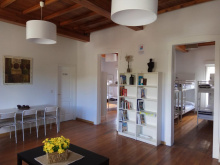
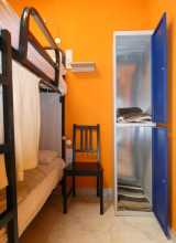
Accommodation in Redondela.
| Albergue Alfonso XII 17€ 12 Booking.com |

|
| Albergue A Conserveira 16-17€ 40 Booking.com |

|
| Albergue A Rotonda 20€ 9 Booking.com |

|
| Albergue A Dársena do Francés 20*€ 29 Booking.com |

|
| Albergue Santiago Apóstol 12€ 30 Booking.com |

|

Getting past Cesantes means crossing the N550 at probably the most dangerous point — a blind curve. Head straight across and keep right. The climb around O Viso peak follows, passing an installation of pilgrim shells where you can leave a message on a sun-bleached shell if you have a marker. Downhill again to the N550 and Arcade.
Getting past Cesantes means crossing the N550 once more, at probably the most dangerous point in a curve in the road. Head straight across and keep to your right.You are climbing uphill now and will traverse around the O Viso peak. Along the way you pass an installation of pilgrim shells and if you have a marker on hand you can leave a message on a sun-bleached shell. From here it is downhill again to the N550.At the entrance to Arcade, the camino turns left rather unnecessarily. It will cross back over the N550 in a few hundred meters, taking you past the albergues and shops of Arcade.
Accommodation in Cesantes.
| O Refuxio De la Jerezana 18€ 34 Booking.com |

|
| Albergue A Dársena do Francés 20*€ 29 Booking.com |
|

If you fancy oysters — and you should — Arcade is the place. The Ostras de Arcade have a protected designation and are harvested from the ria just below town. Several bars along the waterfront serve them fresh. The bridge to Pontesampaio crosses the estuary with a strip of sand on both sides — suitable for a dip.

The hotels are along the main road, which is noisy and dangerous — suitable as a last resort but best avoided. After crossing the bridge, take a left on the first street and follow the zigs and zags uphill. The camino provides a welcome break from road traffic between here and O Pobo.
The Battle of Pontesampaio in 1809 was a key engagement of the Peninsular War. Local Galician militia, aided by a force under Pablo Morillo, destroyed the bridge to prevent the French retreat, trapping and defeating a significant portion of Marshal Ney's forces. The bridge has been rebuilt but the battle is commemorated in the town.
After crossing the bridge, take a left turn on the first street. This turn is followed by a series of zigs and zags that take you up and through town at the highest point. The camino takes a welcome break from the road traffic between here and O Pobo.

A hamlet between Pontesampaio and O Pobo. No services.

In O Pobo an alternative route into Pontevedra presents itself on the left side of the road — turn left to follow signs toward the Rio Tomeza. This riverside path is 3.6 km to the Pontevedra albergue (near the bus and train stations), while the original road route to the same point is 2.8 km. The riverside path is longer but infinitely more pleasant.

A hamlet on the road between O Pobo and Pontevedra. No services.
A hamlet on the outskirts of Pontevedra. No services.
Pontevedra has one of the most walkable old towns in Galicia — the entire historic centre is pedestrianised, and you could spend a happy afternoon wandering its granite squares without a map.
Your entrance is punctuated by the Iglesia de la Virgen Peregrina, a scallop-shell-shaped shrine to the Pilgrim Virgin who, according to legend, guided pilgrims here from Baiona. Inside, the polychrome retablo and the unusual round floor plan are worth a look.
The Basilica de Santa Maria la Mayor, often called the cathedral (Pontevedra lost its bishop to Vigo in 1959), has a spectacular Plateresque facade. The Convento de San Francisco preserves Gothic arches and a fine stone cross. The Plaza de la Lena, the smallest and most atmospheric of the old town plazas, is the one to aim for if you only have time for one coffee.
The Museo de Pontevedra is spread across several buildings and is one of the best provincial museums in Galicia — the collection includes Celtic gold torques, Sargadelos ceramics, and a significant holding of Spanish paintings.
Two routes leave Pontevedra for Santiago: the original camino inland via Caldas de Reis (36 km, the shortest and most popular), and the Variante Espiritual via Combarro and Armenteira (44 km on foot plus 28 km by boat or on foot). The split is about 3 km after the bridge, well signposted. All services available.
Local legend claims Pontevedra was founded by Teucro, a hero of the Trojan War who couldn't return home to Salamis after the fall of Troy (his father Ajax blamed him for his brother's death). Teucro wandered the Mediterranean founding cities — Pontevedra was allegedly one of them. The historical truth is less dramatic: the Romans called it Ad Duos Pontes (at the two bridges), and the town grew at the crossing of the Lerez river. The Plaza de Teucro in the old town keeps the legend alive.
Leave by crossing the Ponte do Burgo and heading straight-ish through the next roundabout, turning left immediately after. Before long you will be alongside the railway, which you will cross just before the church of Alba.TWO WAYS TO PONTECESURES / PADRÓNThere are two routes to Pontecesures/Padrón from Pontevedra, and the split occurs about 3km after crossing the bridge in Pontevedra. The original camino keeps on its inland trajectory and is currently the most popular choice among pilgrims. It is also the shortest.The second option is known as the Variante Espiritual and it turns westward to cross over the Monte Redondo as it heads towards the sea at Vilanova de Arousa. From here you have the option of a 3rd day of walking to Pontecesures or a trip by boat up the Ría to the same place. This variant was created and named by the local tourism sector and although the stories told about its origins are fantastic, they are also just that... stories. Don’t let this clever bit of marketing discourage you though, the route is recognized by the Pilgrim Office as an official variant and you will not have any difficulty obtaining your Compostela regardless of whether you take the boat or not.This recognition, and lots of praise from pilgrims, means that this route is growing in popularity. VIA THE VARIANTE ESPIRITUAL - 44. km on foot + 28 km on foot or ferryThe Variante Espiritual is an alternative route which connects Pontevedra with Pontecesures. It adds 8.2km of walking (and a significant climb to the top of the Monte Redondo) and another 28km by boat (from Vilanova de Arousa to Pontecesures).Getting started is as simple as turning left at the well signposted fork in the road. The way almost immediately begins climbing upwards, though gently at first. It is making its way back to the Ría de Pontevedra, going up and around a small monte before arriving in the waterfront town of Combarro. There is one small hamlet before arriving at Cabaleiro, and it has a bar/shop with a very limited selection, but as it has odd hours it is not included here as being reliable.THE ORIGINAL CAMINO, INLAND VIA CALDAS DE REIS - 36.3 kmThis is the easiest to navigate and shortest of the options. From the split simply carry on straight.
Accommodation in Pontevedra.
| Albergue de Peregrinos (Virgen Peregrina) 10€ 56 |
| Aloxa Hostel 19+€ 60 Booking.com |

|
| Slow City Hostel 20-23€ 6 Booking.com |

|
| dpaso Urban Hostel 20+€ 20 Booking.com |

|
| GBC Hostel Pontevedra 19+€ 40 Booking.com |

|


A hamlet just past the railway crossing beyond Pontevedra. The camino crosses the Ponte do Burgo and passes straight through. No services.

A narrow road with fierce traffic — exercise caution passing through. At the end of town, turn right off the road. Soon you'll be alongside the railway again, following it for several kilometres.
Exercise caution passing through San Caetano as the road is quite narrow and the traffic is quite fierce. At the end of town turn right off the road. Soon you will be along the railway once more which you will follow along for several kilometers.

A hamlet. No services. The camino continues along the railway.
San Amaro sits above the railway tunnel through the hillside. Two bars in town — the first has more character and better service. Turn left at the fork past the park onto a country lane. The turn-off for the A Portela-Barro albergue is along this stretch, uphill to the right.
Turn left at the fork in the road, past the park, and onto a country lane. The turn off for the Portela/Barro albergue is along this stretch, and it takes you uphill to the right.


A deviation from the camino, well signed. The municipal albergue is in a quiet setting that adds a few metres to the journey but provides a welcome change from the road.
Before reaching Briallos, the camino approaches the N550 — signs for the Parque Natural do Rio Barosa and its waterfalls appear here. The waterfalls are 500 m down the opposite road, with picnic areas, a bar, and bathrooms at the base. Worth the detour.
Before arriving at Briallos, the camino approaches the N550 once more. At this point, there are signs for the Natural Park of the Rio Barosa, and the waterfalls. The waterfalls are 500m down the road directly opposite this point and are a worthwhile detour. Picnic areas and a bar and bathroom are at the base of the falls.
The albergue and bar are a few hundred metres from the centre — turn left when you reach town, following the signs. Otherwise, keep straight to continue through.

A hamlet between Briallos and Caldas de Reis. No services.

Caldas de Reis takes its name from the thermal springs — caldas — that drew the Romans here. The springs still flow, though putting your feet in the public fountains is officially discouraged for hygiene reasons. After a long hot day of walking, you'll understand the temptation and why they had to post signs.
To see the springs and follow the camino, turn left after crossing the first bridge. The route passes through the old quarter before reaching another bridge, with the municipal albergue and the way out of town on the far side.
The Iglesia de Santo Tomas Becket is one of very few churches in Spain dedicated to the murdered Archbishop of Canterbury — and possibly the only one in Galicia. The palm trees surrounding it make a cooling rest spot in the afternoon.
All basic services available.
On the way out of town, it is once more along the N550 (which frankly will be the case frequently between here and Santiago). Leave it to your right at the first bend in the road.
Accommodation in Caldas de Reis.
| Albergue A Queimada 14€ 74 Booking.com |

|
| GBC Hostel Caldas 25-28€ 100 Booking.com |

|
| Hotel O Cruceiro 16-18€ 34 Booking.com |

|

The walk to Santa Marina is through a quiet forest, away from the busy road. The bar is friendly and makes a welcome morning stop if you've left from Caldas. The camino crosses the N550 to visit the church in the upper part of town, then crosses back before Casalderrique.

A hamlet between Santa Marina and O Pino. No services.

The camino only touches the back side of O Pino. A bar and a large albergue are about 200 m off the track — the albergue is clean, friendly, and has a shaded park in front.
Accommodation in O Pino (Valga).
| Albergue de Peregrinos Valga 10€ 78 |

|

A modest church and a bar-grocery-everything store. The quaint countryside walking gives way to the sprawl of Pontecesures from here.

A small church on your right, a playground and recreation area on your left. Hidden in the park is an ancient petroglyph — these Galician rock carvings are common throughout the region and new ones are still being discovered. A bar at the far end of town.
This is the first notable stop on the Variante Espiritual after the fork from the main camino. The route descends through the hamlet of Fragmoreira and emerges at a roundabout on the divided highway.
The camino leaves town along the road but quickly picks up a track as it descends through the hamlet of Fragmoreira. It emerges on a roundabout at the divided highway you have crossed over a few times. Keep to the left as you approach Poio.

A hamlet on the descent from Cabaleiro to Poio. No services.
The Mosteiro de San Xoan de Poio, a massive Benedictine monastery, is the first building in town and impossible to miss. The monastery has been a centre of learning since the 7th century, though the current buildings are mostly 17th and 18th century. Several bars along the descent from the monastery.
The route through town requires care — watch for a narrow path turning upward on your left, just before a small B&B called A Marchanta. From the monastery, the camino descends to the waterfront and a large park before climbing to the main road toward Combarro.
The camino descends from the Monastery and turns right at the bottom of the hill. Mind the traffic here, there are no barriers and not too many arrows. Follow the road to the first crosswalk and turn left to pick up a smaller country road. Here there is one tricky turn. Shortly after crossing the road keep an eye open for a narrow path that turns upward on your left-hand side, it is right before a small B&B called A Marchanta. Follow it upward, then turn right, and then left at the fork onto a small dirt track. This track leads you to the waterfront and a large park which plays host to all manner of celebrations, do not be surprised to find it full of teenagers hungover from a late night of partying or packed full with caravans. The arrows are not bountiful here but keep the water to your left and cross to the far end of the park where a paved road takes you uphill to join the main road. This road is very busy and parked cars make for plenty of blind spots. Keep to the left as best you can and soon you will arrive at Combarro.

Combarro is one of the most photographed villages in Galicia, and for good reason. The horreos — the granite granaries that are a defining feature of Galician rural architecture — line the waterfront here, some of them practically hovering above the sea at high tide. They were used to dry fish as well as grain, and the visual effect of a row of them standing on their stilts against the ria is unique.
The town is small, compact, and genuinely beautiful in the way that only a working fishing village can be. The camino doesn't actually pass through the best parts — it turns uphill to join the road before you reach the waterfront. Keep going straight instead to see the horreos and the cruceiros that dot the lanes. Getting lost in Combarro would be an achievement, but be aware that other arrow variations exist and could lead you astray.
A few bars and restaurants. The Variante Espiritual crosses the road from here and immediately begins ascending the Monte Redondo.
The Variante Espiritual crosses the road and immediately begins its ascent of the Monte Redondo. The climb varies in intensity from extremely steep to gently rolling and back again. Go gently.

Not well signposted but identifiable by the large dirt parking lot adjacent to it. The mirador platform doesn't inspire much confidence structurally but offers excellent views east over the Ria de Pontevedra. From here the camino levels out and follows a mountain track before joining a paved road briefly and descending toward Armenteira.
From the mirador the camino levels out a bit and follows along a mountain track. It eventually joins a paved road but only for 250m when it crosses the road and begins the descent into Armenteira.

The camino delivers you directly to the front door of the Monasterio de Santa Maria de Armenteira, a 12th-century Cistercian foundation set in a quiet valley. The church's Romanesque portal and the cloister are the highlights. Two bars in town — the one directly in front is the more popular. The albergue is a few hundred metres further along, following the arrows.
From Armenteira, the camino joins the Ruta da Pedra e da Auga — a popular local trail following a creek downhill to sea level, passing dozens of abandoned water mills. The right-hand side of the creek keeps you closer to the mills and the water. The walking is beautiful and the descent is gradual.
According to legend, a monk named Ero founded the monastery and one day walked into the nearby woods, where he sat listening to a bird sing. When he returned, 300 years had passed. The story of San Ero is one of Galicia's most enduring legends and is similar to the tale of Rip Van Winkle — though it predates it by several centuries.
From Armenteira the camino joins a popular (among locals) trail known as the Ruta de la Piedra y del Agua. It follows along a creek, with trails on both sides, as it descends to sea level. Along the way, it passes several dozen abandoned water mills. Note that although you can safely and easily follow both sides of the river, it is the right-hand side that keeps you closer to the mills and the water.
Accommodation in Armenteira.
| Albergue Armenteira 25€ 22 Booking.com |
|
| Caroi Hostel & Rooms 30€ 20 Booking.com |
|

A large picnic area and recreation space with public bathrooms. A small bar-kiosko operates during the summer months. The riverside walk is interrupted by a highway and roundabouts, but the trail resumes quickly on the far side.
The riverside walk is interrupted by a large highway and associated roundabouts, but no sooner than you pass them do you return to the trail.
A small seasonal bar on your left at this junction. A larger bar-restaurant is over the river. The camino approaches Puente Arnelas via a steel-and-wood walkway under the bridge — follow the arrows up to road level.
As you approach Puente Arnelas you need to follow the arrows that lead you up a steel and wood walkway under the belly of the bridge. At the top, turn right to get up to the road level and follow it into the small village. A short ways on the camino joins the broad Río Umia.
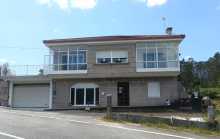
Accommodation in Os Castaños.
| Albergue Camino Espiritual 20€ Booking.com |
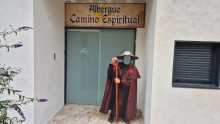
|
A small village with a chapel, a large pharmacy, and bars at both ends. If both bars are closed, a gas station provides backup. The camino continues along the Rio Umia from here.
The camino ahead includes a small climb up through the town of Gombra. It also follows the road for a short stretch before turning left into the small village of Mouzas. There are a few more hamlets along this stretch before the camino arrives at a large crossing of the PO-549. Here there is a pair of bars, including the happy for hamburgers Mississippi Bar. Cross the road towards Cores.
A small village on a brief climb. No services. The camino passes through and returns to the road before turning left into Mouzas.
A hamlet. No services. The camino passes through to a crossing of the PO-549, where a pair of bars await — including the eccentrically named Mississippi Bar.
Just beyond Cores, the camino reaches the sea for the final stretch of the Variante Espiritual. The last 3 km follow sandy paths with beaches on your left and beach bars on your right, arriving at Vilanova de Arousa via a large bridge.
Just beyond Cores the camino arrives at last to the sea, and the last 3km are along sandy paths with beaches on your left and beach bars on your right. The camino keeps close to the water and arrives at Vilanova by way of a large bridge.
A seaside harbour town with bars and restaurants but not much else besides the pleasure of gazing out to sea after days of walking inland. The albergue is the operational hub for arranging the boat to Pontecesures.
The boat recreates the Translatio — the legendary voyage that brought Santiago's body from Palestine to Galicia. Schedule varies with the tide, the number of passengers, and the captain's calculations. You can't reliably plan it days in advance — show up at the albergue and arrange things with the hospitalero.
The alternative to the boat is a roadside walk roughly mirroring the coastline but providing little contact with it. Arrows are lacking in places, and accommodation along this stretch is unreliable outside peak summer months.
THE BOAT. Everything you need to know about the boat to Pontecesures is impossible to print here. The schedule varies with the tide, the number of passengers, and the whims of the captain and the hospitalero at the albergue (he who makes the arrangements). The matter is complicated by the fact that the same captain helms two boats of different sizes and capabilities and there is a daily calculation to maximize profit. Unfortunately, this means that there is little that you can do to plan it days in advance, and more or less need to turn up at the albergue and arrange things with the hospitalero.THE ROAD. The alternative to the boat is a predominantly roadside walk along a path that roughly mirrors the coastline but doesn’t provide for much contact with it. The arrows are lacking in certain areas and the accommodation along this stretch should only be relied upon during peak Summer months and with a reservation.

Pontecesures occupies a pleasant riverside location that is somewhat spoiled by the factory across the Rio Ulla. The town is where the Variante Espiritual (by boat or by road from Vilanova de Arousa) rejoins the main camino.
The bridge here is where, according to the Translatio legend, the stone boat carrying Santiago's body arrived. The Roman bridge foundations survive beneath the current structure. The camino crosses the river into the approach to Padron.
The name Pontecesures derives from Pons Caesaris — Caesar's Bridge. The Roman crossing here connected the Ria de Arousa with the interior, and the site has been a point of arrival since antiquity. The Translatio tradition — the story that Santiago's body was brought by boat from Jaffa to this exact point — made Pontecesures one of the most symbolically important places on any Camino.
The arrows go under the road and over the bridge and across the Río Sar to Aduana. Here it runs all the way into Padrón.
Accommodation in Pontecesures.
| Albergue de Peregrinos Pontecesures 10€ 54 |

|

The Monasterio de San Antonio de Herbon and its albergue could not be better placed for a peaceful penultimate night before Santiago. The albergue is run by the Galician Amigos del Camino and is one of the few places on the route where you can count on eating dinner with everyone staying there.
The monastery's kitchen gardens are where the famous Pimientos de Padron originate — Franciscan monks brought pepper seeds from the Americas in the 16th century and planted them here. The peppers are at their best between May and September.
Follow the red arrows marked Herbon — this is a deviation from the main camino, adding 3 km total (2.7 km from Pontecesures, plus 3 km the next morning to reach Padron). The detour is worth it for the hospitality alone.
To get there simply follow the red arrows marked Herbón. This detour if for anyone wishing to spend the night in the Albergue at the Monastery of Herbón (recommended). From Pontecesures it is 2.7km, with an additional 3km the following morning to bring you to Padrón. In all this detour adds 3.1km to the official route.

A hamlet between Pontecesures and Padron on the main camino. No services.

Padron may be the most important small town on any Camino. This is where, according to the Translatio legend, the stone boat carrying Santiago's body came to rest — the pedron (mooring stone) from which the town takes its name sits beneath the altar of the Iglesia de Santiago on the riverfront. Ask the sacristan to show you; it's in the crypt.
Santiago is said to have preached here during his lifetime, making his posthumous return a homecoming of sorts. The Convento del Carmen, on the hill above town, offers views over the valley.
Padron is also the birthplace of Rosalia de Castro, the 19th-century poet who is to Galicia what Pessoa is to Portugal — the voice of a people and a language. Her house on the edge of town is now a museum. Camilo Jose Cela, the 1989 Nobel laureate, was also born here.
And then there are the peppers. The Pimientos de Padron — small green peppers fried in olive oil and sprinkled with coarse salt — originate from the monastery gardens at nearby Herbon. The famous saying holds: uns pican e outros non (some are hot and some are not). Between May and September they're at their peak. Out of season, you'll still find them, but the Russian roulette is less thrilling.
All services available.
The pedron — the stone beneath the altar of the Iglesia de Santiago — is traditionally identified as the mooring post to which the stone boat carrying Santiago's body was tied when it arrived from Palestine. Archaeological evidence suggests it may be a Roman altar or milestone, repurposed by Christian tradition. Regardless of its origin, the stone has been venerated for over a thousand years and connects Padron to the foundational myth of the entire Camino.
Take a look at the elevation profile for an idea of what these last 24km will be like, many pilgrims underestimate the elevation changes which increase as you near Santiago.
Accommodation in Padrón.
| Albergue de peregrinos de Padrón 10€ 46 |

|
| Albergue Corredoiras 15-19€ 17 Booking.com |

|
| Albergue Camiño Do Sar 15-17€ 20 Booking.com |

|
| Albergue O Pedrón 14-17€ 44 Booking.com |

|

Iria Flavia is one of the most historically important sites on any Camino, though you wouldn't know it from the modern settlement. This was the original bishopric — the episcopal seat before it was transferred to Santiago de Compostela after the discovery of the Apostle's tomb in the 9th century.
The Colegiata de Santa Maria de Iria Flavia is the site of the original cathedral. The Adro (the cemetery and churchyard) is worth visiting — Rosalia de Castro was originally buried here before her remains were moved to the Panteon de Galegos Ilustres in Santiago.
Pass through Pazos, Rueiro, Tarrio and Vilar (albergue); none with services.
Accommodation in Iria Flavia.
| Albergue Cruces de Iria 22-24€ 20 Booking.com |
|
| Albergue O Sabor do Camiño 18+€ 14 Booking.com |
|


A hamlet between Iria Flavia and the approach to Santiago. No services.